경로

플래너

기능

업데이트

App

로그인 또는 가입

앱 다운로드

로그인 또는 가입

로그인 또는 가입

경로
Places to see
Mountain Peaks
이탈리아
트렌티노

비뇰라-팔레시나

비뇰라-팔레시나‬에서 가장 멋진 ‪20‬개의 산 정상

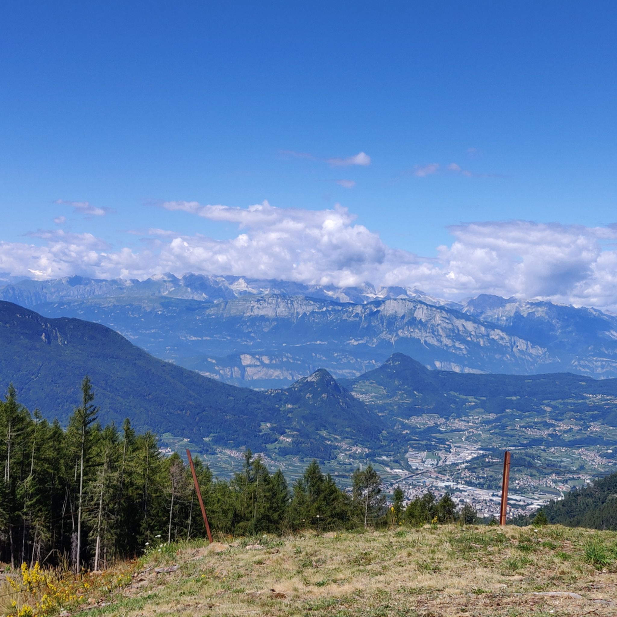
Vignola-Falesina 주변의 최고의 산봉우리들은 이탈리아 트렌티노 지역에서 다양한 경험을 제공합니다. 해발 약 1,000미터에 위치한 이 지역은 라고라이-치마 다스타 산맥(Lagorai-Cima d'Asta Range)으로 가는 길을 열어줍니다. 이 지역은 중요한 역사적 랜드마크와 파노라마 전망대를 갖춘 봉우리들이 특징이며, 울창한 언덕과 고산 목초지로 둘러싸여 있습니다. 자연 경관과 다채로운 야외 활동으로 유명합니다.

Vignola-Falesina 주변 최고의 산봉우리들

  • 가장 인기 있는 산봉우리는 발수 가나 계곡(Valsugana valley)과 레비코 호수(Lake Levico), 칼도나초 호수(Lake Caldonazzo)의 파노라마 전망을 제공하는 치마 베체나 정상 및 요새(Cima Vezzena Summit and Fort)입니다. 이 봉우리에는 제1차…

마지막 업데이트: 5월 9, 2026

치마 베체나 정상과 요새

하이라이트 • 정상

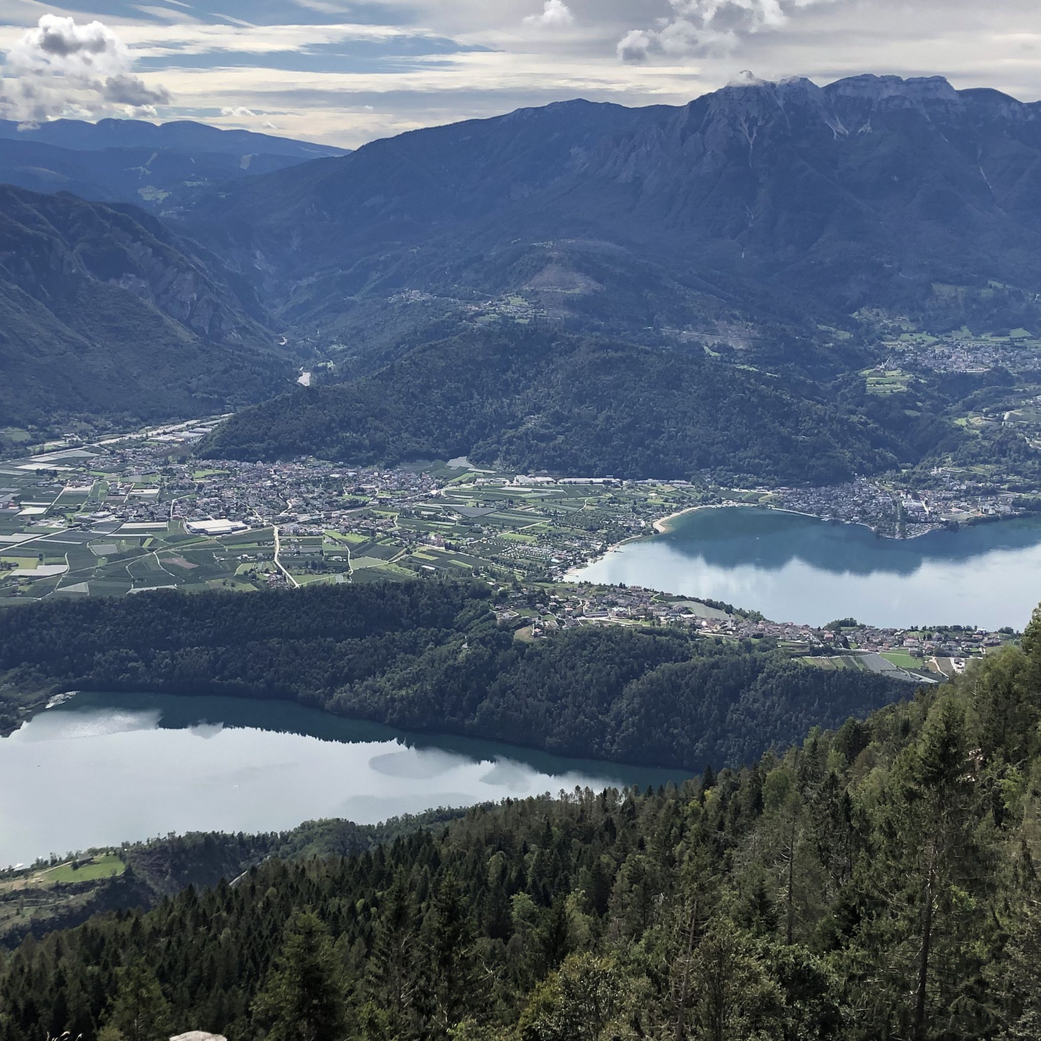
Panoramic terrace overlooking Valsugana and the lakes of Levico and Caldonazzo, Cima Vezzena can be reached either from the Vezzena pass, passing by the Verle fort and continuing on foot along the old carriage road, or via path no. 205.

번역자 Google •

에 의해

하이킹 보기

휴대폰으로 전송

저장

치마 마르졸라

하이라이트 • 정상

Beautiful view of Trento and Lake Caldonazzo

번역자 Google •

에 의해

저장

이런 장소를 발견하려면 지금 가입하세요

최고의 싱글 트랙, 봉우리 및 다양한 흥미로운 야외 장소에 대한 추천을 받아보세요.

무료 회원 가입

몬테 칼리시오 정상 십자가

하이라이트 • 정상

On the Monte Calisio you will be welcomed by a wonderful 360 ° view, which opens the view, both to Trento and the Adige Valley to the south, as well …

번역자 Google •

에 의해

저장

Dos Le Grave

하이라이트 • 전망대

A panoramic point of rare beauty, you will be truly amazed!

번역자 Google •

에 의해

저장

도소 디 코스탈타 (1955m)

하이라이트 • 정상

Great viewpoint with a 360 ° view of Pine with the two lakes, the Fersental and the western part of the Lagoreikette. From the Malga Cambroncoi, the summit can be …

번역자 Google •

에 의해

저장

무료로 가입하여 비뇰라-팔레시나 주변의 더 많은 봉우리를 발견하세요.

무료 회원 가입

이미 komoot 계정이 있나요?

오늘 무료 계정으로 시작하세요

다음 모험이 기다리고 있어요.
로그인 또는 가입하기

비뇰라-팔레시나 주변 인기 장소

비뇰라-팔레시나 하이킹

비뇰라-팔레시나 사이클링

비뇰라-팔레시나 로드 사이클링 경로

비뇰라-팔레시나 MTB 트레일

비뇰라-팔레시나 러닝 트레일

비뇰라-팔레시나 주변 그래블 라이딩

비뇰라-팔레시나 등산

커뮤니티 팁

MatteoLeo
10월 16, 2025, Monte Calisio Summit Cross

Beautiful location with a panoramic view of the Adige Valley, Montevaccino, and the Piné plateau.

번역: Google

0

0

Dos Le Grave (or Doss de le Grave) is one of the most interesting natural areas in the Argentario Ecomuseum, in the Monte Calisio area. It features an important biotope that displays two extremely different environmental typologies: a wetland and an arid zone, located respectively at the foot and on the western flank of Dos. A characteristic of this small, semi-desert-like elevation is the striking presence of bonsai-like Scots pines growing on waste material from silver mining (an activity that affected the entire plateau from the 11th to the 15th century). The arid portion is in immediate contact with the wetland below. This peat bog was formed by the filling of a small lake basin. Small bodies of open water still remain from this basin.

번역: Google

1

0

Mount Calisio (also known as Argentario) is a 1,096-meter peak located between the municipalities of Trento and Civezzano. It is part of the Monte Croce-Sette Selle mountain chain. The area below (the Argentario Plateau) was once home to important silver mines, which declined in importance in the 15th century. The area, semi-abandoned for centuries, was rediscovered in the 20th century with the ever-increasing growth of residential areas. Mount Calisio features an underground fortification built by the Austrians starting in August 1915. It was one of the largest and most modern structures in the Trento fortress, with a classic "H" shape consisting of two galleries, 250 and 160 meters long, and a connecting tunnel. Later, 10-12 meter vertical concrete shafts were dug to install two howitzers in armored cupolas. The bases of the M16 aircraft can still be seen on the summit. Today, Mount Calisio is crisscrossed by numerous hiking trails maintained by the SAT (a subsection of the Italian Alpine Club) in collaboration with the Argentario Ecomuseum. The summit offers a fabulous view of the Adige Valley and part of the Valsugana.

번역: Google

1

0

from the Miola Ice Palace to the Dosso di Costalta beautiful and easy

번역: Google

0

0

Can it be done on foot?

번역: Google

0

0

It has many trails to explore and you can do many kilometers and altitude without ever passing on the same track

번역: Google

0

0

Monte e Cima Calisio You can get there from a really beautiful forest road also suitable for Gravel Bike

번역: Google

0

0

Easy and pleasant excursion, accessible all year round. 360° panorama and with support points at Malga Cambroncoi and Passo Redebus.

번역: Google

0

0

비뇰라-팔레시나 주변에서 가장 인기 있는 경로

비뇰라-팔레시나 하이킹

비뇰라-팔레시나 주변에서 가장 인기 있는 명소

Places to see

Store rating

komoot 모바일 앱으로 영감을 받아보세요

무료 komoot 계정로 끝없는 야외 모험을 손쉽게 찾고, 맞춤 설정하며 길안내할 수 있어요.

또는

지금 komoot에 가입하세요

Store rating

더 살펴보기

이 가이드를 통해 비뇰라-팔레시나 주변의 더 놀라운 정상들을 확인해보세요:

캄피텔로 디 파사카나제이알라마진아비오리바 델 가르다나고 토르볼레브렌토니코레드로포짜 디 파사모리아르코론조-키에니스텐노로베레토코마노 테르메비고 디 파사칼리아노알데노알토피아노 델라 비골라나트람빌레노노미시모네트렌토프레다조드로피아베포마롤로볼라노페르진 발수가나이세라발라사모에나폴가리아베세넬로레비코 테르메소라가카라노테세로바레나드레나카베딘라바로네폰도칼도나조노가레도가르니가 테르메카스텔폰도브레즈빌라 라가리나Rete Di Riserve Alpi Ledrensi론체뇨 테르메아디제보르고 발수가나다이아노노발레도카스텔로-몰리나 디 피엠프라실롱고테나테라뇰로텔베 디 소프라판키아카발레즈텔베루세나칼세라니카 알 라고론존토르체뇨사르노니코말로스코지아노 디 핌메바젤가 디 피네메자노프리미에로 산 마르티노 디 카스트로차페이오론키 발수가나신테 테시노스쿠렐랍비알비아노블레지오 수페리어카바레노마드루초루프레 멘돌라카스텔 이바노피에베 테시노카스텔로 테시노운하 산 보보지오보피에베 디 보노 프레조프레다이아산토르솔라 테르메발레라기이머티오네 디 트렌토메졸롬바르도펠리자노본돈버밀리오암블라 돈알타발레치베짜노포르나스보르고 치즈산 미셸 올아디제켐브라 리지나고스토로베돌로페이도빌 다노니아스포미노어사그론 미스카스텔누오보발플로리아나피에로초팔루 델 페르시나보르고 라레스비에노스포르마조레메조코로나소버그리뇨Parco naturale Paneveggio - Pale di San Martino카리솔로네이브 산 로코스피아초루모핀졸로트레빌캄포덴노스트렘보카베다고라비스잠바나안달로오사나스푸르즈산 로렌조 도르시노셀라 주디카리에덴노로나-라세스담벨주스티노파이 델라 파가넬라메자나스테니코몰베노Parco naturale provinciale dell' Adamello Brenta세곤자노사모네마시메노발다온오스페달레토로베레 델라 루나카르자노디마로 폴가리다콘타카프리아나클로즈코메자두라브레시모남성로메노카데르존 테르메보체나고클레스산제노카스텔 콘디노리보펠루고포르테 디 렌데나테르졸라스카뇨레보크로비아나칼데스몬테 브리오네Riserva Naturale Integrale Tre Cime Del Bondone카비자나시스

근처 어드벤처 가이드

테나 즐길거리

background

새로운 정복을 위한 준비를 하세요

무료로 가입하기

탐험하기
경로경로 플래너기능하이킹MTB 트레일로드 사이클링 경로바이크패킹사이트맵
앱 다운로드
소셜 미디어에서 팔로우하기

© komoot GmbH

개인 정보 보호 정책