ルート

プランナー

機能

アップデート

App

ログインまたはサインアップ

アプリを入手

ログインまたはサインアップ

ログインまたはサインアップ

ルート
ハイキング
ドイツ
ラインラントプファルツ州
フルカナイフェル

シャルケンメーレン

シャルケンメーレンのおすすめウォーキング&ハイキングルート

4.6

(5778)

21,486

ハイカー

94

ハイキング

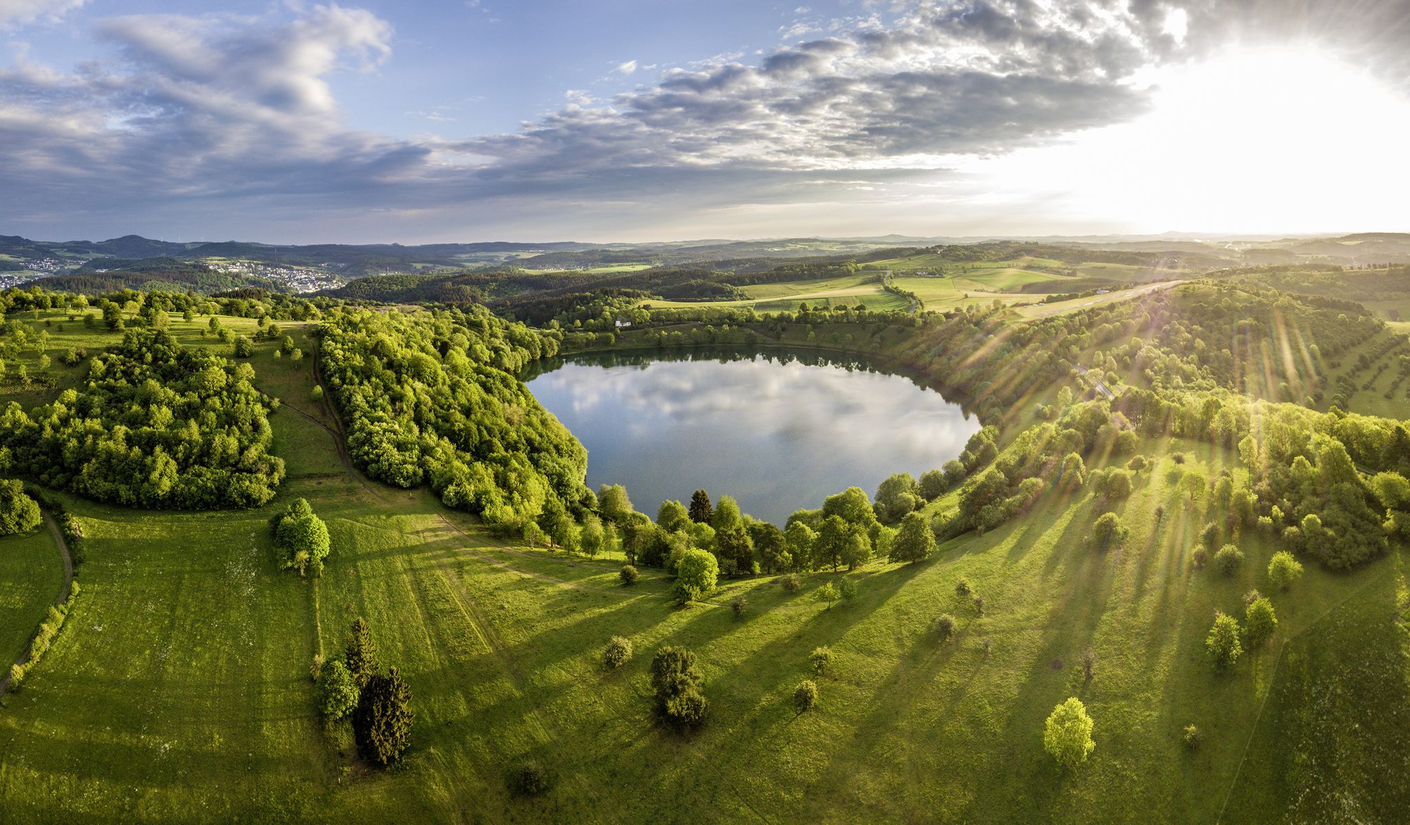
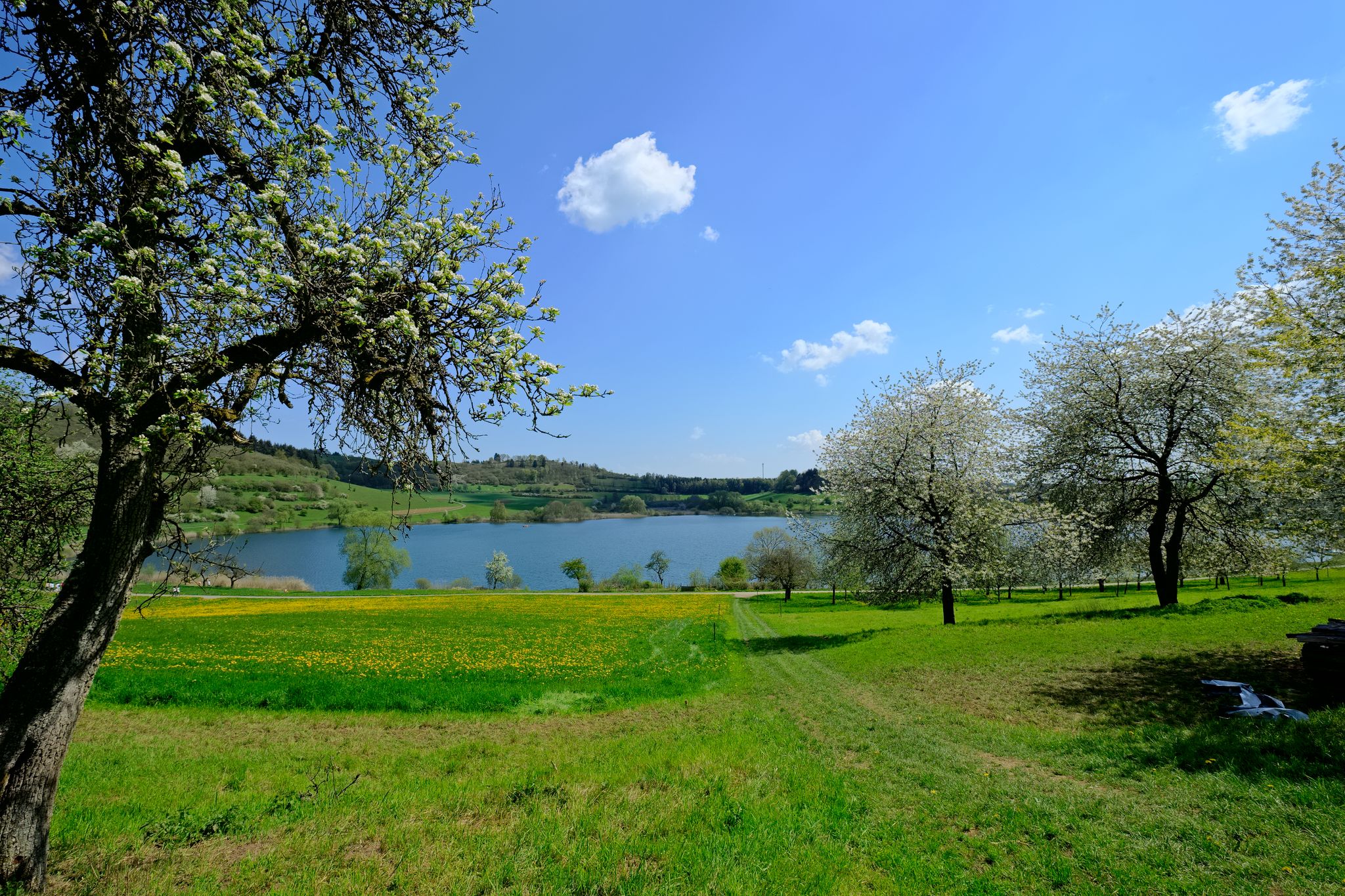
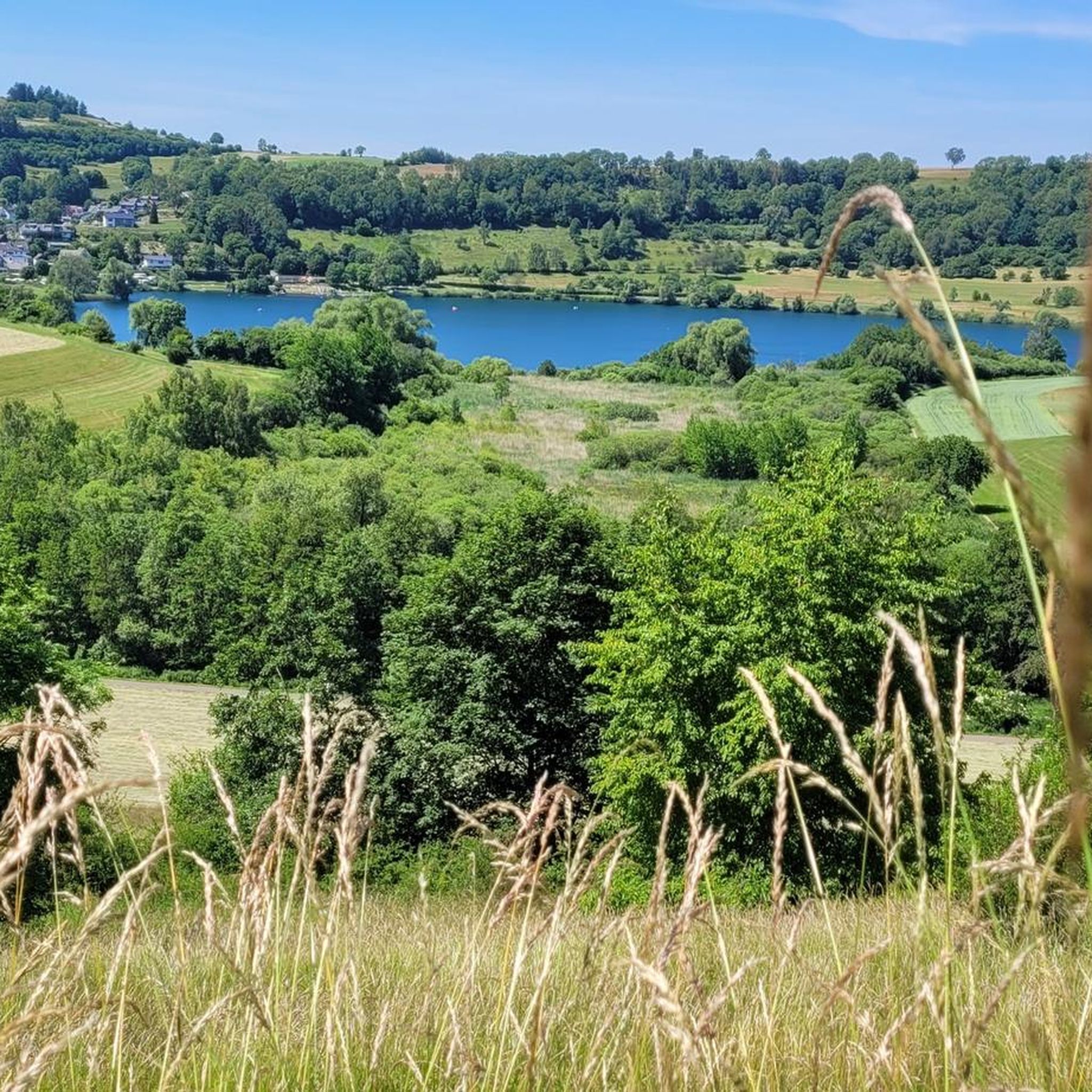
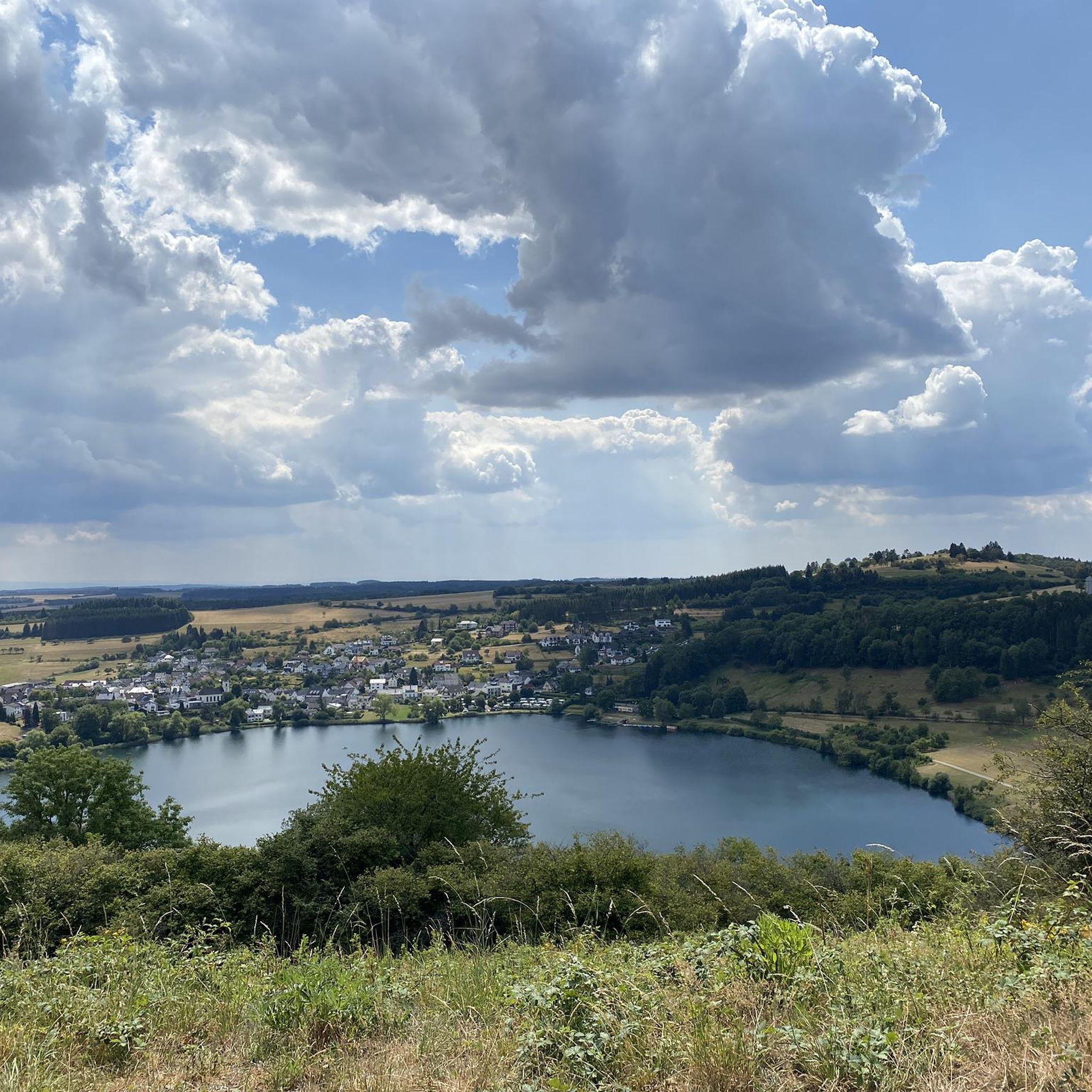
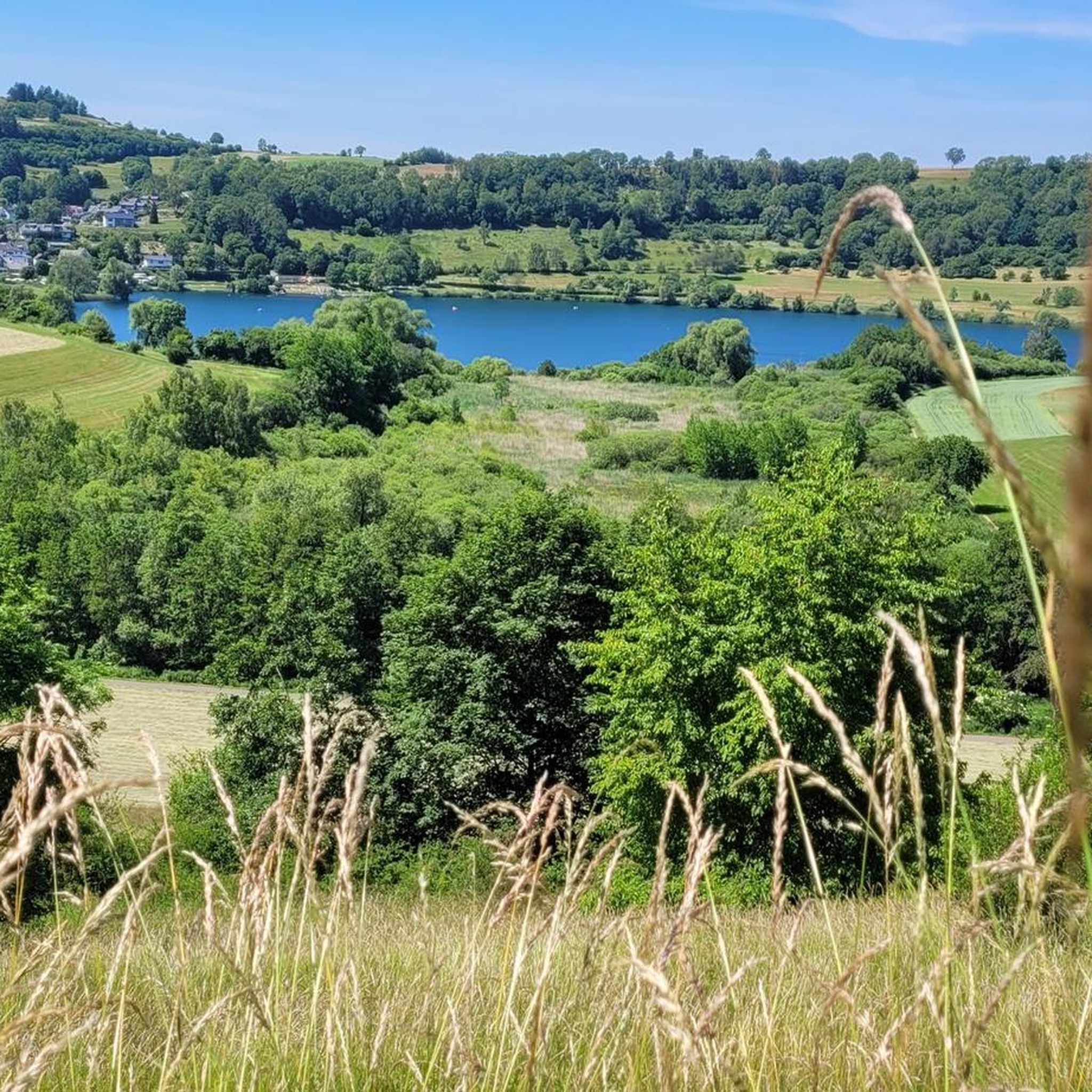
Schalkenmehren周辺のハイキングでは、ドイツのVulkaneifel(火山アイフェル)地区にあるユニークな火山景観を探検できます。この地域は、蒸気爆発によって形成された火山性のクレーター湖であるマールが特徴で、変化に富んだ地形と風光明媚な景色を提供します。SchalkenmehrenはVulkaneifel自然公園内に位置し、広大な森林、広い野原、Lieser川があります。景観には、水没したマールと乾燥したマールの両方が含まれており、ハイカーに多様な地質学的特徴を提供します。

Schalkenmehren周辺のベストハイキングトレイル

  • 最も人気のあるハイキングルートは、HeimatSpur MaareGlück – GesundLand Vulkaneifelで、距離7.1マイル(11.4 km)、所要時間3時間17分です。このルートは、Dauner Maareの自然環境を巡ります。
  • 地元のハイカーに人気のもう一つのルートは、Schalkenmehrener Maar – SchalkenmehrenからのWeinfelder Maarループの眺めで、距離5.0マイル(8.1 km)の中程度のトレイルです。このトレイルは、2つの著名なマール湖を結び、火山景観の眺めを提供します。
  • 地元のハイカーに愛されているのは、DronkeタワーとMäuseberg – SchalkenmehrenからのSchalkenmehrener Maarループで、距離6.0マイル(9.7 km)のトレイルは、火山景観を通り抜け、Dronkeタワーを通過し、所要時間は約2時間50分です。
  • Schalkenmehren周辺のハイキングは、火山性のマール、静かなマール湖、そしてVulkaneifel自然公園の多様な地形によって特徴づけられます。このネットワークは、簡単な散歩、中程度のハイキング、より挑戦的なルートのオプションを提供します。
  • Schalkenmehrenのルートは、komootコミュニティによって高く評価されており、5,500件以上のレビューから平均4.6つ星を獲得しています。21,000人以上のハイカーがkomootを利用して、Schalkenmehrenの多様な地形を探索しています。

最終更新日: 5月 18, 2026

4.8

(628)

2,253

ハイカー

#1.

HeimatSpur MaareGlück

11.4km

03:18

280m

280m

中程度のハイキング. ある程度のフィットネスレベルが必要です。 進みやすいルートです。あらゆるスキルレベルに適しています。

デバイスでナビ

スマートフォンに送信

保存

中程度

中程度のハイキング. ある程度のフィットネスレベルが必要です。 進みやすいルートです。あらゆるスキルレベルに適しています。

中程度
guide_signup
私たちがkomootモバイルアプリで道を示します
無料の komoot アカウントがあれば、無限のアウトドアコースを簡単に見つけてカスタマイズし、ナビで案内できます。

無料新規登録

4.4

(33)

157

ハイカー

26.2km

07:20

510m

510m

難しいハイキング. 標準以上のフィットネスレベルが必要です。 進みやすいルートです。あらゆるスキルレベルに適しています。

難しい

初級者向けハイキング. あらゆるフィットネスレベルに適しています。 進みやすいルートです。あらゆるスキルレベルに適しています。

初級

初級者向けハイキング. あらゆるフィットネスレベルに適しています。 進みやすいルートです。あらゆるスキルレベルに適しています。

初級
無料新規登録すると、シャルケンメーレンでのでのハイキングをさらに90件ご覧いただけます。

さらに多くのルートや他のユーザーのおすすめ情報を確認できます。

無料新規登録

すでにアカウントをお持ちですか?

おすすめのツアーは他のkomootユーザーが実際に経験した何千ものアクティビティに基づいています。

無料アカウントで今日から始めよう

次の冒険が待っています。

ログインまたは登録

シャルケンメーレン周辺で人気

Germany’s Most Beautiful Hiking Trails in the Vulkaneifel

Excellent paths in the Vulkaneifel – Explore the HeimatSpuren

Volcanoes, water, forest – the partner trails of the Eifelsteig
4日間の純粋な地質学的歴史 — 火山アイフェルのツアー
E-biking through the Volcanic Eifel
カンピングカーとレースバイクでドイツをツアーで発見してください。
シャルケンメーレンでのサイクリング
シャルケンメーレンのMTBトレイル
シャルケンメーレンのランニングコース
シャルケンメーレンのロードバイクルート

シャルケンメーレンでのの他の冒険

Germany’s Most Beautiful Hiking Trails in the Vulkaneifel

ハイキングのコレクション によって

GesundLand Vulkaneifel

コミュニティからのヒント

JakobusPilger
5月 21, 2026, Schalkenmehrener Maar

「鳥は歌い、花は咲き, 森も野原も再び緑に。 ああ、それなら行こう、さまよおう この場所からあの場所へ 広大な緑の世界を!」 (Hoffmann von Fallersleben)

Google翻訳による翻訳

3

0

ここに広がる景色を楽しみながら散策するすべてのハイカー/散歩者の皆様に、作家Otto Wilhelm Ullmannの言葉を借りて、世界(そしてそれに伴う自然の美しさ)を発見することをお勧めします。 「ハイキングとは世界を発見すること、 隠れた角を見つけること、 古い路地、静かな場所で 平和の至福を感じること、 古きものへの畏敬の念を抱き 祖先の遺産を大切にすること、 最も小さなものから喜びを見出すこと: ハイキングとは世界を発見すること。」

Google翻訳による翻訳

1

0

「Heimatspur Maareglück」は、Totenmaar、Schalkenmehrener Maar、Gemündener Maarの周辺を散策するハイカーや散歩者が繰り返し出会う、あるいはたどるかもしれないトレイルで、ドイツで最も美しいハイキングトレイル(2026年)の選挙で決勝に進みました。6月30日まで投票したい方は、仮想投票所を以下で見つけることができます。 =>> https://wandermagazin.de/wahlstudio

Google翻訳による翻訳

1

0

Information on the Mürmes nature reserve can be found at NABU: https://www.nabu-daun.de/wir-sichern-fl%C3%A4chen/nsg-m%C3%BCrmes/ or at: https://ellscheid-vulkaneifel.de/408/tourismus/muermes

Google翻訳による翻訳

1

0

The Daun Maars - 10,000-Year-Old Volcanic Lakes The Daun Maars were formed around 10,000 years ago from volcanic steam explosions. Hot lava rises from the Earth's interior and meets water, which suddenly evaporates. This blasts away entire mountain peaks. What remains is a deep crater that fills with water over the years and a wall of boulders surrounding the lake. The Daun Maars include the Gemünden Maar, the Weinfelder Maar, and the Schalkenmehrener Doppelmaar. One crater of the Schalkenmehren Maar has silted up over the millennia. The area is a nature reserve and a refuge for waterfowl and rare dragonfly species. Text / Source: deutschland-outdoor.der https://deutschland-outdoor.de/eifel/dauner-maare

Google翻訳による翻訳

13

0

Weinfelder Maar The Weinfelder Maar, formed by volcanic activity around 20,000 to 30,000 years ago, is the highest of the three Daun Maars at 487 meters above sea level. The lake is 51 meters deep and has a diameter of 396 to 429 meters. An almost melancholic atmosphere surrounds the maar. Many legends surround the tranquil Eifel eye. A castle is said to have once stood on the site of the crater, where a count lived with his wife and only child. After returning home from a hunt, the castle had sunk as punishment for the woman's nastiness, and he found only a lake where a cradle miraculously floated his child safely to the shore. If you look at the dark surface of the water long enough, it is said that you can make out the outline of the castle. The German landscape painter Fritz von Wille was so fascinated by the Weinfelder Maar that he repeatedly immortalized it in his paintings. Among his favorite motifs was the small chapel on the north bank, dedicated to Saint Martin. It was once the parish church of the village of Weinfeld, which was ravaged by the plague in the 16th century. Anyone who rings the bells inside by pulling the ropes can make a wish. To this day, the associated cemetery is maintained and used by the local community of Schalkenmehren. This is also where its second name, Totenmaar, comes from. Donkeys and goats have been introduced to the Weinfelder Maar to regulate vegetation. The maar's unique flora and fauna are protected. Swimming and other water sports are prohibited in the Weinfelder Maar, but a nearly two-kilometer-long path makes it a wonderful place to explore on foot. Parking: Guests can park along the L64 either in the parking lot at the Weinfelder Maar or on the Maarsattel between the Weinfelder Maar and the Schalkenmehrener Maar. Text / Source: GesundLand Vulkaneifel GmbH, Leopoldstr. 9 A, 54550 Daun https://www.eifel.info/a-weinfelder-maar

Google翻訳による翻訳

13

0

The Daun Maars - 10,000-Year-Old Volcanic Lakes The Daun Maars were formed around 10,000 years ago from volcanic steam explosions. Hot lava rises from the Earth's interior and encounters water, which suddenly evaporates. This blasts away entire mountain peaks. What remains is a deep crater that fills with water over the years and a wall of boulders surrounding the lake. The Daun Maars include the Gemünden Maar, the Weinfelder Maar, and the Schalkenmehrener Doppelmaar. One crater of the Schalkenmehrener Maar has silted up over the millennia. The area is a nature reserve and a refuge for waterfowl and rare dragonfly species. Text / Source: deutschland-outdoor.der https://deutschland-outdoor.de/eifel/dauner-maare

Google翻訳による翻訳

13

0

Weinfelder Maar The Weinfelder Maar, formed by volcanic activity around 20,000 to 30,000 years ago, is the highest of the three Dauner Maars at 487 meters above sea level. The lake is 51 meters deep and has a diameter of 396 to 429 meters. An almost melancholic atmosphere surrounds the maar. Many legends surround the quiet Eifel eye. A castle is said to have once stood on the site of the crater, where a count lived with his wife and only child. After returning home from a hunt, the castle had sunk as punishment for the woman's nastiness, and he found only a lake where a cradle miraculously floated his child safely to the shore. If you look at the dark surface of the water long enough, it is said that you can make out the outline of the castle. The German landscape painter Fritz von Wille was so fascinated by the Weinfelder Maar that he repeatedly immortalized it in his paintings. Among his favorite motifs was the small chapel on the north bank, dedicated to Saint Martin. It was once the parish church of the village of Weinfeld, which was struck by the plague in the 16th century. Anyone who makes the bells inside ring by pulling the ropes can make a wish. To this day, the associated cemetery is maintained and used by the local community of Schalkenmehren. This is where its second name, Totenmaar, comes from. Donkeys and goats have been introduced to the Weinfelder Maar to regulate vegetation. The maar's unique flora and fauna are protected. Swimming and other water sports are prohibited in the Weinfelder Maar, but a nearly two-kilometer-long path makes it a wonderful place to explore on foot. Parking: Visitors can park along the L64 either in the parking lot at the Weinfelder Maar or on the Maarsattel between the Weinfelder Maar and the Schalkenmehrener Maar. Text / Source: GesundLand Vulkaneifel GmbH, Leopoldstr. 9 A, 54550 Daun https://www.eifel.info/a-weinfelder-maar

Google翻訳による翻訳

12

0

シャルケンメーレンでのの人気ルート

シャルケンメーレンでのサイクリング

シャルケンメーレンでのの人気観光スポット

Natural Monuments

Store rating

komootモバイルアプリでインスピレーションを得よう

無料のkomootアカウントがあれば、無限のアウトドアコースを簡単に見つけてカスタマイズし、ナビで案内できます。

または

今すぐkomootに参加しよう

Store rating

さらに探索

他の地域の最高のハイキングを見てみましょう。

ゲロルシュタインダウンシャルケンメーレナーマールDauner Maareヴァインフェルダーマールウーックスハイムシュラーシュタットキルヴィンケル(アイフェル)クラーデンバッハウーダースドルフギレンフェルトケテリヘンケルバーグザルマースバッハヒレスハイムケルペン(アイフェル)ドイデスフェルトネロートプルヴェルマアービルレスボルンForst ArenbergLampertstal Und Alendorfer Kalktriften Und Mit Fuhrbach Und Mackentalユンケラートグンデラートリルシュタルハルシュラグシュテッフェルンオーモントシュトロッツビュッシュヴェルハラートミュルレンバッハシュトローンコップペルムヴァレンボルンドゥパッハニッツダルシャイトヴィースバウムサッセンコルヴェラートボンガードシャイドヒンターヴァイラーリッセンドルフザクスラーエルシャイトブロックシャイトベレーボルンノンヘーヒシュトゥベルクデメラートシュッツシュタイニンゲンフルカナイフェルのベルリンゲンドーム・ランマースドルフホーエンフェルスエッシンゲンシュタインエーベルクホルペラートインメラートボーデンバッハブレックハウゼンキルスバッハミュッケルンロッケスキールビルゲルカペリッヒドライス・ブリュックブリュックタールヘルシュハウゼンウアースフェルトドックワイラーベレンバッハマイスブルクオーバーエルツフォイスドルフウエスアルバッハボルラーデンスボルンバスベルクウッツェラートゲレンベルクニーダーシュタットフェルドカッツヴィンケルキルヒヴァイラーウドラーオーバーベッティンゲンベッテルドルフオタクヘルシャイトオーバーシュタットフェルトカレンボルン・ショエルンナイヘンドリーズモスブルッフバインハウゼンライメラートOberehe-StroheichケルシェンバッハRetterathサルム

近くのアドベンチャーガイド

シャルケンメーレナーマールでやるべきこと

background

新しいピークを征服する準備をしよう

無料でサインアップ

探検する
ルートルートプランナー機能ハイキングMTBトレイルロードバイクルートバイクパッキングサイトマップ
アプリをダウンロード
SNSでフォローする

© komoot GmbH

プライバシーポリシー