ガンデッリーノのおすすめ登山&山歩きルート
4.6
(16)
82
ハイカー
8
ハイキング
ベルガモの山々をもっと探索しませんか?このガイドでご紹介するのは、komootがガンデッリーノでの登山&山歩きのコレクション全体を評価して選び抜いた、このエリアの人気ルートです。あなたに合ったルートを見つけるには、他のユーザーがアップロードした役立つ情報や写真を閲覧し、クリック操作で簡単に表示できる詳細なデータを参考にしましょう。ガンデッリーノでの次の冒険にぴったりの登山&山歩きルートが見つかるはずです。
最終更新日: 10月 8, 2026
4.3
(3)
23
ハイカー
12.0km
07:10
1,290m
1,290m
難しい登山ルート. 標準以上のフィットネスレベルが必要です。 安定して歩行できる技術、丈夫な靴、高標高地での登山経験が必要です。
5.0
(2)
14
ハイカー
14.3km
06:17
1,000m
1,000m
難しい登山ルート. 標準以上のフィットネスレベルが必要です。 安定して歩行できる技術、丈夫な靴、高標高地での登山経験が必要です。

3.6
(5)
13
ハイカー
9.88km
04:48
920m
920m
難しい登山ルート. 標準以上のフィットネスレベルが必要です。 安定して歩行できる技術、丈夫な靴、高標高地での登山経験が必要です。
5.0
(1)
6
ハイカー
16.7km
07:42
1,280m
1,280m
難しい登山ルート. 標準以上のフィットネスレベルが必要です。 安定して歩行できる技術、丈夫な靴、高標高地での登山経験が必要です。
6
ハイカー
13.9km
07:58
1,470m
1,460m
難しい登山ルート. 標準以上のフィットネスレベルが必要です。 安定して歩行できる技術、丈夫な靴、高標高地での登山経験が必要です。
さらに多くのルートや他のユーザーのおすすめ情報を確認できます。
すでにアカウントをお持ちですか?
おすすめのツアーは他のkomootユーザーが実際に経験した何千ものアクティビティに基づいています。
無料アカウントで今日から始めよう
次の冒険が待っています。


コミュニティからのヒント

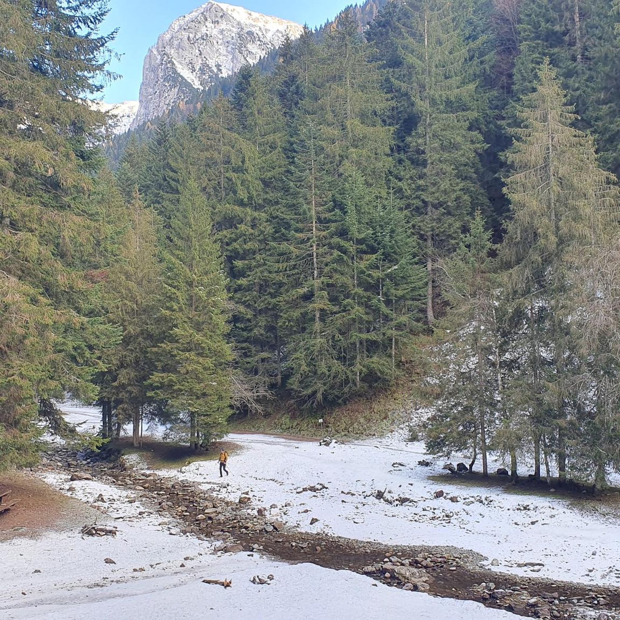
コカ小屋へ向かう途中、この階段があります
0
0


モンテ・マドンニーノは、ヴァル・ブレバンカとヴァル・セリアーナの間の自然な境界線上に位置する、標高2,502メートルのオロビエ・アルプスの頂上です。その名前は、頂上に置かれた小さな聖母マリア像に由来しており、ピッツォ・デル・ディアボロ・ディ・テンダやモンテ・ローザのような巨峰を眺めることができる素晴らしい展望ポイントとなっています。
0
0

A passage that may frighten the less experienced but is safe and without major difficulties
1
0
Merelli Refuge at Coca: a rugged and fascinating place in the Orobie Alps The Mario Merelli Refuge at Coca, at 1,891 meters, is one of the most iconic spots in the Coca Valley. Dedicated to the Bergamo mountaineer Mario Merelli, it retains his spirit: essential, authentic, deeply rooted in the mountains. Its location is what immediately strikes you: a natural balcony leading to the basin of the Orobie Giants, dominated by Pizzo Coca, Redorta, Scais, and Porola, a cluster of peaks that creates an imposing and almost solemn amphitheater. The ascent from Valbondione The classic access starts from Valbondione, near the village of Grumetti. The trail climbs steeply from the start, gaining altitude with regular switchbacks. It's a route that many describe as steep but safe, challenging enough to give you a sense of the mountain without ever becoming technical or exposed. Once out of the forest, the valley opens up and the dark walls of the Coca appear; The final, more challenging stretch leads to the refuge, which suddenly appears on a panoramic hill. The effort is always rewarded: those who arrive speak of its astonishing beauty and a setting that remains in their hearts. A refuge that tells a story The Merelli is a base for climbing Pizzo Coca and for crossings to the Brunone and Curò refuges, but it is also a place of memory. Inside, you can feel the legacy of Mario Merelli, and the atmosphere is that of the refuges of old: simple, welcoming, and sincere. It is a refuge that is not reached by chance: it is reached with commitment, and perhaps for this very reason, it leaves a profound impression.
0
0
Val Sedorniaに向かってTezzi Alti di Gandellinoから登る途中にあるLa Cappelletta di San Carloは、ロンバルディア全土で非常に崇敬されている聖人、サン・カルロ・ボロメオに捧げられた小さなアルプスの崇拝の場です。その起源は、民衆の伝統と、特に17世紀から18世紀にかけて多くの農村共同体が病気、飢饉、自然災害からの保護を求めて礼拝堂や奉納石碑を建てた、ベルガモの谷におけるボロメオ崇拝の広範な存在に関連しています。 この小さな礼拝堂は、Tezziの集落とSedorniaの牧草地を結ぶ古い連絡路沿いに位置しており、羊飼い、農民、旅人にとって必須の通過点です。まさにこのため、地元のコミュニティは、夏場の牧草地への登りを進む人々への保護の印として、ここにシンプルで石造りの小さな聖なる建物を設置することを望みました。小道からわずかに高くなった位置にあり、Sedorniaの渓流を見下ろすその場所は、アルプスの奉納礼拝堂の典型的な機能、すなわち道を祝福し谷を守ることを想起させます。 時が経つにつれて、この小さな礼拝堂はGandellinoとTezziの住民にとってアイデンティティの拠り所となりました。今日でも大切に維持されており、地域の歴史的関心事の一つとして観光ルートに含まれていることからも、地元の文化的なコースの一部となっています。
0
0
The Spiazzi dell'Acqua Picnic Area is one of the most peaceful and pleasant spots in the Gandellino area, surrounded by greenery and perfect for a relaxing break before or after a hike. Located in an easily accessible clearing, it offers tables, natural shade, and a cool atmosphere thanks to the proximity to the water. It's a simple yet meticulously maintained spot, ideal for families, groups, or anyone looking to enjoy a quiet moment in nature. Its secluded location and wooded setting make it a small haven of peace, convenient to reach yet far from the noise.
0
0
よくある質問
ガンデリーノ周辺には、どれくらいの登山ルートがありますか?
ガンデリーノ周辺には20以上の登山ルートがあり、主に険しいオロビエアルプスに位置しています。これらのルートのほとんどは難易度が高く、経験豊富な登山者にとって大きな挑戦となります。
ガンデリーノには初心者向けの簡単な登山ルートはありますか?
ガンデリーノ周辺の登山ルートは一般的に難易度が高く、20ルート中18ルートが難易度が高いと評価されています。いくつか中程度のルートはありますが、初心者専用の簡単なルートはありません。オロビエ山地の地形は、急斜面と厳しい登りで知られています。
ガンデリーノでの登山中に見られる注目すべき自然の特徴やランドマークは何ですか?
ガンデリーノでの登山では、息をのむような自然の特徴を楽しめます。バルベッリーノ貯水池や歴史的なグレンノダムと湖を含む、数多くの高山湖に出会うでしょう。この地域は雄大なオロビエアルプスに支配されており、ピッツォ・ディ・コカのような山頂や特徴的なプレソラーナ山塊があります。ヴァル・セリアーナには、一年のある時期に見られるヴァルボンドーネの壮大な三段滝もあります。
ガンデリーノ地域には周回型の登山ルートはありますか?
はい、ガンデリーノ周辺にはいくつかの周回ルートがあります。例えば、ヴァルゴッリョからの挑戦的なラゴ・スッコット – ラゴ・ダヴィアスコ周回ルートは、複数の高山湖を巡る人気のオプションです。もう一つは、高山地帯を巡る厳しい旅を提供するヴァルカナッレからのコルナ・ネール周回ルートです。
ガンデリーノでの登山に最適な時期はいつですか?
夏は一般的にガンデリーノでのハイキングや登山に理想的な時期であり、高地のオロビエアルプスを探検するのに最も有利な条件を提供します。しかし、ヴァル・セリアーナでは、適切な経験と装備を持つ人々向けに、冬にはスキー登山やアイスクライミングの機会もあります。
ガンデリーノのルートについて、他の登山者はどのように評価していますか?
ガンデリーノの登山ルートは、komootコミュニティから高く評価されており、35件以上のレビューから平均4.6つ星を獲得しています。登山者はしばしば、オロビエアルプスの険しい美しさ、景色の良い高山湖、そしてこの地域を特徴づける挑戦的な登りを称賛しています。
ガンデリーノの登山ルート沿いには山小屋はありますか?
はい、この地域には山小屋が充実しており、登山の拠点として、また休憩や伝統料理を提供する重要な場所となっています。特筆すべき山小屋には、アントニオ・クーロ山小屋、ラギ・ジェメッリ山小屋、フリテッリ・カルヴィ山小屋があります。これらの山小屋は、周辺の山頂を探検するのに戦略的に配置されています。
高い山頂へ続くルートや、パノラマビューを提供するルートは見つけられますか?
もちろんです。ガンデリーノの多くのルートは高い山頂へ続き、オロビエアルプスの広大なパノラマビューを提供します。例えば、ヴァルボンドーネからのリフトゥルフィオ・マリオ・メレッリ・アル・コカ – ラゴ・コカ周回ルートは、ラゴ・コカの眺めが良い有名な山小屋へあなたを連れて行きます。ボアーリオからのリフトゥルフィオ・ヴォダーラ – 息をのむような眺め周回ルートもその名の通り、素晴らしい景色を提供します。
登山ルートには、特別な難所や技術的なセクションはありますか?
ほとんどのルートが難易度が高いと評価されていることを考えると、かなりの難所が予想されます。オロビエ山地は、急斜面と岩の多い地形で知られています。例えば、ラゴ・スピゴレルへのハードハイキングのような一部のルートは、高山での経験を必要とする技術的で危険なセクションを含む場合があります。
ガンデリーノ近郊での登山旅行では、どのような景観が期待できますか?
ガンデリーノ近郊での登山では、多様な景観が楽しめます。高山、深い谷、滝が特徴的な険しいオロビエアルプスを traverses します。山頂に向かって登るにつれて、手つかずの高山湖、低い標高の鬱蒼とした森、そして広大な岩石地帯が見られるでしょう。
ガンデリーノ周辺の登山口へ公共交通機関で行くことは可能ですか?
山岳地帯のため、すべての登山口への直接的な公共交通機関のオプションは限られているかもしれませんが、ガンデリーノはヴァル・セリアーナに位置しており、一般的にいくつかの公共交通機関サービスがあります。車なしで特定の出発点に到達するための詳細情報については、ヴァル・セリアーナの地域のバス時刻表または交通サービスを確認することをお勧めします。

komootモバイルアプリでインスピレーションを得よう


さらに探索
他の地域の最高の登山ハイキング & ルートを見てみましょう。
