オルトレッセンダアルタのおすすめ登山&山歩きルート
4.6
(16)
91
ハイカー
12
ハイキング
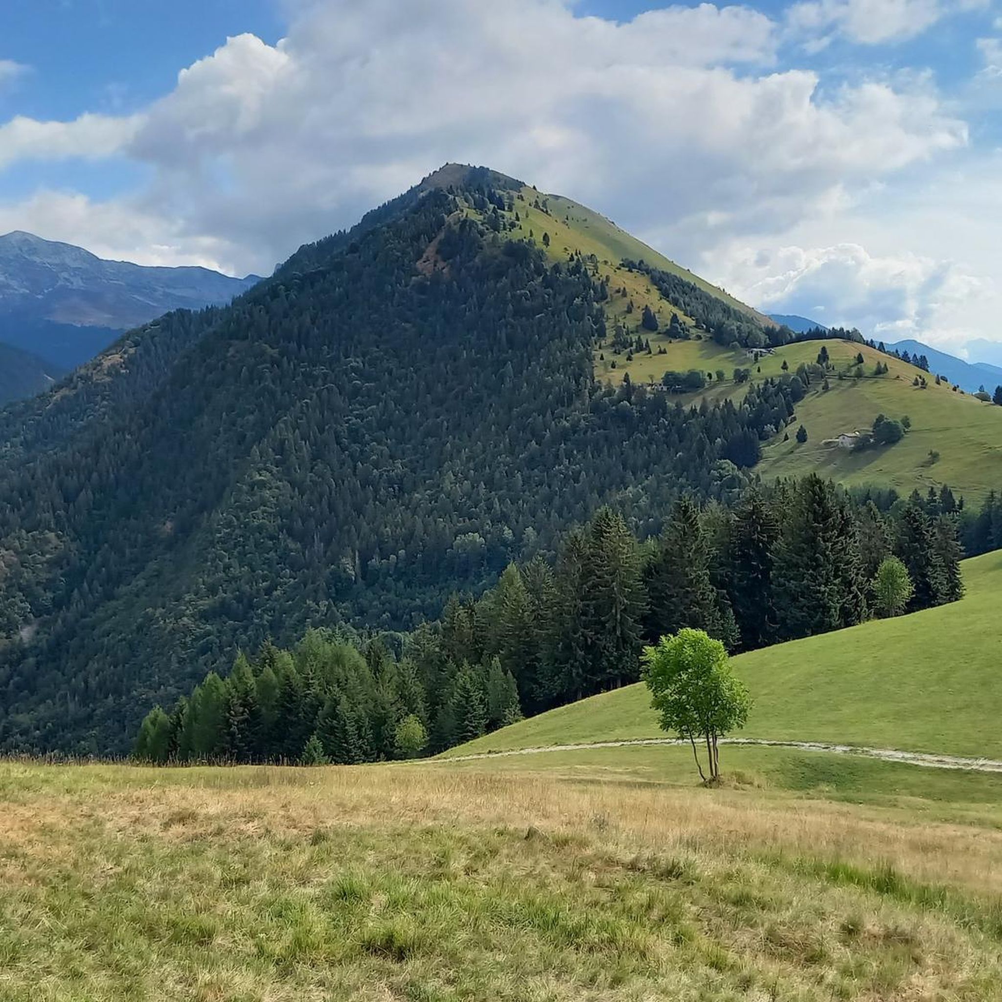
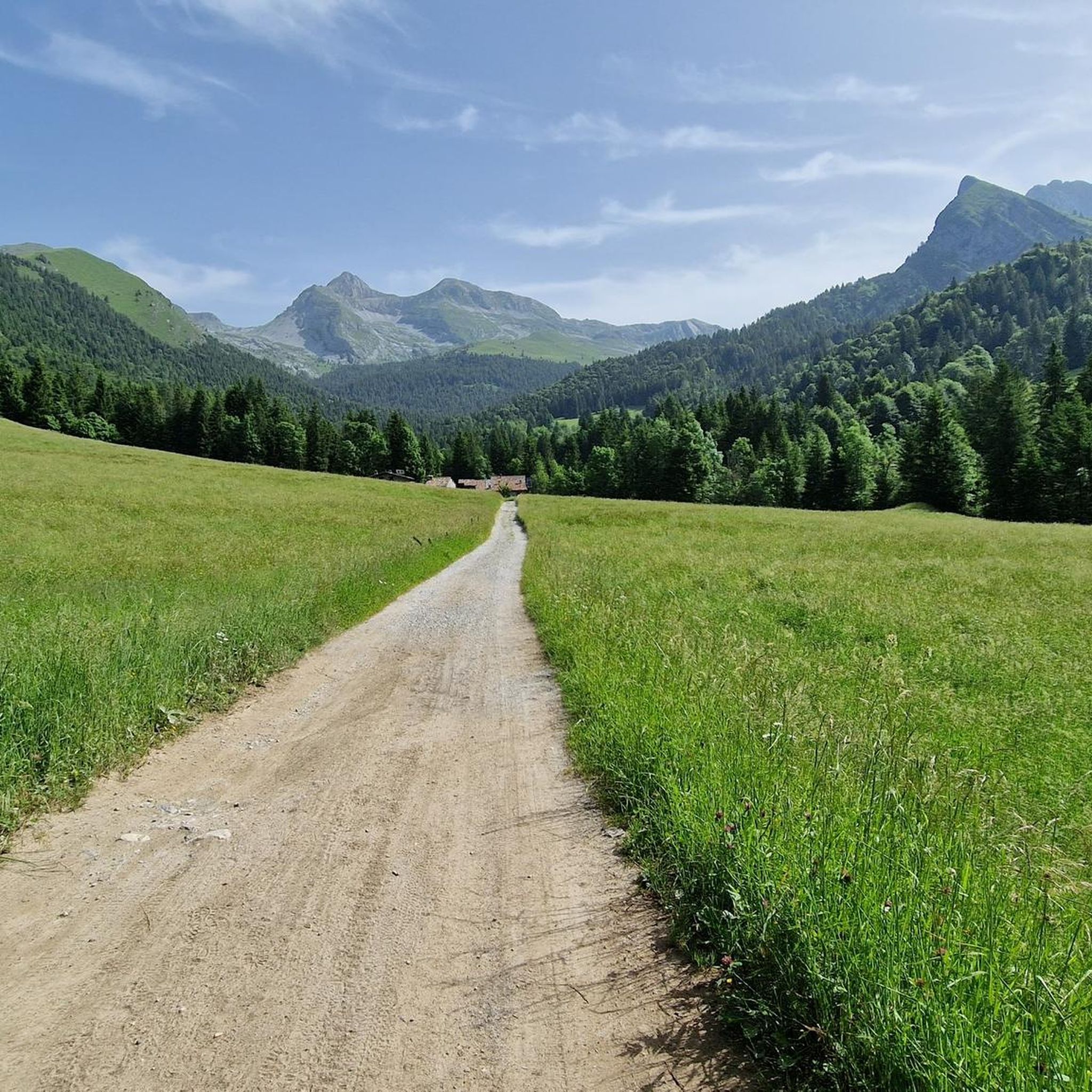
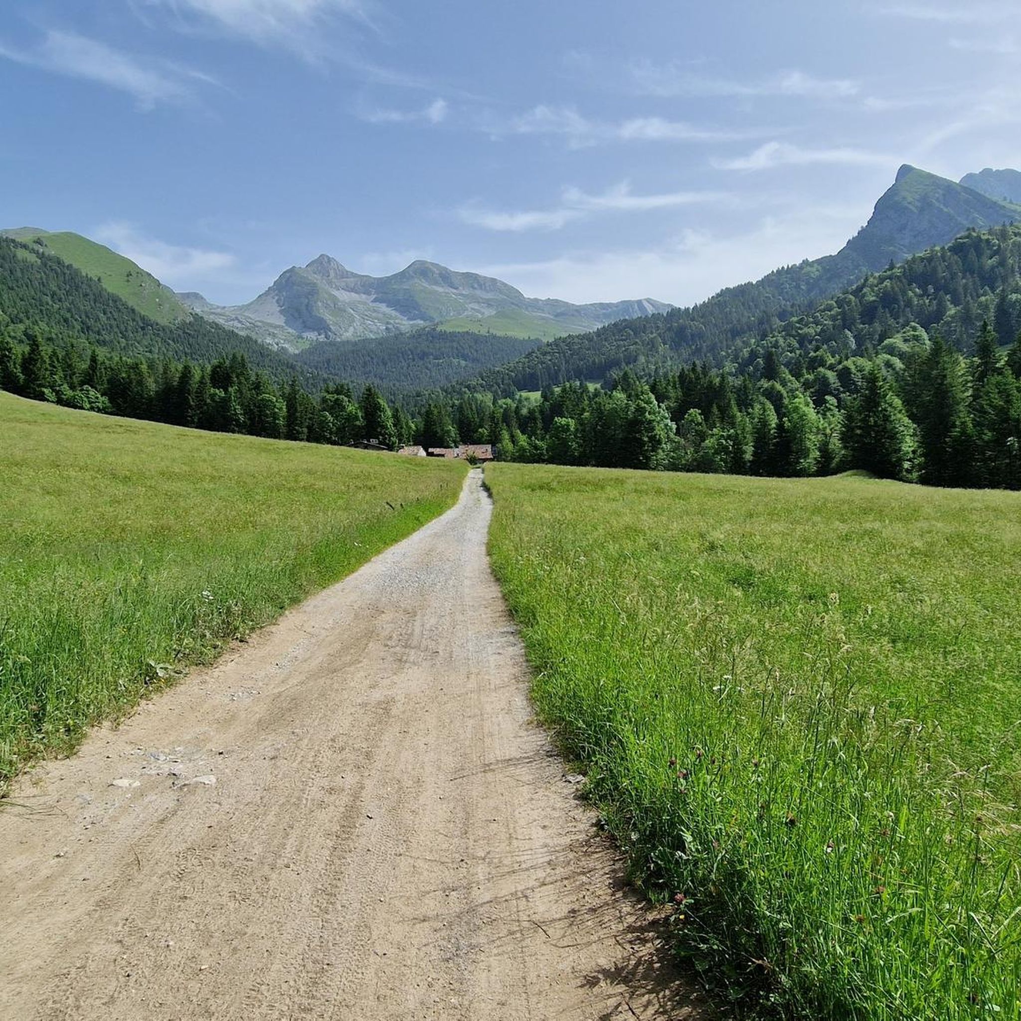
オルトレッセンダ・アルタの登山ルートは、イタリアのロンバルディア州に位置し、標高約600メートルから2,427メートルの多様な山岳地帯を特徴とし、モンテ・フェッランテが最高峰です。この地域には、オグナ川によって形成された絵のように美しいヴァルツリオがあり、強烈な色の「青い湖」を形成しています。登山者は、印象的なプレソラーナ山の圏谷にあるアルペンスタイルの山小屋や、ロッククライミング用の「ナソリーノ」のような挑戦的な岩壁を探検できます。
オルトレッセンダ・アルタ周辺の最高の登山ルート
- 最も人気のある登山ルートは、ヴァルゴーリオからのスッコット湖 – ダヴィアスコ湖ループで、距離は12.0 km(7.4マイル)、所要時間は6時間1分です。この難易度の高いルートは、高山の湖と挑戦的な山道を探検します。
- 地元の登山者の間で人気のもう一つのルートは、ヴァルボンドーネからのリフュージョ・マリオ・メレッリ・アル・コカ – コカ湖ループで、距離は10.2 km(6.3マイル)の難易度の高いルートです。このトレイルは、かなりの標高差と周囲の峰々のパノラマビューを提供します。
- 地元の登山者は、ヴァルゴーリオからのスッコット湖 – マドンニーノ山ループも気に入っています。このルートは11.9 km(7.4マイル)で、変化に富んだ高山の風景を通り抜け、所要時間は約7時間2分です。
- オルトレッセンダ・アルタ周辺の登山は、かなりの標高変化、ヴァルツリオのような絵のように美しい谷、モンテ・フェッランテやプレソラーナのような印象的な峰々によって特徴づけられます。このネットワークは、挑戦的な登りやテクニカルなクライミングを含む、さまざまなスキルレベルのオプションを提供します。
- オルトレッセンダ・アルタのルートは、komootコミュニティから高く評価されており、20件以上のレビューで平均4.5つ星を獲得しています。150人以上の登山者がkomootを利用して、オルトレッセンダ・アルタの多様な地形を探検しています。
最終更新日: 10月 8, 2026
4.3
(3)
23
ハイカー
12.0km
07:10
1,290m
1,290m
難しい登山ルート. 標準以上のフィットネスレベルが必要です。 安定して歩行できる技術、丈夫な靴、高標高地での登山経験が必要です。
5.0
(2)
14
ハイカー
14.3km
06:17
1,000m
1,000m
難しい登山ルート. 標準以上のフィットネスレベルが必要です。 安定して歩行できる技術、丈夫な靴、高標高地での登山経験が必要です。

3.3
(4)
12
ハイカー
9.88km
04:48
920m
920m
難しい登山ルート. 標準以上のフィットネスレベルが必要です。 安定して歩行できる技術、丈夫な靴、高標高地での登山経験が必要です。
6
ハイカー
11.5km
05:04
860m
860m
難しい登山ルート. 標準以上のフィットネスレベルが必要です。 安定して歩行できる技術、丈夫な靴、高標高地での登山経験が必要です。
5.0
(1)
5
ハイカー
16.8km
07:46
1,290m
1,290m
難しい登山ルート. 標準以上のフィットネスレベルが必要です。 安定して歩行できる技術、丈夫な靴、高標高地での登山経験が必要です。
さらに多くのルートや他のユーザーのおすすめ情報を確認できます。
すでにアカウントをお持ちですか?
おすすめのツアーは他のkomootユーザーが実際に経験した何千ものアクティビティに基づいています。
無料アカウントで今日から始めよう
次の冒険が待っています。
コミュニティからのヒント


モンテ・マドンニーノは、ヴァル・ブレバンカとヴァル・セリアーナの間の自然な境界線上に位置する、標高2,502メートルのオロビエ・アルプスの頂上です。その名前は、頂上に置かれた小さな聖母マリア像に由来しており、ピッツォ・デル・ディアボロ・ディ・テンダやモンテ・ローザのような巨峰を眺めることができる素晴らしい展望ポイントとなっています。
0
0

Val Sedorniaに向かってTezzi Alti di Gandellinoから登る途中にあるLa Cappelletta di San Carloは、ロンバルディア全土で非常に崇敬されている聖人、サン・カルロ・ボロメオに捧げられた小さなアルプスの崇拝の場です。その起源は、民衆の伝統と、特に17世紀から18世紀にかけて多くの農村共同体が病気、飢饉、自然災害からの保護を求めて礼拝堂や奉納石碑を建てた、ベルガモの谷におけるボロメオ崇拝の広範な存在に関連しています。 この小さな礼拝堂は、Tezziの集落とSedorniaの牧草地を結ぶ古い連絡路沿いに位置しており、羊飼い、農民、旅人にとって必須の通過点です。まさにこのため、地元のコミュニティは、夏場の牧草地への登りを進む人々への保護の印として、ここにシンプルで石造りの小さな聖なる建物を設置することを望みました。小道からわずかに高くなった位置にあり、Sedorniaの渓流を見下ろすその場所は、アルプスの奉納礼拝堂の典型的な機能、すなわち道を祝福し谷を守ることを想起させます。 時が経つにつれて、この小さな礼拝堂はGandellinoとTezziの住民にとってアイデンティティの拠り所となりました。今日でも大切に維持されており、地域の歴史的関心事の一つとして観光ルートに含まれていることからも、地元の文化的なコースの一部となっています。
0
0
The Spiazzi dell'Acqua Picnic Area is one of the most peaceful and pleasant spots in the Gandellino area, surrounded by greenery and perfect for a relaxing break before or after a hike. Located in an easily accessible clearing, it offers tables, natural shade, and a cool atmosphere thanks to the proximity to the water. It's a simple yet meticulously maintained spot, ideal for families, groups, or anyone looking to enjoy a quiet moment in nature. Its secluded location and wooded setting make it a small haven of peace, convenient to reach yet far from the noise.
0
0
赤紫色のヴェルッカート(verrucano)の直方体である漂礫(ひょうれき)は、体積約20立方メートル、地面から約130cm突出しています。東西の壁は風化作用により巨石から剥がれ、わずかに外側に回転しており、巨石へのアクセスを容易にするための階段状の切り込みの痕跡が見られます。わずかに凹んで谷側に傾斜した上部には、粗雑ながらも一定の対称性をもって配置された、いくつかの彫刻、コッペル(cupel)、小さな溝があります。これらは主に3つの平行な線に沿って配置されています。北向きの面にも、斜めの線に沿って配置されたいくつかのコッペル状の彫刻が見られます。これらの彫刻の形状と配置は、自然発生的なものとは考えられないものです。この祭壇石は、おそらくケルト人のドルイドである古代の司祭たちの聖地でした。おそらく犠牲の場所でした。ここやアルプスの他の地域で行われた研究によると、この祭壇石は紀元前3千年紀から1千年紀にかけて神聖な儀式に使用されたと考えられています。実際、この場所の神聖さは先史時代に限定されるものではありません。「セドルニア(Sedornia)」という名前は、ローマ時代の名前「サトゥルニア(Sáturnia)」の変形であり、やはり宗教的な要素、すなわち自然、繁栄、豊穣の神であるサトゥルヌス神に関連しています。
0
0
Lake Spigorel is a small alpine lake in the Sedornia Valley, accessible from Tezzi Alti (Gandellino) via CAI trail 309. It is a popular destination for its wild location between Monte Barbarossa and Vigna Vaga. 🚶♂️ Route from Tezzi Alti Key details Start: Tezzi Alti (969 m) Arrival: Lake Spigorel (approximately 1,800 m) Difficulty: Hiking (E) Duration: Outward journey: ~3 hours Return journey: ~2 hours Elevation gain: ~830 m General route outline Take the forest road of the Sedornia Valley. Pass by the Chapel of San Carlo (1,163 m). Continue through woods and pastures to the Vigna Vaga huts. The final stretch climbs steeply toward the lake basin. ⭐ Why go there Wild and untouched environment. Excellent viewpoint over the Sedornia Valley. Option to continue toward Sponda Vaga or Rifugio Mirtillo for longer itineraries.
0
0

The trail is suitable for everyone and takes about an hour to reach the refuge. You can either hike along a cobblestone road or through the woods (not recommended if it's snowing in winter because it freezes, and in summer, some sections are very muddy). Be sure to pay extra attention.
0
0

halfway along the circular route from Plassa on the Arera flower trail
1
1
よくある質問
Oltressenda Altaの山岳ルートではどのような地形が予想されますか?
Oltressenda Altaの山岳ルートは、ロンバルディア地方の多様な地域にあり、海抜約600メートルから2,427メートルの山岳地帯が広がっています。最高峰はモンテ・フェッランテです。オグナ川が刻んだヴァルツーリオのような絵のように美しい谷があり、そこでは色が濃い「ラゲッティ・アッズーリ」が形成されています。この地域には、モンテ・フェッランテやプレソラーナ山塊のような印象的な峰もあり、困難な登攀や技術的なクライミングの機会を提供しています。
Oltressenda Altaには初心者向けの山岳ルートはありますか?
Oltressenda Altaは険しい地形で知られていますが、リストにある16のルートのうち、いくつか中級者向けのルートがあります。ほとんどのルートは難易度が高いと分類されているため、初心者はこの地域で山岳活動を試みる前に、自身の経験と体力レベルを慎重に評価する必要があります。
これらのルートで注目すべき自然の特徴やランドマークはありますか?
この地域は自然の美しさに恵まれています。ヴァルツーリオの壮大な巨人のポットホールを探索したり、ヴァルボンドーネの壮観なセーリオ川の滝(年に5回出現)を目撃したり、ヴァルツーリオの静かな「ラゲッティ・アッズーリ」を発見したりできます。プレソラーナ峠からは、「これらの山の女王」と呼ばれるプレソラーナ山塊の息をのむような景色が楽しめます。
周回型の山岳ルートはありますか?
はい、いくつかのルートは周回型として設計されています。例えば、ヴァルゴーリオからのラゴ・スッコット – ラゴ・ダヴィアスコ周回ルートは、高山の湖を探検する人気の難易度の高いルートです。もう一つの挑戦的なオプションは、ヴァルボンドーネからのリフュージオ・マリオ・メレッリ・アル・コカ – コカ湖周回ルートで、かなりの標高差とパノラマビューを提供します。
Oltressenda Altaでの山岳活動に最適な時期はいつですか?
Oltressenda Altaでの山岳活動に最適な時期は、一般的に晩春から初秋(6月から10月)にかけてです。この時期は通常、トレイルに雪がなく、気象条件もより安定しています。ただし、標高によって状況は大きく異なる可能性があるため、出発前に必ず現地の予報とトレイル情報を確認してください。
Oltressenda Alta地域に接続する長距離トレイルはありますか?
はい、数日間の冒険を求める方のために、有名なセニェロ・デッレ・オロビエがあります。これは90kmに及ぶ高山トレイルで、8つの区間にわたる行程で7つの山小屋を結んでいます。このトレイルはオロビエ・ベルガマスケの最高峰の一部へと続き、より広範なセリアーナ渓谷地域の一部を横断します。
Oltressenda Altaのルートについて、他の登山者はどのように評価していますか?
Oltressenda Altaの山岳ルートは、komootコミュニティから高く評価されており、20件以上のレビューから平均4.5つ星を獲得しています。利用者はしばしば、挑戦的な登攀、見事な高山の湖、そして周囲のオロビエ山脈のパノラマビューを称賛しています。
Oltressenda Alta地域にクライミングスポットはありますか?
はい、Oltressenda Altaの「ナソリーノ」クラッグは、評価の高いクライミングスポットです。ドッソの古い集落の上にある日当たりの良い盆地に位置し、ポケット、オーバーハング、エクストリームスラブなど、素晴らしい自然環境の中で多様なクライミングが楽しめます。より広範なセリアーナ渓谷にも、他の人気のクライミング岩壁があります。
ルート沿いには休憩や宿泊ができる山小屋はありますか?
はい、この地域には高地での休憩や食事を提供するいくつかの古典的な山小屋があります。コカ、クーロ、タリアフェッリ、アルバーニなどの山小屋が有名で、これらはしばしば長距離の山岳ルートに組み込まれています。
山岳活動以外で、セリアーナ渓谷で人気のアウトドアアクティビティは何ですか?
山岳活動以外にも、セリアーナ渓谷は幅広いアウトドア愛好家に対応しています。人気のアクティビティには、キャニオニング、マウンテンバイク(渓谷沿いに30kmの自転車道あり)、パラグライダー、ロッククライミングがあります。冬には、スキー登山も選択肢となります。
トレイルの近くに興味深い歴史的建造物や人工的なランドマークはありますか?
はい、いくつかの見どころがあります。例えば、フォルチェッラ・ラルガにある第三千年紀の鐘はユニークなランドマークであり、マニーナ礼拝堂は地元の遺産を垣間見ることができます。旧ヴィア・マラ街道とトンネルも興味深い歴史的特徴です。
Oltressenda Altaにはいくつの山岳ルートがありますか?
Oltressenda Altaには16の山岳ルートが記録されており、そのほとんどが難易度の高い性質のため、主に経験豊富な登山者向けの様々な体験を提供しています。

komootモバイルアプリでインスピレーションを得よう


さらに探索
他の地域の最高の登山ハイキング & ルートを見てみましょう。
