20의 알름도르프가지 명소 & 주요 장소
알름도르프에는 둘러볼 만한 장소가 많답니다. 하이킹 또는 사이클링을 좋아한다면 알름도르프에 숨겨진 20
가지 보석을 만날 수 있을 거예요. 이 지역의 주요 명소를 살펴보면서 다음 모험을 계획해보세요.
마지막 업데이트: 9월 12, 2026
북해와 할리겐의 전망
하이라이트 • 전망대
번역자 Google •
팁에 의해

햄버거 할리히로 가는 염습지 길
하이라이트 (구간) • 트레일
번역자 Google •
팁에 의해

이런 장소를 발견하려면 지금 가입하세요
최고의 싱글 트랙, 봉우리 및 다양한 흥미로운 야외 장소에 대한 추천을 받아보세요.

뤼트무어지엘 방조제와 벨트링하르더 코오크 전망
하이라이트 • 전망대
번역자 Google •
팁에 의해

노르드스트란디슈무어로 가는 로렌반 제방
하이라이트 • 구조물
번역자 Google •
팁에 의해

무료로 가입하여 알름도르프 주변의 더 많은 명소를 발견하세요.
이미 komoot 계정이 있나요?
오늘 무료 계정으로 시작하세요
다음 모험이 기다리고 있어요.
커뮤니티 팁

Lüttmoorsiel, kilometer-long sea dike Halligbahn, Lüttmoorsiel–Nordstrandischmoor Lüttmoorsiel–Nordstrandischmoor, also called Lorenbahn, is a Halligbahn opened in 1934 with a track width of 600 mm through the North Frisian Wadden Sea from Beltringharder Koog to the Hallig Nordstrandischmoor. https://de.m.wikipedia.org/wiki/Halligbahn_L%C3%BCttmoorsiel%E2%80%93Nordstrandischmoor
7
0

The translation takes about 15 minutes, which is only possible for overnight guests.
5
1

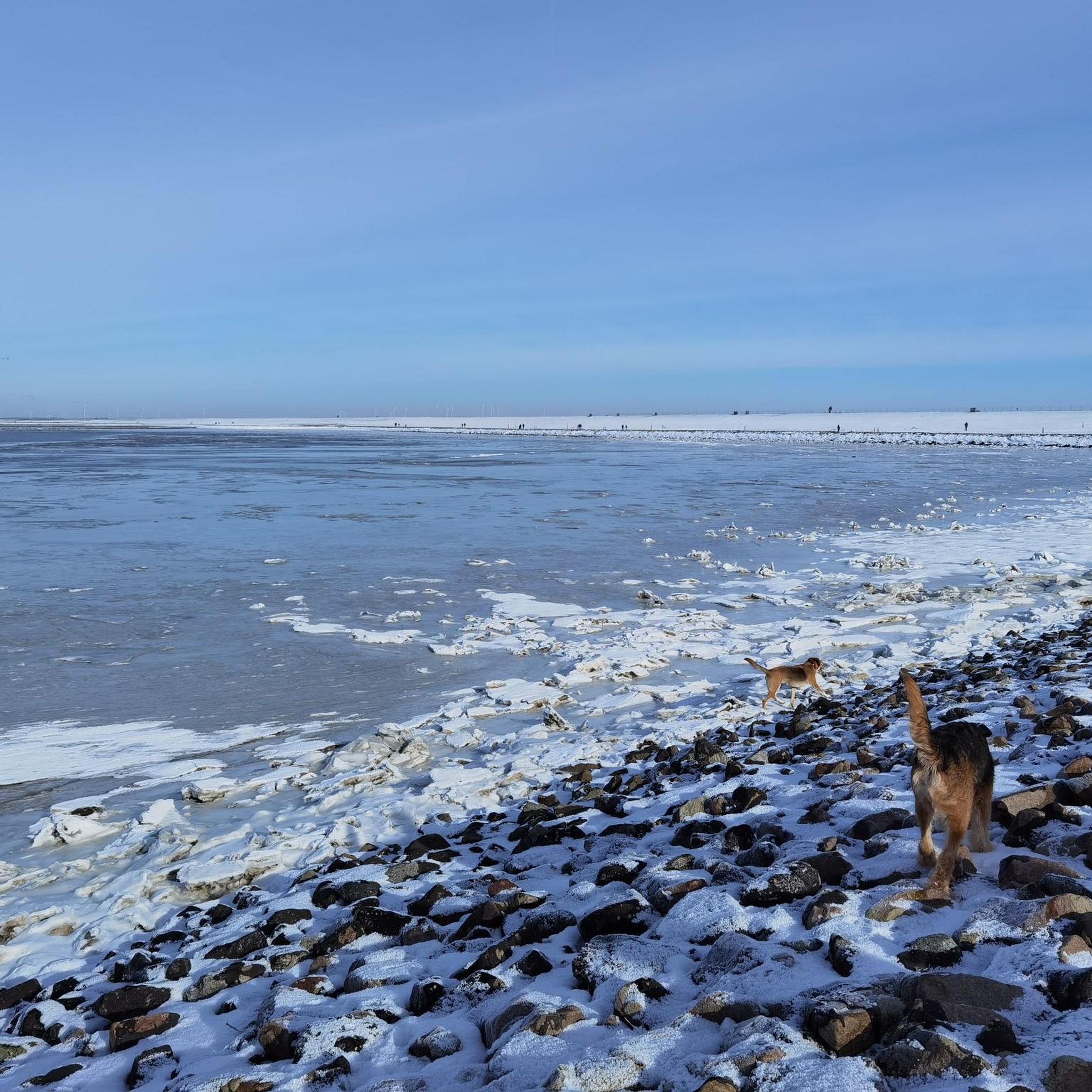
From this dike, you reach infinite horizons. You have views of the sea, but also of the halligens and the Beltringharder Koog. As you evolve near mudflats, many sea wading birds better known as wading birds are visible. Oystercatchers, curlews, sandpipers, sandpipers. All these birds find their pantries in the mud. You also see many sheep. The salty grass they eat makes their meats tastier.
5
2

A 3.5-kilometer-long lorry dam, which leads to the Beltringharder Koog on the mainland and is only navigable at low tide, connects the Hallig Nordstrandischmoor with the mainland. This lorry dam was built in 1926. Worth seeing. 👍🏼
9
0
Magnificent Ausssicht with a clear view of Nordstrandischmoor and the "salt lagoon and the Beltringharder Koog". These natural lagoons no longer exist on the Schleswig-Holstein Wadden Sea coast as a result of dike construction measures. Today there are three artificial lagoons: the Rantum basin on Sylt, the Kronenloch in Speicherkoog Dithmarschen and the Beltringharder Koog. Important breeding colonies of the rare terns, avocets and plovers are found on the artificial islands of the lagoon. Large flocks of wading birds gather there during high water migration periods. As a result, these are not salt marshes in the classic sense. https://www.beltringharderkoog.de/der-beltringharder-koog/salzwasserlagune
10
1
The coast off Schobüll has a largely natural transition from the Hohe Geest to the Wadden Sea with a weak beach wall system. It is the only undeicht section on the entire west coast of Schleswig-Holstein. In front of the former open geest coast with a sandy beach and small dunes, a largely naturally formed salt marsh can be found today, which is largely unused and left to the natural dynamics of the Wadden Sea. http://ag-geobotanik.de/Kieler_Notizen/KN_3/KN39_040-053_(2013)_Stock_Schobueller_ beach.pdf
5
0
Drifts, which can now include plastic and other rubbish from ships, boats or holidaymakers on the coast, is not driven off Husum or Schobüll, but unfortunately everywhere on the coast.
4
0

At 1,000 hectares, the salt marshes along the causeway to the Hamburger Hallig form the largest salt marsh area on the open North Sea.
24
2
알름도르프 주변에서 가장 인기 있는 명소


더 살펴보기
찾고 있는 하이라이트를 아직 못 찾으셨나요? 다른 지역의 주요 명소 가이드를 확인해보세요:
