메르잘벤 최고의 워킹 & 하이킹 경로
4.5
(593)
1,991
등산객
59
하이킹
정확한 경로를 찾는 것이 때로는 어렵지만 메르잘벤에서 하이킹을 하면 다양한 경치를 마음껏 감상할 수 있답니다. 메르잘벤에서 가장 멋진 하이킹과 워킹 중에서 마음에 드는 활동을 시작해보세요.
마지막 업데이트: 10월 8, 2026
4.7
(114)
347
등산객
13.1km
03:41
270m
270m
보통 하이킹. 좋은 체력 필요. 실력과 관계없이 누구나 쉽게 갈 수 있는 길.
4.8
(87)
248
등산객
20.9km
06:00
500m
500m
어려운 하이킹. 우수한 체력 필요. 실력과 관계없이 누구나 쉽게 갈 수 있는 길.

4.7
(27)
76
등산객
21.0km
06:07
530m
530m
어려운 하이킹. 우수한 체력 필요. 실력과 관계없이 누구나 쉽게 갈 수 있는 길.
4.7
(41)
92
등산객
10.0km
02:51
230m
230m
보통 하이킹. 좋은 체력 필요. 실력과 관계없이 누구나 쉽게 갈 수 있는 길.
4.6
(32)
108
등산객
8.59km
02:33
250m
250m
보통 하이킹. 좋은 체력 필요. 실력과 관계없이 누구나 쉽게 갈 수 있는 길.
더 다양한 경로와 다른 탐험가들의 추천을 살펴보세요.
이미 komoot 계정이 있나요?
투어 추천은 다른 사람들이 komoot에서 완료한 수천 개의 활동을 바탕으로 구성되어 있습니다.
오늘 무료 계정으로 시작하세요
다음 모험이 기다리고 있어요.

메르잘벤 주변의 다른 모험

커뮤니티 팁

비스라우터(Wieslauter) 옆의 아늑한 휴식 장소. 유머러스한 이름 짓기.
0
0

Ritterstein 71번, «Am Holläenderklotz»라는 비문이 새겨진 표지석은 Luitpoldturm에서 북쪽으로 약 600미터 떨어진 곳에 있습니다. Ritterstein은 등산객 주차장 중앙에 위치해 있습니다. Ritterstein 옆에는 거의 20미터 높이의 참나무가 자라고 있습니다. 비문에는 잘못된 철자인 «Holläender»라고 적혀 있습니다. 17세기 말, 수많은 네덜란드인들이 조선용으로 특히 큰 통나무를 구입하기 위해 Pfälzerwald로 왔습니다. 이러한 이유로 Holländerschlag, -bäume, -holz, -weg 또는 –fahrer와 같은 명칭이 생겨났습니다.
1
0


A quaint path leads through a winter wonderland when it has snowed.
0
0

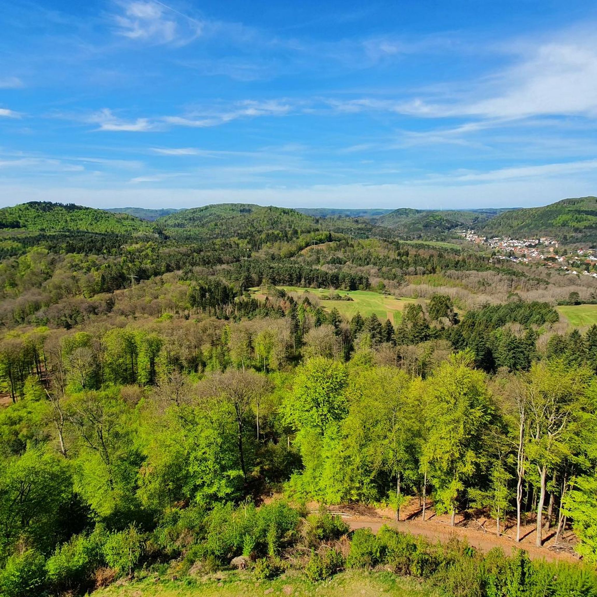
Superb 360° view. At the foot of the Tower there is a room with a table and a fireplace.
0
0

Beautiful view from the Palatinate Forest Trail 🏞 - Wilgartswiesen - Hauenstein Municipality - Southwest Palatinate District
0
0
Beautiful view of the Luitpold Tower 610 m above sea level on the Weißenberg ⛰ from Hermersbergerhof, a hamlet in the municipality of Wilgartswiesen
0
0
The Luitpold Tower (also called Luitpoldsturm) near Merzalben in the Südwestpfalz district of Rhineland-Palatinate is a 34.6 m high observation tower, inaugurated in 1909, on the approximately 610 m above sea level Weißenberg, one of the highest mountains in the Palatinate Forest. It was built of red sandstone. The Luitpold Tower is located in the heart of the Palatinate Forest, within the Palatinate Forest Nature Park. It stands in the municipality of Merzalben, approximately 7 km west-southwest, and 1.3 km north-northwest of the hamlet of Hermersbergerhof, which belongs to the neighboring municipality of Wilgartswiesen, on the summit region of the Weißenberg (approx. 610 m). The idea for building the tower was born on May 29, 1895, at the general meeting of the "Gräfenstein Beautification Association," founded by forestry assessor August Zwissler from Leimen in 1893. It was decided to build an observation tower on the Weißenberg, with an estimated cost of 8,000 to 10,000 marks. The necessary funds were to be raised by association member Martin Jäger, a local poet also known under the pseudonym Fritz Claus. Thanks to his advocacy for the tower, he was able to win over the Palatinate Forest Association (PWV), founded in Ludwigshafen in 1902, to his cause. The PWV leadership took over the coordination of the project, commissioned architect Ludwig Ullmann to draw up the plans, and raised the necessary funds primarily from membership dues. The name was suggested by Karl Albrecht von Ritter, the then chairman of the PWV; it was named after Prince Luitpold of Bavaria. Construction of the tower began on July 19, 1908, and its inauguration took place on September 26, 1909. The cost was approximately 23,000 marks, which, based on the base year 2000, corresponds to approximately 256,000 euros. The Palatinate Forest Association was able to complete payment of this amount as early as 1911. Source: https://de.wikipedia.org/wiki/Luitpoldturm#Renovierung_und_Erhaltung
1
0


더 살펴보기
다른 지역의 최고의 하이킹를 살펴보세요.
