에펜브룬 최고의 워킹 & 하이킹 경로
4.7
(5599)
18,697
등산객
183
하이킹
정확한 경로를 찾는 것이 때로는 어렵지만 에펜브룬에서 하이킹을 하면 다양한 경치를 마음껏 감상할 수 있답니다. 에펜브룬에서 가장 멋진 하이킹과 워킹 중에서 마음에 드는 활동을 시작해보세요.
마지막 업데이트: 10월 14, 2026
4.8
(1301)
4,142
등산객
10.2km
02:47
160m
160m
보통 하이킹. 좋은 체력 필요. 실력과 관계없이 누구나 쉽게 갈 수 있는 길.
4.8
(582)
1,814
등산객
7.58km
02:05
120m
120m
보통 하이킹. 좋은 체력 필요. 실력과 관계없이 누구나 쉽게 갈 수 있는 길.

4.8
(379)
1,221
등산객
15.5km
04:19
280m
280m
보통 하이킹. 좋은 체력 필요. 실력과 관계없이 누구나 쉽게 갈 수 있는 길.
4.8
(327)
1,031
등산객
13.0km
03:37
230m
230m
보통 하이킹. 좋은 체력 필요. 실력과 관계없이 누구나 쉽게 갈 수 있는 길.
4.9
(144)
435
등산객
8.61km
02:22
150m
150m
보통 하이킹. 좋은 체력 필요. 실력과 관계없이 누구나 쉽게 갈 수 있는 길.
더 다양한 경로와 다른 탐험가들의 추천을 살펴보세요.
이미 komoot 계정이 있나요?
투어 추천은 다른 사람들이 komoot에서 완료한 수천 개의 활동을 바탕으로 구성되어 있습니다.
오늘 무료 계정으로 시작하세요
다음 모험이 기다리고 있어요.


커뮤니티 팁


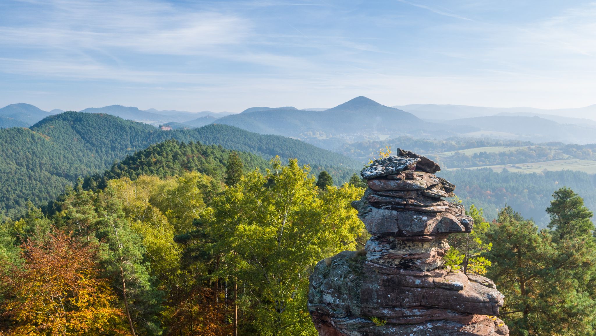
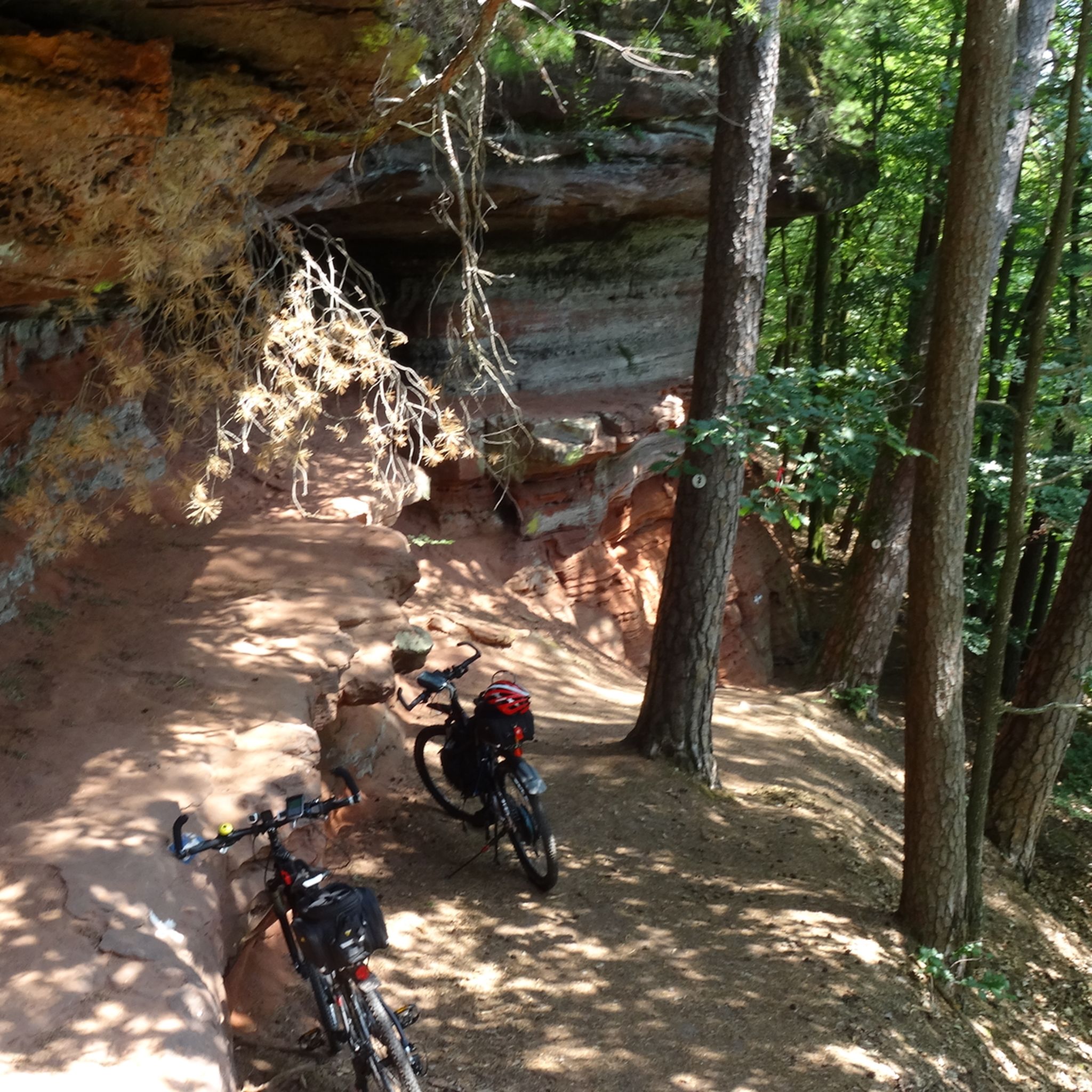
그것과 비할 데 없는 색상의 놀이. 빛에 따라 강렬한 붉은색, 주황색, 그리고 회색과 이끼 낀 바위 사이를 오갑니다. 그리고 끊임없이 다양한 모양, 동굴, 통로들이 나타납니다.
5
0
바위는 예를 들어 에펜브룬(Eppenbrunn)이나 근처 하이킹 주차장에서 도보로만 접근할 수 있습니다. 절대적인 자연의 경관이자 하이라이트입니다.
7
0
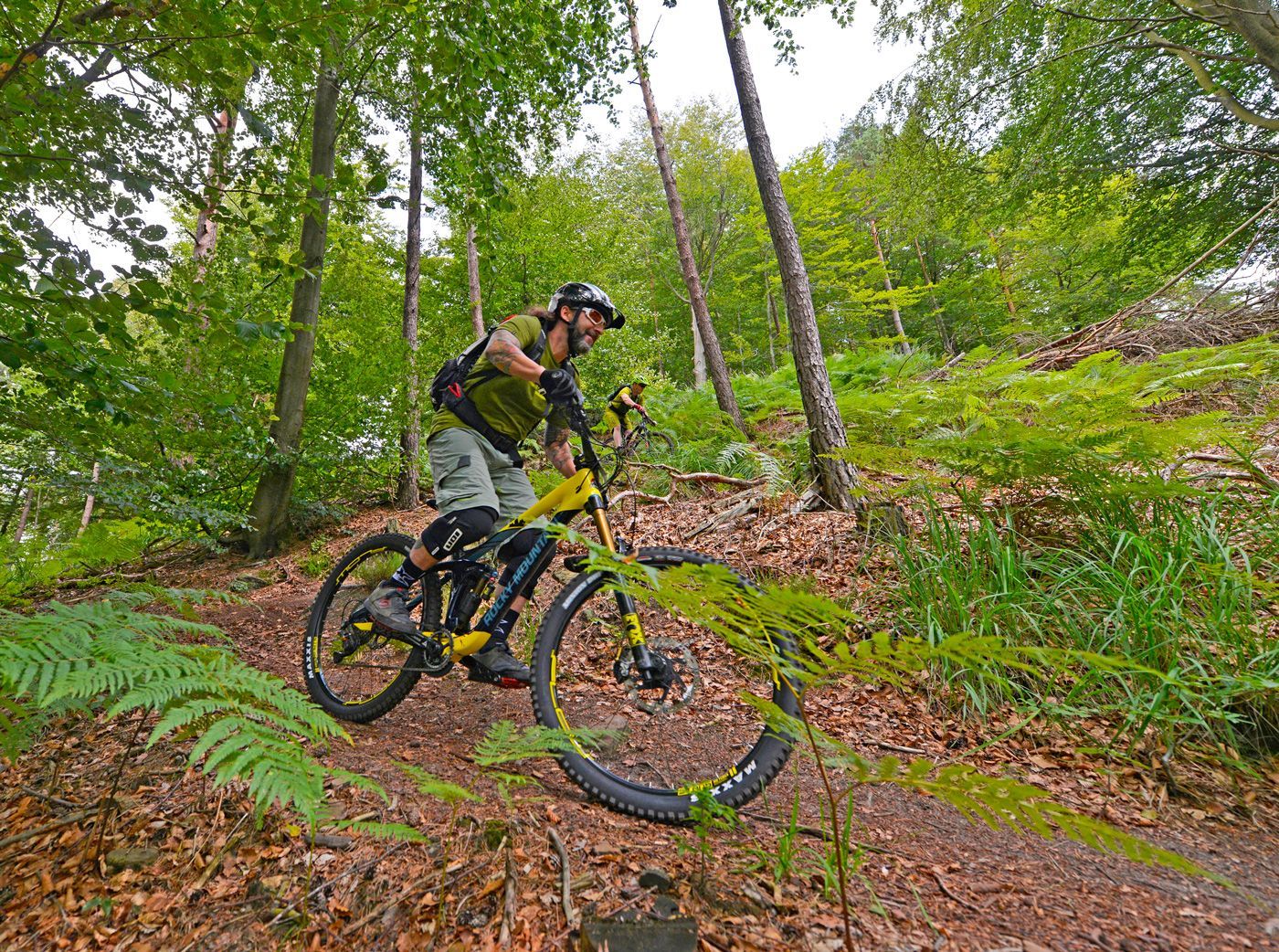
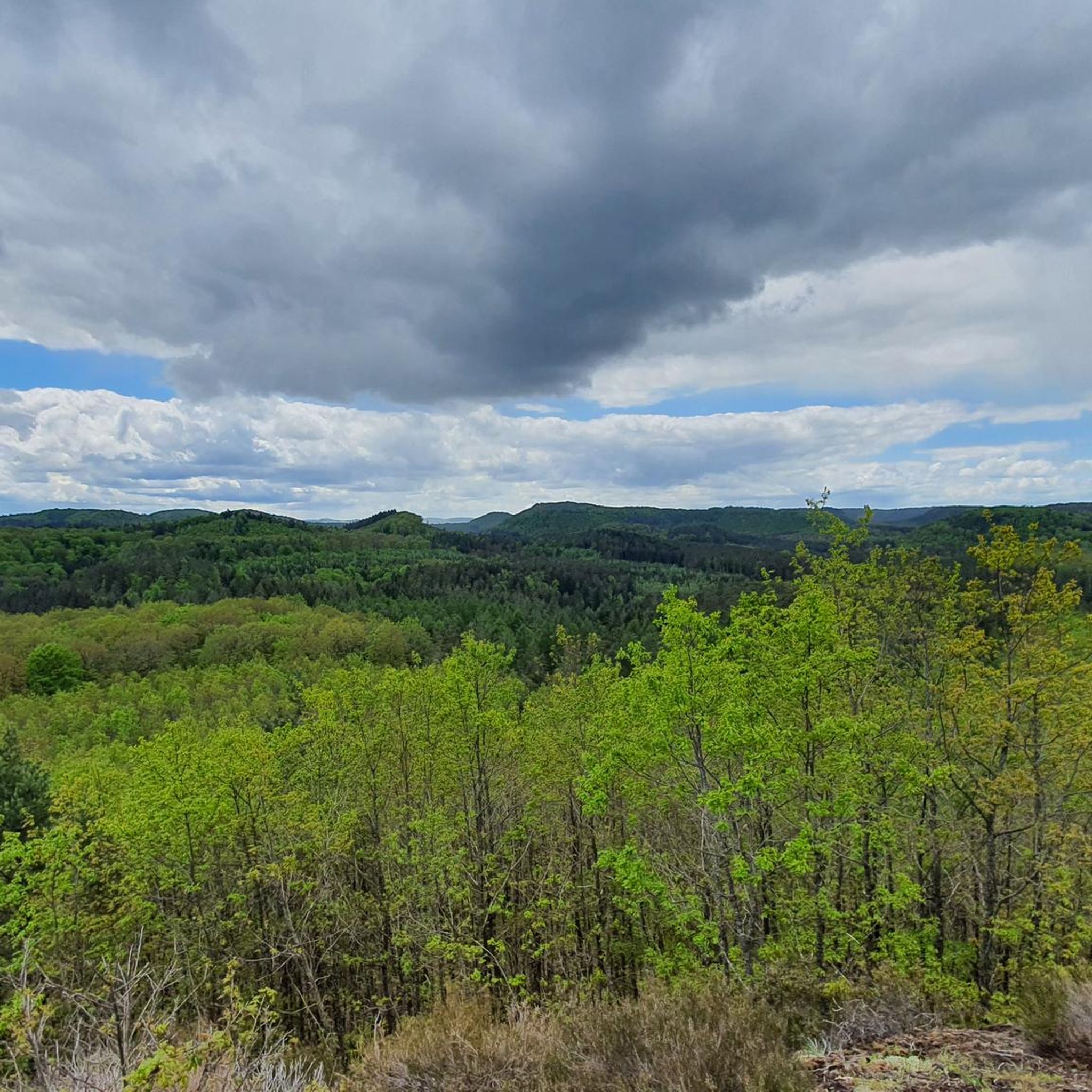
클래식한 숲길을 다시 생각하게 하는 하이킹입니다. 여기서 하이킹은 즐겁습니다. 길 위에 있거나 가로지르는 많은 뿌리들을 주의해야 합니다. 넘어질 위험이 있습니다.
9
0

The Altschlossfelsen (also known as Eppenbrunn Castle) are a group of red sandstone rocks designated as a natural monument (ND) ND-7340-205 and a cultural monument (KD) in the municipality of Eppenbrunn in the Palatinate Forest on the border with France, and are the largest rock formation in the Palatinate. They are located on the eastern slope of the Brechenberg (406 m) near Eppenbrunn and Roppeviller at an elevation of approximately 365 m above sea level at the northeast end and 380 m above sea level at the southwest end of the rock band. The Altschlossfelsen are a group of red sandstone rocks approximately one and a half kilometers long and up to 30 meters high. The group consists of sandstone towers and walls. The Altschlossfelsen are crisscrossed by cracks and joints, some of which are wide enough to climb through. They are known primarily for their diverse weathering phenomena and rare lichens. The summit plateau can be reached from the north and south on narrow paths. There, you'll find a sparse forest and moss-covered rocks. A special lighting situation created by the sun, the "rock glow," is best seen around 7:00 p.m. in the first half of April, depending on weather conditions, vegetation, and the position of the sun. In the morning hours, the glow occurs around 8:45 a.m. Finds from the Hallstatt and Roman periods attest to earlier settlement of the rock group. In 1964, for example, shards from the La Tène period (c. 450–50 BC) were found. Traces of a medieval castle from the 11th or 12th century are found on the four main rocks. These include the remains of a stepped structure, post holes, remains of masonry, and notches for beams in the rock. A depression with a diameter of four meters is located on a rock, which may have served as a cistern. Additionally, on the southern and northern slopes around the rock formation, humped blocks, which may have originated from the structure of a former castle, as well as shards from the High Middle Ages were found in a wall groove. A more precise dating of the castle complex is difficult, as the castle was not mentioned before 1297 or later in the 1605 border description between Lorraine and the County of Hanau-Lichtenberg. Source: https://de.wikipedia.org/wiki/Altschlossfelsen
2
0
The Altschlossfelsen (also known as Eppenbrunn Castle) are a group of red sandstone rocks designated as a natural monument (ND) ND-7340-205 and a cultural monument (KD) in the municipality of Eppenbrunn in the Palatinate Forest on the border with France, and are the largest rock formation in the Palatinate. They are located on the eastern slope of the Brechenberg (406 m) near Eppenbrunn and Roppeviller at an elevation of approximately 365 m above sea level at the northeast end and 380 m above sea level at the southwest end of the rock band. The Altschlossfelsen are a group of red sandstone rocks approximately one and a half kilometers long and up to 30 meters high. The group consists of sandstone towers and walls. The Altschlossfelsen are crisscrossed by cracks and joints, some of which are wide enough to climb through. They are known primarily for their diverse weathering phenomena and rare lichens. The summit plateau can be reached from the north and south on narrow paths. There, you'll find a sparse forest and moss-covered rocks. A special lighting situation created by the sun, the "rock glow," is best seen around 7:00 p.m. in the first half of April, depending on weather conditions, vegetation, and the position of the sun. In the morning hours, the glow occurs around 8:45 a.m. Finds from the Hallstatt and Roman periods attest to earlier settlement of the rock group. In 1964, for example, shards from the La Tène period (c. 450–50 BC) were found. Traces of a medieval castle from the 11th or 12th century are found on the four main rocks. These include the remains of a stepped structure, post holes, remains of masonry, and notches for beams in the rock. A depression with a diameter of four meters is located on a rock, which may have served as a cistern. Additionally, on the southern and northern slopes around the rock formation, humped blocks, which may have originated from the structure of a former castle, as well as shards from the High Middle Ages were found in a wall groove. A more precise dating of the castle complex is difficult, as the castle was not mentioned before 1297 or later in the 1605 border description between Lorraine and the County of Hanau-Lichtenberg. Source: https://de.wikipedia.org/wiki/Altschlossfelsen
1
0
The Altschlossfelsen (also known as Eppenbrunn Castle) are a group of red sandstone rocks designated as a natural monument (ND) ND-7340-205 and a cultural monument (KD) in the municipality of Eppenbrunn in the Palatinate Forest on the border with France, and are the largest rock formation in the Palatinate. They are located on the eastern slope of the Brechenberg (406 m) near Eppenbrunn and Roppeviller at an elevation of approximately 365 m above sea level at the northeast end and 380 m above sea level at the southwest end of the rock band. The Altschlossfelsen are a group of red sandstone rocks approximately one and a half kilometers long and up to 30 meters high. The group consists of sandstone towers and walls. The Altschlossfelsen are crisscrossed by cracks and joints, some of which are wide enough to climb through. They are known primarily for their diverse weathering phenomena and rare lichens. The summit plateau can be reached from the north and south on narrow paths. There, you'll find a sparse forest and moss-covered rocks. A special lighting situation created by the sun, the "rock glow," is best seen around 7:00 p.m. in the first half of April, depending on weather conditions, vegetation, and the position of the sun. In the morning hours, the glow occurs around 8:45 a.m. Finds from the Hallstatt and Roman periods attest to earlier settlement of the rock group. In 1964, for example, shards from the La Tène period (c. 450–50 BC) were found. Traces of a medieval castle from the 11th or 12th century are found on the four main rocks. These include the remains of a stepped structure, post holes, remains of masonry, and notches for beams in the rock. A depression with a diameter of four meters is located on a rock, which may have served as a cistern. Additionally, on the southern and northern slopes around the rock formation, humped blocks, which may have originated from the structure of a former castle, as well as shards from the High Middle Ages were found in a wall groove. A more precise dating of the castle complex is difficult, as the castle was not mentioned before 1297 or later in the 1605 border description between Lorraine and the County of Hanau-Lichtenberg. Source: https://de.wikipedia.org/wiki/Altschlossfelsen
1
0

Nice eye-catcher, only the tree on the rock is missing 🌳
0
1


더 살펴보기
다른 지역의 최고의 하이킹를 살펴보세요.
