써멀바트 비젠바트에서 가장 멋진 19개의 산 정상
써멀바트 비젠바트의 산 정상에 오르면 이 지역의 아름다운 모습을 제대로 구경할 수 있어요. 다만, 19
곳이나 되는 산 정상 중에서 어떤 곳을 가야 할 지 고민된다는 게 문제죠. 써멀바트 비젠바트에서 가장 멋진 산 정상을 살펴본 후에 마음에 드는 산 정상을 다음 모험 계획에 추가해보세요.
마지막 업데이트: 11월 7, 2026
Pöhlberg 전망탑 및 Berghotel Röthberg
하이라이트 • 전망대
번역자 Google •
팁에 의해

드라이브뤼더회 전망대
하이라이트 • 전망대
번역자 Google •
팁에 의해
이런 장소를 발견하려면 지금 가입하세요
최고의 싱글 트랙, 봉우리 및 다양한 흥미로운 야외 장소에 대한 추천을 받아보세요.
Scheibenberg 전망탑 및 산장
하이라이트 • 전망대
번역자 Google •
팁에 의해

슈레켄베르크 전망대
하이라이트 • 기념물
번역자 Google •
팁에 의해

무료로 가입하여 써멀바트 비젠바트 주변의 더 많은 봉우리를 발견하세요.
이미 komoot 계정이 있나요?
오늘 무료 계정으로 시작하세요
다음 모험이 기다리고 있어요.


커뮤니티 팁

At Schatzenstein you will find Nagel's Column, Station 127 of the Saxon State Survey of 1864, and the memorial plaque for Max Schreyer, the composer of the "Vuglbärbaam" song. A large rest area with a shelter offers space for a relaxing break.
3
0

왕립 작센 삼각 측량(여기서는 역사적 고유 명칭으로 표기)은 1862년부터 1890년까지 작센 왕국 영토에서 수행된 국가 측량으로, 동시에 삼각망이 구축되었습니다. 목표는 국가 영토를 과학적-측지학적으로 정확하게 파악하고 영구적으로 표시된 고정점을 설정하여 정확한 지도 제작의 기초를 마련하는 것이었습니다. August Nagel이 만든 삼각 측량망은 당시 세계에서 가장 정확한 측량망 중 하나로 간주되었습니다. Nagel의 기둥은 오늘날 기술 기념물로 보존되어 있습니다. Schatzenstein에서 Greifenstein, Scheibenberg, Fichtelberg, Hirschensprung, Auersberg, Hirschenstein 및 Katzenstein 관측소를 조준했습니다. 안타깝게도 이 파노라마 전망은 더 이상 존재하지 않습니다.
2
0

The survey is primarily of historical significance. This is where the roots of Annaberg silver ore mining lie. In October 1491, Caspar Nietzel came across a silver vein not far from the Frohnauer Obermühle. As a result, in 1496 the “Neustadt am Schockenberg” was built on the opposite bank of the Sehm, which was soon given the name Sankt Annaberg.
1
0

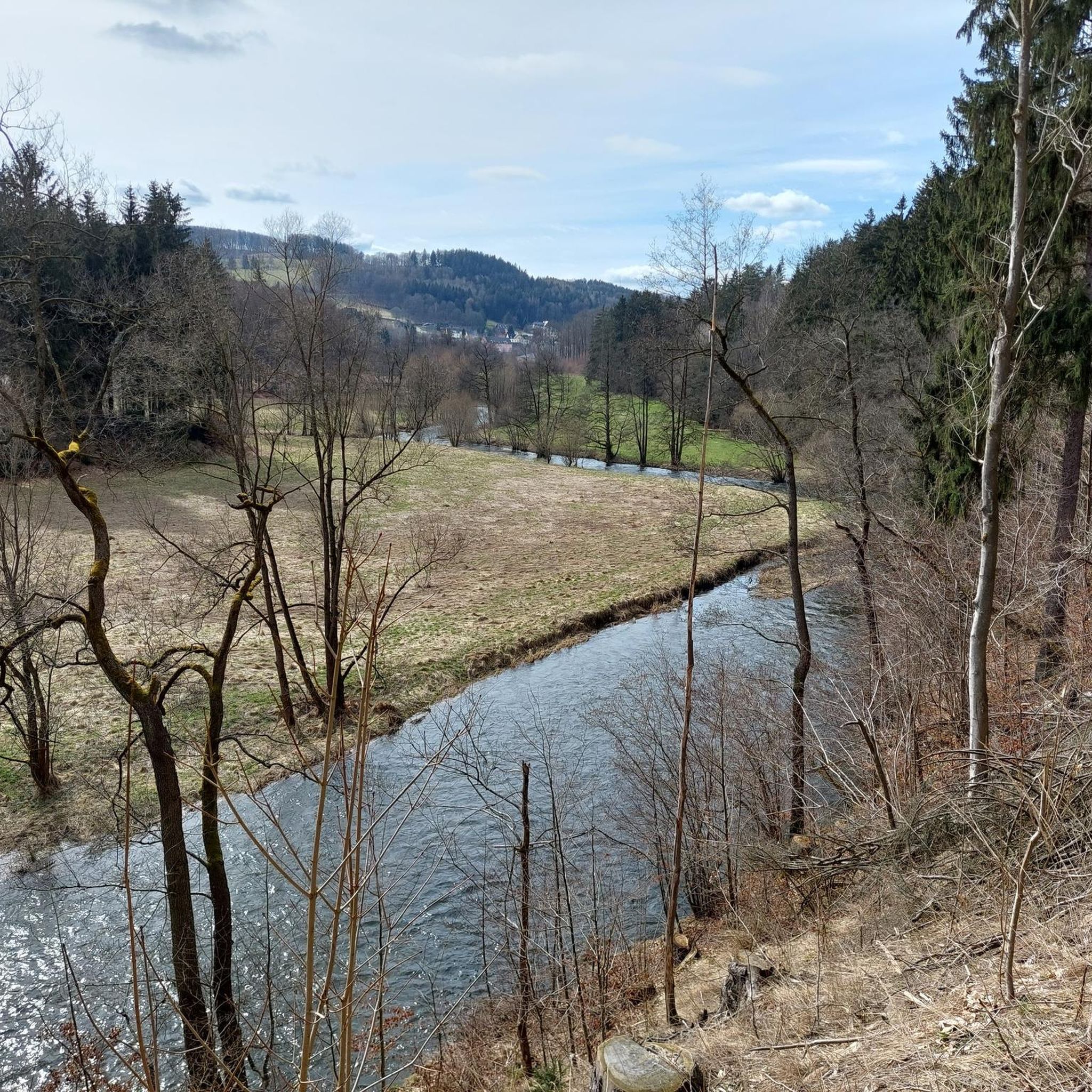
The Schatzenstein is a 760.4 m high mountain in the Ore Mountains. The Schatzenstein lies directly northwest of the town of Elterlein, on the municipal borders with Zwönitz and Grünhain-Beierfeld in the Grünhain Forest. The Schatzenstein area is a popular hiking destination with several phyllite cliffs, some reaching up to ten meters in height. However, due to the dense forest, there are hardly any distant views. At the highest point of the Schatzenstein stands a pillar of the Royal Saxon Triangulation, and a memorial plaque for the dialect poet Max Schreyer, commemorating the 100th anniversary of the creation of his well-known song "Dar Vuglbärbaam," is embedded in the rock. Max Schreyer was the head forester of this district between 1887 and 1893.
1
0

The Schreckenberg near Annaberg-Buchholz is located in the Ore Mountains and has a height of approx. 649 m above sea level. NN. The Schreckenberg is, among other things, a historical place because the roots of Annaberg silver mining lie here. At the end of the 15th century, a silver vein was discovered on the Schreckenberg in the Ore Mountains and a few years later the "Neustadt am Schreckenberg" was founded - which soon received the name "Sankt Annaberg". The Schreckenberg is also known as an attractive vantage point with a good view, e.g. of the Pöhlberg opposite and the mountain town of Annaberg-Buchholz in the Ore Mountains and much more. The castle ruins built in the 19th century on the Schreckenberg (Saxony) are particularly worth mentioning, with the remains of castle walls and a castle tower etc. Around the Schreckenberg you will find idyllic landscapes, attractive hiking trails and much more. The International Mountain Hiking Trail (EB), for example, leads along the Schreckenberg. https://www.dein-erzgebirge.de/aussichtspunkte-berge/schreckenberg.html
5
0

The climb to the Schrecksberg is definitely worth it, as you will be rewarded by a beautiful ruin and a great view.
2
1

The Schreckenberg near Frohnau in the Erzgebirge district is a 648.8 m above sea level. NHN high hill in the middle Ore Mountains. It is located one kilometer northwest of Annaberg-Buchholz in the district of Frohnau. The history of Schreckenberg Castle near Annaberg-Buchholz in Saxony is rather atypical for the construction of a castle. The first reason is that the castle was built very late, between 1854 and 1856. At a time when castles had already lost their importance. Secondly, it is no longer clear why the castle was built. However, one can assume that this can only be seen as emergency work. The client was the Privy Councilor Carl Friedrich Reiche-Eisenstuck. The system was built by the unemployed, which is why the theory of the job creation measure is justified. The construction was privately financed. Today only a ruin remains of the former castle. You can still see the round castle tower and some remains of the wall. The castle was not used after the Second World War and fell into disrepair. After reunification, restoration work was carried out on the tower. The facility is freely accessible.
1
0

In May 1883, an 18-metre-high iron lookout tower on the Drei Brüderhöhe was inaugurated by the Marienberg branch of the Ore Mountains. It was built by Maschinenfabrik C. Reinsch from Dresden at a price of around 6000 Reichsmarks. The tower, named in 1884 after the deceased wife of the then Prince George of Saxony Princess-Marien-Turm, soon became very popular as an excursion destination. The observation tower was closed for a long time by the building authorities. He was also not far from the restricted area at the military training area of the "National People's Army". It was therefore demolished and scrapped on March 11, 1977. The city of Marienberg had a new, 25.4 meter high observation tower built on the Drei Brüderhöhe, which was inaugurated on May 12, 1994 and allows a good view of Marienberg and the charming landscape up to the Fichtelberg and Keilberg.
5
0
써멀바트 비젠바트 주변에서 가장 인기 있는 명소


더 살펴보기
이 가이드를 통해 써멀바트 비젠바트 주변의 더 놀라운 정상들을 확인해보세요:
