4.5
(190)
6,797
ライダー
558
ライド
このガイドでご紹介するのは、komootがインディアナでのロードバイクルートのコレクション全体を評価して選び抜いた、このエリアの人気バイクライドです。あなたに合ったものを見つけるには、以下のルートをクリックして標高データや舗装状態の分析などの細かな情報を把握し、さらにkomootコミュニティのメンバーが投稿した役立つ情報や写真も閲覧しましょう。
最終更新日: 7月 8, 2026
3.0
(2)
112
ライダー
53.9km
02:04
100m
100m
The Monon Trail offers a diverse road cycling experience, stretching 33.5 miles (53.9 km) with a gentle elevation gain of 341 feet (104 metres). You can expect to complete this moderate route in about 2 hours and 4 minutes. As you cycle, you'll transition from the bustling urban core of Indianapolis, through lively neighborhoods like Broad Ripple, where you might spot vibrant murals near the Indianapolis Art Center's ARTPARK, to more serene suburban and rural landscapes further north. The paved surface, a hallmark of its rail-to-trail conversion, ensures a smooth ride throughout.
Planning your ride on the Monon Trail is straightforward, as it's entirely paved and largely flat, making it accessible for many cyclists. You'll find various trailheads along the route, such as the one at 96th Street, which offer convenient parking. While you will encounter major street crossings, many are clearly marked, and pedestrian bridges are in place to enhance safety at busier intersections. Look for amenities like restrooms and water fountains strategically placed along the way to support your journey.
This historic rail-to-trail conversion is a notable feature in the region, providing a continuous, dedicated path for cycling through varied environments. It connects downtown Indianapolis with northern communities, offering a unique perspective on the area's development and natural beauty. The trail's design, with its mix of urban vibrancy and quieter stretches, makes it a popular choice for both recreational rides and longer training sessions, allowing you to explore different facets of central Indiana on two wheels.
5.0
(1)
101
ライダー
81.6km
04:08
710m
710m
The Beanblossom Bottoms loop offers a moderate road cycling experience, winding through the scenic fringes of Morgan-Monroe State Forest and past the critical wetland habitats of the Beanblossom Bottoms Nature Preserve. You'll navigate rural roads, diverse forest landscapes, and bottomland, with glimpses of the preserve's rich birdlife and plant diversity. The route's 50.7 miles (81.6 km) feature significant rolling hills and varied terrain, making it a rewarding challenge for cyclists.
Planning your ride, expect a journey that takes around 4 hours and 8 minutes to complete, with a substantial 2325 feet (709 metres) of elevation gain. While the surfaces are mostly paved, be aware that some segments might be unpaved, adding to the adventure. The route passes through or near Ellettsville, Stinesville Mercantile, and Musgrave Orchard, offering potential stops along the way.
What makes this road cycling route truly stand out is its unique connection to the Beanblossom Bottoms Nature Preserve, an Indiana State Nature Preserve and Important Bird Area. This loop provides an excellent opportunity to appreciate this significant natural wonder from a different perspective, showcasing a thriving wetland ecosystem and diverse wildlife, including bald eagles, without venturing onto the preserve's internal, non-cycling trails.

無料新規登録
70
ライダー
103km
05:25
810m
810m
The Hilly Hundred Loop offers a challenging road cycling adventure through southern Indiana's picturesque rural landscape. You'll navigate rolling country roads, passing through charming settlements and alongside dense woods, with the terrain constantly shifting between steep climbs and exhilarating descents. The route is particularly stunning in early October, when the fall foliage around places like Mt. Tabor creates a vibrant backdrop for your ride.
This difficult 64.1-mile (103.2 km) loop, with its substantial 2657 feet (810 metres) of elevation gain, typically takes around 5 hours and 25 minutes to complete. While it's famous as an organized event, you can tackle it independently. Plan your ride for early October to experience the most vibrant autumn colors, and be prepared for a demanding workout that requires strong climbing ability.
Beyond its challenging hills and beautiful scenery, the Hilly Hundred is nationally recognized as one of the "Best Rides in America." Founded in 1968, it's one of Indiana's longest-running cycling events, attracting thousands of riders annually. Even when ridden solo, the route carries the legacy of this festive atmosphere and its reputation as a significant test for cyclists.
56
ライダー
65.1km
03:04
550m
550m
Embark on a moderate road cycling adventure around Lake Monroe from Bloomington, a route spanning 40.5 miles (65.1 km). You will climb 1795 feet (547 metres) over approximately 3 hours and 4 minutes, cycling through the scenic Hoosier National Forest. The route offers picturesque views of Monroe Lake, Indiana's largest lake, often framed by protected forests and charming country roads. Expect rolling hills that provide a good challenge, and keep an eye out for the SR 446 bridge, which offers memorable scenic overlooks of the lake.
This road cycling route is generally well-paved and suitable for racebikes, though some segments might present a greater challenge. While there isn't a completely separated bike trail around the entire lake, the route often utilizes wide shoulders on roads like SR 446. Parking is generally available in Bloomington, offering convenient access to the start of the route, making it easy to begin your journey.
This loop offers a rewarding experience for cyclists looking for a good workout within a beautiful natural setting. As you cycle, you might pass small farms and limestone quarries, adding to the rural charm. The route highlights the natural beauty of Indiana, showcasing the expansive Monroe Lake and the surrounding protected forests, making it a notable ride in the region.
5.0
(4)
65
ライダー
26.3km
01:02
60m
60m
Embark on an easy road cycling journey along the Monon Trail, a paved route stretching 16.3 miles (26.3 km) with a gentle elevation gain of just 209 feet (64 metres). This ride typically takes about 1 hour and 1 minute, offering a smooth experience across its generally flat terrain. As you cycle, you'll transition from the shaded paths and wide, newly paved sections near Carmel's Central Park to the more urban landscapes of Indianapolis. Keep an eye out for the historic Monon Railroad Bridge Over the Central Canal, a distinctive landmark that marks your progress through varied scenery, including city life, murals, and street art.
Planning your ride on the Monon Trail is straightforward, with ample amenities available along the way. You will find convenient rest areas, water fountains, and public restrooms at various points. Parking is generally accessible at multiple trailheads, such as the one located at 96th Street. Additionally, numerous businesses, restaurants, and shops are directly accessible from the path, especially when you pass through vibrant areas like Broad Ripple and Carmel, making it easy to refuel or take a break.
The Monon Trail holds significant historical importance, tracing the path of the former Monon Railroad. This railway once connected the northern and southern parts of Indiana, playing a crucial role in the region's development. Today, it serves as a vital greenway, connecting communities and offering a unique perspective on the urban and suburban landscape. The trail's transformation from a railway to a recreational path highlights a successful effort to repurpose infrastructure for public enjoyment and active transportation.
5.0
(1)
45
ライダー
80.3km
04:01
630m
630m
If you're after a road cycling adventure that truly tests your legs, the State Forest loop delivers with its varied terrain and scenic rewards. This moderate 49.9-mile (80.3 km) route winds through the tranquil wooded areas and mixed hardwood forests of the Morgan-Monroe State Forest, offering a journey across rolling hills and steep ridges. You'll encounter both well-paved sections and some unpaved or loose gravel segments, making it a dynamic ride that keeps you engaged for its typical duration of 4 hours and 1 minutes.
Planning your ride means being ready for a significant challenge, as the loop includes 2070 feet (631 metres) of elevation gain. While much of the route is on paved roads, a suitable racebike is recommended to handle any unpaved sections. The historic town of Ellettsville provides a convenient stop for refreshments, and the fall season is particularly recommended for its stunning foliage.
One of the unique aspects of this loop is the inclusion of the Morgan Monroe Hike-Bike Trail, also known as the "Breaking Away Trail." This 5-mile paved section adds a touch of cinematic history, named after the 1979 movie *Breaking Away* which centered on the Little 500 bicycle race at Indiana University. It's a route that combines natural beauty, a good workout, and a nod to cycling culture.
25
ライダー
140km
06:06
1,070m
1,070m
Prepare for a challenging road cycling adventure on the Lake Monroe and Story Village loop, a demanding route that covers 86.9 miles (139.8 km) with a significant 3505 feet (1068 metres) of elevation gain. This difficult ride, estimated to take around 6 hours and 6 minutes, winds through the picturesque landscapes of Southern Indiana. You will experience varied terrain, from rolling hills to scenic stretches alongside Monroe Lake, Indiana's largest lake. The route also takes you through the historic Story Inn and Village, offering a glimpse into a quaint community amidst your ride.
This extensive road cycling route demands very good fitness, so make sure you are well-prepared for the endurance challenge. The surfaces are generally well-paved, providing a smooth ride throughout the loop. While specific parking details for the starting point are not provided, Bloomington, Indiana, serves as an excellent hub for cyclists in the region. You can find various access points and amenities there to begin your journey. Plan your start time carefully to allow ample daylight for the full 6 hours and 6 minutes of riding.
This loop is notable for showcasing the natural beauty and rolling hills characteristic of Southern Indiana. Beyond the expansive views of Monroe Lake, you will pass through the charming Nashville, Indiana Town Center, adding a cultural touch to your ride. The entire area is renowned for its scenic appeal, making this route a prime example of the region's cycling offerings. It's a great way to explore the diverse scenery and historic communities of Brown County State Park.
24
ライダー
81.6km
03:46
700m
700m
This moderate racebike loop, the Bloomington to Nashville half century, offers 50.7 miles (81.6 km) of riding through Southern Indiana's scenic landscape. You will climb 2287 feet (697 metres) over approximately 3 hours and 46 minutes, making it a rewarding challenge. Expect to cycle past serene Griffy Lake, enjoying tranquil water views as you follow East South Shore Drive by Lake Lemon. The route winds through rolling hills and lush vegetation, providing a classic Indiana cycling experience.
The route primarily uses well-maintained, paved state roads and streets, ensuring a smooth ride for most of the journey. Be aware that some short segments might require you to dismount and push your bike. Nashville, Indiana, serves as an excellent midpoint, offering various amenities like restaurants and shops where you can refuel and take a break. Plan your start time to allow for daylight hours, especially if you intend to explore Nashville.
This half-century ride is a great way to experience the charm of Nashville, Indiana, a town renowned as the heart of the Brown County Art Colony. The route takes you directly into this vibrant community, giving you a chance to pause and explore its unique character. It stands out as a challenging yet accessible road cycling option for those looking to combine a good workout with cultural exploration in Southern Indiana.
3.0
(1)
16
ライダー
41.9km
01:53
80m
80m
Embark on an easy road cycling journey through northwest Indiana and eastern Illinois with the Erie Lackawanna and Pennsy Greenway Loop. This 26.0-mile (41.9 km) route, featuring a gentle 249-foot (76 metres) elevation gain, offers a smooth ride along former railroad corridors. You can expect to complete it in about 1 hour and 53 minutes. As you cycle, you'll pass through diverse landscapes, from the natural beauty of wetlands and prairies near the Ivan Gatlin Nature Preserve spur to the green spaces and residential areas surrounding Centennial Park.
Planning your ride on this loop is straightforward, as both the Erie Lackawanna Trail and the Pennsy Greenway are designed for convenience. You will find amenities like restrooms, water fountains, and picnic areas readily available along the Erie Lackawanna Trail. Parking is generally easy to find at various access points along the route, making it simple to begin your adventure. Consider starting your ride in the morning for cooler temperatures and fewer people on the path.
This loop offers a unique blend of natural and suburban environments, making it a notable route in the region for its accessibility and varied scenery. The use of former railroad corridors provides a consistently flat and enjoyable surface for road cycling. You can observe local wildlife in the natural areas and appreciate the green spaces integrated within suburban settings. It's an excellent option if you are looking for a relaxed ride that connects different communities and natural preserves.
5.0
(1)
14
ライダー
35.5km
01:53
90m
90m
The Indiana-Michigan River Valley Trail is a fantastic option for an easy road cycling adventure, stretching 22.1 miles (35.5 km) with a minimal 295 feet (90 metres) of elevation gain. You can expect a smooth ride on mostly paved surfaces, winding through diverse scenery from urban centers to shaded natural sections along the St. Joseph River. It's a journey that typically takes around 1 hour and 52 minutes, perfect for a relaxed outing where you can enjoy views of Saint Joseph's Lake and the surrounding landscape.
Planning your visit to the Indiana-Michigan River Valley Trail is straightforward, as it's designed for accessibility and convenience. The trail serves as a crucial connector, linking downtowns like Niles and South Bend, and providing access to several universities, including Notre Dame. While specific parking locations aren't detailed, its multi-use nature means there are many points to hop on, making it a great choice for family friendly cycling or a casual spin.
This trail is notable for its regional significance, aiming to eventually connect Niles, Michigan, to Mishawaka, Indiana, with a planned length of up to 34 miles. It's a multi-use path that welcomes not just cyclists but also walkers and runners, often utilizing former railroad corridors. Its role in linking communities, parks, and cultural attractions like the Basilica of the Sacred Heart makes it a unique and valuable asset for the area.
さらに多くのルートや他のユーザーのおすすめ情報を確認できます。
無料新規登録
すでにアカウントをお持ちですか?
おすすめのツアーは他のkomootユーザーが実際に経験した何千ものアクティビティに基づいています。
Beautiful park in Carmel as part of the Monon trail. Nice place to take a break.
0
0
Carmel is a cycling paradise, where the bike lanes dominate all of the roads. Very good stop as part of the Monon trail.
0
0
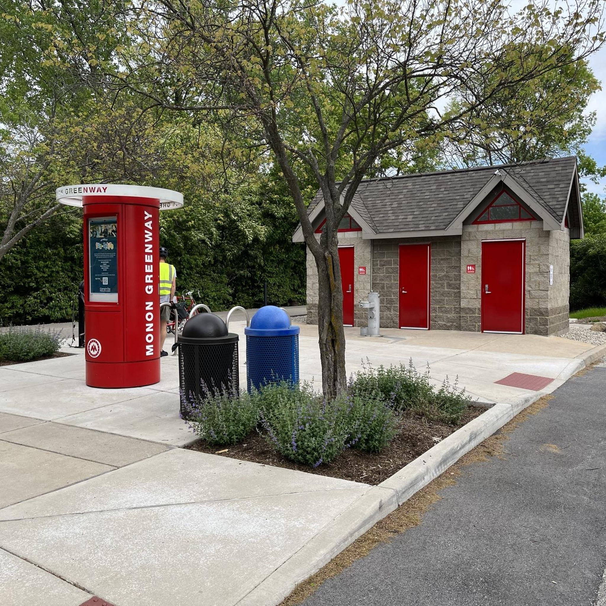
One of the nicest stops I've seen on a bike path, with bathrooms and water as well as some bike repair tools.
0
0
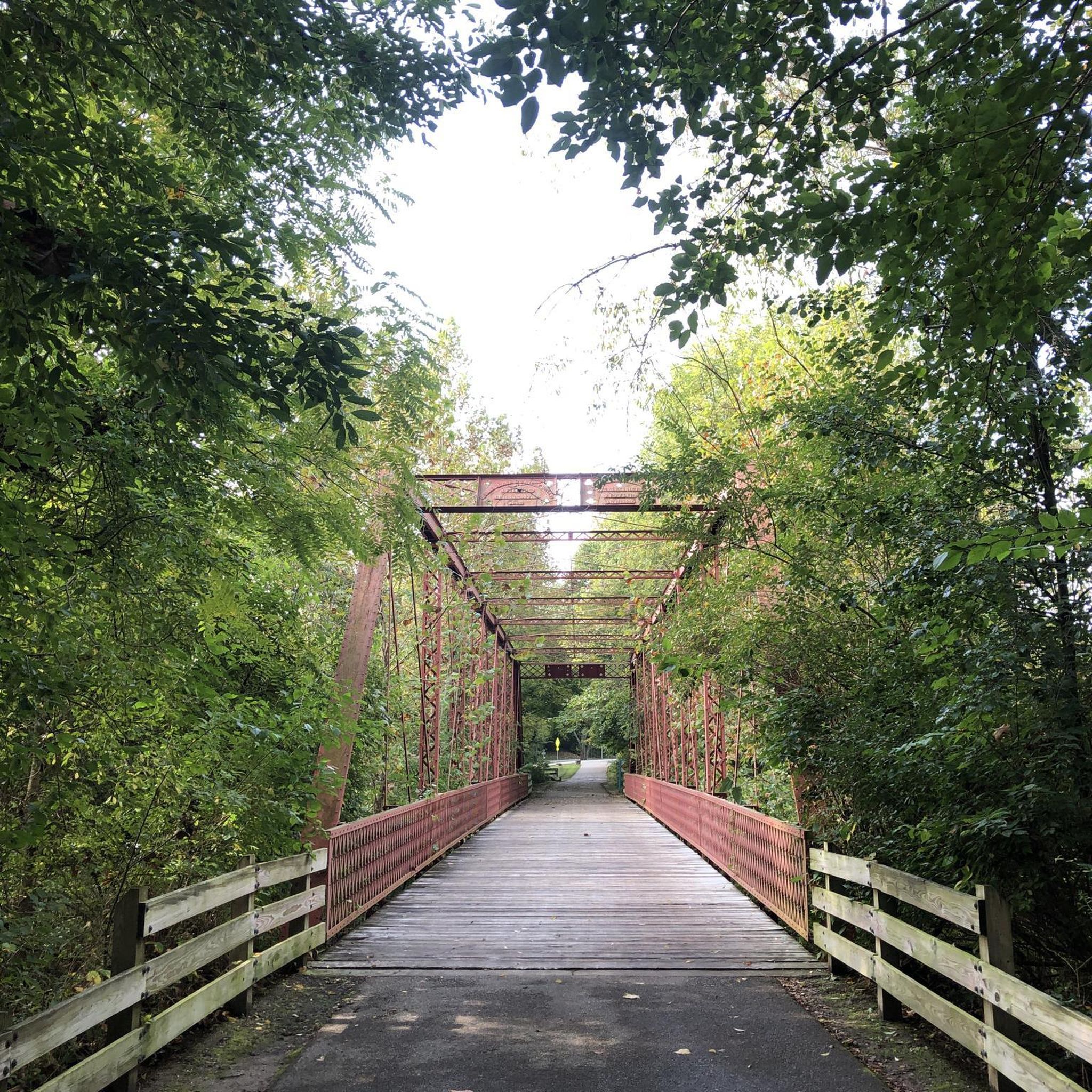
Quant bridge as part of the sprawling Monon trail heading north from the heart of the city. Biking the entire way will leave you in pure American farm country.
0
0
Just what it says on the tin! You get great views of the Indianapolis skyline from this bridge, which is part of the Canal Walk. Although biking is allowed, the trail is usually too crowded for that to be enjoyable. You'll probably have more fun if you come in the early morning or on weekday evenings.
0
0
Pennsy Greenway is a 14.5-mile rails-to-trails paved path following the former Penn Central Railway. It currently connects Munster, Indiana, to Lansing, Illinois.
0
0
Centered around the Monroe County Courthouse, the Square is downtown Bloomington's most popular areas. With numerous eateries and cafes, it's a great place to start, end, or or pass through on a ride.
0
0


インディアナの下にある他のロードサイクリングルートをチェックして、目的地で完璧なルートを見つけましょう。
他の地域の最高のロードサイクリングルートを見てみましょう。