경로

플래너

기능

업데이트

App

로그인 또는 가입

앱 다운로드

로그인 또는 가입

로그인 또는 가입

경로
Places to see
Natural Monuments
이탈리아
롬바르디아
브레시아

바골리노

바골리노‬에서 가장 멋진 ‪20‬개의 천연기념물


천연기념물을 방문하여 바골리노의 아름다운 풍경을 만나보세요. 바골리노에 있는 20
개의 천연기념물과 상세 정보를 살펴본 후에 방문하고 싶은 천연기념물을 다음 모험 계획에 추가해보세요!

마지막 업데이트: 5월 13, 2026

크로체도미니 고개

하이라이트 • 산악 고개

The Crocedòmini pass is an alpine pass of the Brescia Prealps located in the province of Brescia at 1892 m. s.l.m. south of the Adamello park

번역자 Google •

에 의해

라이딩 보기

휴대폰으로 전송

저장

일곱 개의 작은 십자가 고개

하이라이트 • 산악 고개

This is the Passo delle Sette Crocette! An ancient road between the upper Val Trompia and Val Grigna, with a dry stone wall and seven iron crosses. A 1688 cippus …

번역자 Google •

에 의해

저장

이런 장소를 발견하려면 지금 가입하세요

최고의 싱글 트랙, 봉우리 및 다양한 흥미로운 야외 장소에 대한 추천을 받아보세요.

무료 회원 가입

발 그리냐 지역 산림

하이라이트 • 숲

The Val Grigna Regional Forest covers an area of 2,847.50 hectares, located in the municipalities of Berzo Inferiore, Bienno, Bovegno, Esine and Gianico. It extends from an altitude of 1,000 …

번역자 Google •

에 의해

저장

치마 몬테 무페토

하이라이트 • 정상

A peak over two thousand meters high, overlooking the Montecampione plain and the Bassinale valley.
On the grassy, rounded summit, a simple cross with two howitzers fixed at its base. …

번역자 Google •

에 의해

저장

몬테 아리오

하이라이트 • 정상

Mount Ario offers a magnificent 360 degree view, you will be delighted.

번역자 Google •

에 의해

저장

무료로 가입하여 바골리노 주변의 더 많은 자연 기념물을 발견하세요.

무료 회원 가입

이미 komoot 계정이 있나요?

오늘 무료 계정으로 시작하세요

다음 모험이 기다리고 있어요.

로그인 또는 가입하기

바골리노 주변 인기 장소

클래식 알프스 교차로부터 멀리 - L1 가르미쉬에서 브레시아까지

이탈리아 발레 사비아와 발레 트롬피아 사이의 그래벌 라이딩

이탈리아의 발 사비아 탐험 - 코르노네 디 블루모네 山麓에서

Anello Valsabbino - Val Sabbia의 마을 사이를 트레킹

이탈리아-오스트리아 전통 국경 일대 - Alta Via del Caffaro

발 카모니카 모험 - 롬바르디아 부분 3 카민나포레스테

브레시아 선착장 산맥의 MTB 링 - 크리나레 길

마운틴바이크를 타고 알타 발레 사비아를 탐험하세요

바골리노 하이킹

바골리노 사이클링

바골리노 주변의 다른 모험

클래식 알프스 교차로부터 멀리 - L1 가르미쉬에서 브레시아까지

하이킹 컬렉션 에 의해

Mareike

커뮤니티 팁

Stefano
10월 14, 2025, Passo delle Sette Crocette

wonderful view of the valley below

번역: Google

0

0

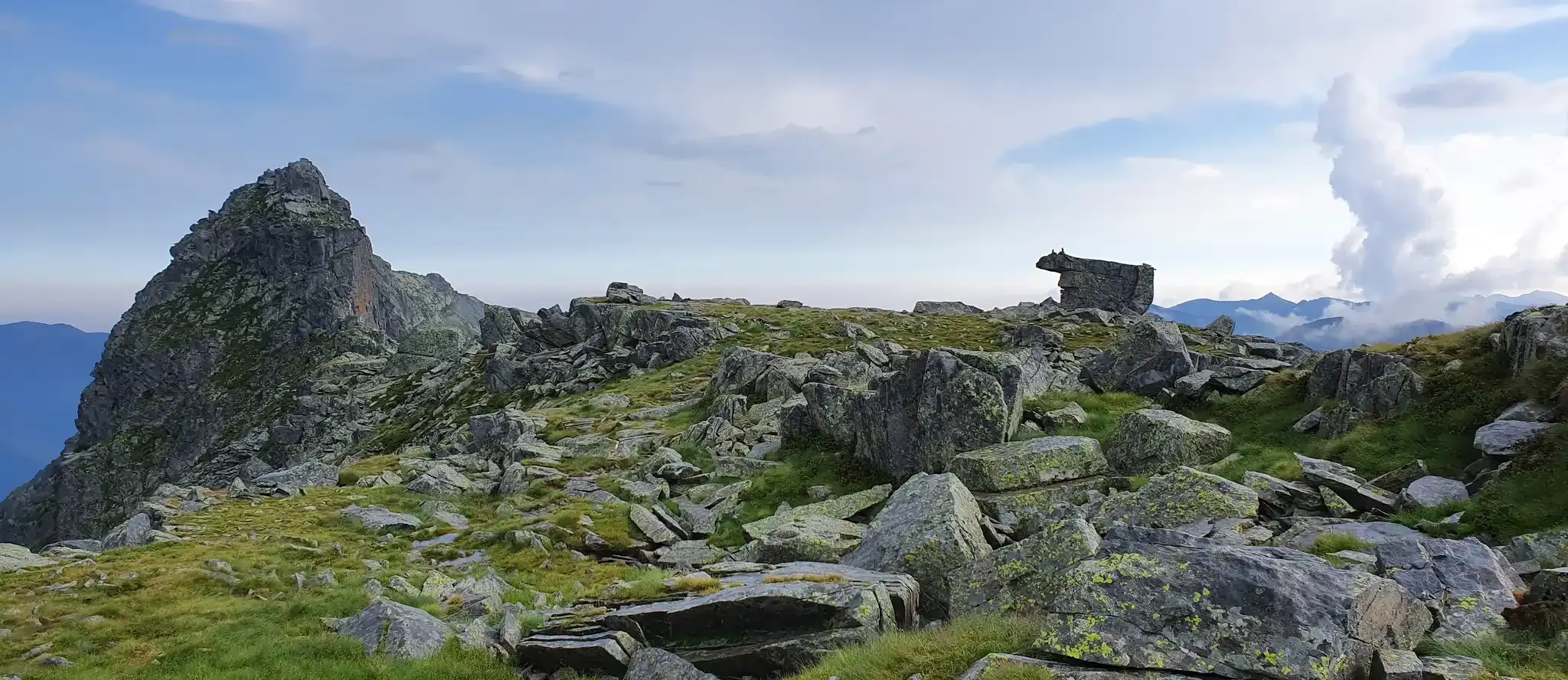
A peak over two thousand meters high, overlooking the Montecampione plain and the Bassinale valley. On the grassy, rounded summit, a simple cross with two howitzers fixed at its base. It can be reached via various trails, or by following the two main ridges: the southeast (EE) and the northwest (EE+, which also features a small equipped cliff mid-ridge). From the summit, you can enjoy a splendid panorama wherever you turn, surrounded by imposing mountain ranges at the four cardinal points, as well as the upper part of Lake Sebino, the Camonica Valley, and the Trompia Valley. With a particularly trained eye, you can see: to the north the Orobie mountain range and at first sight the Presolana (you can also glimpse the snow-capped Bernina), to the east the Adamello massif and the Brenta Dolomites, to the south the mountains of the Maniva mountain range, to the west the Monte Guglielmo group.

번역: Google

3

0

Spectacular 360° view

번역: Google

0

0

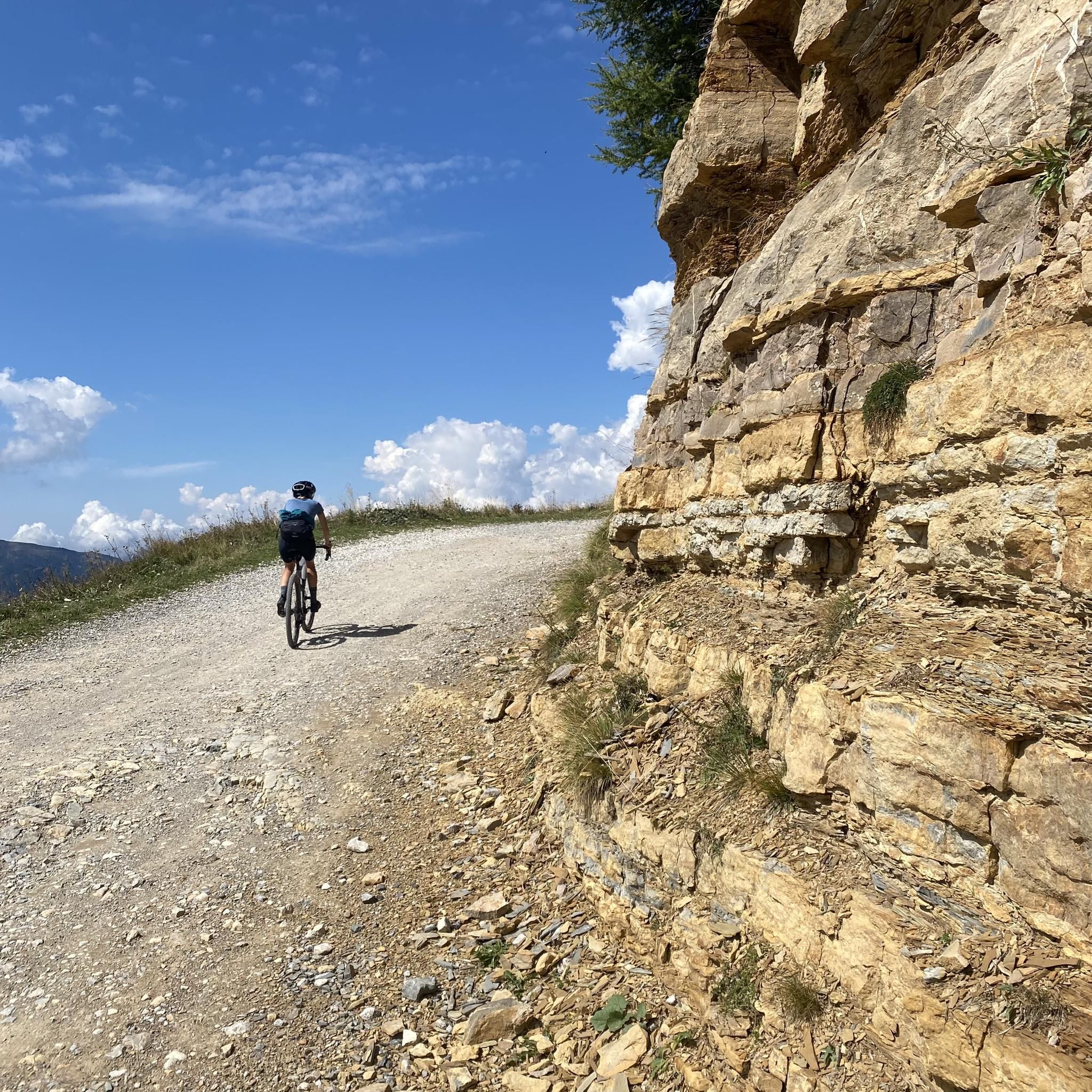
A famous pass in the Brescian Pre-Alps, the Crocedomini has a very long history (it is said that Emperor Frederick Barbarossa passed through here in the 12th century) and is almost 1,900 meters above sea level. It represents a real challenge for those who decide to tackle it by bicycle: from Bagolino it is a 22 kilometer climb at an average 5%, while the Breno side is even harder, around 20 kilometers at an average 7.5%. You can also get to Crocedomini in a third way, that is, through the splendid partly dirt road (very simple gravel) that comes from the south, from the Maniva pass.

번역: Google

4

0

Quite long and hard stride

번역: Google

1

0

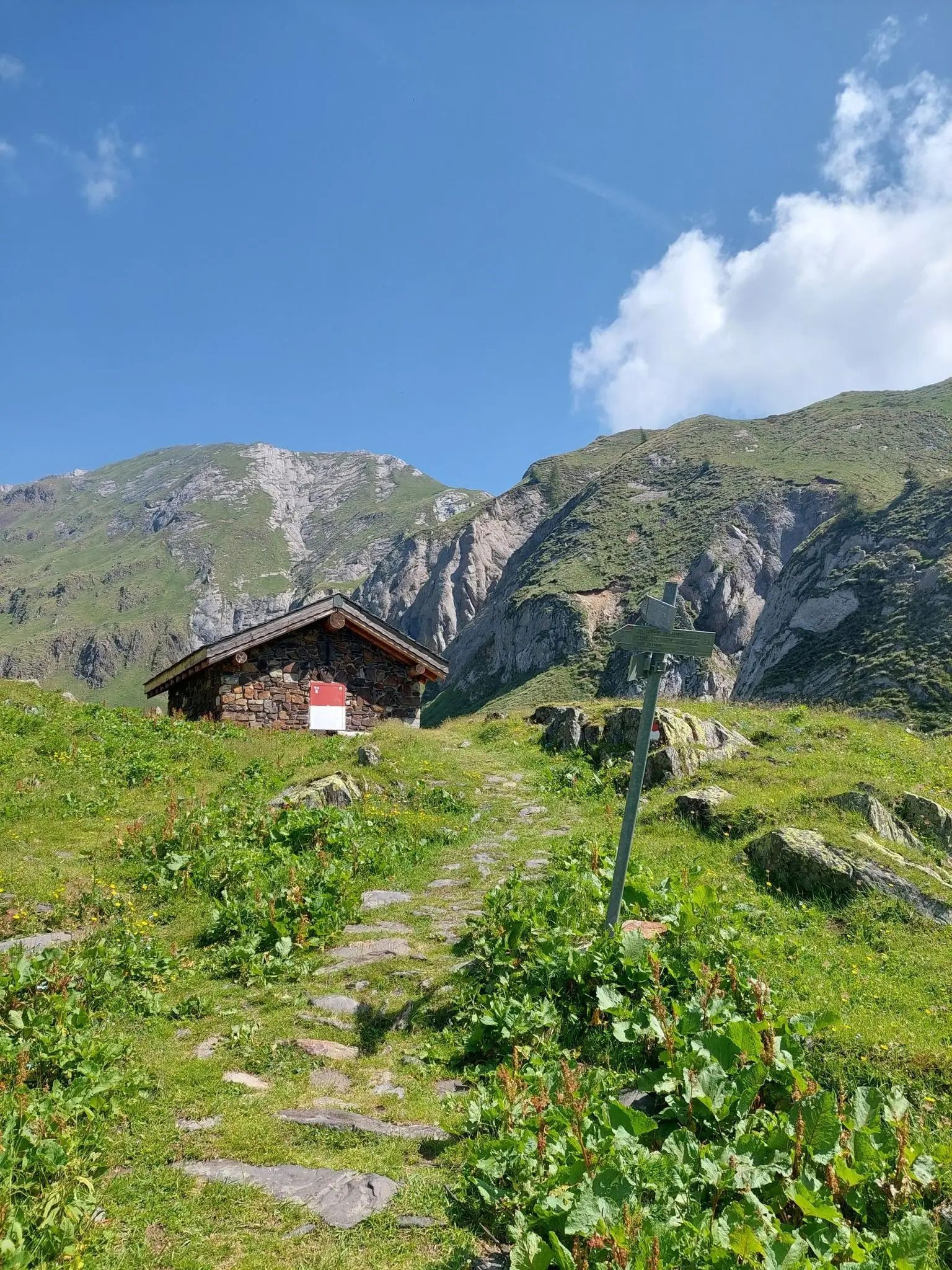
This is the Passo delle Sette Crocette! An ancient road between the upper Val Trompia and Val Grigna, with a dry stone wall and seven iron crosses. A 1688 cippus adds to the historic charm. Legends tell of witchcraft and mountain piety linked to tragic events. A fascinating place steeped in history and mystery.

번역: Google

3

1

Monte Muffetto is a mountain located in the province of Brescia, Lombardy. With its suggestive landscapes and unspoiled nature, it is an ideal destination for hiking and nature lovers. The top of Monte Muffetto offers spectacular views of the surrounding area and allows visitors to immerse themselves in the tranquility and beauty of the Lombardy mountains. It is a popular destination for those looking for a pleasant outdoor adventure and a way to get away from the daily grind.

번역: Google

1

0

The Val Grigna Regional Forest covers an area of 2,847.50 hectares, located in the municipalities of Berzo Inferiore, Bienno, Bovegno, Esine and Gianico. It extends from an altitude of 1,000 meters to the summit of Monte Crestoso, which reaches 2,207 metres. The landscape of the area is characterized by spruce fir and larch woods, interspersed with large clearings used as pastures. Much of the forest is in Valle Camonica, but a significant portion of the south-facing pastures extend beyond the watershed, into Valle Trompia. Inside the Forest there are numerous structures, originally linked to alpine farming and cattle grazing. Over time, many of these structures have been restructured to continue to perform their function, while others have been transformed into bivouacs, refuges, agritourisms, environmental education centers and ethnographic museums. Access to the Forest and to the alpine pastures is through some forest roads, but the internal connections are mainly pedestrian, through ancient paths which today also offer considerable excursion interest. Furthermore, the area is crossed by long-distance paths, such as the Tre Valli Bresciane path and the Via dei Silter, which connect the pastures of the Vasta Valgrigna area in a fascinating trek. Hunting is prohibited in the regional forests, but it is possible to spot deer, chamois and black grouse for those with good eyesight or a bit of luck.

번역: Google

1

0

바골리노 주변에서 가장 인기 있는 경로

바골리노 하이킹

바골리노 주변에서 가장 인기 있는 명소

Places to see

Store rating

komoot 모바일 앱으로 영감을 받아보세요

무료 komoot 계정로 끝없는 야외 모험을 손쉽게 찾고, 맞춤 설정하며 길안내할 수 있어요.

또는

지금 komoot에 가입하세요

Store rating

더 살펴보기

바골리노 주변의 최고의 동굴을 찾기 위해 이 가이드를 확인해보세요:

리모네 술 가르다트레모신 술 가르다티그날레가르냐노마론앙골로 테르메피안 카무노피소뉴몬테 이솔라마가사세일 마라시노보르노가르돈 발 트롬피아밸브스티노술자노다르포 보아리오 테르메피안코노토스콜라노-마데르노타베르놀 술 멜라가르도네 리비에라마르체노사레초페짜즈아르토뉴폴라베노보바르노파이스코 로베노폰테 디 레뇨지아니코비엔노이서브레노보베뇨빌라 카르시나살로브라오네세토산 펠리체 델 베나코니아르도카포발레마르멘티노세보파시라노빌라누오바 술 클리시로에 볼치아노가바르도프로바글리오 디세오카자고 산 마르티노침베르고몬티첼리 브루사티코르테 프랑카페르티카 바사페르티카 알타아드로이르마오시모테무파스파르도브리오네에신양보루메잔구세주 델아다멜로로치오베르조 인페리오레체르베노세데골로보베초에도로소니코파라티코프로바글리오 발 사비아오메시르미오네로신라베논콜리오칼바지스 델라 리비에라마네르바 델 가르다베르조 데모로덴고-사이아노파데르노 프란치아코르타머스코린프레슬리오노 산 피에트로비오네구사고안포말로노트레비소 브레시아노사비오 치즈푸에나고 술 가르다카이노모니가 델 가르다코르테노 골지비오네카포 디 폰테셀레로본당파뎅게 술 가르다세를레베짜 돌리오오돌로베스톤폴페나제 델 가르다소이아노 델 라고아그노신이드로발리오 테르메콜레비토로드리노보티치노무라로나토 델 가르다파르코 지역 델'아다멜로카프리올로누볼레라레자또마자노바르게시비데이트 카무노카스토말레뇨누볼렌토프레발레파이톤카스테냐토인쿠딘베디졸셀라티카오스피탈레토모노데센자노 델 가르다론카델카스테네돌로산 제노 나빌리오보르고사톨로팔라졸로 술올리오몬티로네게디칼시나토에르부스코플레로로바토Monumento Naturale Altopiano Di Cariadeghe포졸렝고쾰른폰카라레몬티치아리코칼리오Parco naturale dell'Alto 가르다 브레시아노카스텔 멜라트라바글리아토토르볼레 카사글리아카프리아노 델 콜레빌라키아라오르지누오비

근처 어드벤처 가이드

안포 즐길거리

background

새로운 정복을 위한 준비를 하세요

무료로 가입하기

탐험하기
경로경로 플래너기능하이킹MTB 트레일로드 사이클링 경로바이크패킹사이트맵
앱 다운로드
소셜 미디어에서 팔로우하기

© komoot GmbH

개인 정보 보호 정책