Timeline
Steph Lightfoot planned a run
November 22, 2024
Time
Distance
Pace
Ascent
Descent
Steph Lightfoot planned a run
November 22, 2024
Time
Distance
Pace
Ascent
Descent
November 22, 2021
This is the official route of the TDS® (Courmayeur - Bourg Saint Maurice - Chamonix). You will find the full six-day route here:
Translated by Google •
Steph Lightfoot planned a run
November 22, 2024
Time
Distance
Pace
Ascent
Descent
Hugo PERCHER, Nicola and Teo like this.
November 9, 2021
This is the official route of the CCC® (Courmayeur - Champex - Chamonix). You will find a three-day route here:
komoot.com/collection/1364255/trois-jours-trois-pays-courir-l-emblematique-ccc-courmayeur-champex-chamonix
Translated by Google •
Steph Lightfoot planned a road ride
September 6, 2022
Time
Distance
Speed
Ascent
Descent
Alexandre VALDIN, Saliousy Sy and Mount_Magdalena like this.
Steph Lightfoot planned a run
December 6, 2021
Time
Distance
Pace
Ascent
Descent
December 21, 2021
It's the last day of this Haute Route des traileurs. With tired legs, you have 35 kilometers to cover with 2,500 meters of elevation gain. From Saint-Nicolas, it takes about two hours to climb to reach a balcony path facing Zermatt, which unfolds towards your final destination.
The path climbs in laces
Translated by Google •
Steph Lightfoot planned a run
December 6, 2021
Time
Distance
Pace
Ascent
Descent
December 20, 2021
The sixth day of this Haute Route des traileurs is the longest, with more than 35 kilometres, almost 2,500 meters of elevation gain and 2,800 meters of negative elevation. Luckily, the spectacular scenery and excellent running trails will keep you entertained all day.
Between Zinal and the picturesque
Translated by Google •
Steph Lightfoot planned a run
December 6, 2021
Time
Distance
Pace
Ascent
Descent
December 20, 2021
On the fifth day of this Haute Route des traileurs, you will find yourself in the heart of the typical Swiss Alps, surrounded by turquoise blue lakes and snow-capped peaks. The finish line is in sight, even if you still have three days to get there! With just over thirty kilometers and about 2,500 meters
Translated by Google •
Steph Lightfoot planned a run
December 6, 2021
Time
Distance
Pace
Ascent
Descent
December 20, 2021
This fourth day of the Haute Route des traileurs is not the longest but it is probably the most technical. A little over thirty kilometers in distance with approximately 1,500 meters of positive elevation and 1,800 meters of negative elevation. Don't fall into the trap of thinking it's a relatively easy
Translated by Google •
Steph Lightfoot planned a run
December 6, 2021
Time
Distance
Pace
Ascent
Descent
December 20, 2021
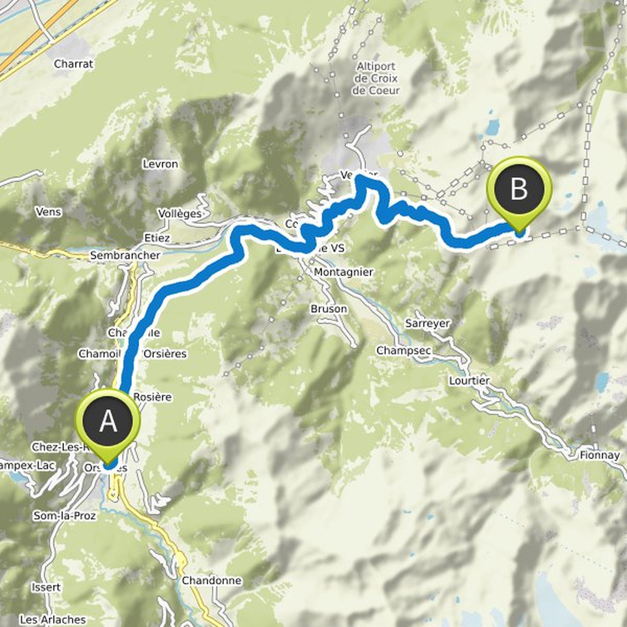
On this third day of the Haute Route des traileurs, it's going to climb! From the small village of Orsières, you follow a rolling path that climbs slightly for seven kilometers, crossing small villages and typical mountain pastures.
A short descent brings you to Le Châble, gateway to the famous upscale
Translated by Google •
Steph Lightfoot planned a run
December 6, 2021
Time
Distance
Pace
Ascent
Descent
December 20, 2021
Departing from the Refuge du Col de Balme, this second day of the Haute Route des traileurs covers 21 kilometers with just over 1,000 meters of elevation gain and a long descent of nearly 2,500 meters of negative elevation. For very trained trail runners it is possible to combine days one and two.
By
Translated by Google •
Steph Lightfoot planned a run
December 6, 2021
Time
Distance
Pace
Ascent
Descent
December 20, 2021
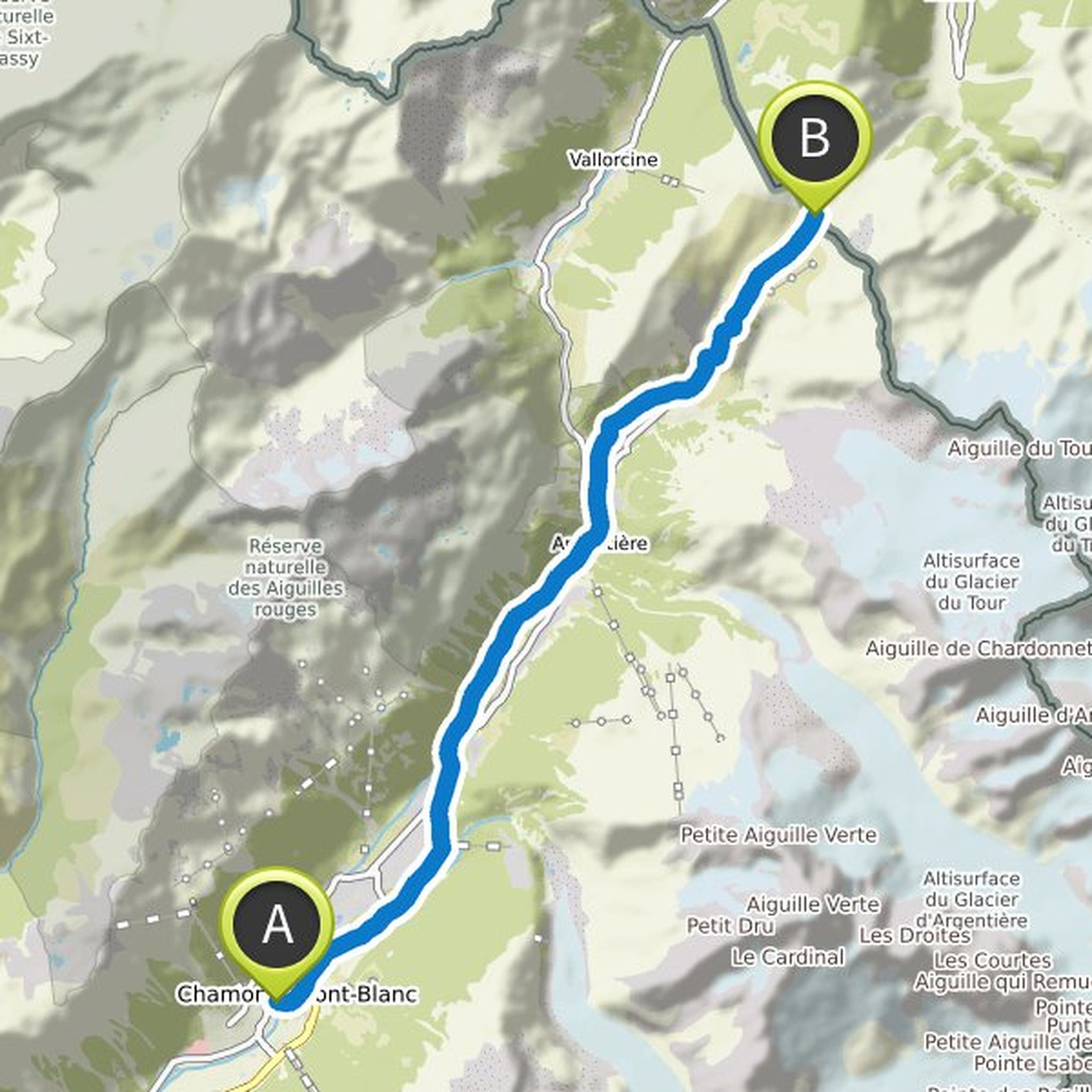
The first day of this Haute Route des traileurs is the easiest and the shortest, only 17 kilometers with 1250 meters of elevation gain. This can be done in half a day, if you take the morning to explore Chamonix.
For the purists among us, myself included, your day starts in the center of Chamonix. The
Translated by Google •
Steph Lightfoot planned a run
November 15, 2021
Time
Distance
Pace
Ascent
Descent
November 23, 2021
Be happy that the last day of this TDS was the easiest! Less than twenty-four kilometers with less than 1,500 meters of elevation gain and descent, it's almost a rest compared to the previous days. But mentally prepare yourself for a journey of emotional contrasts: from high mountains, immense glaciers
Translated by Google •
Steph Lightfoot planned a run
November 15, 2021
Time
Distance
Pace
Ascent
Descent
November 23, 2021
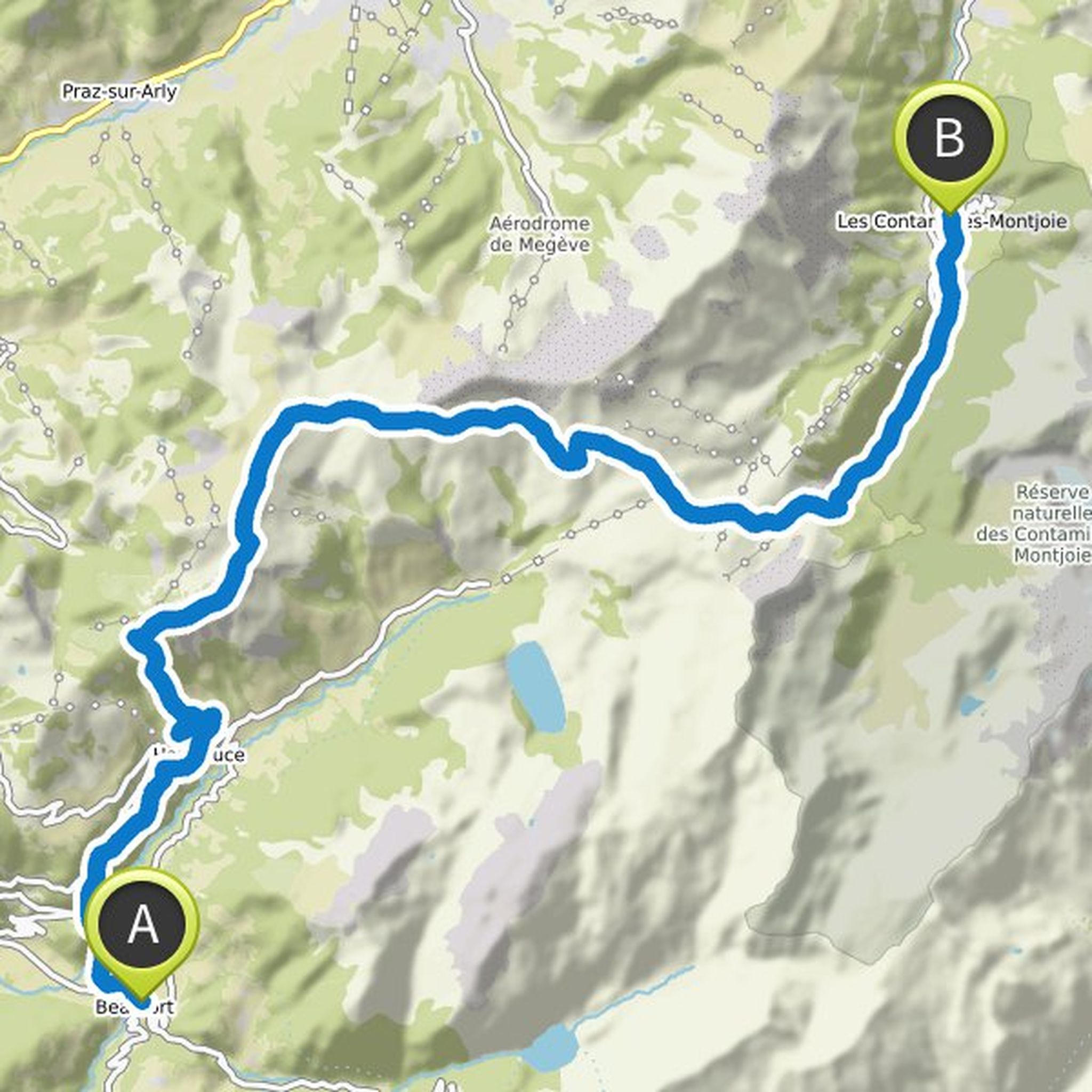
This fifth stage of the TDS is fun, with 32 kilometers of distance and roughly equal ascent and descent with around 1,650 positive elevation and 1,250 meters descent. Back in Haute-Savoie, you find yourself on more frequented trails.
From the Beaufort valley, you immediately start to climb towards the
Translated by Google •
Steph Lightfoot planned a run
November 15, 2021
Time
Distance
Pace
Ascent
Descent
November 23, 2021
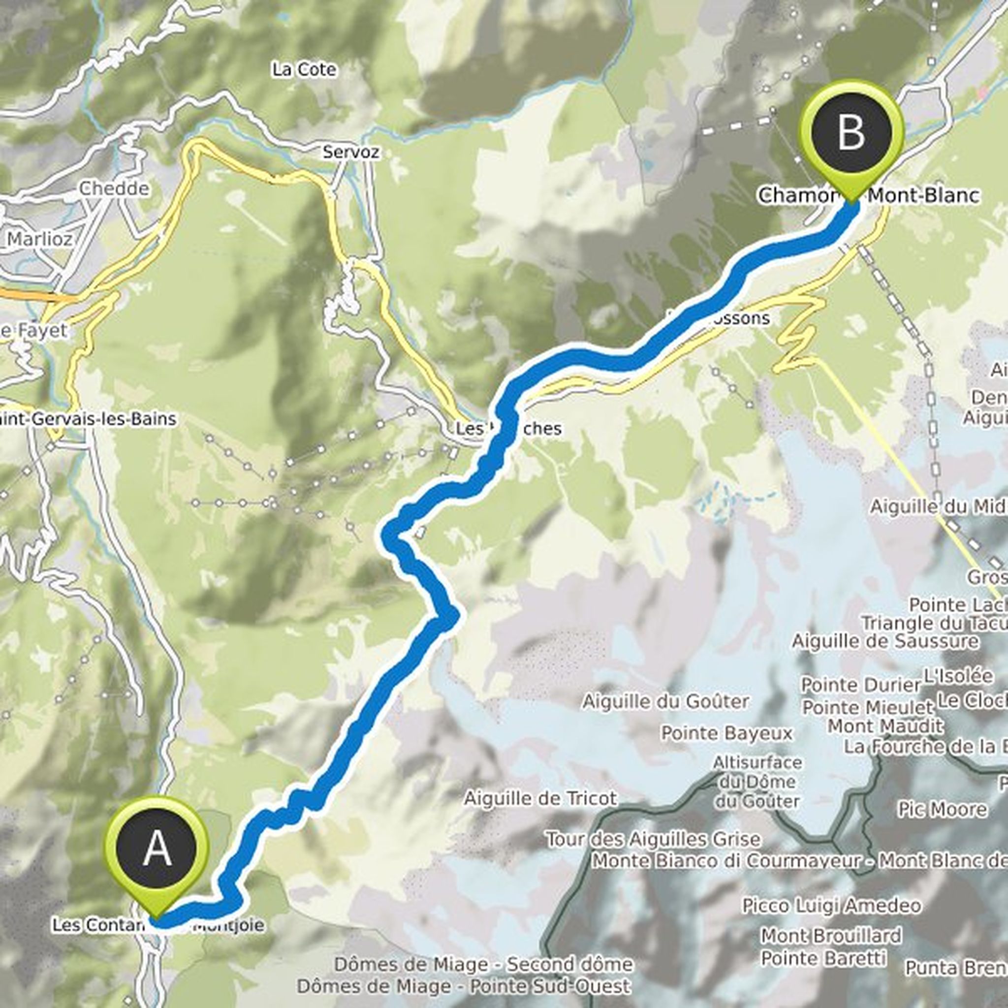
This fourth stage of the TDS covers nearly forty kilometers with 1,600 meters of elevation gain and a beautiful descent of over 3,000 meters to the city of Beaufort. Watch out for legs that were already tired from the previous days, especially in the technical parts of the descent.
Leaving your high mountain
Translated by Google •
Steph Lightfoot planned a run
November 15, 2021
Time
Distance
Pace
Ascent
Descent
November 22, 2021
The third day of this Collection is under the sign of the climbs! With a distance of 22 kilometers, and almost 2,500 meters of vertical drop, it will require a good dose of energy. Leaving the town of Bourg Saint Maurice and its valley, you immediately take a path that climbs for nearly ten kilometers
Translated by Google •
December 13, 2021
This is a course of the Haute Route from Chamonix to Zermatt created for trail runners. There is no official route as there are so many options and detours. You will find this complete course in seven days here:
komoot.com/collection/1375438/pour-les-amoureux-du-trail-la-mythique-haute-route-de-chamonix-a-zermatt
Translated by Google •