경로

플래너

기능

업데이트

App

로그인 또는 가입

앱 다운로드

로그인 또는 가입

경로
Places to see
독일
슐레스비히-홀슈타인
슐레스비히-플렌스부르크

클루저 발트

13의 클루저 발트가지 명소 & 주요 장소


클루저 발트에는 둘러볼 만한 장소가 많답니다. 하이킹 또는 사이클링을 좋아한다면 클루저 발트에 숨겨진 13
가지 보석을 만날 수 있을 거예요. 이 지역의 주요 명소를 살펴보면서 다음 모험을 계획해보세요.

마지막 업데이트: 7월 20, 2026

플렌스부르크 만 자전거길

하이라이트 • 자전거 도로

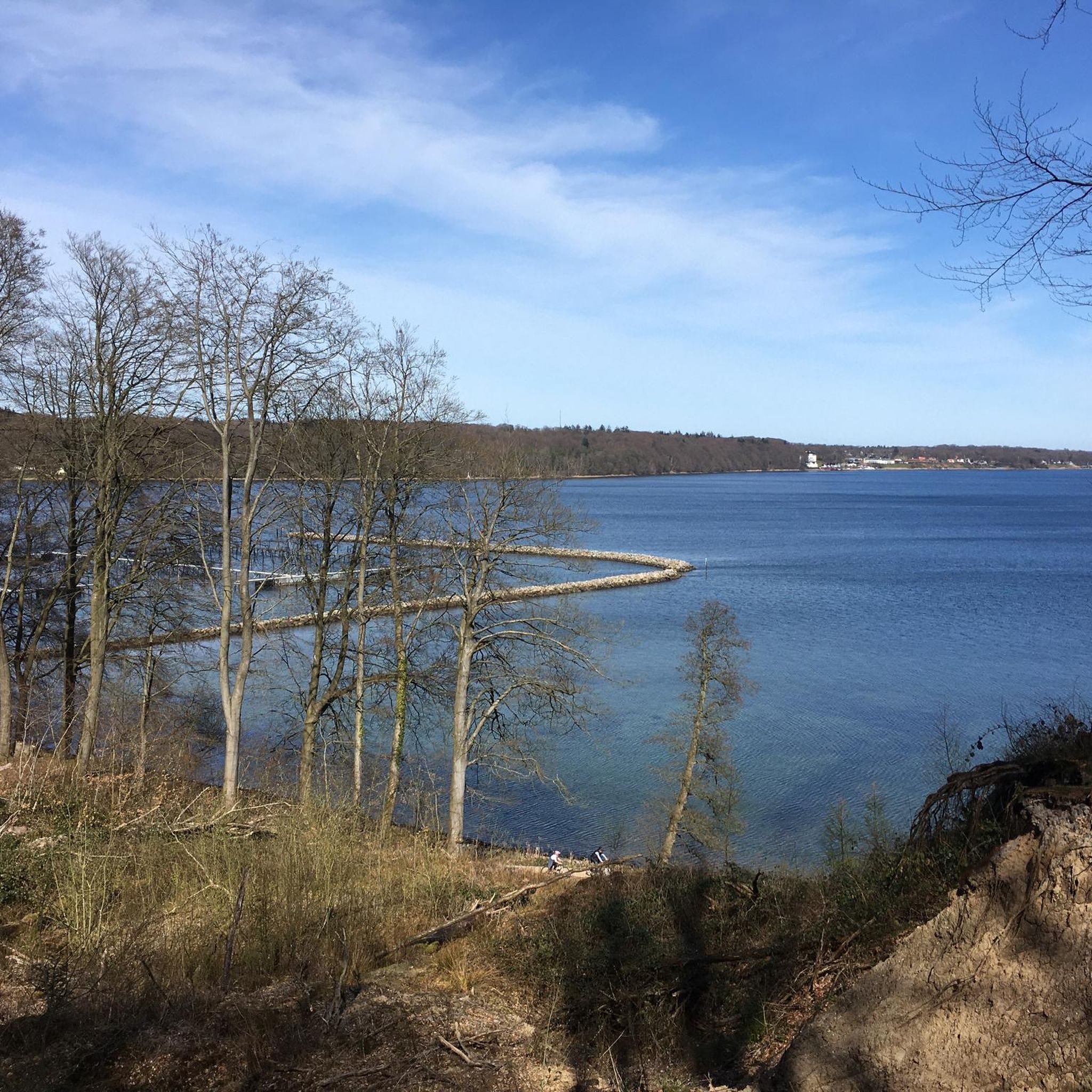
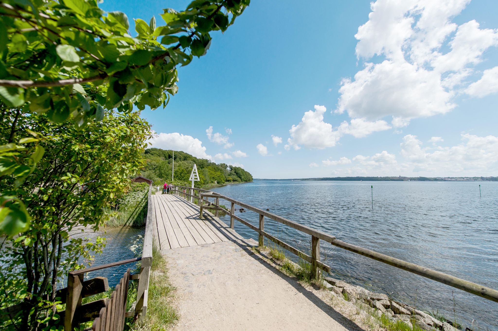
This beautiful (firm and easy to drive) gravel path runs between Flensburg and Wasserleben. One side is surrounded by forest, on the other side you can see the Flensburg Fjord!

번역자 Google •

에 의해

라이딩 보기

휴대폰으로 전송

저장

플렌스부르크 만을 따라 이어지는 자전거 길

하이라이트 (구간) • 자전거 도로

The Flensburg Fjord (Danish: Flensborg Fjord) is an approximately 40 to 50-kilometer-long inlet of the western Baltic Sea and forms the border between Germany (Schleswig-Holstein) and Denmark along its northern …

번역자 Google •

에 의해

저장

이런 장소를 발견하려면 지금 가입하세요

최고의 싱글 트랙, 봉우리 및 다양한 흥미로운 야외 장소에 대한 추천을 받아보세요.

무료 회원 가입

Have swimming trunks with you. A great place to swim

번역자 Google •

에 의해

저장

바서슬레벤 해변

하이라이트 • 해변

The Wasserleben beach is located immediately north of the city of Flensburg and about 300 meters from the German-Danish border. It is about half a kilometer long, 50 meters wide …

번역자 Google •

에 의해

저장

크루자우 터널 계곡 국경 트레일

하이라이트 (구간) • 트레일

This is where the border route runs, which lets you immerse yourself in German-Danish history. You cycle through beautiful nature and find information boards at numerous points with interesting or curious anecdotes about the peculiarities of life on the border.

번역자 Google •

에 의해

저장

무료로 가입하여 클루저 발트 주변의 더 많은 명소를 발견하세요.

무료 회원 가입

이미 komoot 계정이 있나요?

오늘 무료 계정으로 시작하세요

다음 모험이 기다리고 있어요.

로그인 또는 가입하기
클루저 발트 주변 인기 장소

Two countries, one region – cycling Tours on the Flensburg Fjord

클루저 발트 하이킹

클루저 발트 사이클링

클루저 발트 러닝 트레일

클루저 발트 MTB 트레일

클루저 발트 주변 그래블 라이딩

클루저 발트 로드 사이클링 경로

클루저 발트 주변의 다른 모험

Two countries, one region – cycling Tours on the Flensburg Fjord

사이클링 컬렉션 에 의해

Tourismus Agentur Flensburger Förde GmbH

커뮤니티 팁

PinionRadlerJan
5월 9, 2026, Cycle Path Along the Flensburg Fjord

멋진 전망이 있는 비포장 자전거 도로.

번역: Google

0

0

Why is a detour worthwhile? Because the ride here is definitely more pleasant than the alternative route along the main road. You can really enjoy the ride, and despite the good weather, it wasn't too busy today.

번역: Google

1

0

Cycle path with great views

번역: Google

1

0

The Flensburg Fjord (Danish: Flensborg Fjord) is an approximately 40 to 50-kilometer-long inlet of the western Baltic Sea and forms the border between Germany (Schleswig-Holstein) and Denmark along its northern and southern sides. Geologically, it was formed by the indentation of a glacial tongue in the inland ice during the Weichselian glaciation. It is classified as a fjord rather than a fjord because its flanks are relatively low. The fjord is divided into two sections: the inner fjord toward Flensburg and the outer fjord, separated by the Holnis peninsula. At its western end, in Flensburg, it flows inland—the westernmost point of the Baltic Sea also lies along this line. Today, the region is an important sporting area, especially for sailors, and hosts major regattas such as the Flensburg Fjord Regatta and the Rum Regatta. Fjord Week, with events for classic yachts, is also part of the regular schedule. The Flensburg Fjord is also attractive for its landscape and tourism. It offers charming shorelines with beaches, steep coastlines, and moraine cliffs, nestled among gentle sandy areas. Nature and culture lovers will find a wealth of destinations along both shores: Flensburg with its historic old town and museum harbor, Glücksburg Castle, the Holnis peninsula with its protected salt marshes and lighthouses, as well as the Geltinger Birk nature reserve and the towns along the northern shore with the Gendarmenpfad (Gendarmen Trail) – a former border path along the Danish border. For centuries, the fjord has been shaped by passenger and freight traffic – historic steamers connected Flensburg with towns on both sides. Today, leisure boating, excursion boats, traditional yachts and marine activities dominate in Mürwik.

번역: Google

3

0

Beautiful cycle path, with many swimming opportunities.

번역: Google

1

0

Tip top to stay 👌

번역: Google

1

0

After the damage from the storm surge of Oct. 23 has been repaired, the path is now better than before the storm surge. And it's not far to the border with Denmark!

번역: Google

1

0

Northernmost German Baltic Sea beach in the immediate vicinity of the Danish border.

번역: Google

0

0

클루저 발트 주변에서 가장 인기 있는 경로

클루저 발트 하이킹

Store rating

komoot 모바일 앱으로 영감을 받아보세요

무료 komoot 계정로 끝없는 야외 모험을 손쉽게 찾고, 맞춤 설정하며 길안내할 수 있어요.

또는

지금 komoot에 가입하세요

Store rating

더 살펴보기

찾고 있는 하이라이트를 아직 못 찾으셨나요? 다른 지역의 주요 명소 가이드를 확인해보세요:

크론스가드하셀베르그포머비탕헤크겔화마솔름랭발리그링스버그그런트호프스톨테뷜니비라벤홀츠라벤키르헨-파울뤼크글뤽스부르크마스뷜라벨카펠른Naturpark Schlei그뢰더스비문크브라럽아르니스해리슬리타스트럽남편위즈프라이엔윌돌러럽후룹웨스터홀츠에스그루니스그라우외르스베르그감독타르스테트울스니스소스트럽로이트노트펠트보르그베델겔토르프샬비쥐더브라룹웨거스로트돌로트펠트노르더브라룹파르도르프셀크골토프트보렌셰게로트슈타인베르크 교회크롭단네베르크자겔버스도르프뉘벨Süderfahrenstedt핸드윗슐레스비히클라인 라이드트웨트쇠룹노르더스타펠쥐더스타펠로토프슈비뤼르샤우엘링스테트휘스비Idstedt노이버렌드스토크스테룹볼링스테트그로스솔트자연 공원 겔팅거 버크뵈클룬드클라인 베네벡브레벨뤼게주벡테텐후센그로스 라이드오자커실버스테트아네비뵈엘울스비미텔란겔른하토프트시에베르스테트스트룩스도르프클라폴츠방수포방황되프스테트알트 베네벡뵈름Nordhackstedt린데윗회룹볼데모르키르히제리슈발스뷜샤플룬트에게벡에르프데베르겐후젠자델룬드슈나럽-썸비랑슈테트잡목 숲메거도르프Moore Der Eider-Treene-Sorge-Niederung그로스엔비에메델비트레이아하데바이어 누르티엘렌슐라이문둥메이인위즈비벡슬룬드자네비Süderhackstedt부르크제요를솔러럽Handwitter Forest산켈마커 호수랑제아렌홀저 호수셀커 누르Naturschutzgebiet Fröslev-Jardelunder Moor알테 조르게-슐라이페

근처 어드벤처 가이드

콜룬드 스코프 즐길거리

background

새로운 정복을 위한 준비를 하세요

무료로 가입하기

탐험하기
경로경로 플래너기능하이킹MTB 트레일로드 사이클링 경로바이크패킹사이트맵
앱 다운로드
소셜 미디어에서 팔로우하기

© komoot GmbH

개인 정보 보호 정책