소종 최고의 라이딩 경로
4.0
(167)
4,634
자전거 타는 사람
43
라이딩
소종의 로드 사이클링 경로를 찾으시나요? 그렇다면 소종 로드 라이딩 컬렉션 중에서 가장 멋진 라이딩 장소를 아래에서 살펴보세요.
마지막 업데이트: 8월 27, 2026
24
자전거 타는 사람
56.0km
02:25
360m
360m
보통 도로 자전거 타기. 좋은 체력 필요. 지면 대부분이 잘 포장되어 있고 라이딩하기 쉬움.
16
자전거 타는 사람
55.2km
02:06
110m
110m
보통 도로 자전거 타기. 좋은 체력 필요. 지면 대부분이 잘 포장되어 있고 라이딩하기 쉬움.

무료 회원 가입
8
자전거 타는 사람
56.9km
02:27
210m
210m
보통 도로 자전거 타기. 좋은 체력 필요. 지면 대부분이 잘 포장되어 있고 라이딩하기 쉬움.
5
자전거 타는 사람
36.8km
01:30
150m
150m
초급용 로드 라이딩. 모든 체력 수준에 적합. 지면 대부분이 잘 포장되어 있고 라이딩하기 쉬움.
5
자전거 타는 사람
80.7km
03:20
450m
450m
보통 도로 자전거 타기. 좋은 체력 필요. 투어 중 라이딩하기 어려운 비포장 구간이 있을 수 있음.
더 다양한 경로와 다른 탐험가들의 추천을 살펴보세요.
무료 회원 가입
이미 komoot 계정이 있나요?
투어 추천은 다른 사람들이 komoot에서 완료한 수천 개의 활동을 바탕으로 구성되어 있습니다.
오늘 무료 계정으로 시작하세요
다음 모험이 기다리고 있어요.
로그인 또는 가입하기

커뮤니티 팁

Gironde 강어귀의 남쪽 통로를 표시하고 위험한 모래톱인 la barre à l'Anglais의 존재를 알리기 위해 St-Palais-sur-Mer 지역의 Terre-Nègre 곶에 위치하고 있습니다.
0
0

생-팔레-쉬르-메르의 카흘레(carrelets)는 샤랑트 해안의 가장 상징적인 요소 중 일부입니다. 그들의 역사는 전통적인 낚시, 관광의 발전, 지역 유산을 융합합니다. 🐟 카흘레의 기원 원래 "카흘레"라는 단어는 17세기부터 사용된 정사각형 어망을 지칭합니다. 1769년, 샤랑트 해안에서의 이 낚시 유형을 언급한 학자 앙리-루이 뒤아멜 뒤 몽소(Henri-Louis Duhamel du Monceau)의 글에서 정확한 설명을 찾을 수 있습니다. 👉 당시에는 아직 현재의 오두막이 아니라, 조잡한 구조물에서 조작되는 단순한 그물이었습니다. ⚓ 수공예 낚시 구조물 최초의 지역 카흘레는 어부들이 물 위로 올라서기 위해 직접 만든 단순한 나무 플랫폼이었습니다. 주로 바다로 나가지 않고 해안 근처에서 새우, 물고기, 게를 잡는 데 사용되었습니다. 👉 이는 바다 낚시보다 덜 위험한 가족적이고 연안적인 낚시였습니다. 🏖️ 19세기 – 20세기 초: 여가 활동으로의 전환 20세기 초, 생-팔레와 같은 해변 휴양지의 부상과 함께 카흘레는 진화했습니다. 휴가객과 유명 인사들이 이 관행을 받아들였습니다: 고정식 부두 건설, 기둥 위의 오두막 등장. 카흘레는 낚시 장소만큼이나 휴식 장소가 되었습니다. 👉 이미 해안의 엽서 같은 이미지에 기여하고 있었습니다. 🪵 1945년 이후: 대중화 및 확산 제2차 세계 대전 이후 카흘레의 수는 급격히 증가했습니다. 그것들은 대중적인 레저와 사교성의 상징이 되었습니다. 점진적으로 생계 수단에서 레크리에이션 활동으로 전환되었습니다. 🌊 폭풍과 재건 카흘레는 폭풍에 취약합니다: 1999년: 대규모 파괴 (일부 지역 최대 90%) 2010년 (신시아 폭풍): 새로운 피해. 많은 것들이 전통을 존중하여 동일하게 재건되었습니다. 🏛️ 오늘날: 보호받는 유산 샤랑트-마리팀에는 약 400개의 카흘레가 있습니다. 그것들은 다음과 같습니다: 공공 해양 구역에 통합됨 행정 허가로 할당됨 (종종 5년마다 갱신됨) 2018년부터 이 지역의 문화 유산으로 인정받고 있습니다. 👉 생-팔레에서는 특히 다음 장소에서 볼 수 있습니다: 악마의 다리(Pont du Diable) 콩시에 만(conche du Concié) 오튀르 우물(Puits de l’Auture)
0
0

Here you'll find a romantic little lighthouse, and behind it lies a garden with a bench overlooking the sea, a lovely place to stop for a break. Afterwards, you can continue along the cliff to the right until you reach Euro Velo 1 again.
0
0

Easily accessible place, only the last meters are prohibited for cyclists.
0
0

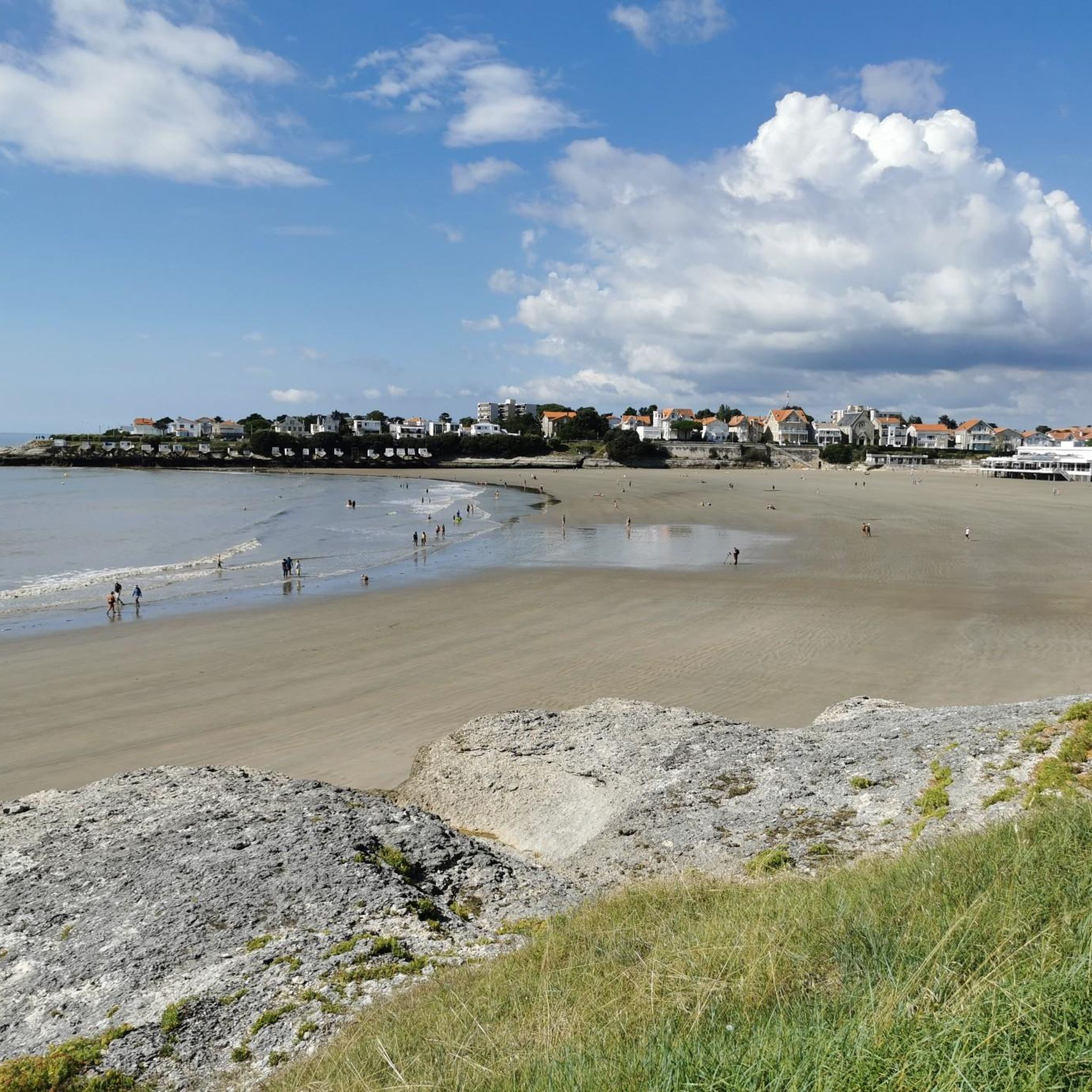
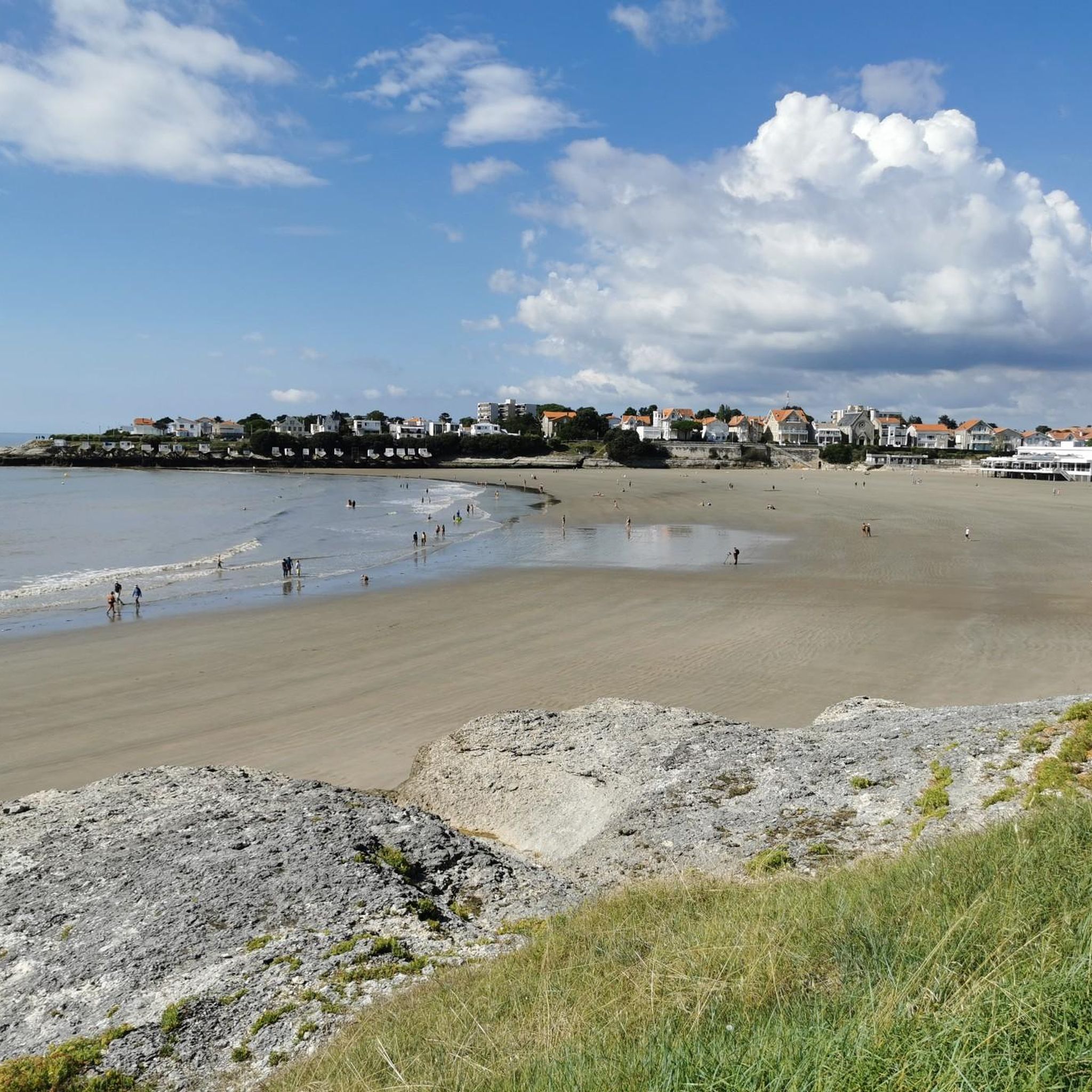
Perfect beachside bike trail along the boulevard, with several rest stops with seating and beach acces.
0
0
The port of Royan is located between the Foncillon district and the Grande Conche beach, in the heart of the city. Ideally located at the mouth of the Gironde, in the immediate vicinity of the Atlantic Ocean and opposite Port-Médoc, it consists of a marina with a thousand rings and a fishing port, specializing in “noble” species (sole, meagre, sea bass, etc.). You will find the harbor master's office, the Fishing Port and the auction, as well as a covered shopping arcade, “Les voûtes du Port”, which extends the shopping arcades of the “Front de Mer”. Port, 1100 sheltered places – Reception pontoon – Secure pontoons. Access pass is 0.30 m above the zero of the nautical charts. Basins after dredging 2.30 m from the zero of the nautical charts. Services: water, electricity (220 V) on pontoon, toilets, WC, showers, handling in closed technical area, recovery of careening water, grey water and black water pumps, maintenance and ship repair workshops, ship chandlers on the port, wifi, 24/24 CB fuel, slipway. V.H.F. 9. The port is sheltered from all winds because it is protected by the landing stage of the ferries which ensure the crossing of the Gironde for the crossings to the Pointe de Grave/Le Verdon-sur-Mer.
1
0

On the beach of Royan (20,000 inhabitants). This is where the boat that takes you across the Gironde docks/departs.
0
0
The Terre-Nègre lighthouse is a landmark forming a cylindrical tower a little over 26 meters high. Located on the tip of Terre-Nègre, in the commune of Saint-Palais-sur-Mer, in Charente-Maritime, it is intended to mark the southern pass of the Gironde estuary and to signal the presence of a dangerous sandbank, the "Anglais bar". This building forms a tower-column 3.16 meters in diameter and 26.60 meters high. A spiral staircase with a central core of 143 steps leads to a summit platform equipped with a directional light. The tower is painted in two different colors to make it more visible: the upper part is red, the lower part is white. The base of the lighthouse is hidden by a building that once served as the keeper's accommodation. The installation of a beacon at this location was considered as early as 1763. De Kearney took over the beaconing plan four years later. Construction work on the tower began in 1770 and was completed in 1773, probably under the supervision of the Bordeaux engineer Claude Tardy. In 1807, the tower was raised. However, this work was considered insufficient by some of the estuary's navigators. In 1834, sailors from the nearby port of Royan sent a request to the Ministry of the Navy to study the possibility of equipping the tower with a light. However, this request was postponed the following year due to lack of sufficient funds. A new request from sailors prompted the lighthouse commission to experiment with a first light in 1836. Finally, on October 15, 1838, a fixed white 4th order light was permanently installed. The latter was replaced in 1856 by a fixed white light of the 4th order of a small dioptric model with a reinforced sector of the 5th order catoptric. It was equipped with new lights in 1899 and 1904. In 1939, it was electrified. During the German occupation, the lighthouse served as an observatory for the soldiers of the Wehrmacht. Damaged during the fighting of 1945 (presence of breaches at the top of the tower), it was restored in the immediate post-war period. In March 1947, the lighthouse was operational again. A light with 3 occultations — changing every 12 seconds — was installed. Its colors are white, red and green. Its current range is 18 miles. Listed as a Historic Monument since 2011, the lighthouse is not open to visitors. However, it can be admired from the outside and a pretty passage provides direct access to the coastal path.
0
0
소종 주변에서 가장 인기 있는 명소


더 살펴보기
다른 지역의 최고의 로드 사이클링 경로를 살펴보세요.
