20의 샬레베트가지 명소 & 주요 장소
샬레베트에는 둘러볼 만한 장소가 많답니다. 하이킹 또는 사이클링을 좋아한다면 샬레베트에 숨겨진 20
가지 보석을 만날 수 있을 거예요. 이 지역의 주요 명소를 살펴보면서 다음 모험을 계획해보세요.
마지막 업데이트: 8월 30, 2026
생팔레의 비행사들을 위한 노트르담 예배당
하이라이트 • 기타
번역자 Google •
팁에 의해

Conche de Gilet
하이라이트 • 해변
번역자 Google •
팁에 의해

이런 장소를 발견하려면 지금 가입하세요
최고의 싱글 트랙, 봉우리 및 다양한 흥미로운 야외 장소에 대한 추천을 받아보세요.
무료 회원 가입
플라탱 해변, 생-팔레-쉬르-메르
하이라이트 • 해변
🌊 바다가 빚어낸 장소
플라탱 해변은 석회암 절벽과 작은 만으로 구별됩니다. 이 해안선은 로이앙과 라 …
번역문 보기
팁에 의해

라 그랑드 코트의 독일 벙커
하이라이트 • 역사적 장소
번역자 Google •
팁에 의해
라 그랑드 코트 해변
하이라이트 • 해변
번역자 Google •
팁에 의해
무료로 가입하여 샬레베트 주변의 더 많은 명소를 발견하세요.
무료 회원 가입
이미 komoot 계정이 있나요?
오늘 무료 계정으로 시작하세요
다음 모험이 기다리고 있어요.
로그인 또는 가입하기
커뮤니티 팁

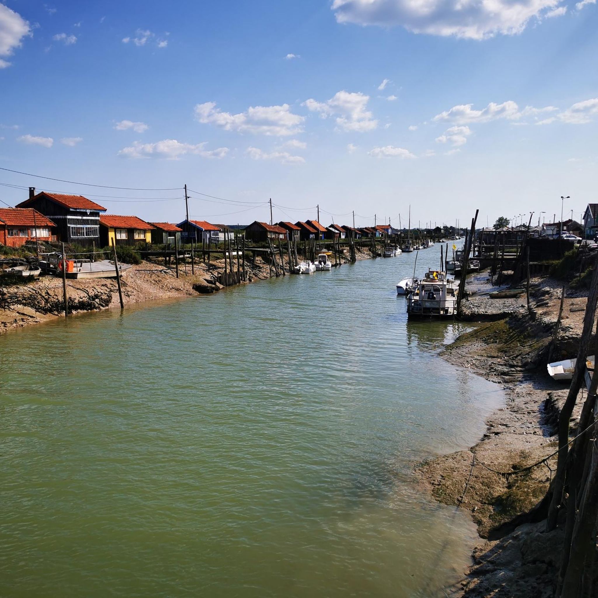
생-팔레-쉬르-메르에 위치한 플라탱 해변은 풍경과 역사 모두에서 이 지역에서 가장 특징적인 해안 지역 중 하나입니다. 🌊 바다가 빚어낸 장소 플라탱 해변은 석회암 절벽과 작은 만으로 구별됩니다. 이 해안선은 로이앙과 라 팔미르 사이의 뷰티 북부 해안에 속합니다. “플라탱”이라는 단어는 지역 방언에서 유래했으며, 썰물 때 드러나는 암석 고원을 의미합니다. 수천 년 동안 해양 침식은 이 바위를 조각하여 동굴, 돌출부, 전형적인 지형을 만들어냈습니다. 🐟 전통적인 활동: 조개잡이와 어업용 오두막 샤랑트 해안의 다른 모든 곳과 마찬가지로: - 주민들은 갯벌에서 조개류, 갑각류 등을 잡았습니다. - 어업용 오두막(기둥 위에 세운 낚시 오두막)이 바위나 절벽 위에 설치되어 지역 풍경의 상징이 되었습니다. - 이러한 시설은 오늘날 유산 및 관광의 요소가 되었습니다. 🪖 제2차 세계 대전의 흔적이 있는 장소 제2차 세계 대전 중 - 플라탱을 포함한 해안선은 독일군이 건설한 대서양 방벽에 통합되었습니다. - 지롱드 강 하구를 감시하기 위해 고지대에 벙커와 방어 시설이 배치되었습니다. - 일부 유적은 오늘날에도 볼 수 있으며 풍경 속에 통합되어 있습니다. 🏖️ 관광의 부흥 19세기 말부터, 특히 20세기에는 생-팔레-쉬르-메르가 인기 있는 해변 휴양지가 되었습니다. 플라탱 해변은 다음으로 매력적입니다: - 큰 해변보다 더 야생적인 환경, - 바위와 만, - 강 하구의 전망. 오늘날에는 수영, 산책, 사진 촬영으로 사랑받고 있습니다. 🌿 오늘날: 자연 및 유산 장소 플라탱 해변은 다음으로 인정받고 있습니다: - 보존된 환경, - 주목할 만한 지질학적 특징, - 역사와 자연의 조화. 이곳은 해양 유산과 역사적 기억 사이의 샤랑트 해안의 상징적인 장소 중 하나입니다
0
0
📍 Introducing the Gilet Cove The Gilet Cove is a small, natural beach on the oceanfront, located on Boulevard de la Conche de Gilet / Boulevard de la Falaise, in the town of Vaux-sur-Mer, just before Royan. 🌿 It's a sheltered, rocky cove, appreciated for its tranquility and more intimate setting compared to the larger urban beaches nearby. 🏖️ At high tide, the sea can completely cover this small beach, making the space very limited; at low tide, you can enjoy a patch of sand and rocks for relaxing or swimming. 🧭 Features & Tips 📍 Type of place: small, unsupervised beach, nestled among the rocks with sand and cliffs. 🏖️ Tides: access is best at low tide — at high tide the beach can disappear underwater. 🐶 Animals: prohibited from April 1st to September 30th (subject to municipal regulations). 👣 Access: via stairs from the boulevard above, surrounded by villas with sea views. 🚫 Lifeguard services: no lifeguard station or marked services. 📍 Location La Conche de Gilet is often considered the last small beach in Vaux-sur-Mer before reaching Royan/Pontaillac when following the coastline from Saint-Palais-sur-Mer.
0
0
Forming a transitional space between the sandy coves and cliffs that characterize the surroundings of Royan, from Meschers-sur-Gironde to the tip of Terre-Nègre, and the vast straight expanse of the wild coast, exposed to the furious assaults of the ocean, the Grande-Côte presents itself as a large beach of fine sand, edged with dunes planted with pine trees. Overlooking the mouth of the Gironde and the Atlantic Ocean, it is often subject to a strong swell, taken advantage of by many surfers in the region. If the phenomena of rip currents are absent, strong currents require a certain amount of caution. The Grande-Côte is divided into 4 sectors: the beach of the Grande-Côte itself, the beaches of Combots and Lède, both partly naturist (over a length of 800 meters) and the beach of Pins de Cordouan. The Grande-Côte stretches from the tip of the Grande-Côte (Saint-Palais-sur-Mer) to the bay of Bonne Anse (La Palmyre, commune of Les Mathes). A vast, straight expanse bordered by a dune line and a pine forest, the Combots d'Ansoine forest (La Coubre massif), it announces, by its configuration and its geomorphological characteristics, the beaches of the Côte Sauvage and the Côte d'Argent. Its northwest/southeast orientation, however, differentiates it from the latter, which face due west. Less exposed to the swell, it is nonetheless occasionally subject to strong waves and rollers, which make it a favorite spot for surfers. Outside of the summer period, sports such as sand yachting are also practiced there. The site of the tip of the Grande-Côte, accessible from the city center by a wide avenue doubled by a cycle path, is a prime tourist site, where souvenir shops, bars, restaurants and fast food restaurants are located. Several parking areas have been set up there. It is a stopover on the EuroVelo 1 cycle route, a European route linking Norway to Portugal, known in its French part as the "Vélodyssée". Its section between the Grande-Côte and Ronce-les-Bains has been developed into a greenway, on a dedicated site for nearly thirty kilometers: the greenway from Ronce-les-Bains to Saint-Palais-sur-Mer thus goes back up towards La Palmyre and crosses part of the Arvert peninsula.
0
0
The Grande Côte, a strategic point covering the entrance to the Gironde estuary, concentrated artillery batteries. From mid-1943 and faced with the threat of an Anglo-Saxon landing, Saint-Palais-sur-Mer became part of the Atlantic Wall. While the Todt Organization built massive blockhouses and small concrete structures there, a multitude of anti-landing obstacles dotted the coastal front of St Palais. We can notably mention the fortified battery of the Grande Côte beach, that of the Grande Côte promontory and that of the Puits de l’AUture, as well as the bunker of the Kriegsmarine artillery headquarters. Guided and commented tours of these bunkers are organized and offered on the WEB, among others http://www.blockhausstpalaissurmer.com/descriptif-visite/
0
0

Discover the hidden history of the Second World War along the coast of Saint-Palais-sur-Mer. There you can explore the well-preserved German bunkers, nestled between the forest and the ocean. Don't miss the German Command Bunker, which served as headquarters for Abteilung 284 of the marine artillery. You will be able to enjoy breathtaking views of the ocean while discovering this fascinating historical site.
2
0
There you can explore a 2.5 kilometer beach lined with dunes and forests. This scenic expanse offers a variety of activities, including fishing, surfing, body boarding and windsurfing. Don't miss the historic blockhouses that line the shore.
2
0
If you are looking for a quiet and shady place to relax, the Conche de Gilet is a natural gap in the rocks which offers a narrow and peaceful beach. Please note, however, that the beach is only accessible at low tide, as the sea completely covers it at high tide.
2
0
What's a conch? This word does not seem to be French, and it seems that it is only used in Charente Maritime while everywhere else we speak of cove, cove or beach. A conche is therefore a beach, whether it is of a respectable size like the Grande Conche and its 2.5 kilometers or narrow and enclosed between two rocky plateaus like the conche de Gilet. Gilet beach is the last conch of Vaux-sur-Mer before arriving at Pontaillac beach in Royan. To come to this small calm and quiet beach, access is via stairs. In order to take advantage of the expanse of sand, it is recommended to come at low tide because at high tide, the sea completely covers it. A few rocks on the side allow you to put your towel down. No surveillance, no infrastructure on this beach, only a few squares to enjoy it in complete privacy ...... outside the tourist period!!!!!
0
0


더 살펴보기
찾고 있는 하이라이트를 아직 못 찾으셨나요? 다른 지역의 주요 명소 가이드를 확인해보세요:
