ルートプランナー機能アップデート
App
ログインまたはサインアップ
アプリを入手
ログインまたはサインアップ
ルート
Places to see
イタリア
サルデーニャ
ヌオロ

トナラ

トナラ周辺のアトラクション&必見スポット - トップ20


トナラには必見のスポットがたくさんあります。ハイキング愛好家やサイクリング愛好家の方は、ぜひトナラを探索してこのエリアにある20
の隠れたスポットを訪れてみてください。このエリアの必見スポットを確認し、次の冒険に出かける計画を立てましょう。

最終更新日: 10月 10, 2026

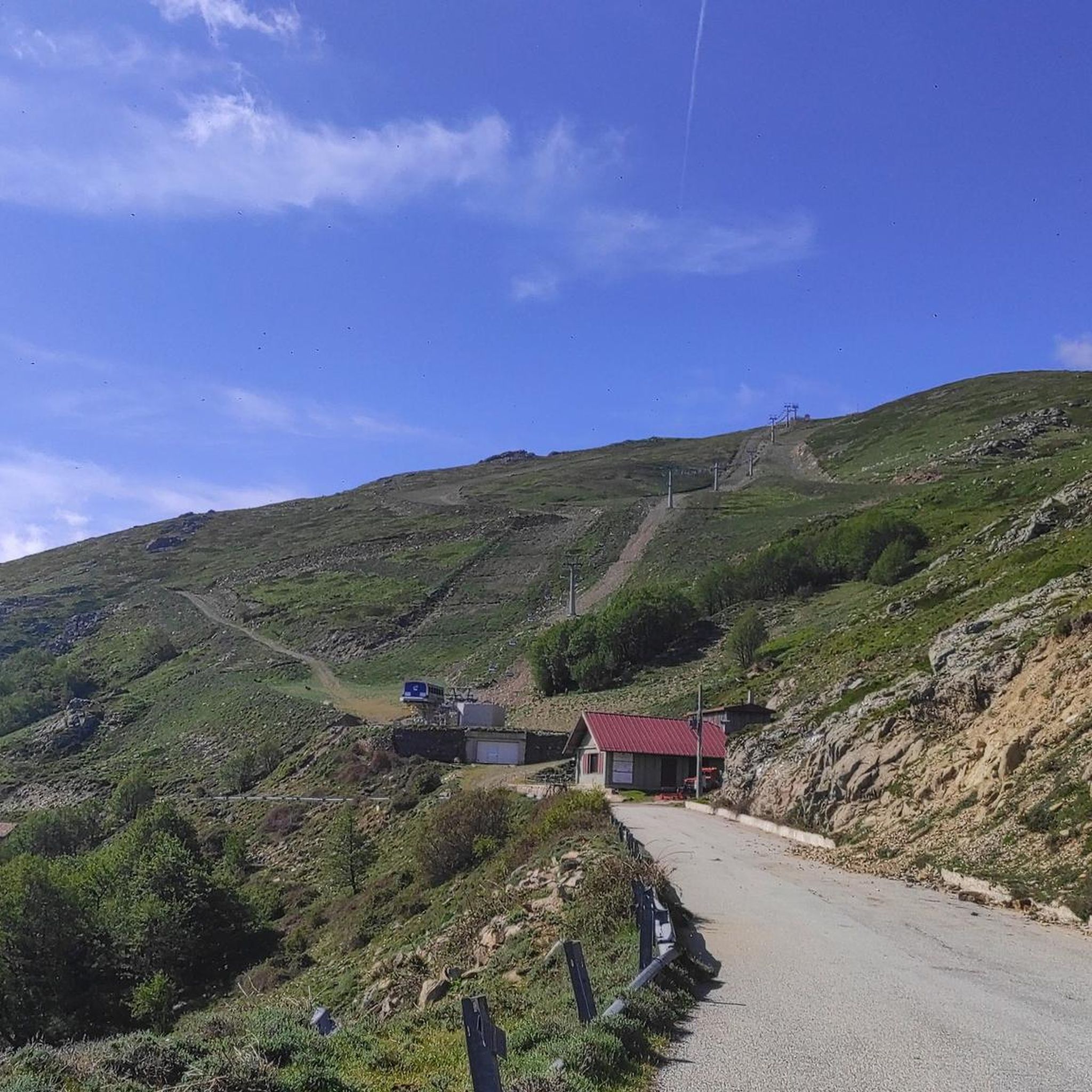
プンタ・ラ・マルモラ山頂

ハイライト • 山頂

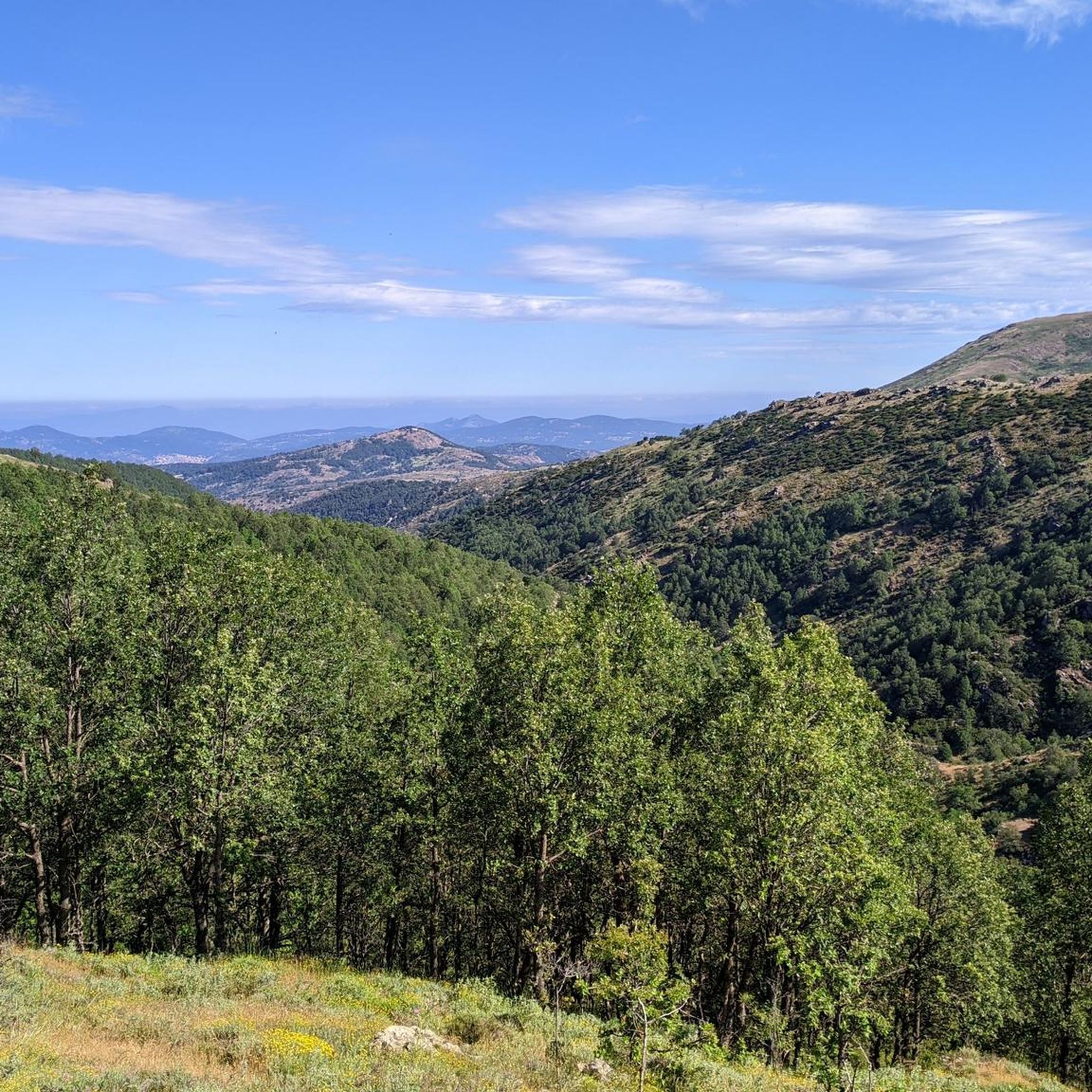
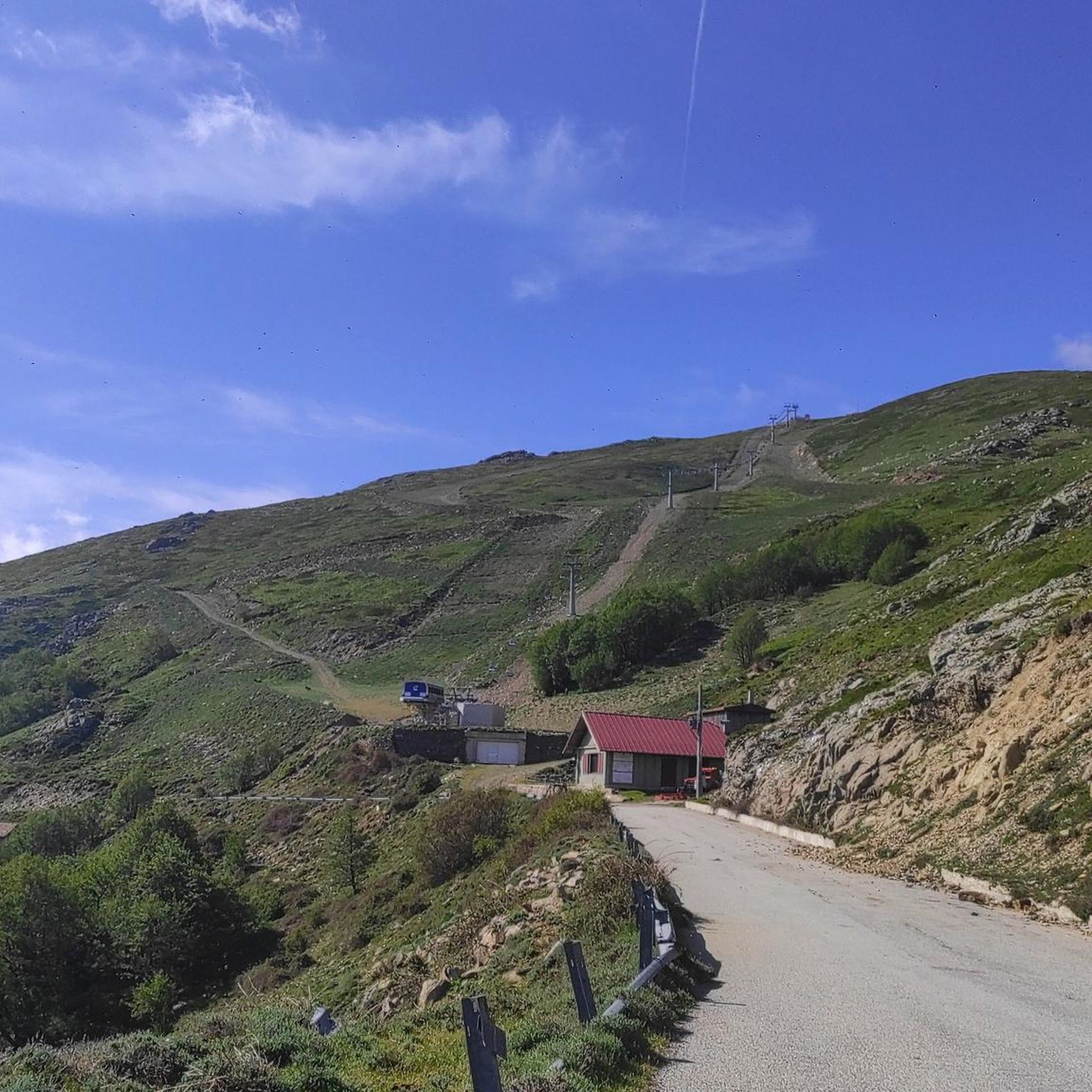
Imagine standing on the highest point in Sardinia, Punta La Marmora, and your gaze sweeps over the entire island. On a clear day you can even see the silhouettes of …

翻訳者 Google •

役立つ情報 は

によるものです

ここでのハイキングを見るスマートフォンに送信
保存
The cross of Punta La Marmora, Punta della Croce, is not exactly the highest point, as it is mistakenly believed. In fact, it is actually a little further along the …

翻訳者 Google •

役立つ情報 は

によるものです

保存

今すぐサインアップして、こんな場所を発見しよう

最高のシングルトラック、ピーク、その他のエキサイティングなアウトドアスポットのおすすめを受け取ろう。

無料新規登録

プンタ・パウリヌ

ハイライト • 山頂

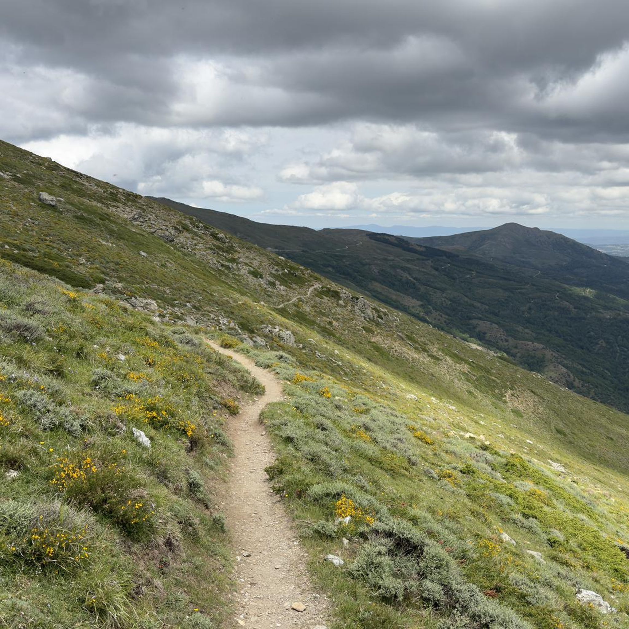
Punta Paulinu belongs to the Gennargentu mountain range. It is part of the main mountain ridge, made up of the five highest peaks on the island (Punta La Marmora, Bruncu …

翻訳者 Google •

役立つ情報 は

によるものです

保存

ブルンク・スピナ山

ハイライト • 山頂

This is not the highest peak in the area yet, but the views are great

翻訳者 Google •

役立つ情報 は

によるものです

保存

プンタ・ラ・マルモラ山頂の十字架

ハイライト (セグメント) • 山頂

At 1,834 meters, Punta La Marmora is the highest peak in the whole of Sardinia. It is located in the Gennargentu massif, between the municipalities of Arzana and Desulo, and …

翻訳者 Google •

役立つ情報 は

によるものです

保存

無料でサインアップして、さらに多くの観光スポットを発見しましょう トナラでの。

無料新規登録

すでにアカウントをお持ちですか?

無料アカウントで今日から始めよう

次の冒険が待っています。
ログインまたは登録

トナラ周辺で人気

トナラのロードバイクルート

トナラのMTBトレイル

トナラでのハイキング

トナラのランニングコース

トナラでのサイクリング

コミュニティからのヒント

Max
7月 6, 2026, Summit Cross of Punta La Marmora

ジェンナルジェントゥ山脈はサルデーニャ島の最高峰であり、「島の屋根」を形成しています。バルバギアの中心部に位置しています。荒々しく岩の多い山岳地帯には、サルデーニャ島の最高峰であるプンタ・ラ・マルモラ(海抜1,834 m)や、歴史的なヌラーゲ村があり、素晴らしいハイキングの機会を提供しています。

Google翻訳による翻訳•

1

0

ジェンナルジェントゥ山脈はサルデーニャで最も高い山脈であり、「島の屋根」と呼ばれています。バルバッジャの中心部に位置しています。荒々しく岩の多い山岳地帯には、サルデーニャで最も高い山であるプンタ・ラ・マルモラ(1,834 m)や、歴史的なヌラーゲの村があり、素晴らしいハイキングの機会を提供しています。

Google翻訳による翻訳•

1

0

Great view. Beautiful area.

Google翻訳による翻訳•

0

0

Great view. Beautiful area.

Google翻訳による翻訳•

2

0

At 1,834 meters, Punta La Marmora is the highest peak in the whole of Sardinia. It is located in the Gennargentu massif, between the municipalities of Arzana and Desulo, and is named after the general and scientist Alberto Ferrero della Marmora, who described the Sardinian island in two scientific-literary works.

Google翻訳による翻訳•

2

0

It may not be obvious that Sardinia's highest mountain is crowned by an imposing summit cross, but it seems completely natural to the mountain hiker. A base made of natural stone from the surrounding area forms the lower level of this small sacred monument. A round column bears the Latin inscription "Ave Crux spes unica" (loosely translated "Hail [Holy] Cross, [our] only hope") and continues further up - almost seamlessly - into the longitudinal beam of the cross. Like many other summit crosses, it is comparatively simple in its design and has no corpus, but is certainly dignified.

Google翻訳による翻訳•

3

0

With an all-mountain mountain bike you can do almost everything on the bike, both uphill and downhill

Google翻訳による翻訳•

1

0

Treasure chest with everything possible and a summit book.

Google翻訳による翻訳•

1

0

トナラでのの人気ルート

トナラのロードバイクルート

トナラでのの人気観光スポット

Natural Monuments

Store rating

komootモバイルアプリでインスピレーションを得よう

無料のkomootアカウントがあれば、無限のアウトドアコースを簡単に見つけてカスタマイズし、ナビで案内できます。

または

今すぐkomootに参加しよう
Store rating

さらに探索

まだ探しているハイライトが見つかりませんか?他の地域のトップアトラクションのガイドを見てみましょう:

ゲンナルゲントゥ国立公園ドゥルガリ/ドルガーリOrthullè/ Urzuleiバウネーイウリアナ/オリエーナSupramonte Di Oliena, Orgosolo E Urzulei - Su Serconeオルゴーゾロ/オルゴーゾロガイル/ガイロタラナトリエーイBiddamannaIstrisàili/ VillagrandeStrisailiカルデードゥÒsini/ Osiniラヌゼイ/ラヌゼイテルテニーアオロセイトルペThiniscole / Siniscolaイェルツ/イェルツバリ・サルドロチェーリLodèGarteddi /Galtellìお兄ちゃんだけど愛イルゴリパサダ/ポサダCantiere Forestale BiderosaÀrthana/ Arzanaヌオロ/ヌオロウッサッサイ/ウッサッサイトルトリオンネ/フォンニゲリスリ/ジラソーレロッツォラーイシンディア/シンディアウラッサイ/ウラッサイエリーニIrvonu / IlbonoLòcula/ LoculiMonti Del GennargentuAritzu / AritzoLùvula/ LulaMonte Alboオルーネデーズロ/デスロBitzi / Bittiマムジャダ/マモイアーダオラネ/オラニOnanìe/Onanìガドーニティアナ/ティアナガヴォイBòrore/ Bororeマコメル/マコメルMeana / Meana SardoオヴォッダFoghesu / PerdasdefoguLodineオルトゥエーリオッロラーイ/オッロラーイBrebì/Belvìアッツァーラサルーレボルティガーリ/ボルティガーリソルゴノ/ソルゴノボロタナ/ボロータナレイシラノス/シラヌスDuarche / Dualchiテティビロロ/ビロリオルツァイ/オルツァイオースティスノラグーグメオロテッリ/オロテッリオッターナ/オッターナオジッダ/オジッダオニフェーリ/オニフェーリStagno Sa CurcuricaStagno Longu di PosadaMonte OrtobeneArea Di Protezione Botanica E Rimboschimento

近くのアドベンチャーガイド

ティアナ/ティアナでやるべきこと

background

新しいピークを征服する準備をしよう

無料でサインアップ
探検する
ルートルートプランナー機能バウチャーを利用ハイキングMTBトレイルロードバイクルートバイクパッキングサイトマップ
アプリをダウンロード
SNSでフォローする

© komoot GmbH

プライバシーポリシー