ルート

プランナー

機能

アップデート

App

ログインまたはサインアップ

アプリを入手

ログインまたはサインアップ

ログインまたはサインアップ

ルート
ハイキング
ドイツ
ラインラントプファルツ州
プファルツの森
ズュートヴェストファルツ

シュヴァイックス

シュヴァイックスのおすすめウォーキング&ハイキングルート

4.5

(5249)

20,673

ハイカー

14

ハイキング

シュヴァイックス周辺でのハイキングは、景色を満喫するのに最適な手段のひとつですが、適切なハイキングルートを見つけることは簡単ではありません。 シュヴァイックス周辺の人気ハイキング&ウォーキングコースを参考にすれば、行きたいルートをすぐに見つけられます。

最終更新日: 5月 14, 2026

4.7

(77)

266

ハイカー

#1.

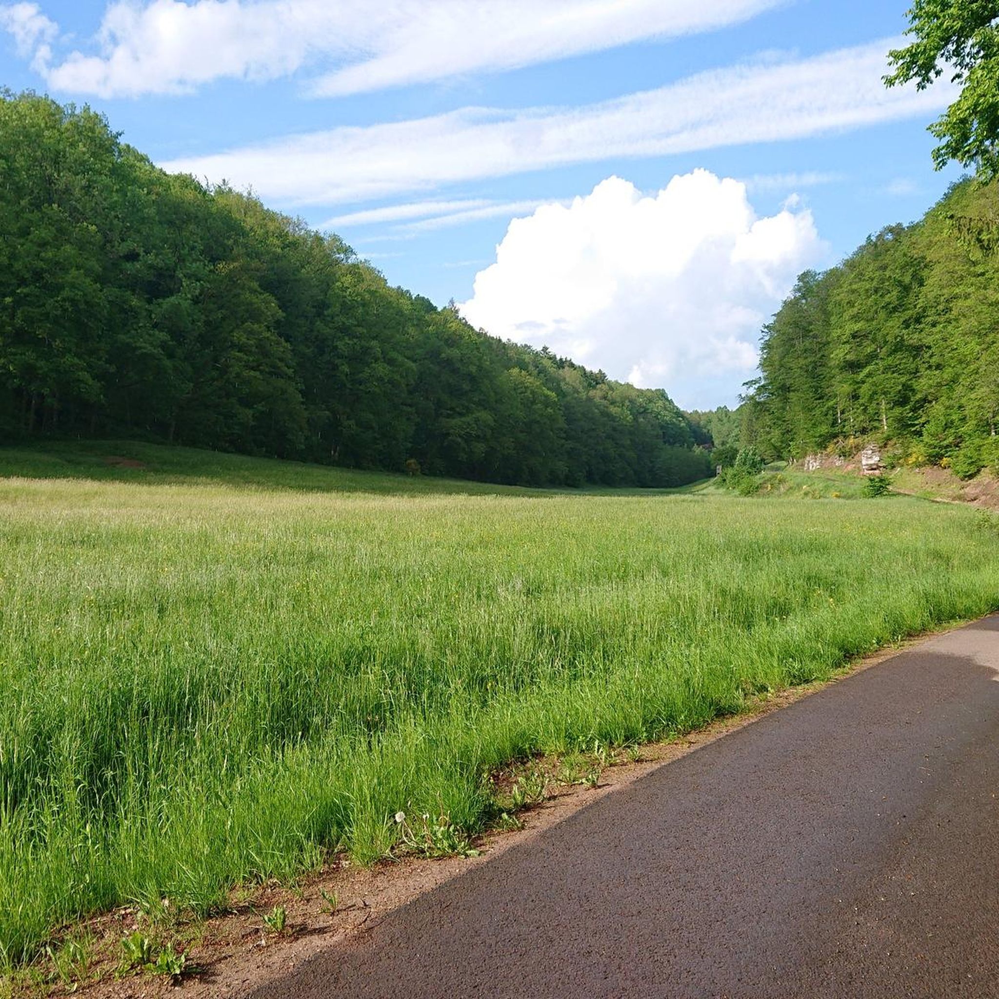
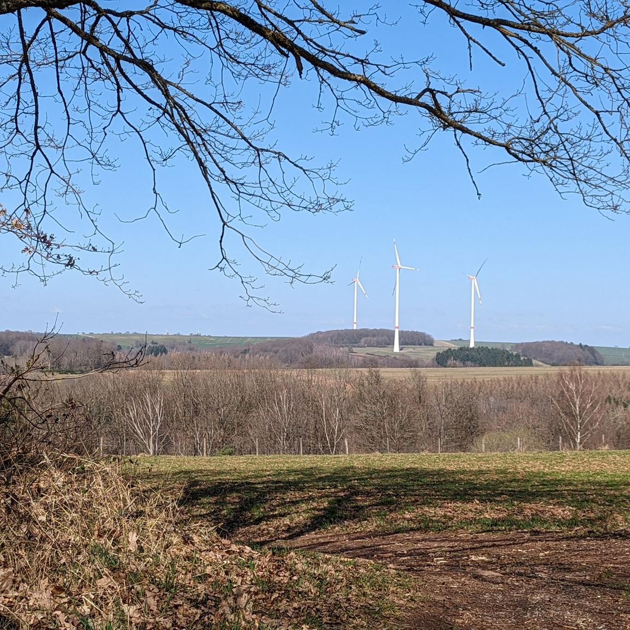
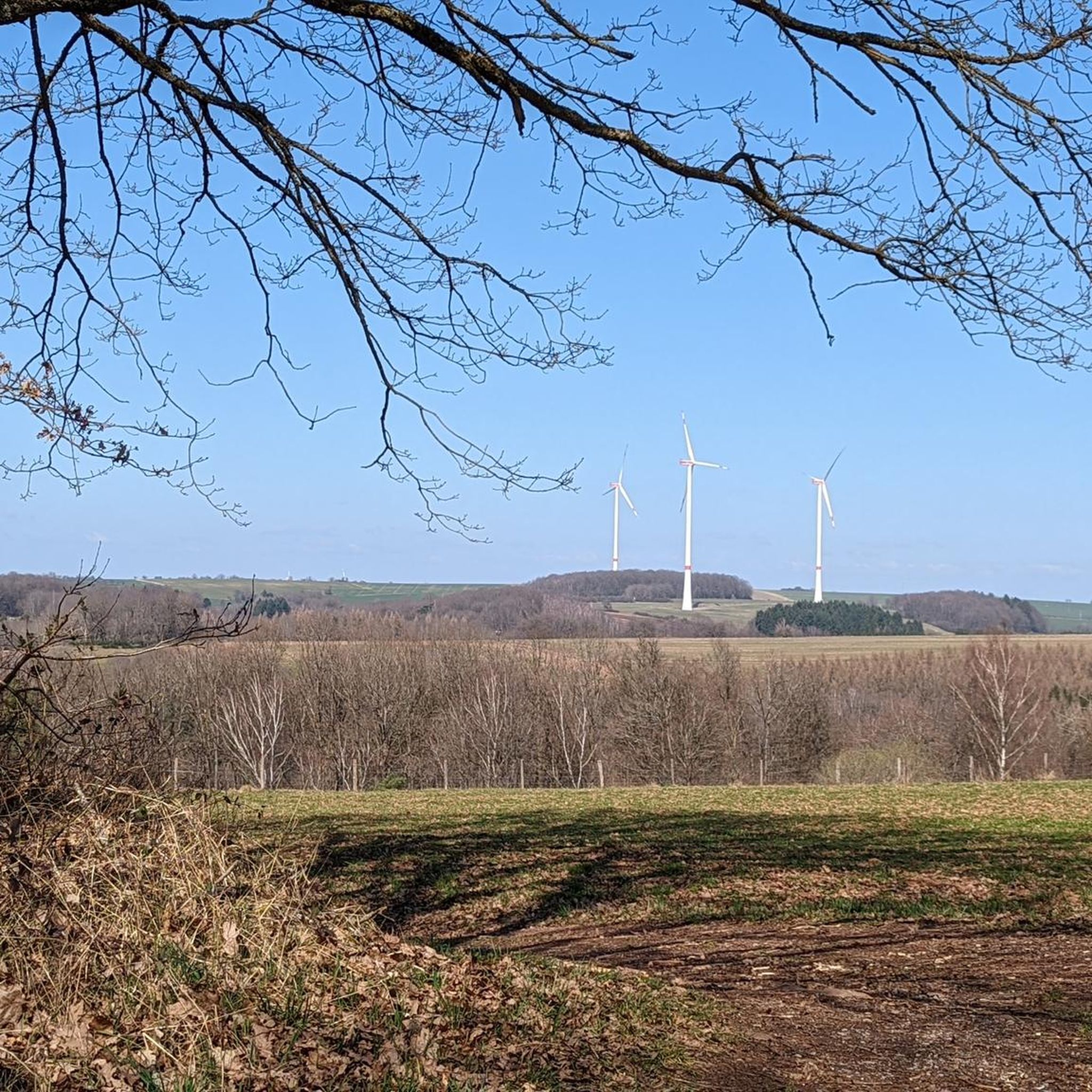
Liederschiedtから出発する 岩場の通路 – アルトシュロスフェルセン・トレイル ループコース

20.2km

05:33

330m

330m

難しいハイキング. 標準以上のフィットネスレベルが必要です。 進みやすいルートです。あらゆるスキルレベルに適しています。

デバイスでナビ

スマートフォンに送信

保存

難しい

難しいハイキング. 標準以上のフィットネスレベルが必要です。 進みやすいルートです。あらゆるスキルレベルに適しています。

難しい
guide_signup
私たちがkomootモバイルアプリで道を示します
無料の komoot アカウントがあれば、無限のアウトドアコースを簡単に見つけてカスタマイズし、ナビで案内できます。

無料新規登録

中程度のハイキング. ある程度のフィットネスレベルが必要です。 進みやすいルートです。あらゆるスキルレベルに適しています。

中程度

初級者向けハイキング. あらゆるフィットネスレベルに適しています。 進みやすいルートです。あらゆるスキルレベルに適しています。

初級

中程度のハイキング. ある程度のフィットネスレベルが必要です。 進みやすいルートです。あらゆるスキルレベルに適しています。

中程度
無料新規登録すると、シュヴァイックスでのでのハイキングをさらに10件ご覧いただけます。

さらに多くのルートや他のユーザーのおすすめ情報を確認できます。

無料新規登録

すでにアカウントをお持ちですか?

おすすめのツアーは他のkomootユーザーが実際に経験した何千ものアクティビティに基づいています。

無料アカウントで今日から始めよう

次の冒険が待っています。
ログインまたは登録

シュヴァイックス周辺で人気

シュヴァイックスのランニングコース

シュヴァイックスのロードバイクルート

シュヴァイックスでのサイクリング

シュヴァイックスのMTBトレイル

シュヴァイックスでののグラベルライド

コミュニティからのヒント

Dieter
5月 3, 2026, Altschlossfelsen Trail

早朝または夕方は、特に光が美しく、静かです。私たちは昼間に訪れたため、場所によっては、光が岩に強く当たったり、かすかに当たったりしました。それでも素晴らしい自然体験でした。 丈夫な靴をお勧めします。

Google翻訳による翻訳

8

0

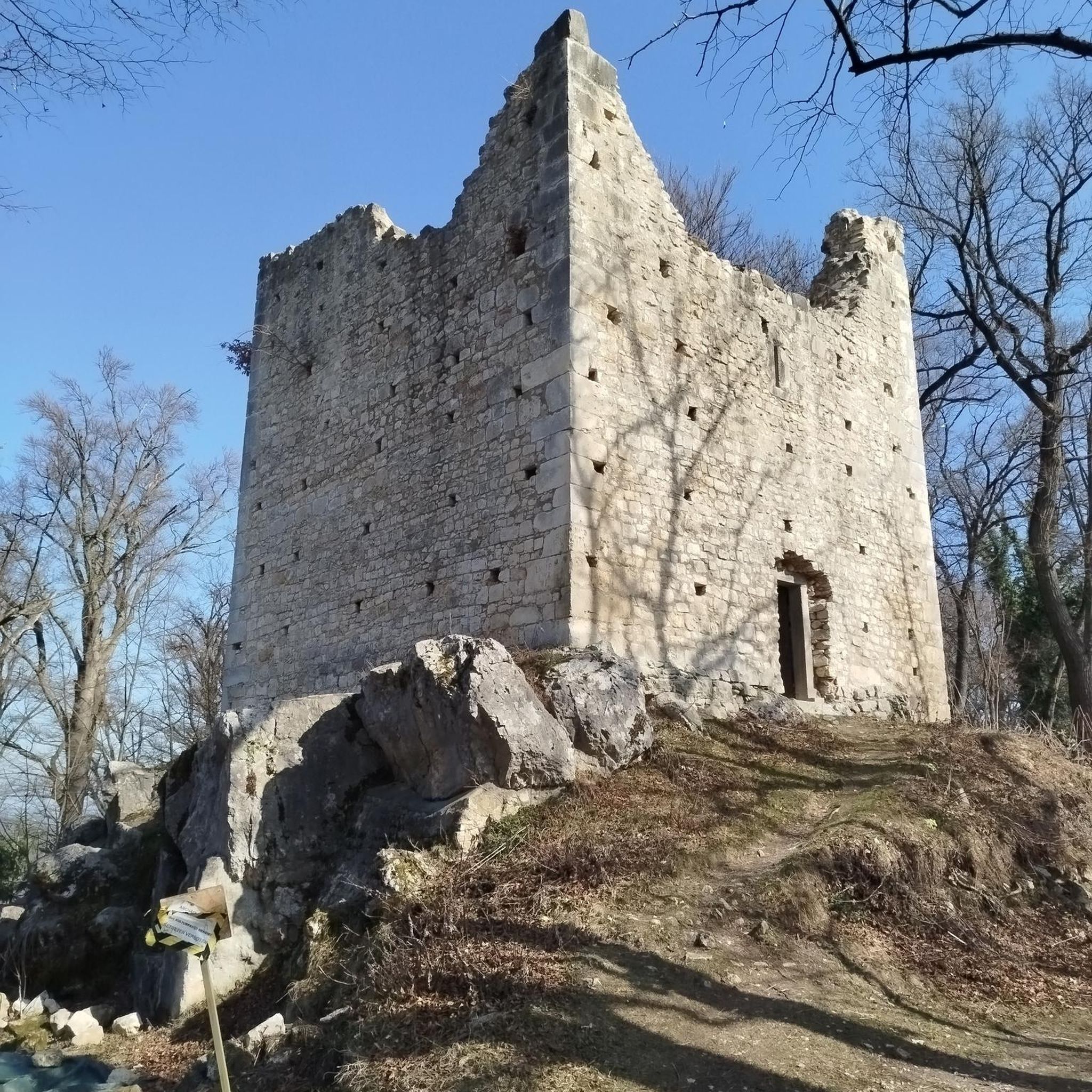
The Altschlossfelsen (also known as Eppenbrunn Castle) are a group of red sandstone rocks designated as a natural monument (ND) ND-7340-205 and a cultural monument (KD) in the municipality of Eppenbrunn in the Palatinate Forest on the border with France, and are the largest rock formation in the Palatinate. They are located on the eastern slope of the Brechenberg (406 m) near Eppenbrunn and Roppeviller at an elevation of approximately 365 m above sea level at the northeast end and 380 m above sea level at the southwest end of the rock band. The Altschlossfelsen are a group of red sandstone rocks approximately one and a half kilometers long and up to 30 meters high. The group consists of sandstone towers and walls. The Altschlossfelsen are crisscrossed by cracks and joints, some of which are wide enough to climb through. They are known primarily for their diverse weathering phenomena and rare lichens. The summit plateau can be reached from the north and south on narrow paths. There, you'll find a sparse forest and moss-covered rocks. A special lighting situation created by the sun, the "rock glow," is best seen around 7:00 p.m. in the first half of April, depending on weather conditions, vegetation, and the position of the sun. In the morning hours, the glow occurs around 8:45 a.m. Finds from the Hallstatt and Roman periods attest to earlier settlement of the rock group. In 1964, for example, shards from the La Tène period (c. 450–50 BC) were found. Traces of a medieval castle from the 11th or 12th century are found on the four main rocks. These include the remains of a stepped structure, post holes, remains of masonry, and notches for beams in the rock. A depression with a diameter of four meters is located on a rock, which may have served as a cistern. Additionally, on the southern and northern slopes around the rock formation, humped blocks, which may have originated from the structure of a former castle, as well as shards from the High Middle Ages were found in a wall groove. A more precise dating of the castle complex is difficult, as the castle was not mentioned before 1297 or later in the 1605 border description between Lorraine and the County of Hanau-Lichtenberg. Source: https://de.wikipedia.org/wiki/Altschlossfelsen

Google翻訳による翻訳

4

0

The Altschlossfelsen (also known as Eppenbrunn Castle) are a group of red sandstone rocks designated as a natural monument (ND) ND-7340-205 and a cultural monument (KD) in the municipality of Eppenbrunn in the Palatinate Forest on the border with France, and are the largest rock formation in the Palatinate. They are located on the eastern slope of the Brechenberg (406 m) near Eppenbrunn and Roppeviller at an elevation of approximately 365 m above sea level at the northeast end and 380 m above sea level at the southwest end of the rock band. The Altschlossfelsen are a group of red sandstone rocks approximately one and a half kilometers long and up to 30 meters high. The group consists of sandstone towers and walls. The Altschlossfelsen are crisscrossed by cracks and joints, some of which are wide enough to climb through. They are known primarily for their diverse weathering phenomena and rare lichens. The summit plateau can be reached from the north and south on narrow paths. There, you'll find a sparse forest and moss-covered rocks. A special lighting situation created by the sun, the "rock glow," is best seen around 7:00 p.m. in the first half of April, depending on weather conditions, vegetation, and the position of the sun. In the morning hours, the glow occurs around 8:45 a.m. Finds from the Hallstatt and Roman periods attest to earlier settlement of the rock group. In 1964, for example, shards from the La Tène period (c. 450–50 BC) were found. Traces of a medieval castle from the 11th or 12th century are found on the four main rocks. These include the remains of a stepped structure, post holes, remains of masonry, and notches for beams in the rock. A depression with a diameter of four meters is located on a rock, which may have served as a cistern. Additionally, on the southern and northern slopes around the rock formation, humped blocks, which may have originated from the structure of a former castle, as well as shards from the High Middle Ages were found in a wall groove. A more precise dating of the castle complex is difficult, as the castle was not mentioned before 1297 or later in the 1605 border description between Lorraine and the County of Hanau-Lichtenberg. Source: https://de.wikipedia.org/wiki/Altschlossfelsen

Google翻訳による翻訳

1

0

The Altschlossfelsen (also known as Eppenbrunn Castle) are a group of red sandstone rocks designated as a natural monument (ND) ND-7340-205 and a cultural monument (KD) in the municipality of Eppenbrunn in the Palatinate Forest on the border with France, and are the largest rock formation in the Palatinate. They are located on the eastern slope of the Brechenberg (406 m) near Eppenbrunn and Roppeviller at an elevation of approximately 365 m above sea level at the northeast end and 380 m above sea level at the southwest end of the rock band. The Altschlossfelsen are a group of red sandstone rocks approximately one and a half kilometers long and up to 30 meters high. The group consists of sandstone towers and walls. The Altschlossfelsen are crisscrossed by cracks and joints, some of which are wide enough to climb through. They are known primarily for their diverse weathering phenomena and rare lichens. The summit plateau can be reached from the north and south on narrow paths. There, you'll find a sparse forest and moss-covered rocks. A special lighting situation created by the sun, the "rock glow," is best seen around 7:00 p.m. in the first half of April, depending on weather conditions, vegetation, and the position of the sun. In the morning hours, the glow occurs around 8:45 a.m. Finds from the Hallstatt and Roman periods attest to earlier settlement of the rock group. In 1964, for example, shards from the La Tène period (c. 450–50 BC) were found. Traces of a medieval castle from the 11th or 12th century are found on the four main rocks. These include the remains of a stepped structure, post holes, remains of masonry, and notches for beams in the rock. A depression with a diameter of four meters is located on a rock, which may have served as a cistern. Additionally, on the southern and northern slopes around the rock formation, humped blocks, which may have originated from the structure of a former castle, as well as shards from the High Middle Ages were found in a wall groove. A more precise dating of the castle complex is difficult, as the castle was not mentioned before 1297 or later in the 1605 border description between Lorraine and the County of Hanau-Lichtenberg. Source: https://de.wikipedia.org/wiki/Altschlossfelsen

Google翻訳による翻訳

1

0

A very varied circular tour with many rock formations and surprises. This tour was recently completed. Highly recommended for hiking. Top-notch rock passage with cozy seating.

Google翻訳による翻訳

2

0

Today the light, and the time, did not favor the brightness among the rocks.

Google翻訳による翻訳

1

0

It's curious to see how the Franco-German border blurs at various points along the way.

Google翻訳による翻訳

1

0

Andy
7月 27, 2025, Felsenglühen

It was very beautiful there, but I was there at the wrong time. I'll be back :) Does anyone know the best time to see the rocks like this?

Google翻訳による翻訳

0

0

シュヴァイックスでのの人気ルート

シュヴァイックスのランニングコース

シュヴァイックスでのの人気観光スポット

Natural Monuments

Store rating

komootモバイルアプリでインスピレーションを得よう

無料のkomootアカウントがあれば、無限のアウトドアコースを簡単に見つけてカスタマイズし、ナビで案内できます。

または

今すぐkomootに参加しよう

Store rating

さらに探索

他の地域の最高のハイキングを見てみましょう。

ダーンエッペンブルンヒルストブーゼンベルクディムバッハレンベルグローダルベンヒルシュタールエルレンバハベイダーンハウエンシュタインシェーナウ(プファルツ)ノスヴァイラーヴィルガルツヴィーゼンルートヴィヒスヴィンケルエアフヴァイラーブルッフヴァイラーベーレンバッハフィッシュバッハバイダーンヘルシュベルクメルツァルベンクラウセンシュヴァンハイムヒンターヴァイデンタールラグミュンヒヴァイラー・アン・デア・ロダルブNaturpark Pfälzerwald - Kernzone Quellgebiet Der WieslauterシャウアーベルクWaldfischbach-BurgalbenブンデンタールマスヴァイラーダルシュタインケスホーフェンThaleischweiler-FröschenボーベンタールニーダーシュレッテンバッハNaturpark Pfälzerwald - Kernzone Bobenthaler Knopfシュピルケルバッハマウシュバッハルンバッハヘルタースベルクホルンバッハビーダースハウゼンシュミツハウゼンコントヴィヒシントハルトザールシュタットヴィンターバッハ(プファルツ)トルルベンヘーアインエードライフェンベルクルッパーツヴァイラーリーシュヴァイラーミュールバッハヘーフレーシェンボッテンバッハヘーエイシュヴァイラーニュンシュヴァイラーヘルマースベルクKröppenクラインシュタインハウゼングロースブンデンバッハヴィースバッハヴェセルベルクドンジーダースクラインブンデンバッハヴィニンゲンリーデルベルクヴァルスハウゼンシュタイナルベンオーバーシムテンローゼンコップフデルフェルトクノップ・ラーバッハヴァルハルベンガイゼルベルクシュマーレンベルクバットヴァイラーグロースシュタインハウゼンディートリヒンゲンクレーエンベルクアルトホルンバッハヘッテンハウゼンオーベルンハイムキルヒェナーンバッハ

近くのアドベンチャーガイド

リーダースキエードでやるべきこと

background

新しいピークを征服する準備をしよう

無料でサインアップ

探検する
ルートルートプランナー機能ハイキングMTBトレイルロードバイクルートバイクパッキングサイトマップ
アプリをダウンロード
SNSでフォローする

© komoot GmbH

プライバシーポリシー