プラスキー郡のおすすめライド
198
ライダー
25
ライド
Pulaski Countyでのロードサイクリングは、ブルーリッジ山脈内に多様な景観を提供します。この地域には、ニュー川沿いの川の谷やドレイパー山のような高台など、変化に富んだ地形があります。これらの地理的特徴は、比較的平坦な道からかなりの高低差があるルートまで、さまざまなロードサイクリング体験を提供します。この地域は自然環境に特徴づけられ、アウトドアアクティビティの背景となっています。
Pulaski Countyの最高のロードサイクリングルート
- 最も人気のあるロードサイクリングルートは、長さ16.3マイル(26.2 km)、所要時間1時間15分のバージニア工科大学発ダック・ポンド~ヘスウッド・ポンド・ループです。この中程度の難易度のルートは、地元の池の周りの変化に富んだ地形を巡ります。
- 地元のロードサイクリストに人気のもう一つのルートは、ニューリバー・トレイル駐車場発ハイワシー川橋~ニュー川橋ループです。これは、長さ21.1マイル(33.9 km)のイージーなルートです。このルートは、ニュー川沿いに景色の良い比較的平坦な体験を提供します。
- 地元のロードサイクリストは、エッグルストン発シンキング・クリーク・ループも気に入っています。これは長さ30.1マイル(48.4 km)のルートで、かなりの高低差を伴う変化に富んだ地形を通り抜け、通常は約3時間5分で完了します。
- Pulaski Countyでのロードサイクリングは、ブルーリッジ山脈、ニュー川、そして変化に富んだ地形によって特徴づけられます。このネットワークは、簡単な平坦なライドから、かなりの登りがある挑戦的なルートまで、さまざまなスキルレベルのオプションを提供します。
- Pulaski Countyのルートは、1件以上のレビューから平均5.0つ星という高評価をkomootコミュニティから受けています。155人以上のロードサイクリストがkomootを使用して、Pulaski Countyの多様な地形を探索しています。
最終更新日: 11月 2, 2026
28
ライダー
32.3km
01:30
390m
390m
中程度のロードライド. ある程度のフィットネスレベルが必要です。 全般的に舗装状態が良好で走行しやすい道です。
17
ライダー
39.5km
02:06
330m
330m
中程度のロードライド. ある程度のフィットネスレベルが必要です。 全般的に舗装状態が良好で走行しやすい道です。

13
ライダー
104km
04:44
1,090m
1,090m
難しいロードライド. 標準以上のフィットネスレベルが必要です。 全般的に舗装状態が良好で走行しやすい道です。
11
ライダー
111km
05:15
1,250m
1,250m
難しいロードライド. 標準以上のフィットネスレベルが必要です。 全般的に舗装状態が良好で走行しやすい道です。
9
ライダー
48.4km
03:06
1,140m
1,140m
難しいロードライド. 標準以上のフィットネスレベルが必要です。 全般的に舗装状態が良好で走行しやすい道です。
7
ライダー
50.3km
02:17
520m
520m
中程度のロードライド. ある程度のフィットネスレベルが必要です。 全般的に舗装状態が良好で走行しやすい道です。
8
ライダー
44.1km
01:58
410m
410m
中程度のロードライド. ある程度のフィットネスレベルが必要です。 全般的に舗装状態が良好で走行しやすい道です。
5
ライダー
141km
06:56
1,690m
1,690m
難しいロードライド. 標準以上のフィットネスレベルが必要です。 全般的に舗装状態が良好で走行しやすい道です。
3
ライダー
42.0km
01:57
460m
460m
中程度のロードライド. ある程度のフィットネスレベルが必要です。 全般的に舗装状態が良好で走行しやすい道です。
さらに多くのルートや他のユーザーのおすすめ情報を確認できます。
すでにアカウントをお持ちですか?
おすすめのツアーは他のkomootユーザーが実際に経験した何千ものアクティビティに基づいています。








コミュニティからのヒント

The Hoover Mountain Bike Complex has over three miles of trails open to hikers and mountain bikers, all rated easy or moderate. These trails explore what was once a mining area used by Hoover Color Corporation and have informational signage about the area's past. You'll see colorful rock walls and mountain vistas. The trails in this park can make for a fun detour and a change of pace if you choose to add them to an adventure along the paved New River Trail.
0
0
This small gravel parking lot is the northern terminus of The New River Trail and an entrance point for the Dora Trail. Both trails are paved and signage in the lot denotes the required parking fees.
0
0
The Whistle Stop Inn is a small, one-unit, nightly rental that is just steps away from New River Trail. The building was originally used as the city of Allisonia's train station in the late 1800's. It sleeps 2 to 4 people and can be reserved through New River Retreat's website.
0
0
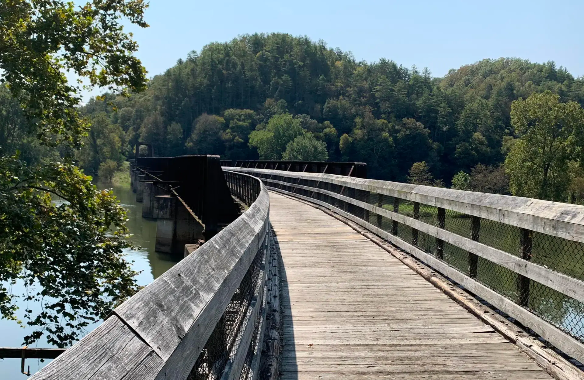
Hiwassee River Bridge is one of three major bridges along the New River Trail. This is a 951-foot long trestle bridge that provides a crossing point over the New River and offers beautiful views along the way.
0
0

Free but quite small hiking parking lot as an ideal starting point for the hike to Mac Afee Knob. Free but quite small hiking parking lot as an ideal starting point for the hike to Mac Afee Knob.
1
0

This free parking lot is the ideal place to start your adventure to McAfee Knob, either through the Appalachian trail or the McAfee Knob Trail. Unfortunately, it is currently closed!! More information at: https://roanokeoutside.com/mcafee-knob-parking-lot-to-close-for-pedestrian-bridge-construction-on-november-30/
0
0

The Roanoke River stretches 410 miles through southern Virginia and northeastern North Carolina. It is a vital habitat for large numbers of fish, birds, and mammals, as well as a recreational area for locals.
0
0

Great spot to stop off and picnic. Easy access with parking right over the road from the water near the VT golf course.
0
0
プラスキー郡の人気観光スポット

komootモバイルアプリでインスピレーションを得よう


探していたものは見つかりませんでしたか?
プラスキー郡の下にある他のロードサイクリングルートをチェックして、目的地で完璧なルートを見つけましょう。
さらに探索
他の地域の最高のロードサイクリングルートを見てみましょう。
