Timeline
Krombacher planned a hike
September 9, 2024
Time
Distance
Speed
Ascent
Descent
AgWem likes this.
Krombacher planned a hike
September 5, 2024
Time
Distance
Speed
Ascent
Descent
Thilo likes this.
June 15, 2020
This hike takes you to the so-called "Dach Hesse": You explore the Habichtswald Nature Park, which is characterized by its large beech forest stands, the diverse flora and its basaltic peaks of volcanic origin. A wonderful region in the north of Hesse that is particularly easy to explore on foot. The
Translated by Google •
Krombacher planned a hike
September 5, 2024
Time
Distance
Speed
Ascent
Descent
June 17, 2020
This family-friendly circular hike takes you to the most exciting places on the Ginsberger Heide. You can not only look forward to an exciting castle ruin and idyllic forest paths, but also to wide views. From the starting point at the parking lot on the Giller, you hike directly to the Gillerberg tower
Translated by Google •
Krombacher planned a hike
September 2, 2024
Time
Distance
Speed
Ascent
Descent
March 23, 2021
No surprise at the headline: On your circular hike today you will discover three real castles and countless fantastic views. The Drei-Burgen-Weg was set up for the 700th anniversary of Königstein in 2013. Along the way, you will discover not only the Königstein castle ruins but also the Falkenstein and
Translated by Google •
Krombacher planned a hike
March 19, 2021
Time
Distance
Speed
Ascent
Descent

March 20, 2021
The devil was going on in the Spreewald. In ancient times he set out with a plow and two harnessed oxen to break up the riverbed of the Spree. The oxen, however, ran in all directions, criss-cross through the forest and dug hundreds of small ditches and canals. When you stroll through the mystical world
Translated by Google •
Krombacher planned a hike
March 19, 2021
Time
Distance
Speed
Ascent
Descent

dk🥾 likes this.
March 20, 2021
Berlin is not exactly known for its alpine terrain. Nevertheless, in the middle of the capital there is one or the other hill that will make you sweat on the ascent. And at the top? White tarpaulins await you there, fluttering ghostly from strange round knolls. It goes up to the famous Teufelsberg and
Translated by Google •
Krombacher planned a hike
March 19, 2021
Time
Distance
Speed
Ascent
Descent

March 20, 2021
It protrudes like a wedge into the city of Halle: the Dölauer Heide. In the middle is a high plateau with palisades, ramparts and gates, which belong to one of the largest and oldest fortifications from the Neolithic Age. A place where, as a Stone Age person, you would certainly have felt right at home
Translated by Google •
Krombacher planned a hike
March 19, 2021
Time
Distance
Speed
Ascent
Descent
March 20, 2021
An island, a small temple and lots of water - what sounds like a typical holiday in Greece is actually an enchanting hike through the greenery of Magdeburg. The tour takes you to the beautiful Elbe island, a gem between the Alter Elbe and Stromelbe. Here in the Rotehorn Park, the water goddess Elwine
Translated by Google •
Krombacher planned a hike
March 19, 2021
Time
Distance
Speed
Ascent
Descent

Nadja likes this.
March 20, 2021
A hut tour is as much a part of the Alps as the sand is to the sea. But hut hopping is also possible in Brandenburg. Instead of massive rock faces, there are delicate purple heather blossoms, instead of ice-cold glacier lakes inviting beaches and instead of the tree line, boundless forest romance awaits
Translated by Google •
Krombacher planned a hike
March 13, 2021
Time
Distance
Speed
Ascent
Descent
March 23, 2021
The Hainig is Lauterbach's local mountain and has a proud height of 417 meters. But it goes even higher, because in the middle of the mountain, between old oaks, stands the Hainigturm, which was rebuilt as a stone tower in 1907. From the Hainigturm you can enjoy a great view over the Lautertal and deep
Translated by Google •
Krombacher planned a hike
March 13, 2021
Time
Distance
Speed
Ascent
Descent

FWalter, 🇩🇪 PittiLine 🥾 and Maurizio Grasso like this.
March 23, 2021
The Sababurg Primeval Forest is incredibly beautiful. On this circular hiking trail you dive into a forest of ancient oaks and beeches. You can reach the most beautiful photo opportunities on the mystical-looking hiking trail. There is, for example, the black spokes that are majestically enthroned right
Translated by Google •
Krombacher planned a hike
March 13, 2021
Time
Distance
Speed
Ascent
Descent

March 23, 2021
On your hike over the karst and cave nature trail in Breitscheid, you will discover a fascinating landscape. Mysterious caves, a brook disappearing underground, a jungle-like gorge - you will definitely not get bored here. The circular route is very well signposted and gives you a great insight into
Translated by Google •
Krombacher planned a hike
March 13, 2021
Time
Distance
Speed
Ascent
Descent

Christiane and Maurizio Grasso like this.
March 23, 2021
Art meets nature - this hike not only reveals wonderful views, but also a wide variety of works of art made of wood, red sandstone and metal. It starts at the Kreidacher Höhe bus stop near Wald-Michelbach. The art trail will soon start on the Tromm Höhenweg between Wagenberg and Tromm. You will be accompanied
Translated by Google •
Krombacher planned a hike
March 13, 2021
Time
Distance
Speed
Ascent
Descent
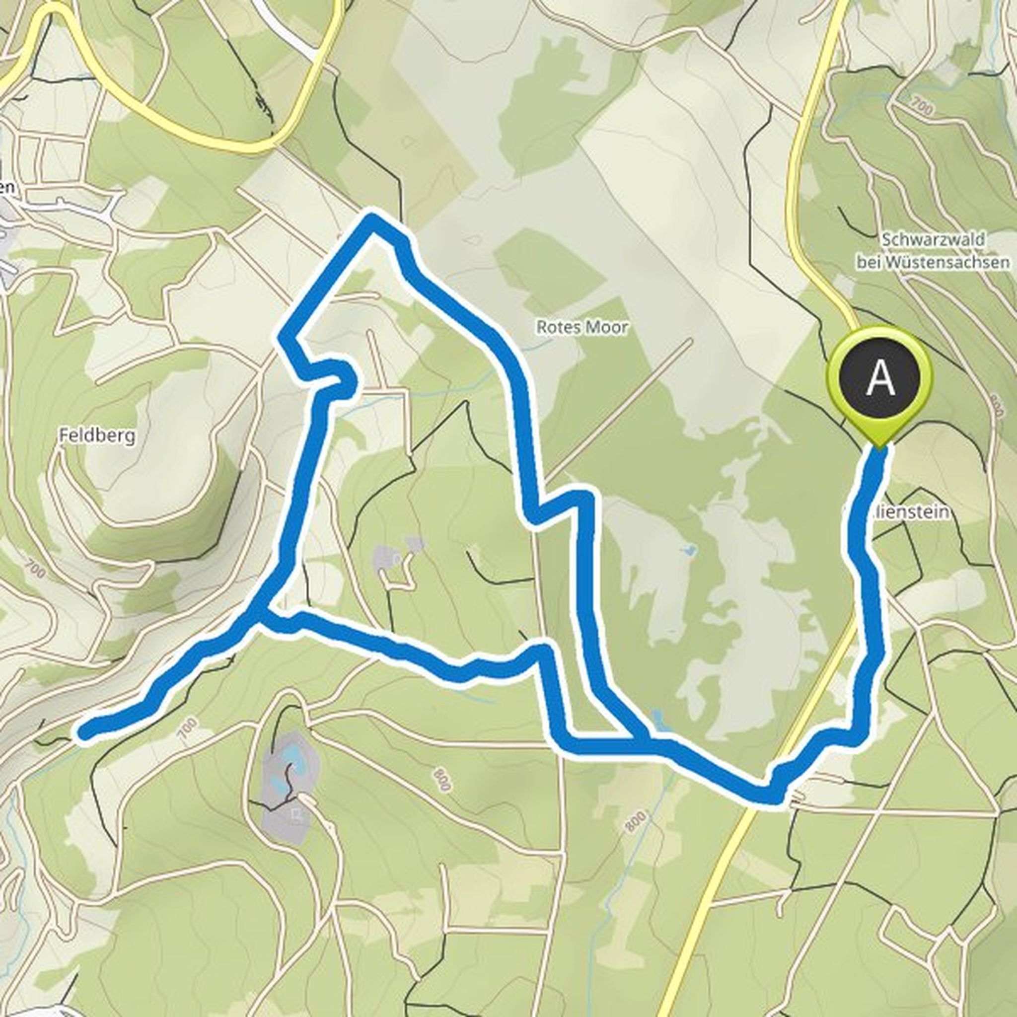
March 23, 2021
On this hike you will explore two jewels in the Rhön: the Rote Moor and the Kaskadenschlucht. You start in the parking lot at the Moorwiese, only a few minutes away from Gersberg. Those arriving by public transport can also start the tour in Sandberg and first hike through the Kaskadenschlucht gorge
Translated by Google •
Krombacher planned a hike
March 13, 2021
Time
Distance
Speed
Ascent
Descent
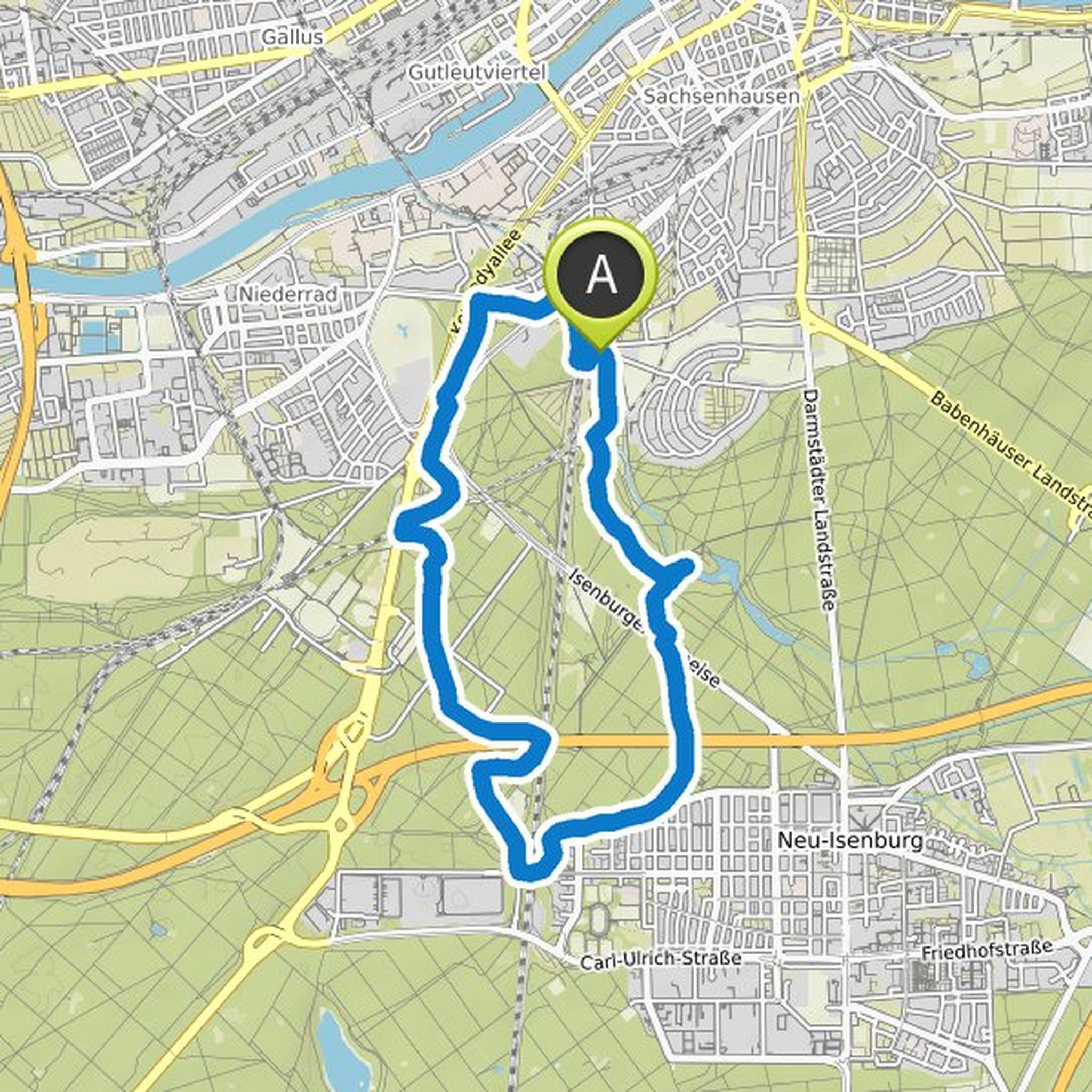
June 4, 2020
600 hectares of forest, right in the city: The Duisburg city forest is a popular local recreation area and the green lung of the region. This relaxed circular hike shows you the different faces of the forest. Since the Duisburg city forest is traversed by a network of wide paths and narrow paths, you
Translated by Google •