Timeline
Christopher planned a bike ride
October 4, 2017
Time
Distance
Speed
Ascent
Descent

Christopher planned a bike ride
September 18, 2017
Time
Distance
Speed
Ascent
Descent

F71 likes this.
August 9, 2017
After Pagny-sur-Moselle, Jouy-aux-Arches approaches. The Roman aqueduct, which even protrudes over a few houses, immediately catches your eye. After only 14 more kilometers, today's stage destination Metz is reached. The impressive Saint-Étienne Cathedral and numerous other small and large buildings
Translated by Google •
Christopher planned a bike ride
September 18, 2017
Time
Distance
Speed
Ascent
Descent

F71, Rainer Kr☮ne and Ewa und Christof like this.
August 9, 2017
In the regenerating presence of nature, we continue via Les Turbines to Nancy. With a population of 100,000, Nancy offers a wide selection of cozy bistros, restaurants and attractions. The cityscape with its many historic buildings is a real pleasure. The picturesque Place Stanislas, the Königsplatz
Translated by Google •
Christopher planned a bike ride
September 18, 2017
Time
Distance
Speed
Ascent
Descent

F71 likes this.
August 9, 2017
From Épinal it goes to Golbey and directly on the Moselle on to Chavelot. Shortly after Chavelot you will reach the Lorraine region. On the way to Vincey, you'll see an old factory building that once had a weaving mill. Finished goods were then transported by water. In Bainville-aux-Miroirs begins the
Translated by Google •
Christopher planned a bike ride
September 18, 2017
Time
Distance
Speed
Ascent
Descent

F71 likes this.
August 9, 2017
It goes on a little-traveled road on Éloyes to Épinal. On this stage you have to overcome a few vertical meters again, but from Épinal the landscape changes. With the Vosges in the back you can look forward to a wide and open terrain and less altitude. Èpinal, the capital of the French department of
Translated by Google •
Christopher planned a bike ride
September 18, 2017
Time
Distance
Speed
Ascent
Descent

August 9, 2017
The Moselle rises in the Vosges near Bussang, not far from the center of the village at an elevation of about 600 m. Take a moment to start your journey at the spring. Being aware of the origins of the culture along the Moselle and perhaps becoming aware of it will perhaps open you with a little reverence
Translated by Google •
Christopher planned a bike ride
August 9, 2017
Time
Distance
Speed
Ascent
Descent

F71 likes this.
August 9, 2017
The last stage leads along the left bank of the Moselle from Löf to shortly before Koblenz. On the last kilometers of the Mosel cycle path through the region Terrassenmosel, some typical Mosellan wine places wait to be discovered by you. Thus, in Kobern-Gondorf the medieval market square and probably
Translated by Google •
Christopher planned a bike ride
August 9, 2017
Time
Distance
Speed
Ascent
Descent

F71 likes this.
August 9, 2017
On this stage, you can look forward to interesting castles and palaces. The stage starts with a view of the majestic Reichsburg. About Klotten and Pommern it goes to the historic place Treis-Karden.
From Moselkern you can make a trip to the castle Eltz, one of the most beautiful castles in Germany. The
Translated by Google •
Christopher planned a bike ride
August 9, 2017
Time
Distance
Speed
Ascent
Descent

F71 likes this.
August 9, 2017
The next stage starts at the historic railway bridge in Bullay. Face the challenge and climb the steepest vineyard in Europe on the "Calmont via ferrata". But you will be rewarded with one of the most beautiful views over the Mosel valley. The bike tour continues along the idyllic wine villages of Ediger
Translated by Google •
Christopher planned a bike ride
August 9, 2017
Time
Distance
Speed
Ascent
Descent

F71 likes this.
August 9, 2017
It continues to the next wine town Enkirch. The place is also referred to as the treasure trove of the Rhenish half-timbered building and is certainly worth a visit. The ride continues on castle in the winegrower Puenderich. The bike path finally leads via the wine village Breidel on to Zell, home of
Translated by Google •
Christopher planned a bike ride
August 9, 2017
Time
Distance
Speed
Ascent
Descent
F71 likes this.
August 9, 2017
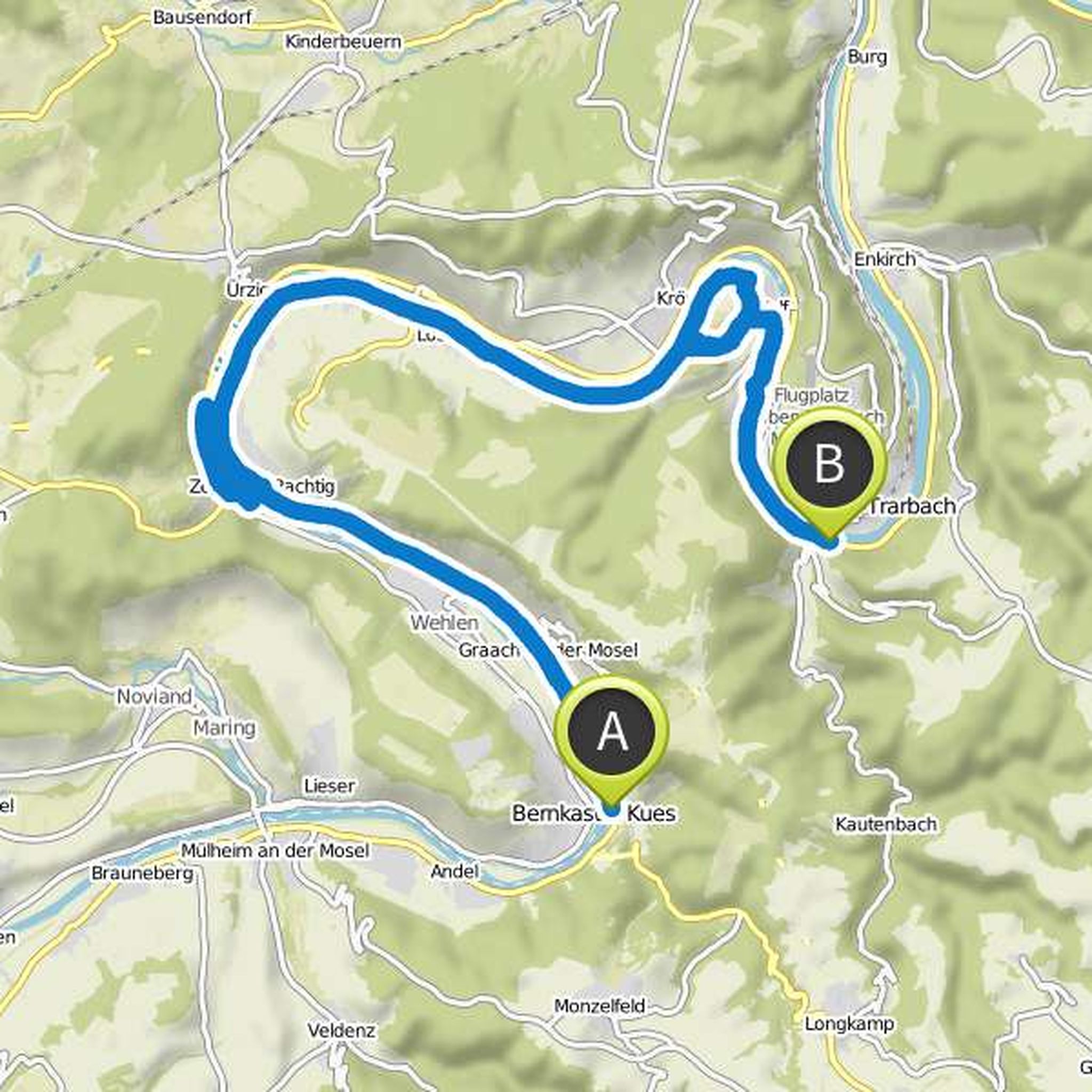
After the medieval town of Bernkastel-Kues, the Moselle Cycle Path leads on this stage - always along the right bank - to Zeltingen-Rachtig. A detour through the center with its old estates and half-timbered houses worthwhile. Opposite of Rachtig is the former Cistercian monastery Machern, within whose
Translated by Google •
Christopher planned a bike ride
August 9, 2017
Time
Distance
Speed
Ascent
Descent

F71 likes this.
August 9, 2017
Through wide Moselle bends and vineyards, the Mosel cycle path leads on its twelfth stage - from Mehring to the wine town of Piesport. One of the most beautiful and well-known loops is located between Leiwen and Trittenheim, in front of Neumagen-Dhron, the oldest wine town in Germany and the site of
Translated by Google •
Christopher planned a bike ride
August 9, 2017
Time
Distance
Speed
Ascent
Descent
August 9, 2017
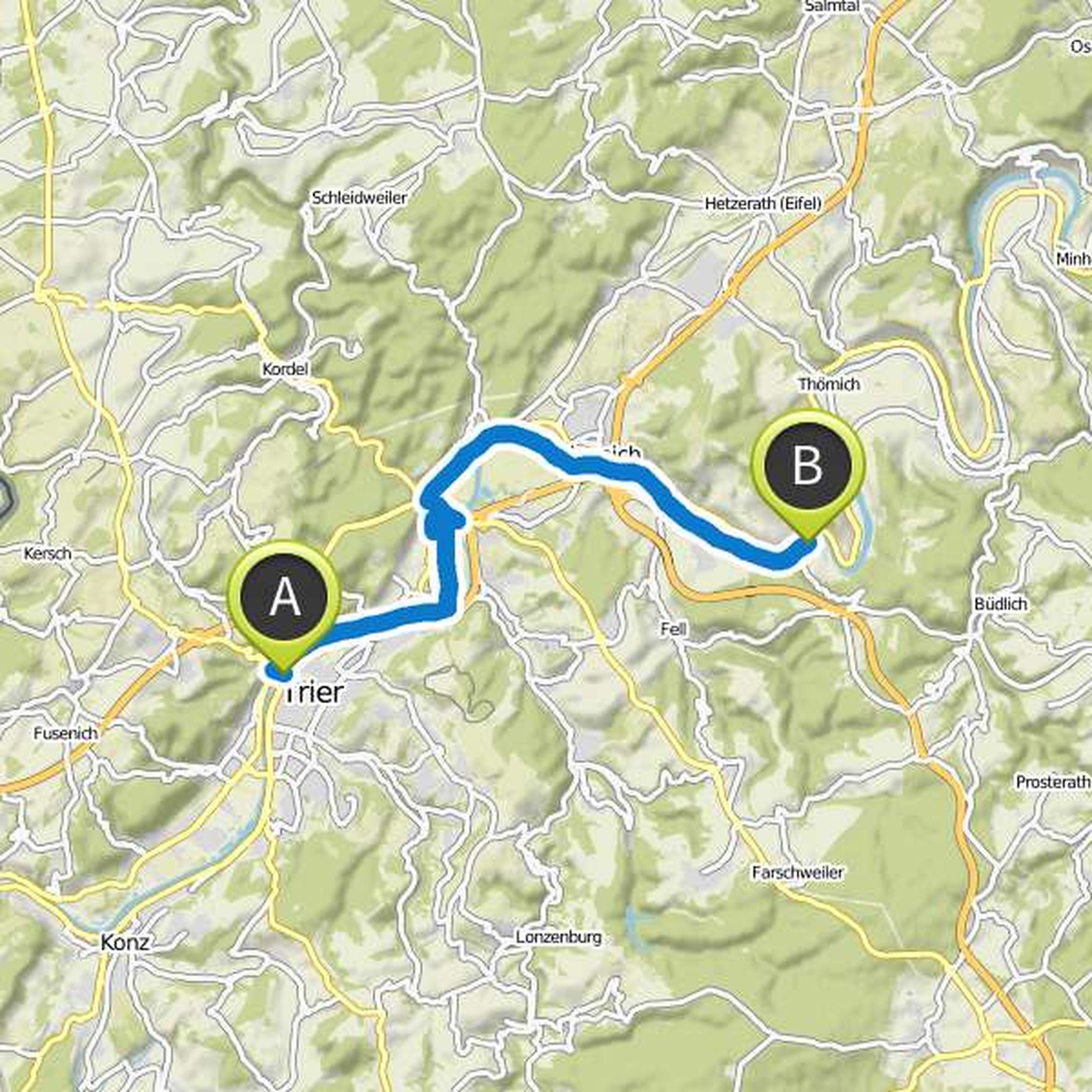
The starting point of the stage is Trier - a treasure chest of architecture characterized by Roman architecture. Via the Kaiser-Wilhelm-Brücke bridge, the cycle path along the left bank of the Moselle leads first to the Pfalzel district, which for a long time was the summer residence of the Roman emperors
Translated by Google •
Christopher planned a bike ride
August 9, 2017
Time
Distance
Speed
Ascent
Descent

F71 likes this.
August 9, 2017
This stage of the Mosel cycle path leads along the right bank of the Moselle to the Moselle metropolis of Trier and starts in the attractive wine village of Nittel, which lies at the foot of high dolomite and limestone cliffs. A little further along the bike path you reach the village of Oberbillig
Translated by Google •
Christopher planned a bike ride
August 9, 2017
Time
Distance
Speed
Ascent
Descent

gaga gugu, F71 and Ralf Foehrmann like this.
August 9, 2017
This stage of the Mosel cycle path runs completely on the right, German Moselufer. However, since the Moselle always forms the border between the neighboring states, it is possible to look at Luxembourg. The well-developed bike path leads without gradients through the broad valley of the Upper Moselle
Translated by Google •
August 9, 2017
This stage leads along the right bank of the Moselle along the wine town of Piesport to historic Bernkastel-Kues. Downstream, vineyards, orchards and picturesque wine-growing villages such as Wintrich, Brauneberg and Mülheim culminate in the cultural highlight of the stage. The famous Moselle town of
Translated by Google •