마스동크에서 가장 멋진 20개의 천연기념물
천연기념물을 방문하여 마스동크의 아름다운 풍경을 만나보세요. 마스동크에 있는 20
개의 천연기념물과 상세 정보를 살펴본 후에 방문하고 싶은 천연기념물을 다음 모험 계획에 추가해보세요!
마지막 업데이트: 10월 13, 2026
베다프세 베르헨 모래언덕
하이라이트 • 자연
번역자 Google •
팁에 의해

Haanwijk 에스테이트
하이라이트 • 자연 기념물
번역자 Google •
팁에 의해

이런 장소를 발견하려면 지금 가입하세요
최고의 싱글 트랙, 봉우리 및 다양한 흥미로운 야외 장소에 대한 추천을 받아보세요.
잔드페르스퇴빙 베다프
하이라이트 • 자연 기념물
번역자 Google •
팁에 의해

우덴 근처의 필란트 단층
하이라이트 (구간) • 자연 기념물
번역자 Google •
팁에 의해

Wijstgronden Peelrandbreuk
하이라이트 • 자연 기념물
번역자 Google •
팁에 의해

무료로 가입하여 마스동크 주변의 더 많은 자연 기념물을 발견하세요.
이미 komoot 계정이 있나요?
오늘 무료 계정으로 시작하세요
다음 모험이 기다리고 있어요.



커뮤니티 팁

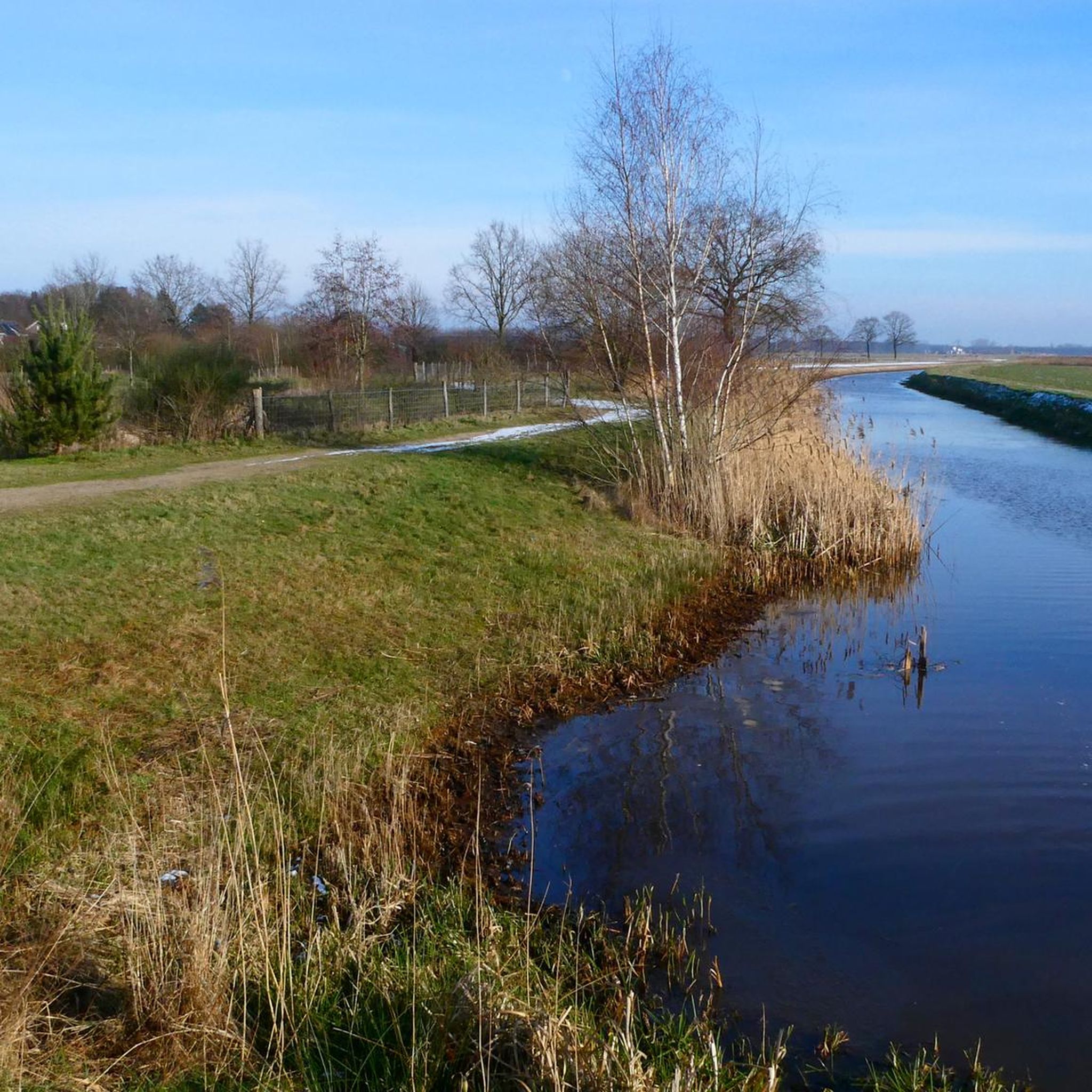
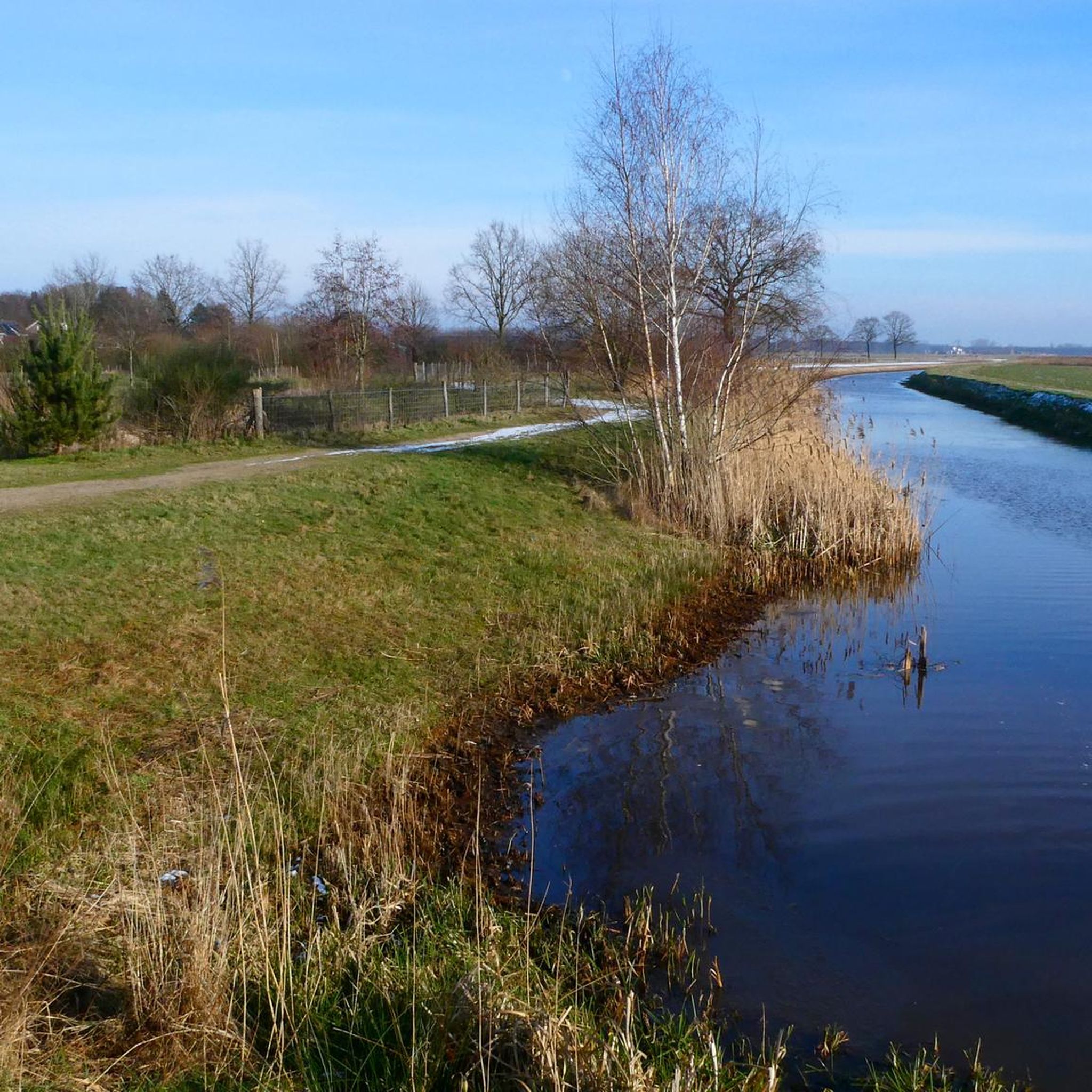
The Peelrand fault near Uden is one of the most recognizable fault zones in Brabant and cuts across the landscape between the Bedafse Bergen and the Annabos. This geological fault causes a height difference of several meters, but more importantly, a difference in water management that is immediately visible in the terrain. On the higher side of the fault, mineral-rich groundwater rises, making this higher part wetter than the lower-lying zone adjacent to it. This inverse pattern of wet and dry is both indicative and unique to this area. Along the fault line, you can see how the dry drifting sand of the Bedafse Zandduinen abruptly transitions into dark, moist soil where seepage water surfaces. The water often has a reddish-brown hue due to the iron carried from the deeper layers. This transition is clearly visible in the field: a few meters further, the landscape changes completely, from dry and light sand to wet, boggy terrain with alders, sedges, and other moisture-loving plants. The Peelrand fault near Uden is therefore a significant geological feature that shapes the entire area. Without it, the Bedafse Bergen wouldn't be so dry and drifting, and the Annabos wouldn't be so wet and seepage-prone. The fault makes this part of Uden one of the best places to see the "wisp" phenomenon in person, and it gives the hiking trail a scenic quality found in few other places.
0
0
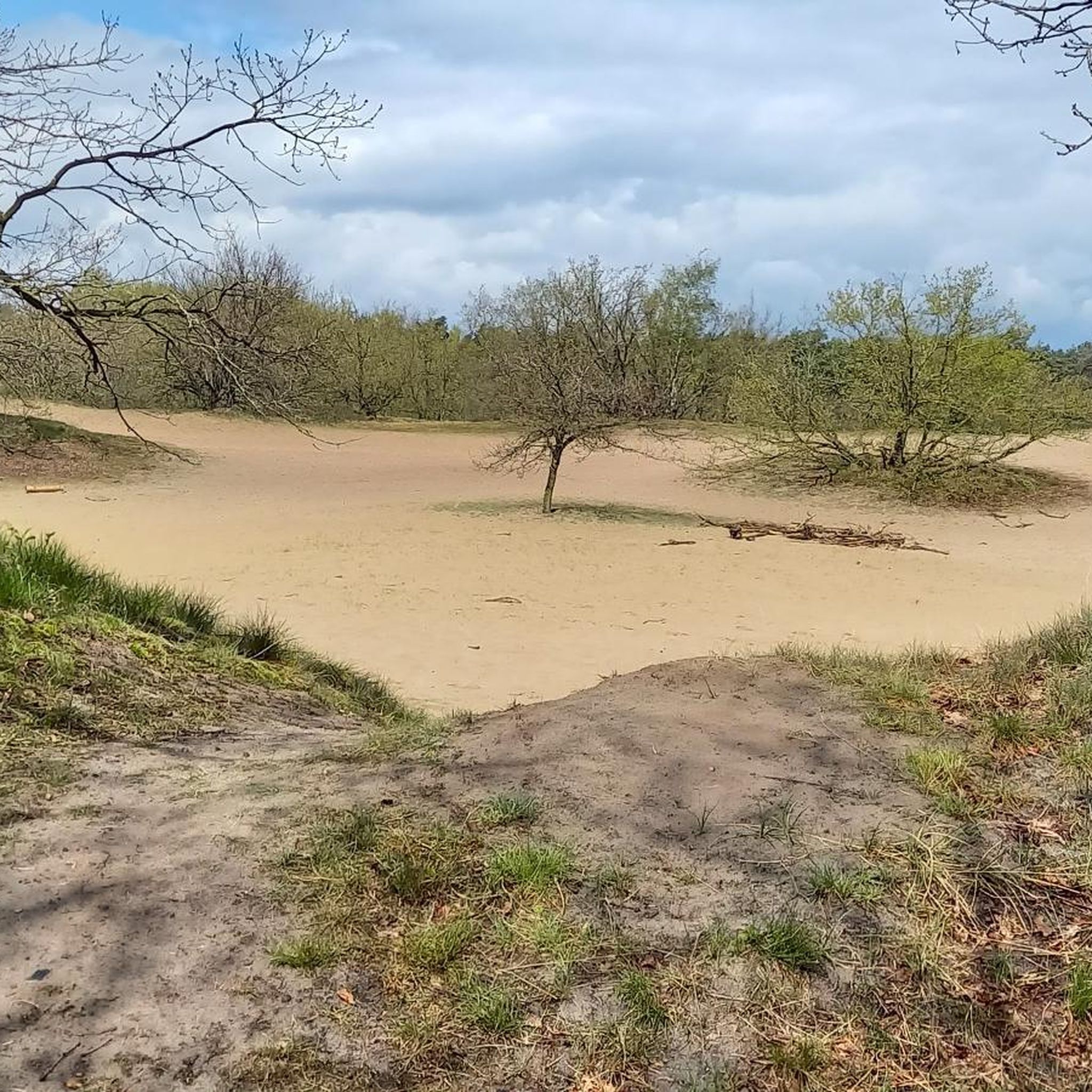
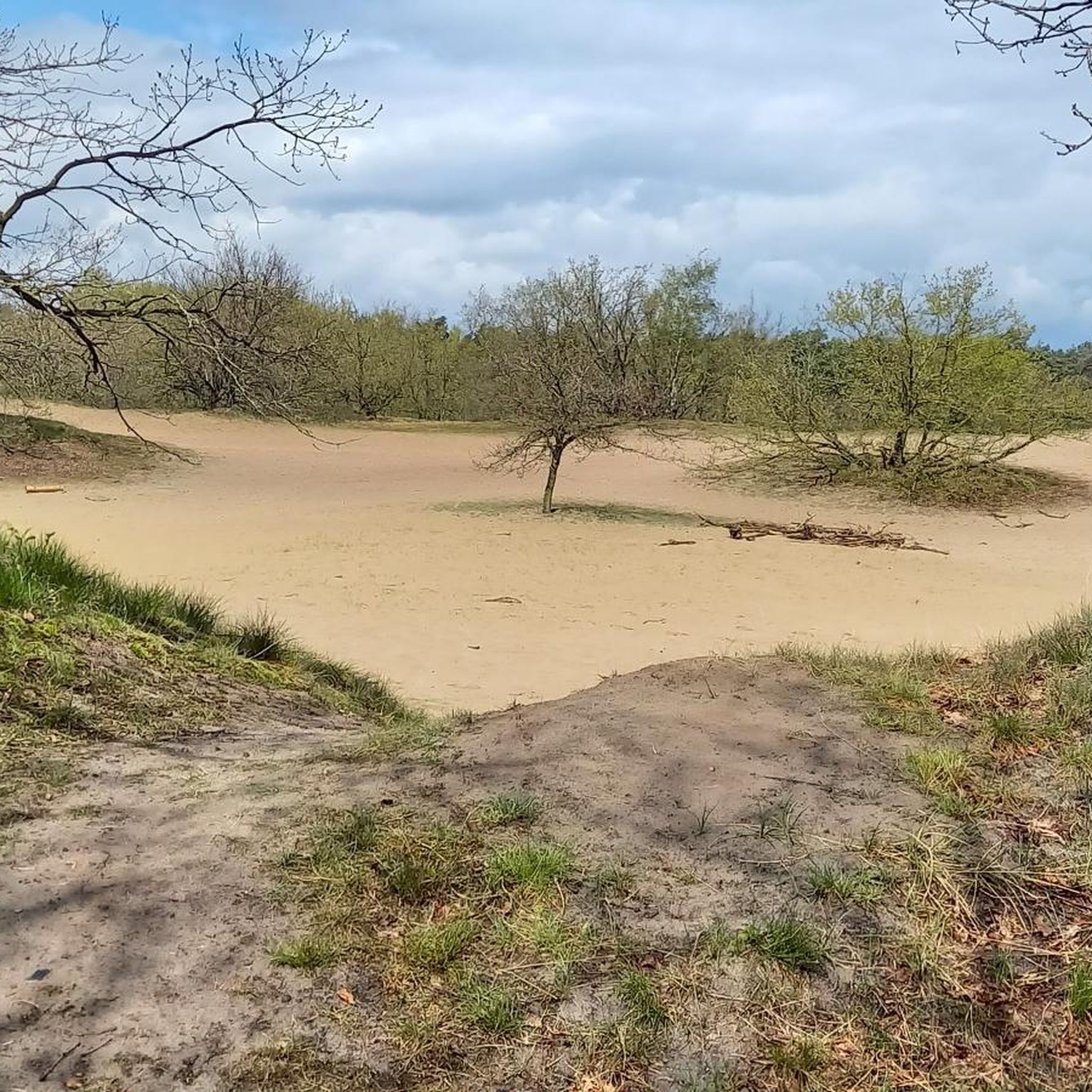
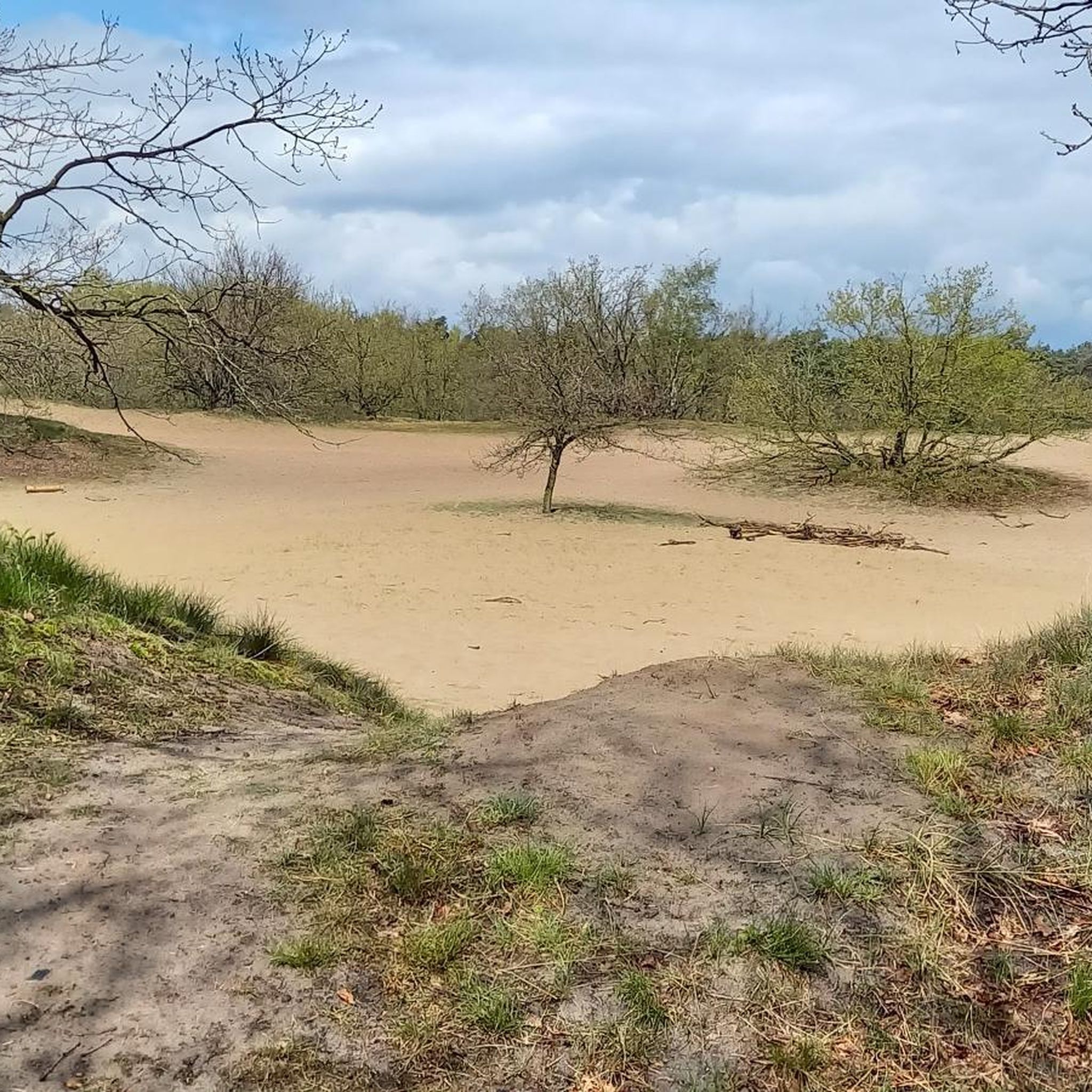
The Bedafse Bergen form a striking drifting sand area between Uden and Vorstenbosch. The landscape was created by centuries of sand drift after the original forests were cleared for agriculture and firewood in the Middle Ages. The wind carried the loose sand and accumulated it into hills and sand ridges—the present-day sand dunes of the Bedafse Bergen. The area consists of open drifting sand, low and high sand hills, dry heathland, and small transitions to forest. The dunes have remained active because managers keep sections open, thus preserving the character of a true drifting sand area. The higher ridges offer clear views over the undulating sand landscape, which differs significantly from the typical Brabant forests and farmland. The Bedafse Bergen are one of the few remaining places in North Brabant where this type of landscape can still be seen so clearly: a rugged, dry, and dynamic terrain with natural elevation changes. This makes it both scenically unique and physically challenging, especially when you hike up and down the steep sandy slopes several times. Today, it's a protected nature reserve and a popular hiking area due to its unique dune landscape, open vistas, and stark contrast with the surrounding landscape.
0
0
The Bedafse Bergen form a striking drifting sand area between Uden and Vorstenbosch. The landscape was created by centuries of sand drift after the original forests were cleared for agriculture and firewood in the Middle Ages. The wind carried the loose sand and accumulated it into hills and sand ridges—the present-day sand dunes of the Bedafse Bergen. The area consists of open drifting sand, low and high sand hills, dry heathland, and small transitions to forest. The dunes have remained active because managers keep sections open, thus preserving the character of a true drifting sand area. The higher ridges offer clear views over the undulating sand landscape, which differs significantly from the typical Brabant forests and farmland. The Bedafse Bergen are one of the few remaining places in North Brabant where this type of landscape can still be seen so clearly: a rugged, dry, and dynamic terrain with natural elevation changes. This makes it both scenically unique and physically challenging, especially when you hike up and down the steep sandy slopes several times. Today, it's a protected nature reserve and a popular hiking area due to its unique dune landscape, open vistas, and stark contrast with the surrounding landscape.
2
0
I first read on the sign 'you see the beech', I looked for it but only understood it later... learned something new again.
1
0

These high, marshy areas with iron-rich seepage water are called wijstgronden, a rare phenomenon that is nowhere in Europe as visible as near Uden. That is why the province of Noord-Brabant declared the special area “De Wijstgronden” in 2004 as the first geological monument in the province. At the moment there is even the ambition to have the entire area around the Peelrandbreuk recognized as Unesco Geopark Peelhorst.
0
0
The Peelrand fault is clearly visible in the landscape in several places. For example, in the Sint Annabos near Uden you can see a height difference or steep edge of almost 2 meters. It is also noticeable that the vegetation on the high part of the fault is different from that on the low side. This is because the soil on the high side is much wetter. Soil scientists would normally expect it to be the other way around, but due to the tectonic movement of the soil, the density of the soil around the fault plane is much greater and practically impermeable to water. As a result, the groundwater that flows from the higher Peelhorst towards the lower Roerdalslenk is forced to the surface at the Peelrand fault. This groundwater naturally contains a great deal of dissolved iron. As soon as the iron particles come into contact with oxygen, rusty deposits form on the soil. If this process is repeated in the same place over and over again, large, hardened iron concentrations can form: the iron ore banks.
2
0

The Peel Edge Fault is a geological fault line that owes its name to the Peel.
1
0
The Bedafse Bergen is a special piece of primeval territory where you can wander freely and where it feels as if time has stood still.
2
0
마스동크 주변에서 가장 인기 있는 명소


더 살펴보기
마스동크 주변의 최고의 동굴을 찾기 위해 이 가이드를 확인해보세요:
