10의 팔몰리가지 명소 & 주요 장소
팔몰리에는 둘러볼 만한 장소가 많답니다. 하이킹 또는 사이클링을 좋아한다면 팔몰리에 숨겨진 10
가지 보석을 만날 수 있을 거예요. 이 지역의 주요 명소를 살펴보면서 다음 모험을 계획해보세요.
마지막 업데이트: 10월 18, 2026

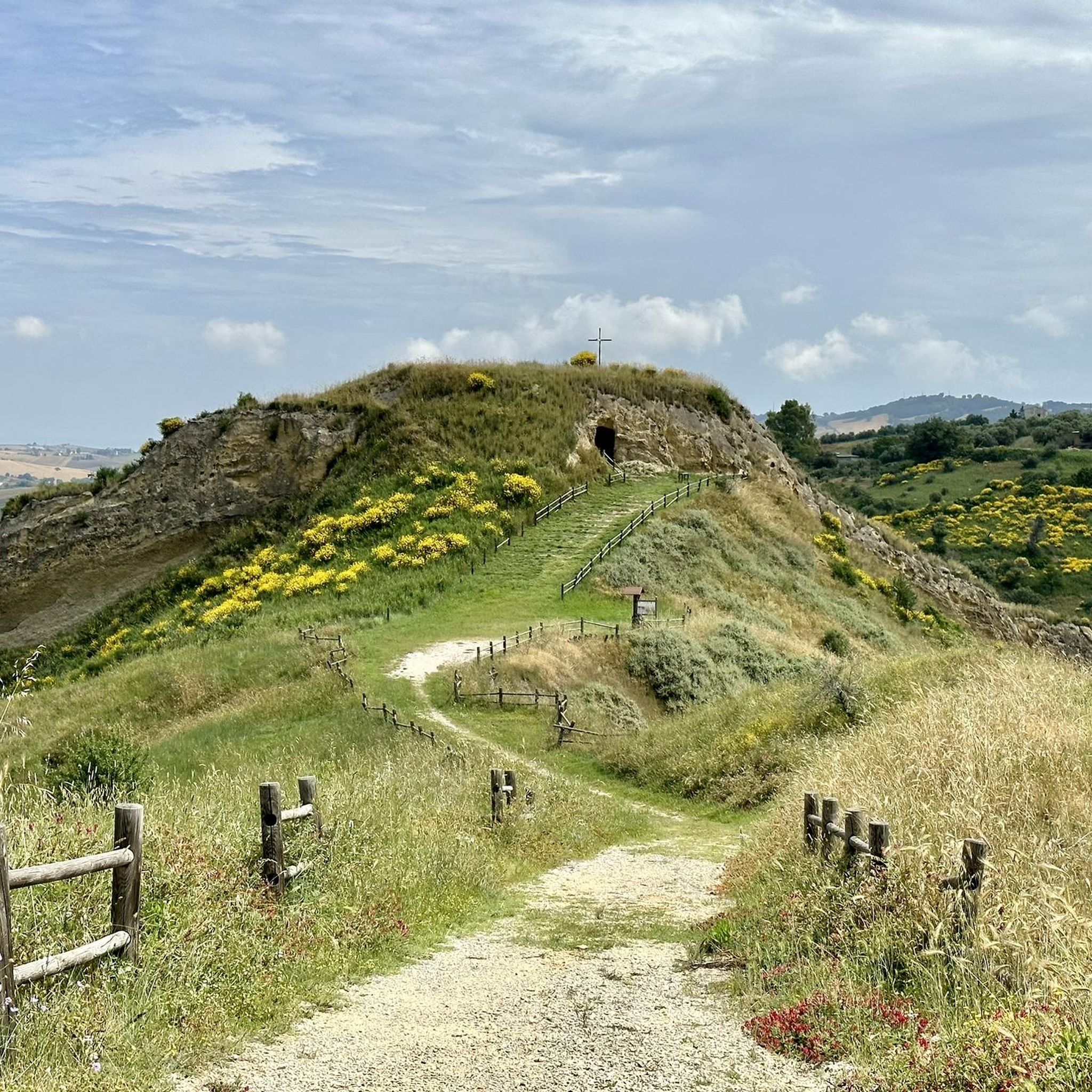
리시아의 산 미켈레 아르칸젤로 동굴
하이라이트 • 동굴
그로타 디 산 미켈레 아르칸젤로(에레모 디 산 미켈레라고도 함)는 리시아 마을 바로 외곽의 바위 속에 있는 독특하고 오래된 성소입니다. 이 교회는 약 10미터 깊이의 자연적인 석회암 동굴을 중심으로 지어졌습니다.
번역문 보기
팁에 의해

이런 장소를 발견하려면 지금 가입하세요
최고의 싱글 트랙, 봉우리 및 다양한 흥미로운 야외 장소에 대한 추천을 받아보세요.
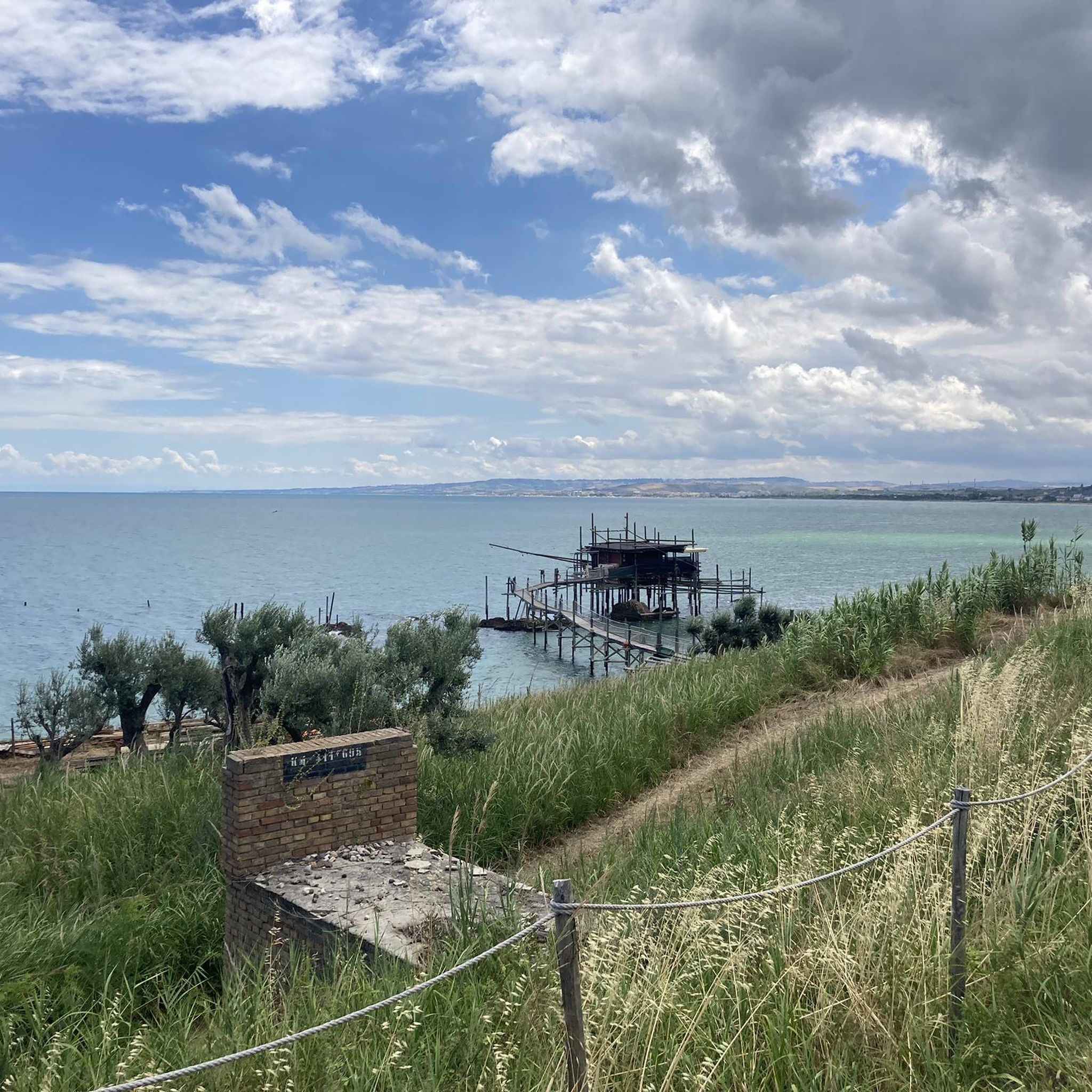
로카비바라 시내 중심가
하이라이트 • 정착지
번역자 Google •
팁에 의해

콘벤토 디 산탄토니오
하이라이트 • 종교적 장소
Convento di Sant'Antonio는 Chieti 지방의 내륙 깊숙한 곳에 있는 언덕 마을 San Buono 바로 외곽의 목가적이고 조용한 곳에 위치해 있습니다. 이 …
번역문 보기
팁에 의해
최근에 포장된 도로와 아름다운 전망
하이라이트 (구간) • 자전거 도로
번역자 Google •
팁에 의해

무료로 가입하여 팔몰리 주변의 더 많은 명소를 발견하세요.
이미 komoot 계정이 있나요?
오늘 무료 계정으로 시작하세요
다음 모험이 기다리고 있어요.

커뮤니티 팁

푸른 계곡에 숨겨진 영적인 성스러운 바위 성소. 그로타 디 산 미켈레 아르칸젤로(에레모 디 산 미켈레라고도 함)는 리시아 마을 바로 외곽의 바위 속에 있는 독특하고 오래된 성소입니다. 이 교회는 약 10미터 깊이의 자연적인 석회암 동굴을 중심으로 지어졌습니다. 지역 전설에 따르면 대천사 미카엘 자신이 풀리아의 유명한 몬테 산탄젤로로 가기 전에 몬테 소르보 주변의 이 숲에 들렀다고 합니다. 고요하고 바위투성이인 동굴 안에는 작은 샘물이 돌 벽을 따라 흐릅니다. 이곳에서 돌 대야에 모인 물은 순례자들이 예로부터 신성하고 치유력이 있다고 여겨왔습니다. 하얀 석회암 외관, 트레스테 계곡의 거친 자연, 영적인 고요함의 조합은 이곳을 아브루초 내륙의 가장 매혹적인 숨겨진 보물 중 하나로 만듭니다.
2
0
수백 년 된 프란치스코 수도원이 녹음 속에 숨겨져 있습니다. Convento di Sant'Antonio는 Chieti 지방의 내륙 깊숙한 곳에 있는 언덕 마을 San Buono 바로 외곽의 목가적이고 조용한 곳에 위치해 있습니다. 이 프란치스코 수도원 단지는 원래 1575년 지역 왕자 Giovannantonio Caracciolo의 명령으로 지어졌습니다. 교회는 기념비적인 석조 건축물과 특징적인 이중 종탑으로 즉시 눈길을 사로잡습니다. 이곳을 아웃도어 애호가들에게 특별하게 만드는 것은 고요하고 평화로운 위치입니다. 단지 내부에는 중앙 우물이 있는 아름답고 진정한 수도원 회랑(chiostro)이 있습니다. 오늘날 이 단지는 지역 예술 및 고고학 박물관 등을 포함하고 있습니다. 넓고 그늘진 앞마당은 자전거를 잠시 세워두고 자연 속에서 받을 만한 휴식을 즐기기에 완벽합니다.
2
0

The Torre della Fara is located in Torre della Fara in the municipality of Celenza sul Trigno in the province of Chieti. The tower is located near the Trigno river and the Ateleta-Biferno sheep track and was in visual connection with neighboring towns and with the monastery of Santa Maria del Canneto of Roccavivara (Molise). (Source Wikipedia.)
1
0

The Torre della Fara is located in Torre della Fara in the municipality of Celenza sul Trigno in the province of Chieti. The tower is located near the Trigno river and the Ateleta-Biferno tratturo and was in visual connection with neighboring towns and with the monastery of Santa Maria del Canneto in Roccavivara (Molise). The tower dates back to the 12th century.[1] Even if the toponym recalls the Longobard fara, it is, however, difficult to identify the period of construction of the site.[ The tower has a cylindrical structure and is made of stone[1], but stone fragments are also used to frame the openings and loopholes[2]. The tower is 15 meters high and 6 meters in diameter. The tower has no scarp walls and, at a third of the height there is an opening which, probably, is a raised entrance. Furthermore, inside there are the holes where the beams used to support the various levels. The roof inside is vaulted with a lowered cap. The use of mortar in the Torre della Fara decreases with height[1] just as the thickness of the walls decreases with increasing height
0
0
According to oral tradition, it seems that San Michele, who left from the East to defeat paganism, stopped in a wood near Liscia before arriving on the Gargano; this wood is located around Monte Sorbo, an area that in ancient times had a high anthropic density, as can be seen from the remarkable archaeological material found here and coming from Italic tombs. Still on the subject of legend, it is said that a man from Palmoli, a village in the upper Vasto bordering Liscia, intent on grazing cows near the Treste river, noticed that a young bull got lost every day and then returned in the evening. One day, however, the farmer, intrigued by this mysterious behavior, decided to follow his animal and saw that the vegetation opened up, as if by magic, as it passed, as if to indicate a direction to follow; this strange path led him to a cave where he saw the bull kneeling in front of a wooden image of St. Michael the Archangel, which miraculously made water gush out so that man could quench his thirst and recover from the discovery to witness this event supernatural. In memory of these events that occurred in Liscia, the Marquesses of Avalos, in the eighteenth century incorporated the cave inside a small church, perhaps, to regulate the large influx of pilgrims who are here recalled by popular devotion to the Archangel Michael, a cult that is lost in the mists of time.
1
0

Beautiful convent, surrounded by oak woods. There is also a picnic area.
0
0

Newly paved road with gentle gradients and wonderful views. But: officially prohibited for bicycles
0
0

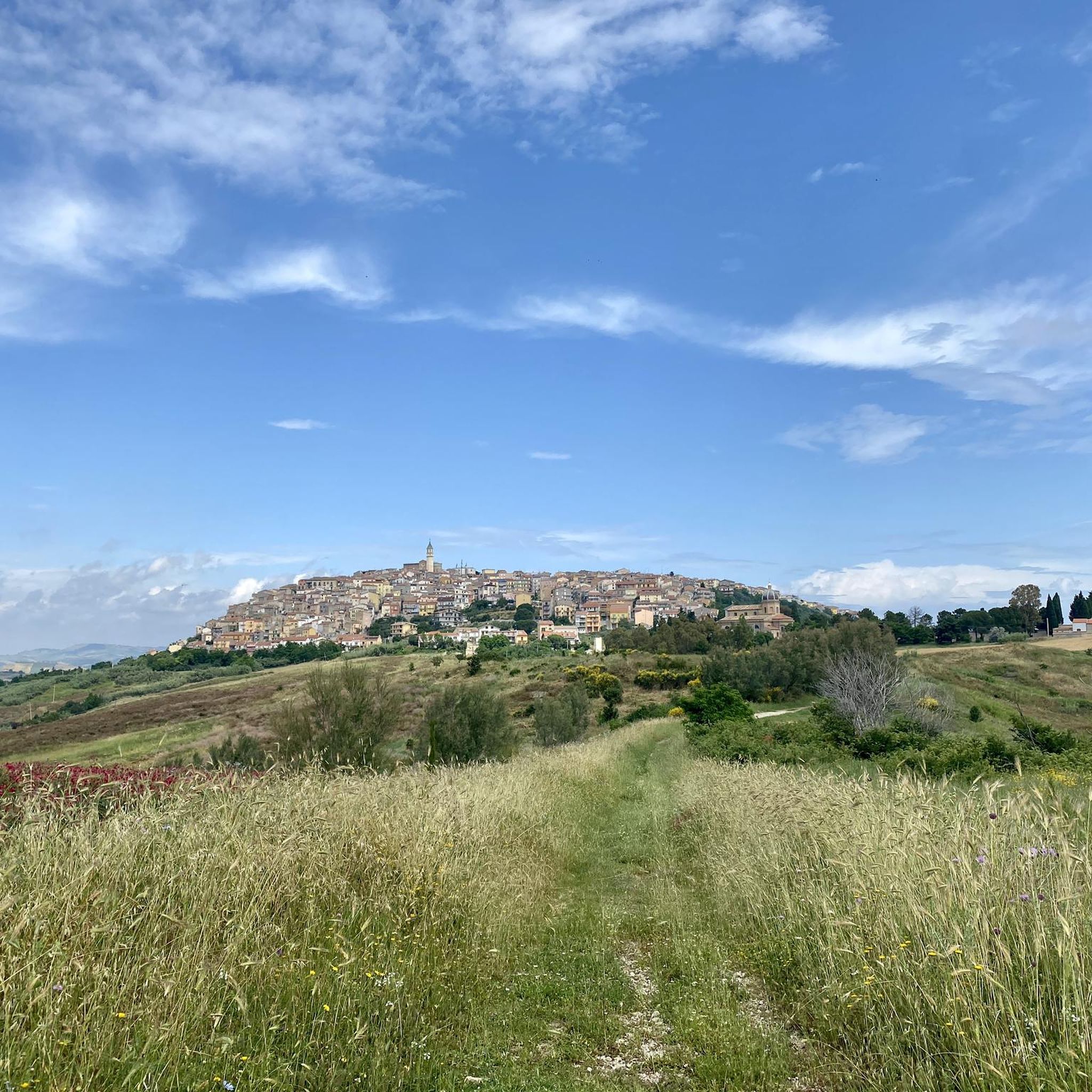
There are two hypotheses on the origins of its name, the first has it that it derives from Rocca Bonnarii, referring to its founder, a certain Bonnario; the second that it comes from Rocca di Vivara, referring to the district of Vivara still existing and bordering the municipality of Roccavivara. The lower part of the Roccavivara countryside offers ample evidence of the presence of inhabited centers at the time of republican and imperial Rome. Historical information tells us that in 1268 Gualtiero di Vollers was feudal lord of Roccavivara; he was followed by Bertrando Cantelmo, whose descendants held the dominion until 1442. Subsequently the power passed to the Sangro, the Carafa and the Coppola until the abolition of feudalism. A very interesting site was found in San Fabiano: a Roman villa certainly built on a ground floor supported by a megalithic construction.
0
0
팔몰리 주변에서 가장 인기 있는 경로


더 살펴보기
찾고 있는 하이라이트를 아직 못 찾으셨나요? 다른 지역의 주요 명소 가이드를 확인해보세요:
