아르멘토 최고의 사이클링 경로
21
자전거 타는 사람
10
라이딩
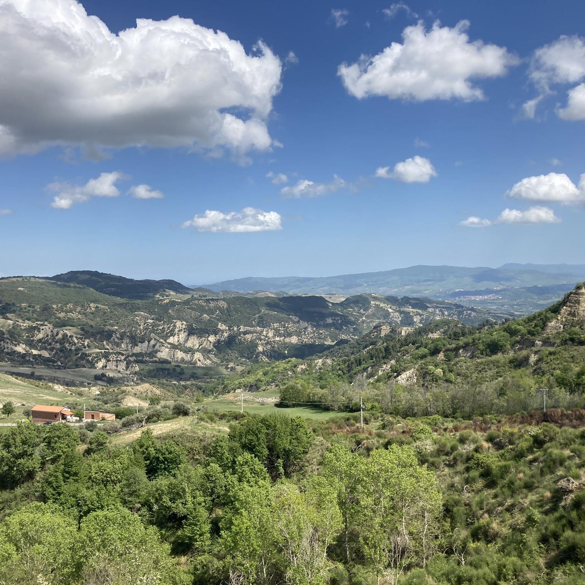
이탈리아 아르멘토 주변의 투어링 사이클링은 바실리카타의 다양한 풍경을 가로지르는 루트를 제공합니다. 발 다그리(Val d'Agri)에 위치한 이 지역은 해발 325미터에서 1080미터까지의 고도를 자랑하며 사이클리스트에게 다양한 지형을 제공합니다. 이 지역은 구불구불한 언덕, 루카니아 아펜니노 산맥의 산악 구간, 그림 같은 계곡으로 특징지어집니다. 사이클리스트는 칼란키(Calanchi)의 독특한 지질학적 지형을 포함하여 이러한 자연적 특징을 통과하는 루트를 기대할 수 있습니다.
아르멘토 주변 최고의 투어링 사이클링 루트
- 가장 인기 있는 투어링 사이클링 루트는 알리아노 및 칼란키 루프로, 1시간 57분이 소요되는 26.3km(16.3마일) 길이의 트레일입니다. 이 어려운 루트는 독특한…
마지막 업데이트: 7월 18, 2026
1
자전거 타는 사람
42.4km
02:54
710m
710m
Embark on the Lake Pertusillo and Grumentum Loop, a challenging touring cycling adventure that spans 26.3 miles (42.4 km). You will climb a significant 2315 feet (705 metres) in elevation,…
2
자전거 타는 사람
64.9km
05:12
1,830m
1,830m
Prepare for a difficult touring cycling adventure on the Lucanian Dolomites Loop from Corleto Perticara, covering 40.3 miles (64.9 km) with a significant 6020 feet (1835 metres) of elevation gain.…

무료 회원 가입
5
자전거 타는 사람
76.3km
05:00
1,070m
1,070m
어려운 자전거 타기. 우수한 체력 필요. 대부분 포장된 지면. 실력과 관계없이 누구나 갈 수 있음.
5
자전거 타는 사람
35.1km
03:18
1,080m
1,080m
어려운 자전거 타기. 우수한 체력 필요. 대부분 포장된 지면. 실력과 관계없이 누구나 갈 수 있음.
3
자전거 타는 사람
40.3km
03:24
1,160m
1,160m
어려운 자전거 타기. 우수한 체력 필요. 대부분 포장된 지면. 실력과 관계없이 누구나 갈 수 있음.
더 다양한 경로와 다른 탐험가들의 추천을 살펴보세요.
무료 회원 가입
이미 komoot 계정이 있나요?
투어 추천은 다른 사람들이 komoot에서 완료한 수천 개의 활동을 바탕으로 구성되어 있습니다.
오늘 무료 계정으로 시작하세요
다음 모험이 기다리고 있어요.
로그인 또는 가입하기
아르멘토 주변 인기 장소

커뮤니티 팁


After the narrow alleys and steps through the old town, the climb to the rocks is worthwhile. Even in rainy weather, the rocks are easily accessible via iron stairs. In heavy rain, every small alley becomes a rushing stream.
3
0

The Grumentum Archaeological Park preserves, within an exceptionally suggestive landscape, the remains of one of the major Roman cities of Regio III: Lucania et Bruttii. Initially a small Lucanian center allied with Rome, settled since the beginning of the 3rd century BC, it was crossed by Hannibal during the Second Punic War, when he took the side of the Carthaginians, and was the scene of a battle narrated by Livy. Following a slow process of Romanization, which provided for land assignments to the Romans through the centuriation system, the center was monumentalized starting from the middle of the 1st century BC, when it was refounded as a Roman colony. From this period onwards, it was equipped with all the typical monuments of Roman cities, in imitation of the Urbe. Today the site, a unique example in Basilicata of a Roman urban plan that is clearly legible as a whole, allows a visit through the public and private spaces of the Roman city, still delineated by the regularity of the ancient road axes. From the theater you can reach the Italic temple, the domus with mosaics and, along the paving of the main plateia, the area of the Forum with public, civil and religious buildings (Capitolium, Augusteo, Porticus, Curia, Basilica, Forensic Baths). The route then continues to the Terme Maggiori, an extraordinarily preserved thermal complex, rich in luxurious decorative apparatus (mosaics, imported marbles...), to the Basilica of Santa Maria Assunta, which represents the first cathedral when the center became the seat of a bishop. The route ends near the monumental amphitheater, one of the oldest masonry amphitheaters known to us. Strategically positioned on the eastern edge of the hill, it is located overlooking the Pietra del Pertusillo Lake, in the heart of the Appennino Lucano National Park. A visit to Grumentum allows you to fully appreciate the close relationship between archaeology and nature, between landscape and culture. Source Ministry of Culture Discover all our routes on www.viaggiatorelento.com
0
0

Steep stairs, narrow streets, some chapels and churches are waiting to be explored. There are beautiful views from the Piazza Emilio Caizzo of the village and the surrounding countryside.
2
0

Archaeological area of the ancient Roman Grumentum.
0
0
Ancient remains of an amphitheater of Roman origin.
0
0
the archaeological park deserves a greater enhancement, difficult to visit as it is almost always closed.
0
0

Small and picturesque village that rises almost lying on the Lake of Pietra del Pertusillo and at the foot of Mount Raparo, in the heart of the Appennino Lucano Val D’Agri Lagonegrese National Park. In the historic center stands a terrace from which it is possible to enjoy an exceptional view over the entire Val d'Agri.
1
0
자주 묻는 질문
아르멘토 주변에서 투어링 사이클링을 할 때 어떤 지형을 예상할 수 있나요?
발 다그리(Val d'Agri)에 위치한 아르멘토(Armento) 주변의 투어링 사이클링은 다양하고 종종 험준한 풍경을 포함합니다. 구불구불한 언덕, 루카니아 아펜니노 산맥의 산악 구간, 그림 같은 계곡을 만나게 될 것입니다. 고도는 325미터에서 1080미터까지 크게 변하며, 흥미로운 오르막과 멋진 내리막을 선사합니다. 이 지역은 칼란키(Calanchi) 황무지와 같은 독특한 지질학적 지형도 특징입니다.
아르멘토의 투어링 사이클링 코스는 얼마나 어렵나요?
아르멘토 주변의 투어링 사이클링 코스는 주로 숙련된 사이클리스트에게 적합합니다. 이용 가능한 9개 코스 중 8개가 어려움으로 분류되며, 보통 난이도는 하나뿐입니다. 이는 이 지역의 산악 지형과 상당한 고도 변화를 반영합니다.
아르멘토 근처 투어링 사이클링 코스에서 어떤 자연 지형이나 랜드마크를 볼 수 있나요?
많은 코스가 멋진 자연 경관을 제공합니다. 예를 들어, 페르투실로 호수와 그루멘툼 루프는 페르투실로 호수의 전망을 제공합니다. 알리아노와 칼란키 루프는 독특한 칼란키 황무지를 탐험합니다. 또한 베르사글리에르 계곡 전망대와 같은 전망대와 코를레토 페르티카라 출발 루카니아 돌로미티 루프와 같은 코스에서 드라마틱한 루카니아 돌로미티를 볼 수 있습니다.
아르멘토 주변에서 사이클링을 할 때 방문할 만한 역사 유적지가 있나요?
네, 아르멘토와 그 주변은 역사적으로 풍부합니다. 이 마을 자체는 아르멘토 라이더와 크리토니오스 왕관을 포함한 중요한 고고학적 발견으로 유명합니다. 페르투실로 호수와 그루멘툼 루프는 고대 고고학 유적지인 그루멘툼을 지납니다. 또한, '그리스도는 에볼리에서 멈췄다'에 등장하는 마을인 알리아노는 알리아노와 칼란키 루프를 통해 접근할 수 있습니다.
아르멘토 지역에서 더 긴 투어링 사이클링 코스는 어떤 것이 있나요?
더 긴 라이딩을 위해서는 약 5시간 11분이 소요되며 길이가 64.9km(40.3마일)인 코를레토 페르티카라 출발 루카니아 돌로미티 루프를 고려해 보세요. 또 다른 광범위한 옵션으로는 76.3km를 커버하는 스피노소 출발 페르투실로 호수 전망 – 카부르 수로 루프가 있습니다.
아르멘토에 가족 친화적인 투어링 사이클링 코스가 있나요?
아르멘토 주변의 투어링 사이클링 코스는 대부분 어렵고, 보통 난이도의 코스는 하나뿐입니다. 이는 대부분의 코스가 어린이나 매우 쉽고 평탄한 라이딩을 찾는 가족에게는 너무 어려울 수 있음을 시사합니다. 경험이 풍부한 사이클링 가족은 보통 난이도의 코스가 적합하다고 생각할 수 있지만, 상당한 고도 변화와 험준한 지형 때문에 주의가 필요합니다.
다른 투어링 사이클리스트들이 아르멘토에서의 투어링 사이클링에서 가장 즐기는 것은 무엇인가요?
이 지역은 komoot 커뮤니티에서 별점 5.0점으로 매우 높은 평가를 받고 있습니다. 리뷰어들은 종종 다양하고 도전적인 지형, 루카니아 아펜니노 산맥과 칼란키 황무지의 멋진 자연의 아름다움, 역사 유적지와 고요한 시골 이탈리아를 탐험할 기회를 칭찬합니다.
아르멘토 근처에 순환 투어링 사이클링 코스가 있나요?
네, 이 지역의 많은 투어링 사이클링 코스는 순환형입니다. 인기 있는 알리아노와 칼란키 루프, 페르투실로 호수와 그루멘툼 루프, 그리고 코를레토 페르티카라 출발 루카니아 돌로미티 루프가 그 예입니다. 이러한 루프 코스는 같은 장소에서 라이딩을 시작하고 끝낼 수 있게 해줍니다.
아르멘토에서 투어링 사이클링을 하기에 가장 좋은 시기는 언제인가요?
이 지역의 산악 및 구릉 지형을 고려할 때, 봄과 가을은 일반적으로 투어링 사이클링에 가장 쾌적한 조건을 제공합니다. 기온이 더 온화하고 풍경이 생기 넘칩니다. 여름은 특히 계곡에서 매우 더울 수 있으며, 겨울에는 더 추운 기온과 높은 고도에서 어려울 수 있는 도로 상황이 발생할 수 있습니다.
루카니아 아펜니노 산맥의 전망을 제공하는 투어링 사이클링 코스가 있나요?
물론입니다. 이 지역은 루카니아 아펜니노 산맥으로 특징지어지며, 많은 코스가 파노라마 전망을 제공합니다. 특히 코를레토 페르티카라 출발 루카니아 돌로미티 루프는 이 드라마틱한 산맥을 통과합니다. 코를레토 페르티카라 출발 루카니아 아펜니노 전망 – 숲길 루프라는 또 다른 코스도 아펜니노 산맥의 멋진 풍경을 제공합니다.
아르멘토 주변에서 가장 인기 있는 경로
아르멘토 주변에서 가장 인기 있는 명소


더 살펴보기
다른 지역의 최고의 자전거 경로를 살펴보세요.
