브리치히에서 가장 멋진 4개의 호수
독일 메클렌부르크포어포메른주 브리치히 근처의 호수들은 상호 연결된 호수 및 운하 시스템으로 유명한 지역인 광대한 메클렌부르크 호수 지구 내에 자리 잡고 있습니다. 이 지역은 수많은 수역을 갖춘 다양한 자연 경관을 제공합니다. 지형은 호수 주변의 완만하고 숲이 우거진 지역으로 이루어져 있어 탐험 기회를 제공합니다. 이 지역의 지리는 광범위한 호수 네트워크로 특징지어지며, 주목할 만한 자연 명소가 됩니다.
브리치히 주변 최고의 호수
- 가장 인기 있는 호수는 작은 휴식 장소를 제공하는 호수인 Village Pond Rollwitz입니다. 짧은 휴식에 이상적입니다.
- 또 다른 꼭 봐야 할 명소는…
마지막 업데이트: 9월 17, 2026
프랑조젠베크 기념석
하이라이트 • 기념물
The approximately 20 hectare body of water is located in the urban area of Strasburg …
번역자 Google •
팁에 의해


이런 장소를 발견하려면 지금 가입하세요
최고의 싱글 트랙, 봉우리 및 다양한 흥미로운 야외 장소에 대한 추천을 받아보세요.
슈트라스부르크 구시가지 전경(슈타트제 건너편에서 본 모습)
하이라이트 • 전망대
The approximately 20 hectare body of water is located in the urban area of Strasburg …
번역자 Google •
팁에 의해
Stadtsee 전망
하이라이트 • 호수
번역자 Google •
팁에 의해


오늘 무료 계정으로 시작하세요
다음 모험이 기다리고 있어요.
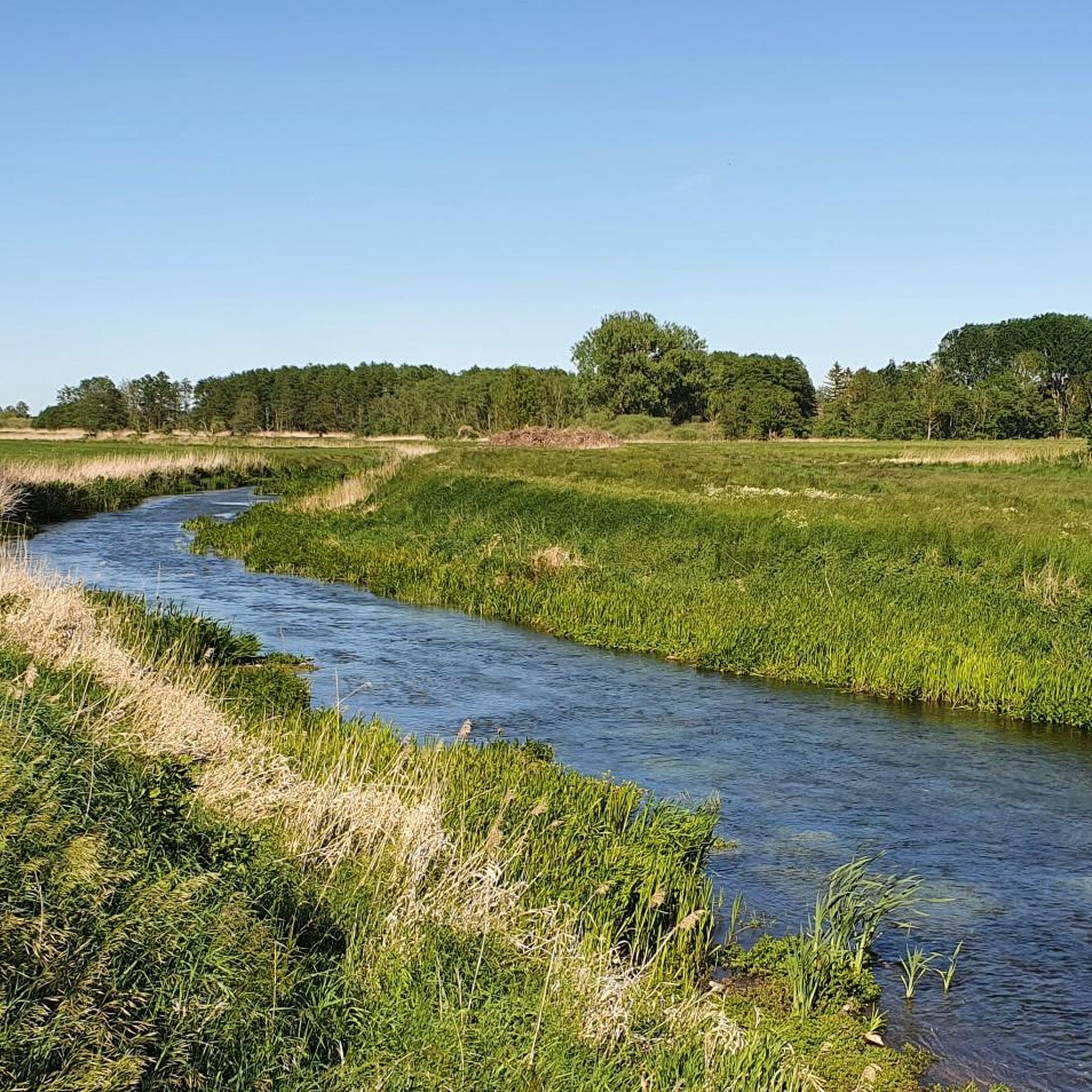
커뮤니티 팁


The city lake is approximately 20 hectares in size (580 x 420 m) and between 1 and 2.5 m deep.
0
0

Unfortunately, the lake is not recommended, totally covered with algae with a cloudy view, it has certainly seen better days
0
0

There is a bench here from which you have a beautiful view over the Klarer See.
2
0

The Stadtsee is a lake near Strasburg (Uckermark) in the Vorpommern-Greifswald district in Mecklenburg-Western Pomerania. The approximately 20 hectare body of water is located in the urban area of Strasburg (Uckermark), 500 meters southeast of the town center at an altitude of around 56 m above sea level. The lake also has a small overgrown island. From the west, the lake has a tributary through the Mühlbach, which leaves it in the north and flows towards the Uecker. The maximum extent of the city lake is about 580 by 420 meters, the depth 1 to 2.5 m. The lake was formed during the last Vistula Ice Age. It was desludged in 1921, 1949, 1955 and 1977/1978. On the initiative of Mayor Merk, workers laid the Merkpromenade in the western area in 1904. In 1941 the lake's water was drained and diverted to supply the Strasburg sugar factory with water. French prisoners of war had to clean up the lake, lay rails on the bottom and create the sea route with the excavation. This began on Jüteritzer Strasse and ran to the bridge over the Prinzengraben. In 1955 the southern course of the path was changed and extended to a total length of 1045 m. Due to its history, it is known as the Franzosenweg. A boulder with an information board on the southwestern shore of the lake is a reminder of this work. In the same year, the small island in the lake was created by landfills. Most of the bank is covered with reeds. Eels, bream, roach and pikeperch live in the lake. The mute swan, goosander, common snipe, bluethroat, black tern, nightingale as well as spoonbills, teal and golden-bellied ducks have been spotted among bird species. There is a swimming area on the northern bank. A circular hiking trail leads around the lake and the Merkpromenade. Source: https://de.wikipedia.org/wiki/Stadtsee_(Strasburg)
1
0
The Stadtsee is a lake near Strasburg (Uckermark) in the Vorpommern-Greifswald district in Mecklenburg-Western Pomerania. The approximately 20 hectare body of water is located in the urban area of Strasburg (Uckermark), 500 meters southeast of the town center at an altitude of around 56 m above sea level. The lake also has a small overgrown island. From the west, the lake has a tributary through the Mühlbach, which leaves it in the north and flows towards the Uecker. The maximum extent of the city lake is about 580 by 420 meters, the depth 1 to 2.5 m. The lake was formed during the last Vistula Ice Age. It was desludged in 1921, 1949, 1955 and 1977/1978. On the initiative of Mayor Merk, workers laid the Merkpromenade in the western area in 1904. In 1941 the water in the lake was drained and diverted to supply the Strasburg sugar factory with water. French prisoners of war had to clean up the lake, lay rails on the bottom and create the sea route with the excavation. This began on Jüteritzer Strasse and ran to the bridge over the Prinzengraben. In 1955 the southern course of the path was changed and extended to a total length of 1045 m. Due to its history, it is known as the Franzosenweg. A boulder with an information board on the southwestern shore of the lake is a reminder of this work. In the same year, the small island in the lake was created by landfills. Source: https://de.wikipedia.org/wiki/Stadtsee_(Strasburg)
1
0

자주 묻는 질문
브리치히 근처에서 어떤 호수 경험을 기대할 수 있나요?
브리치히는 "천 개의 호수"라고도 불리는 메클렌부르크 호수 지구로 유명한 메클렌부르크-포어포메른 주에 위치해 있습니다. 항해에 이상적인 넓은 개방 수역부터 휴식에 완벽한 고요한 만까지 다양한 자연의 아름다움을 기대할 수 있습니다. 이 지역은 다양한 수상 스포츠, 자연 관찰, 경치 좋은 트레일을 제공합니다.
브리치히 주변에 가족 친화적인 호수가 있나요?
네, 메클렌부르크 호수 지구 전반에 걸쳐 여러 호수가 가족 친화적입니다. 예를 들어, 롤비츠 마을 연못은 짧은 휴식을 위한 쾌적하고 작은 장소를 제공합니다. 슈트라스부르크 근처의 슈타트제(Stadtsee)는 북쪽 제방에 수영 구역과 순환 하이킹 트레일을 갖추고 있어 가족에게 적합합니다. 이 지역의 많은 호수에는 조용한 만, 피크닉 장소, 해변이 있습니다.
브리치히 근처 호수에서 인기 있는 레크리에이션 활동은 무엇인가요?
메클렌부르크 호수 지구의 호수는 다양한 수상 스포츠에 훌륭합니다. 인기 있는 활동으로는 세일링, 카누, 카약, 스탠드업 패들보딩, 모터보트 타기 등이 있습니다. 많은 장소에서 면허가 필요 없는 소형 선박 옵션을 포함한 보트 대여 서비스를 제공합니다. 수상 스포츠 외에도 수영, 낚시, 해변에서의 휴식을 즐길 수 있습니다.
호수 주변에서 어떤 자연 지형과 야생 동물을 관찰할 수 있나요?
이 지역은 완만한 산림 경관이 특징이며 독특한 동식물의 서식지입니다. 멸종 위기종을 발견할 수 있으며 사슴, 멧돼지 등 야생 동물 관찰 기회도 흔합니다. 호수 지구의 중요한 부분인 뮐리츠 국립공원(Müritz National Park)은 다양한 호수 풍경을 가로지르는 광범위한 하이킹 및 자전거 트레일을 제공하여 자연 관찰에 탁월한 기회를 제공합니다.
호수 근처에 역사 유적지나 랜드마크가 있나요?
네, 일부 호수에는 역사적 중요성이 있습니다. 예를 들어, 슈트라스부르크의 슈타트제 근처에서 프란초젠베크 기념석을 찾을 수 있습니다. 이 기념물은 1941년 호수를 정화하고 제방을 강화하여 현재 프란초젠베크(Franzosenweg)로 알려진 길을 만든 프랑스 전쟁 포로들의 노고를 기념합니다. 슈타트제 자체는 슈트라스부르크 구시가지 전망도 제공합니다.
브리치히 근처 호수를 방문하기 가장 좋은 시기는 언제인가요?
호수를 방문하기 가장 좋은 시기는 주로 선호하는 활동에 따라 달라집니다. 여름(6월~8월)은 수영, 수상 스포츠, 따뜻한 날씨를 즐기기에 이상적입니다. 봄(4월~5월)과 가을(9월~10월)은 하이킹과 자전거 타기에 쾌적한 기온을 제공하며 아름다운 자연 경관과 적은 인파를 즐길 수 있습니다. 겨울은 조용한 산책에 평온할 수 있지만, 수상 활동은 제한적입니다.
호수 주변에 하이킹 또는 사이클링 트레일이 있나요?
네, 메클렌부르크 호수 지구에는 트레일이 잘 갖춰져 있습니다. 뮈리츠 국립공원만 해도 400km 이상의 하이킹 및 자전거 트레일이 있습니다. 슈트라스부르크의 슈타트제 주변에는 지정된 순환 하이킹 트레일이 있습니다. 브리치히 근처의 더 구체적인 루트를 찾으려면 브리치히 주변 러닝 트레일, 브리치히 주변 MTB 트레일 또는 브리치히 주변 로드 사이클링 루트와 같은 옵션을 탐색해 보세요.
브리치히 근처 호수에서 수영할 수 있나요?
네, 메클렌부르크 호수 지구의 많은 호수에서 수영은 인기 있는 활동입니다. 예를 들어, 슈트라스부르크의 슈타트제는 북쪽 제방에 지정된 수영 구역이 있습니다. 이 지역에는 또한 상쾌한 물놀이에 완벽한 수많은 조용한 만과 가족 친화적인 해변이 있습니다.
호수의 아름다운 경치를 즐길 수 있는 전망대가 있나요?
물론입니다. 많은 호수에서 아름다운 전망을 제공합니다. 예를 들어, 클라러 제(Klarer See)에는 호수 위로 멋진 전망을 제공하는 벤치가 있습니다. 슈타트제 또한 호수 건너편 슈트라스부르크의 구시가지의 아름다운 전망을 제공합니다. 이 지역 전체가 자연의 아름다움을 감상할 수 있는 그림 같은 장소들로 가득합니다.
메클렌부르크 호수 지구에서 가장 큰 호수는 무엇인가요?
독일 내에 완전히 위치한 가장 큰 호수이자 메클렌부르크 호수 지구의 중심 부분은 뮈리츠(Müritz)입니다. 이 호수는 110제곱킬로미터 이상을 차지하며 수상 스포츠 및 자연 애호가들의 주요 중심지입니다. 광활한 개방 수역은 세일링 및 기타 활동에 탁월한 조건을 제공합니다.
호수에서 여러 날 동안 보트 여행을 할 수 있는 옵션이 있나요?
네, 메클렌부르크 호수 지구는 서로 연결된 호수와 운하 시스템으로 유명합니다. 플라우어 제(Plauer See), 플레세너 제(Fleesensee), 쾰핀 제(Kölpinsee)와 같은 호수들은 운하와 수문을 통해 연결되어 있어 끊임없이 변화하는 풍경을 가로지르는 여러 날 보트 여행이 가능합니다. 이를 통해 물 위에서 이 지역을 광범위하게 탐험할 수 있습니다.
브리치히 주변에서 가장 인기 있는 경로
브리치히 주변에서 가장 인기 있는 명소


더 살펴보기
브리치히 주변에서 완벽한 호수를 아직 못 찾으셨나요? 이 지역의 가이드를 확인하여 더 아름다운 장소를 찾아보세요.
