경로

플래너

기능

업데이트

App

로그인 또는 가입

앱 다운로드

로그인 또는 가입

경로
Places to see
Mountain passes
스위스
그리손

모에사

모에사‬에서 가장 멋진 ‪16‬개의 산길

모에사에서 가장 멋진 산길을 아래에서 살펴보세요. 풍경을 감상하기에도 좋고, 오르막길/내리막길을 따라 걷기에도 좋은 곳이랍니다. 커뮤니티가 특별 도움을 통해 공유한 콘텐츠인 만큼 믿을 수 있는 정보이니 마음에 드는 산길이 있다면 바로 다음 모험 계획에 추가해서 바로 방문해보세요.

마지막 업데이트: 7월 23, 2026

산 베르나르디노 마을

하이라이트 • 정착지

The small holiday resort is located near the pass of the same name in the canton of Graubünden. The place is the starting point for numerous hikes. There are a …

번역자 Google •

에 의해

하이킹 보기

휴대폰으로 전송

저장

산 베르나르디노 고개

하이라이트 • 산악 고개

The San Bernardino Pass connects the Graubünden Hinterrheintal in the north with the also Graubünden Misox in the south. The small holiday resort of San Bernardino is located near the pass with diverse hiking and winter sports opportunities.

번역자 Google •

에 의해

저장

이런 장소를 발견하려면 지금 가입하세요

최고의 싱글 트랙, 봉우리 및 다양한 흥미로운 야외 장소에 대한 추천을 받아보세요.

무료 회원 가입

벨린초나에서 산베르나르디노 고개

하이라이트 (구간) • 산악 고개

The San Bernardino Pass is an Alpine pass in the canton of Graubünden, in southeastern Switzerland. It reaches an altitude of 2063 m. above sea level and is located on …

에 의해

저장

파시트의 작은 호수들

하이라이트 • 호수

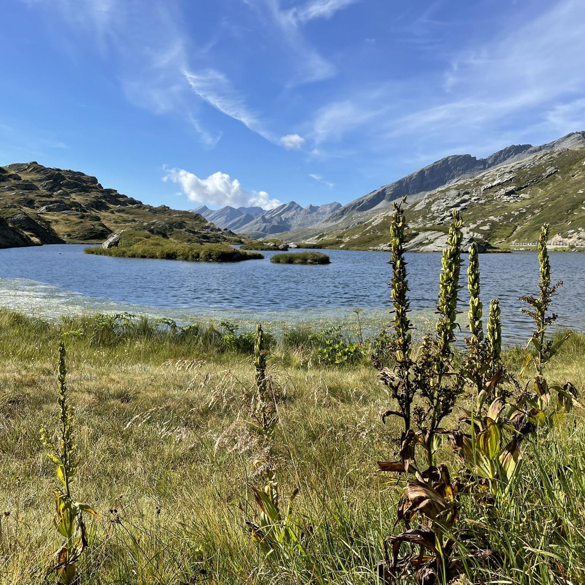
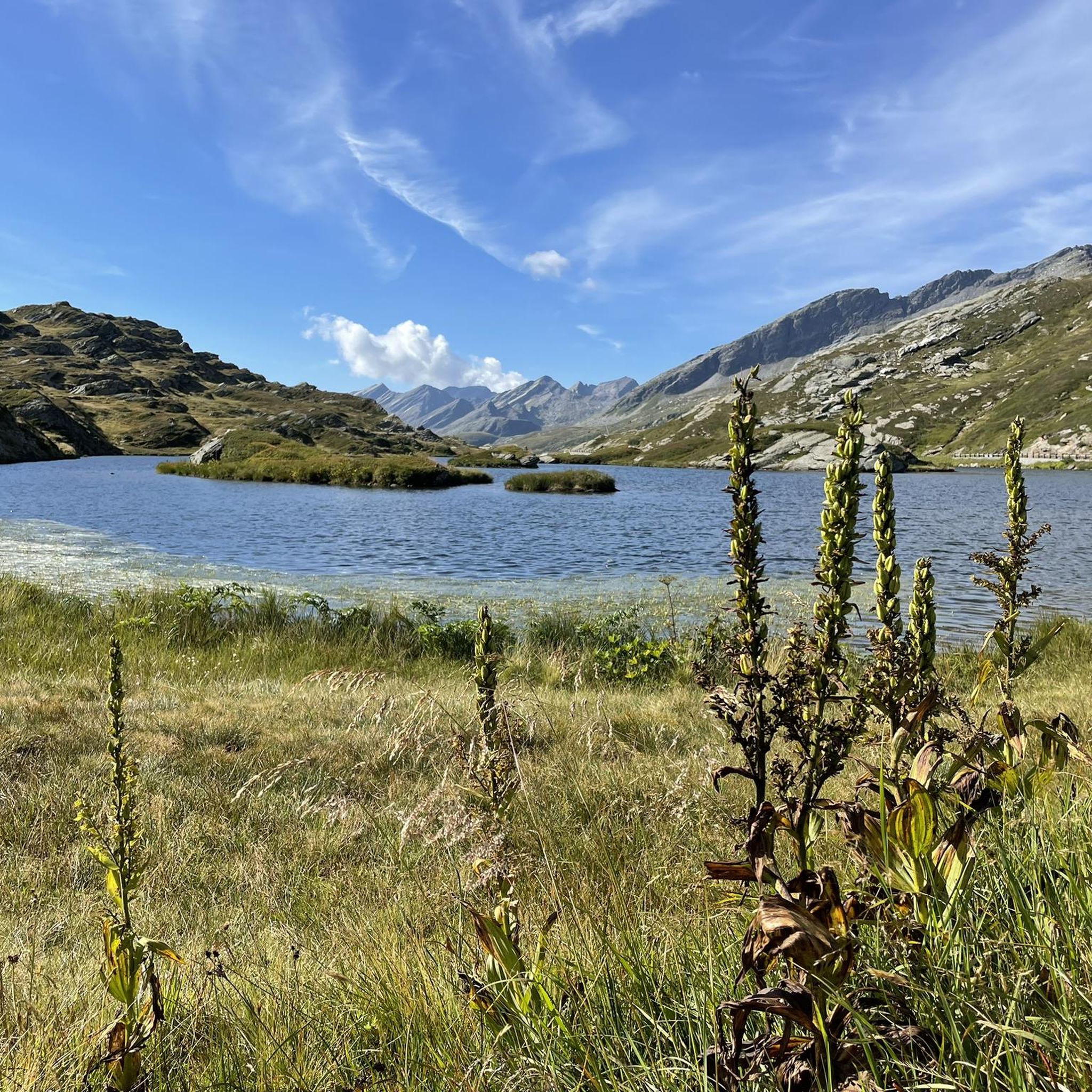
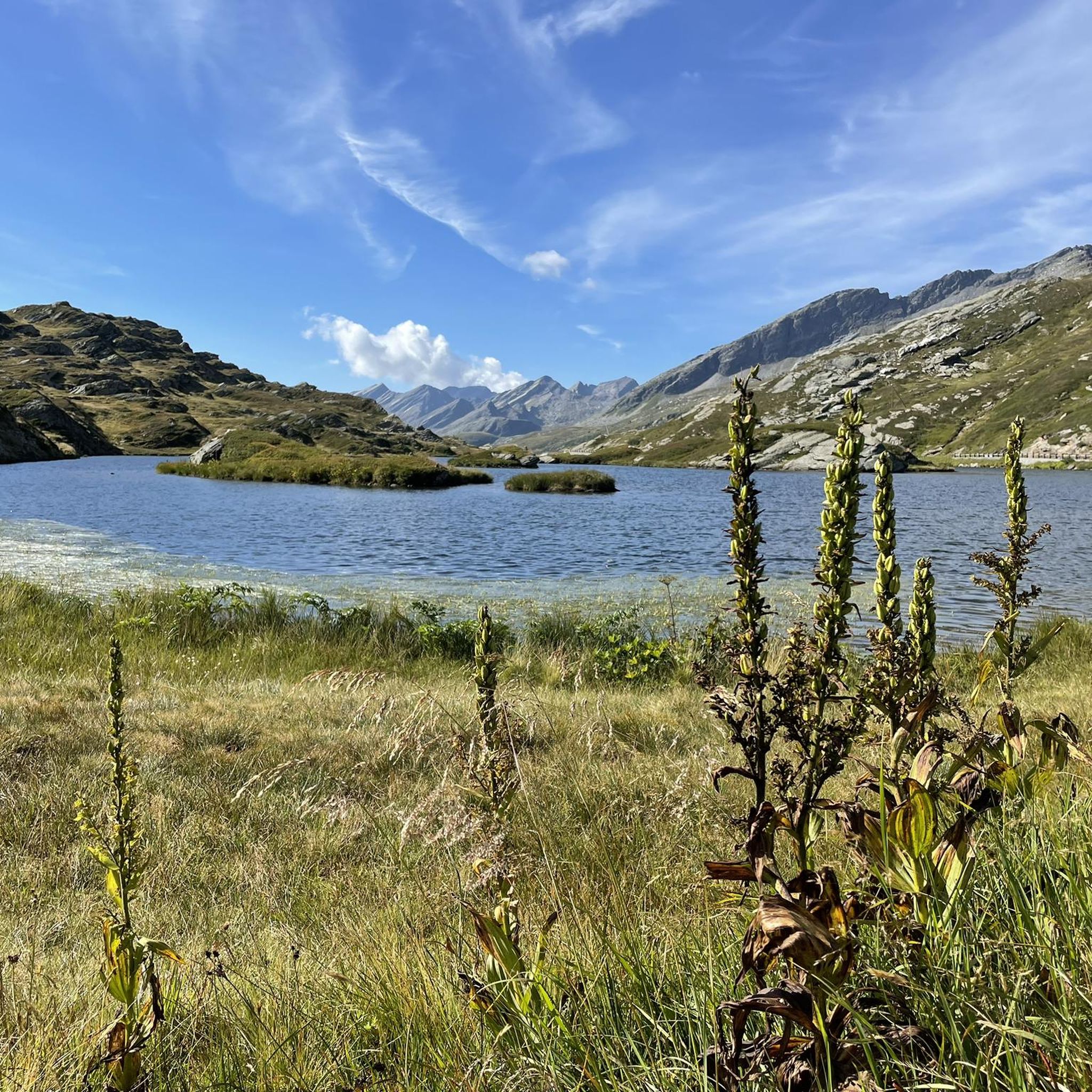
From Passo di Passit (2082 m) you can admire the two Passit lakes at the foot of the Fopela and Piz Arbeola peaks.

번역자 Google •

에 의해

저장

스트렉 드 비뇽 고개

하이라이트 • 산악 고개

The pass (2,373 meters) lies between Nufenen and San Bernardino. The ascent through the Val Vignun from San Bernardino is fairly flat, while from the Val Curciusa it is steep up to the top of the pass.

번역자 Google •

에 의해

저장

Pass de Buffalora

하이라이트 • 산악 고개

Compared to other passes in the Calanca massif, this transition is easy from an alpine point of view, especially if you can drive to Alp de Bec-Sot by car or …

번역자 Google •

에 의해

저장

파르쿠르 1 #TCRNo9 // 파소 델로 스플루가

하이라이트 (구간) • 산악 고개

Heading south to the Alps for the first Control Point of the Race, TCRNo9 riders face a parcours that follows in the millenia-old tracks of pass-storming armies and traders — …

에 의해

저장

보케타 디 카메도

하이라이트 • 산악 고개

The Bocchetta di Camedo allows you to connect the Val d'Aiàn and the Valle Fiumetto (Lombardy).
On clear days on the Italian side the view reaches as far as Lake …

번역자 Google •

에 의해

저장

Passo del Segnale di Vazzola

하이라이트 • 산악 고개

세냐레 고개는 약 2,100미터에 위치하며, X자 모양의 십자가가 있는 눈에 띄는 나무 기둥 덕분에 멀리서도 잘 알아볼 수 있습니다. 이 고개는 발 카마와 발 레지아를 연결하며 두 계곡 사이의 중요한 통로 역할을 합니다. 양방향으로 아름다운 전망을 감상할 수 있습니다.

번역문 보기

에 의해

저장

La Bocchetta de Curciusa is located at 2420m, together with a small lake. The route to get there is advisable for somewhat experienced hikers.

번역자 Google •

에 의해

저장

무료로 가입하여 모에사의 더 많은 산악 고개를 발견하세요.

무료 회원 가입

이미 komoot 계정이 있나요?

오늘 무료 계정으로 시작하세요

다음 모험이 기다리고 있어요.
로그인 또는 가입하기

모에사 주변 인기 장소

Step into the hiking season – spring routes in Graubünden

Transcontinental Race No9 2023

숨막히는 알프스 - 자전거로 그라우뷘덴 루트에서

Kultur und Natur – Weitwandern im Kanton Graubünden

Wandern im Moesano: Weite Wege und stille Täler im Schweizer Süden

모에사 하이킹

모에사 러닝 트레일

모에사 사이클링

모에사 MTB 트레일

모에사 로드 사이클링 경로

모에사의 다른 모험

Step into the hiking season – spring routes in Graubünden

컬렉션 에 의해

Graubünden

커뮤니티 팁

Sarina
5월 7, 2026, Passo del Segnale di Vazzola

세냐레 고개는 약 2,100미터에 위치하며, X자 모양의 십자가가 있는 눈에 띄는 나무 기둥 덕분에 멀리서도 잘 알아볼 수 있습니다. 이 고개는 발 카마와 발 레지아를 연결하며 두 계곡 사이의 중요한 통로 역할을 합니다. 양방향으로 아름다운 전망을 감상할 수 있습니다.

번역: Google

0

0

One of the most beautiful passes IMHO! Very long from the south, never too steep (if you stay on the main road: do not take the bike path after Mesocco!), and you will experience the vegetation transitioning from palm trees to alpine climate! The S. Bernardino village is a bonus, take the chance to eat something and get a water refill before the last push.

0

0

The Passit Pass (2082 m) is at the crossroads of various paths. From the pass you can admire the two lakes of the same name at the foot of the Fopela and Piz Arbeola peaks.

번역: Google

0

0

The Passo del Segnale di Vazzola (2108 m) allows you to pass from the Val di Cama to the Val di Leggia and vice versa.

번역: Google

0

0

La Bocchetta de Curciusa is located at 2,420 meters, along with a small lake. The route to get there is advisable for somewhat experienced hikers.

번역: Google

0

0

The San Bernardino Pass connects the Hinterrhein Valley of Graubünden with the Misoncino. The pass overlooks the beautiful Moesola lake and is the starting point for numerous summer and winter excursions.

번역: Google

0

0

From Passo di Passit (2082 m) you can admire the two Passit lakes at the foot of the Fopela and Piz Arbeola peaks.

번역: Google

0

0

The Bocchetta di Camedo allows you to connect the Val d'Aiàn and the Valle Fiumetto (Lombardy). On clear days on the Italian side the view reaches as far as Lake Como, and from the The view towards Italy is unfortunately spoiled by mist, on a clear day you would see Lake Como, on the other the slopes of Cima di Paina or Cima dello Stagn.

번역: Google

1

0

모에사에서 가장 인기 있는 경로

모에사 하이킹

모에사에서 가장 인기 있는 명소

Places to see

Store rating

komoot 모바일 앱으로 영감을 받아보세요

무료 komoot 계정로 끝없는 야외 모험을 손쉽게 찾고, 맞춤 설정하며 길안내할 수 있어요.

또는

지금 komoot에 가입하세요

Store rating

찾고 계신 것을 찾지 못하셨나요?

모에사의 더 놀라운 산악 통과를 지역별로 찾아보세요:

칼랑카카마로스탈로레기아그로노소아자베르다비오메소코로베레도(GR)부세노로사칼랑카의 산타마리아카스타네다산 비토레

더 살펴보기

이 가이드를 통해 더 많은 장대한 산악 통과를 확인해보세요 모에사:

근처 어드벤처 가이드

소아자 즐길거리

background

새로운 정복을 위한 준비를 하세요

무료로 가입하기

탐험하기
경로경로 플래너기능바우처 사용하이킹MTB 트레일로드 사이클링 경로바이크패킹사이트맵
앱 다운로드
소셜 미디어에서 팔로우하기

© komoot GmbH

개인 정보 보호 정책