20의 페오네가지 명소 & 주요 장소
페오네에는 둘러볼 만한 장소가 많답니다. 하이킹 또는 사이클링을 좋아한다면 페오네에 숨겨진 20
가지 보석을 만날 수 있을 거예요. 이 지역의 주요 명소를 살펴보면서 다음 모험을 계획해보세요.
마지막 업데이트: 10월 23, 2026


이런 장소를 발견하려면 지금 가입하세요
최고의 싱글 트랙, 봉우리 및 다양한 흥미로운 야외 장소에 대한 추천을 받아보세요.

이졸라에서 이졸라 2000을 경유해 콜 드 라 롬바르드 오르막길
하이라이트 (구간) • 산악 고개
번역자 Google •
팁에 의해

생테티엔 드 티네에서 출발하는 콜 드 라 보네뜨 등반
하이라이트 (구간) • 등반
번역자 Google •
팁에 의해

무료로 가입하여 페오네 주변의 더 많은 명소를 발견하세요.
이미 komoot 계정이 있나요?
오늘 무료 계정으로 시작하세요
다음 모험이 기다리고 있어요.




커뮤니티 팁

The Col de la Couillole is a mountain pass in the Massif du Mercantour-Argentera of the French Alps, situated at an altitude of 1,678 m (5,505 ft) in the Alpes-Maritimes department, France. The road connection is open for six to seven months of the year, allowing travel between the Cians gorges in the west and the Tinée valley in the east.
0
0

spectacular, also very pleasant to ride up and down along the gorges
0
0


A spectacular passage, this bridge that connects the two mountains is stunning.
17
1

The La Mariée bridge was built from 1910 for the passage of the tramway that linked Pont de Geydan and Guillaumes. The construction site gave rise to technical feats in the Daluis gorges with the digging of tunnels and the construction of this spectacular bridge with a span of 58 meters. The line, 19 km long, took the same route as the current road. The work brought life to the valley but caused many victims, as evidenced by the commemorative plaques along the track. They were slowed down during the war of 1914-1918 and the tramway did not arrive in Guillaumes until 1923, but the line, with its costly maintenance, only operated for 6 years before its final shutdown in 1929. This structure is one of the first railway viaducts in an arch made of reinforced concrete in France. It owes its name to a tragic incident that occurred on July 30, 1927. A young, wealthy Parisian couple arrived on their honeymoon in Guillaumes and decided to visit the gorges at the end of the day. They stopped at the first bridge they came across on the road, then called the Tramway Bridge. The young bride is said to have leaned over to admire the view and fell into the gorges. In the absence of witnesses, the accident theory was favored, but the mysterious circumstances surrounding the young woman's disappearance have long fueled rumors. Closed to motor traffic, it now offers one of the best viewpoints over the Daluis gorges. So don't hesitate to stop there to enjoy it. With a bit of luck, you might also see daredevils bungee jumping there. https://www.youtube.com/watch?v=BxJ1N6wYt_o
4
0

This (southern) face of the Col de la Bonette is more spectacular than the north face and also a bit tougher, as it has more kilometers and more elevation gain. I've always done it downhill, so it's on my list of challenges.
0
0
The red of these mountains looks painted.
18
0
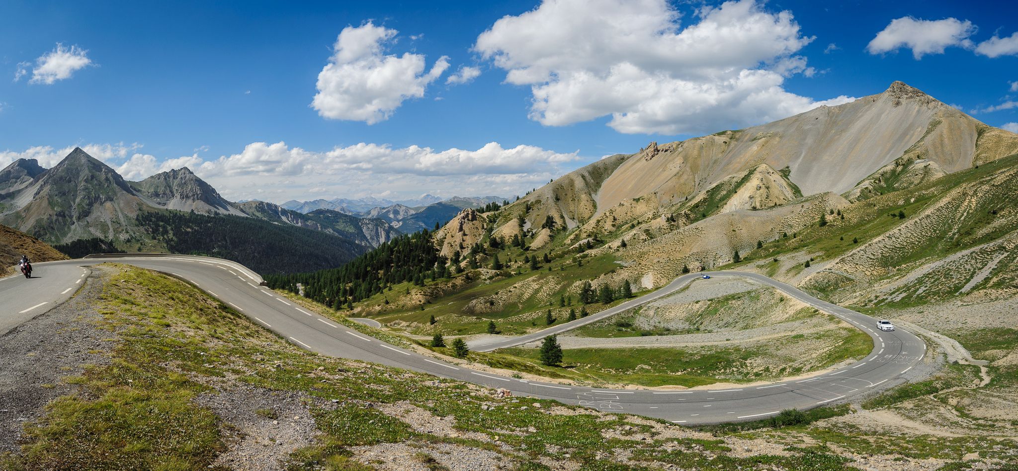
The western and French slope of the Col de la Lombarde is hard and long with 20 km and almost 1,500m of elevation gain. Until you reach the Isola 2000 ski resort, which is the main part of the climb, you travel along a road that goes up a very narrow valley. The first kms are the hardest, with an average of 9% and ramps above 10%. Afterwards, the slope softens and is very constant, with some rest sections. After the Isola 2000 station, we face the last 4 km where the slope increases to 8%, with several horseshoe curves and very beautiful views of the valley and the ski resort. A port that remembers the old mountain passes. A pleasure for the senses.
1
0
페오네 주변에서 가장 인기 있는 명소


더 살펴보기
찾고 있는 하이라이트를 아직 못 찾으셨나요? 다른 지역의 주요 명소 가이드를 확인해보세요:
