ハスボルンのおすすめツーリングルート
4.5
(5669)
25,412
ライダー
389
ライド
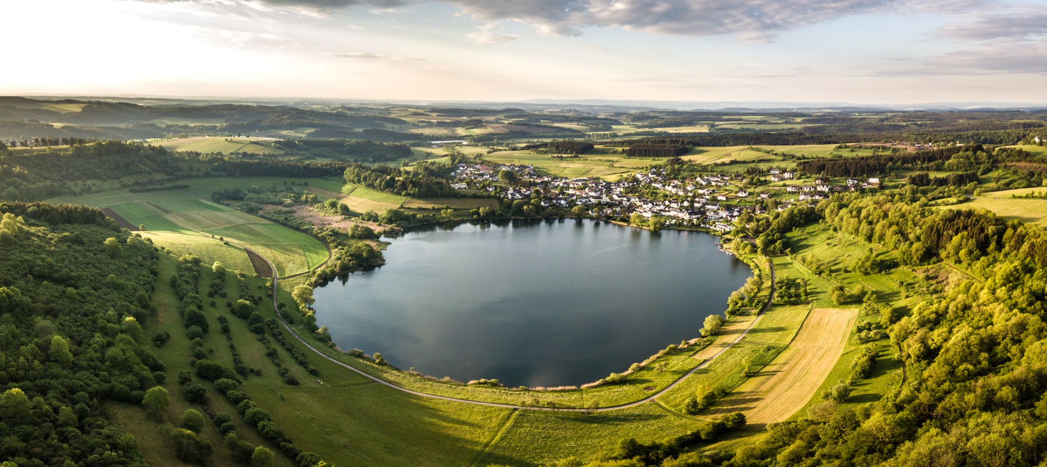
ハスボルン周辺のサイクリングルートは、火山活動の起源とマールのようなユニークな自然景観が特徴のフォルダーアイフェル地域にあります。この地域には、緑豊かな森、広大な草原、そして絵のように美しいリーザー渓谷があります。多くのルートは、かつての鉄道線路跡に建設された、整備されたサイクリングインフラを利用しており、ほとんどが舗装路面です。これにより、風光明媚な景観と史跡の両方を探索することができます。
ハスボルン周辺の最高のサイクリングルート
- 最も人気のあるサイクリングルートは、ハスボルン発の プライナー・トンネル – グリューネヴァルト高架橋ループ です。このルートは38.7マイル(62.2 km)で、所要時間は3時間46分です。この難易度の高いルートは、プライナー・トンネルとグリューネヴァルト高架橋周辺の景色の良い区間が特徴です。
- 地元のサイクリストに人気のもう一つのルートは、グライマーラート発の A1高架橋トンネル(MMR) – 鉄道線路跡サイクリングパスループ です。このルートは23.9マイル(38.4 km)で、中程度の難易度です。このルートは、かつての鉄道線路跡に建設されたサイクリングパスに沿っており、比較的平坦な体験ができます。
- 地元のサイクリストに愛されているのは、グライマーラート発の A1高架橋トンネル(MMR) – マール・モーゼル・サイクリングパスループ です。このルートは13.5マイル(21.7 km)で、マール・モーゼル・サイクリングパスを通り抜け、所要時間は約1時間19分です。
- ハスボルン周辺のサイクリングは、火山性のマール、高架橋、そしてよく整備されたサイクリングパスが特徴です。このネットワークは、カジュアルなライドからより意欲的なツアーまで、さまざまなレベルのオプションを提供しています。
- ハスボルンのルートは、komootコミュニティから高く評価されており、3900件以上のレビューで平均4.5つ星を獲得しています。18,000人以上のサイクリストがkomootを利用して、ハスボルンの多様な地形を探索しています。
最終更新日: 10月 18, 2026
4.7
(360)
1,475
ライダー
52.4km
03:15
540m
540m
難しい自転車ライド. 標準以上のフィットネスレベルが必要です。 全般的に舗装された状態です。あらゆるスキルレベルに適しています。
4.7
(239)
987
ライダー
62.3km
03:46
460m
460m
難しい自転車ライド. 標準以上のフィットネスレベルが必要です。 全般的に舗装された状態です。あらゆるスキルレベルに適しています。

5.0
(1)
31
ライダー
13.8km
00:58
260m
260m
中程度の自転車ライド. ある程度のフィットネスレベルが必要です。 全般的に舗装された状態です。あらゆるスキルレベルに適しています。
4.6
(5)
44
ライダー
52.6km
03:19
540m
540m
難しい自転車ライド. 標準以上のフィットネスレベルが必要です。 全般的に舗装された状態です。あらゆるスキルレベルに適しています。
4.9
(19)
82
ライダー
26.9km
01:42
320m
320m
中程度の自転車ライド. ある程度のフィットネスレベルが必要です。 全般的に舗装された状態です。あらゆるスキルレベルに適しています。
さらに多くのルートや他のユーザーのおすすめ情報を確認できます。
すでにアカウントをお持ちですか?
おすすめのツアーは他のkomootユーザーが実際に経験した何千ものアクティビティに基づいています。





コミュニティからのヒント


🌉 The Moselle bridge in Bernkastel-Kues is far more than just a transport link – it is the vital artery that connects the two very different districts of Bernkastel (old town) and Kues (plateau & hospital).
1
0

Whether the view from the castle or from Bernkastel-Kues to the castle, both perspectives are worthwhile.
8
0

A truly amazing experience for young and old. Turn on the lights – even though the tunnel is lit. And in hot weather, it's like riding through a "refrigerator."
0
0

Great view across the Moselle to the castle. Landshut Castle is the ruins of a hilltop castle in Bernkastel-Kues in the Bernkastel-Wittlich district of Rhineland-Palatinate. Landshut Castle is located on the western slope of the Hunsrück above Bernkastel, a district of Bernkastel-Kues. It stands on the approximately 235 m above sea level[1] high castle hill, a northern spur of Mount Olympus (415 m above sea level).[1] The Moselle, flowing toward the castle from the southwest, turns northwest below the castle (approx. 107 m above sea level).[1] This allows travelers traveling upstream and downstream along the Moselle to see the castle on the horizon from afar. Source: https://de.m.wikipedia.org/wiki/Burg_Landshut
18
0


Pleiner Tunnel - Hasborn–Wittlich Directly after the former Plein train station, approximately 5 km beyond Hasborn, the cycle path leads through the 585-meter-long Pleiner Tunnel. It then continues downhill through deciduous and mixed forests to Wittlich. From the rather rugged Volcanic Eifel, the cycle path descends into the Wittlich Valley. The route passes vineyards and leads into the town of Wittlich. Text / Source: wikipedia.org/wiki/Maare-Mosel https://de.wikipedia.org/wiki/Maare-Mosel-Radweg#:~:text=Direkt%20nach%20dem%20ehemaligen%20Bahnhof%20von%20Plein%2C%20ca.,f%C3%BChrt%20der%20Radweg%20hinab%20in%20das%20Wittlicher%20Tal.
15
0

komootモバイルアプリでインスピレーションを得よう


さらに探索
他の地域の最高のサイクリングルートを見てみましょう。
