경로

플래너

기능

업데이트

App

로그인 또는 가입

앱 다운로드

로그인 또는 가입

로그인 또는 가입

경로
Places to see
프랑스
옥시타니아
프라데

폰트라비우스

20의 폰트라비우스가지 명소 & 주요 장소


폰트라비우스에는 둘러볼 만한 장소가 많답니다. 하이킹 또는 사이클링을 좋아한다면 폰트라비우스에 숨겨진 20
가지 보석을 만날 수 있을 거예요. 이 지역의 주요 명소를 살펴보면서 다음 모험을 계획해보세요.

마지막 업데이트: 5월 25, 2026

부이요스 호수

하이라이트 • 호수

The bullosa lake, in French lac des Bouillouses, is a 149-hectare lake located in the highest part of the Capcir, at 2,016 m altitude. It is located at the foot …

번역자 Google •

에 의해

하이킹 보기

휴대폰으로 전송

저장

콜 드 파예르

하이라이트 • 산악 고개

The Col de Pailhères, or Port de Pailhères, is one of the emblematic passes of the Pyrenees and the Tour de France. Culminating at 2,001 meters above sea level, it …

번역자 Google •

에 의해

저장

이런 장소를 발견하려면 지금 가입하세요

최고의 싱글 트랙, 봉우리 및 다양한 흥미로운 야외 장소에 대한 추천을 받아보세요.

무료 회원 가입

콜 드 라 크레우

하이라이트 • 산악 고개

The coll de la Perche is a mountain pass that culminates at 1579 meters, on the plateau of La Perxa, in Alta Cerdanya, in Northern Catalonia. The port from the …

번역자 Google •

에 의해

저장

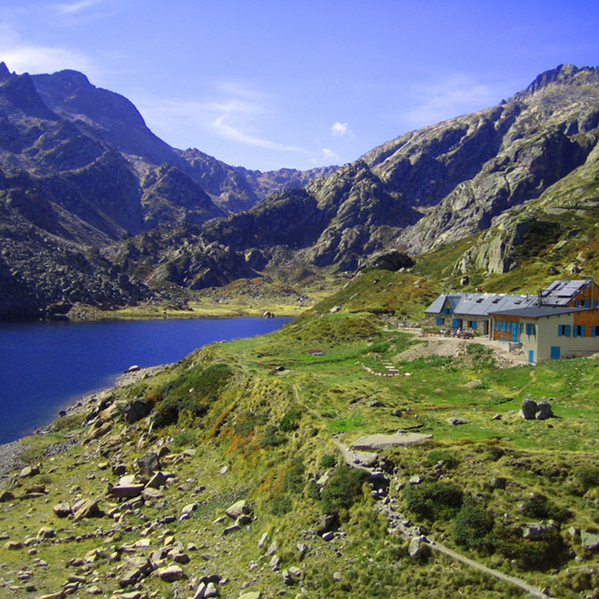
부유루즈 산장

하이라이트 • 산장

리모델링된 산장은 주변 자연 환경에 걸맞은 서비스와 편의 시설을 제공합니다. 모든 것이 완벽합니다!
여름과 겨울 모두 19개의 침대 공간이 있습니다. 텐트를 칠 수도 있습니다(예약 필수).
또한 산장 주변에는 자유롭게 야영할 …

번역문 보기

에 의해

저장

앙 베이즈 산장

하이라이트 • 레스토랑

The En Beys refuge which overlooks the eponymous ponds culminates at an altitude of 1,970 meters, in the heart of the Orlu national reserve. Situated on the great GR 7 …

번역자 Google •

에 의해

저장

무료로 가입하여 폰트라비우스 주변의 더 많은 명소를 발견하세요.

무료 회원 가입

이미 komoot 계정이 있나요?

오늘 무료 계정으로 시작하세요

다음 모험이 기다리고 있어요.
로그인 또는 가입하기

폰트라비우스 주변 인기 장소

폰트라비우스 하이킹

폰트라비우스 로드 사이클링 경로

폰트라비우스 MTB 트레일

폰트라비우스 러닝 트레일

폰트라비우스 사이클링

폰트라비우스 주변 그래블 라이딩

폰트라비우스 등산

커뮤니티 팁

Catreg
3월 2, 2025, Refuge des Bouillouses

Magnificent

번역: Google

0

0

It is a simply spectacular port that unites the regions of Conflent and Capcir. It is one of the most beautiful ports in the easternmost Pyrenees. It is very close to the Col de la Llosa, and you can take a circular route that is known as the "Route des Cols". It is also indicated on nearby road signs. The hardest slope is the one that begins in Olette (Conflent) and goes up through Aiguatèbia. There are almost 22 km of ascent and 1,089 meters of elevation gain. It has 3 very different zones: (1) the first is a constant 5 km at 7%; (2) the second is 10 km at 4% and with some very pleasant rest areas, with beautiful views; (3) The final part is 6 km on average at 7%, since it passes the town of Railleu, although the hard part is the last 3 km, with several ramps that exceed 10%. The road is narrow and has uneven asphalt, with hardly any cars and motorcycles. For me, the final part of this port is truly spectacular and should not be missed. The west slope begins in the town of Matamala (Capcir) and is 3 km with an average of close to 8%. It is a long irregular stretch along a narrow and very quiet road, with panoramic views of the valley when the thick black pine forest gives some opportunity.

번역: Google

0

0

A little disappointing: the pass is in the middle of the forest and offers no view. The climb from (and to!) Railleu is nevertheless superb. A nice picnic area to have a bite to eat.

번역: Google

1

0

One of the best experiences on my entire tour. I have this picture with the view of the mountains as my screen background. The roads are still closed, the snow is piled up meters high on the sides and at the same time there is not a single car on the road. Simply fantastic

번역: Google

1

0

Beautiful refuge to rest and gain strength, the starting point of an emblematic route that visits multiple lakes and can culminate with the imposing Carlit.

번역: Google

1

0

리모델링된 산장은 주변 자연 환경에 걸맞은 서비스와 편의 시설을 제공합니다. 모든 것이 완벽합니다! 여름과 겨울 모두 19개의 침대 공간이 있습니다. 텐트를 칠 수도 있습니다(예약 필수). 또한 산장 주변에는 자유롭게 야영할 수 있는 구역이 있습니다. 그 외에도 산장은 식수대와 외부 건식 화장실을 제공합니다. 샤워 시설은 없다는 점에 유의하십시오. 점심과 저녁 식사도 가능합니다(정해진 시간에 한 번만 제공). 저녁에는 공동 식사가 있습니다.

번역: Google

1

0

At 2,016 meters, this vast lake and its dam are ideally located for a refreshing break. In addition to the gîte and a refuge, there is also a small water fountain.

번역: Google

0

0

The Col de Pailhères, or Port de Pailhères, is one of the emblematic passes of the Pyrenees and the Tour de France. Culminating at 2,001 meters above sea level, it is one of the few passes in the Pyrenees to exceed the symbolic bar of 2,000 meters. The climb from Mijanès is 10.6 kilometers long with an average of 8.2%, including some passages at more than 10%. It is also possible to climb from Ax-les-Thermes by means of a climb of 18.6 kilometers with an average of 6.9%.

번역: Google

4

0

폰트라비우스 주변에서 가장 인기 있는 경로

폰트라비우스 하이킹

폰트라비우스 주변에서 가장 인기 있는 명소

Lakes

Store rating

komoot 모바일 앱으로 영감을 받아보세요

무료 komoot 계정로 끝없는 야외 모험을 손쉽게 찾고, 맞춤 설정하며 길안내할 수 있어요.

또는

지금 komoot에 가입하세요

Store rating

더 살펴보기

찾고 있는 하이라이트를 아직 못 찾으셨나요? 다른 지역의 주요 명소 가이드를 확인해보세요:

메이트메일몽루이스꼬디에 드 콩플랑수안야볼케르에스카로파이피레네 카탈루냐세르디냐라 라곤사우토라 카바나스라일류올레트사호르타르가손Jujols아이과테비아-탈라우에스타바르카나베유산사나이어퐁페드루즈생피에르델포르카츠플라네오레이라푸야에가트포르미게르만테Font-Romeu-Odeillo-Via작은 각도바일스타비로스 마소스에스토허파인스트렛도레스튀에스 앙트르 발스타우리냐필롤코달렛Corneilla-De-Conflent카스테일클라라베르네 레뱅리아-시라크글로리아네스케이스패브르일쉬르텟발마냐Enveitg불테르네르에스피라 드 콩플랑생 미셸 드 로테불다몽몬탈바 르 샤토포르테 퓌모랑빈차빌프랑슈 드 콩플랑아르부솔마르키잔아이네프루네에 벨푸이그리가다타라라크트릴라앙구스트린-빌뇌브-데-에스칼드코낫로데스요흐푸이발라도르트레비야흐오류에우스발세볼레르포르타세일러구스노에데스캐틀러모셋수니아Prats-De-Sournia진짜캠퍼스시페질라 드 콩플랑펠룬오세야팔라우 드 세르다뉴몰리트레뱅생 레오카디캄퐁르 비비에나후자우르바냐라투르 드 캐롤라부예부르마담우르자연 보호 구역 드 망테

근처 어드벤처 가이드

포르미게르 즐길거리

background

새로운 정복을 위한 준비를 하세요

무료로 가입하기

탐험하기
경로경로 플래너기능하이킹MTB 트레일로드 사이클링 경로바이크패킹사이트맵
앱 다운로드
소셜 미디어에서 팔로우하기

© komoot GmbH

개인 정보 보호 정책