드럼세스크 최고의 사이클링 경로
4.4
(12)
557
자전거 타는 사람
43
라이딩
드럼세스크 최고의 사이클링 경로를 찾으시나요? 드럼세스크에서 가장 멋진 자전거 라이딩 장소를 살펴본 후에 바로 떠나보세요. 여기서 마음에 드는 경로만 고르시면 돼요!
마지막 업데이트: 9월 8, 2026
5.0
(1)
6
자전거 타는 사람
28.1km
01:52
460m
460m
어려운 자전거 타기. 우수한 체력 필요. 대부분 포장된 지면. 실력과 관계없이 누구나 갈 수 있음.
2
자전거 타는 사람
42.6km
02:45
470m
480m
어려운 자전거 타기. 우수한 체력 필요. 투어 중 라이딩하기 어려운 비포장 구간이 있을 수 있음.

무료 회원 가입
5.0
(1)
44
자전거 타는 사람
15.8km
01:30
350m
350m
보통 자전거 타기. 좋은 체력 필요. 대부분 포장된 지면. 실력과 관계없이 누구나 갈 수 있음.
26
자전거 타는 사람
22.2km
02:34
950m
950m
어려운 자전거 타기. 우수한 체력 필요. 대부분 포장된 지면. 실력과 관계없이 누구나 갈 수 있음.
20
자전거 타는 사람
12.2km
01:30
540m
540m
어려운 자전거 타기. 우수한 체력 필요. 대부분 포장된 지면. 실력과 관계없이 누구나 갈 수 있음.
더 다양한 경로와 다른 탐험가들의 추천을 살펴보세요.
무료 회원 가입
이미 komoot 계정이 있나요?
투어 추천은 다른 사람들이 komoot에서 완료한 수천 개의 활동을 바탕으로 구성되어 있습니다.
오늘 무료 계정으로 시작하세요
다음 모험이 기다리고 있어요.
로그인 또는 가입하기



커뮤니티 팁

Added to the collection: komoot.com/de-de/collection/3600632/-naturdenkmaeler-besondere-baeume-und-weitere-schaetze-der-natur
0
0

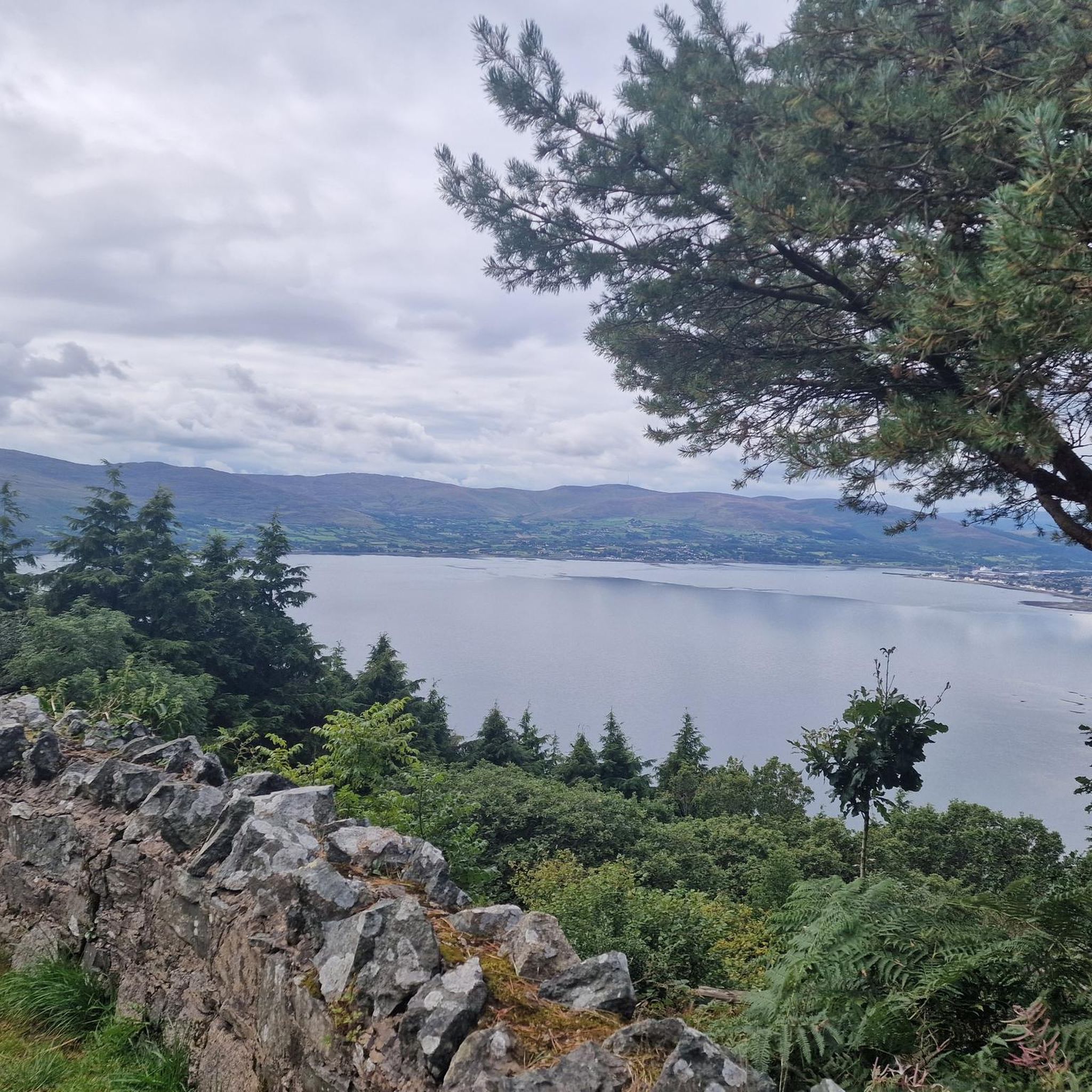
The route winds gently uphill, offering small clearings through which you can catch a glimpse of the valley and the sparkling water in the distance. The air here is wonderfully fresh and filled with the surrounding forests. During the climb you can feel the peace of the forest, accompanied only by the hum of the tires on the asphalt and the chirping of the birds. Once you reach the top, you are rewarded with a magnificent panorama.
0
0
This impressive tree, which has stood here for centuries, is a testament to the region's rich natural history. The paths leading there lead through dense forest and offer a pleasant ride away from traffic. However, some sections are slippery in wet weather, so care should be taken. A particular highlight is the proximity to the Cloughmore Stone, a huge boulder that was transported here during the last Ice Age.
1
0
The well-signposted mountain bike trails take you through dense forests and offer breathtaking views of Carlingford Lough and the Mourne Mountains. The descent from the Cloughmore Stone, a huge boulder that was transported here during the last ice age, is a particular highlight. However, some sections are technical and require a certain level of riding technique. The trails can become slippery in wet weather, so caution is advised. Another plus point is the proximity to the charming village of Rostrevor, where you can relax in one of the cafes after the tour.
3
0
The Yellow Road takes you straight into the heart of an impressive landscape that takes your breath away. The path winds gently through the undulating, lush green that stretches to the horizon. The further up you go, the more the view of the valley opens up and you can almost feel the vastness around you. Once you reach the top, the world suddenly seems to stand still - no sound except the gentle wind that blows over the blades of grass.
0
0
There is something magical about the landscape - on the left the towering hills reaching up into the sky, on the right the calm water shimmering in the light. The road winds along the coast, picturesque and with a touch of wildness that is so rarely found. The air smells fresh and slightly salty, and the constant wind from the water gives the route a refreshing note.
1
0

There’s heaps to do when you visit Kilbroney park so bring a picnic, kids, dogs, bikes, walking boots and enjoy the day. Start at the Visitor Centre and learn about the forest and extraordinary Cloughmore Stone. There are tennis courts, play area, sports fields, an arboretum, walking and bike trails in the forest. Fiddler’s Green was once used for local entertainment and festivals.
2
0
The hike to the Cloghmór Stone feels like a journey through time. Over 10,000 years ago, the ice brought this massive granite block from Scotland here, and now, weighing an estimated 50 tons, it towers majestically over the landscape. But it's not just the geology that's fascinating - according to legend, it was the giant Finn McCool who threw this enormous stone over Carlingford Lough. To be honest, the legend is a much more exciting explanation, isn't it? Once you've reached the top, you'll not only be greeted by the imposing boulder, but also by a fantastic view of Carlingford Lough and the surrounding hills. It's the perfect place to pause for a moment, take in the vastness and enjoy the peace that this place exudes.
0
0
드럼세스크 주변에서 가장 인기 있는 경로
드럼세스크 주변에서 가장 인기 있는 명소


더 살펴보기
다른 지역의 최고의 자전거 경로를 살펴보세요.
