발리니콜 최고의 러닝 경로
3.6
(10)
1,332
달리기 하는 사람
82
러닝
발리니콜에서 하이킹하며 Ards 구석 부분까지 살펴볼까요? 발리니콜에 있는 모든 하이킹 및 워킹 경로 컬렉션 중 가장 멋진 하이킹 경로를 엄선하여 소개해드릴게요. 다른 하이커가 공유한 실제 팁과 사진을 살펴보고 후기를 읽으며 마음에 드는 발리니콜 워킹 경로를 찾아보세요.
마지막 업데이트: 9월 30, 2026
15
달리기 하는 사람
11.4km
01:11
80m
90m
보통 조깅. 좋은 체력 필요. 대부분 포장된 지면. 실력과 관계없이 누구나 갈 수 있음.
15
달리기 하는 사람
9.95km
01:02
30m
30m
보통 조깅. 좋은 체력 필요. 대부분 포장된 지면. 실력과 관계없이 누구나 갈 수 있음.

8
달리기 하는 사람
11.1km
01:12
170m
170m
보통 조깅. 좋은 체력 필요. 대부분 포장된 지면. 실력과 관계없이 누구나 갈 수 있음.
9
달리기 하는 사람
보통 조깅. 좋은 체력 필요. 대부분 포장된 지면. 실력과 관계없이 누구나 갈 수 있음.
8
달리기 하는 사람
4.70km
00:29
10m
10m
초급용 러닝. 모든 체력 수준에 적합. 대부분 포장된 지면. 실력과 관계없이 누구나 갈 수 있음.
더 다양한 경로와 다른 탐험가들의 추천을 살펴보세요.
이미 komoot 계정이 있나요?
투어 추천은 다른 사람들이 komoot에서 완료한 수천 개의 활동을 바탕으로 구성되어 있습니다.
오늘 무료 계정으로 시작하세요
다음 모험이 기다리고 있어요.
발리니콜 주변 인기 장소
커뮤니티 팁

Nendrum Monastery was a Christian monastery founded in the 5th century. The monastery finished somewhere between 974 and 1178, but the church survived until the 15th century. You can visit the ruins if you're riding past.
0
0

This tower-house, said to have been built in 1570 by an English soldier, Captain Browne, is badly ruined but is still of considerable interest. Rectangular and fairly small in ground plan, it was entered by a door in the north-west wall which has a draw bar socket and a murder-hole. To the left of the door was a stair to the next floor. There are two ground floor rooms, the larger with a semi-circular vault built on plank centring and the smaller with a pointed vault built on paired wicker mats. The smaller room, once thought to be a secure boat bay, may be just a storeroom (compare nearby Sketrick). There were two storeys above, but the upper parts are ruined. Part of the bawn wall survives to the south-west, cut into the hill.
0
0
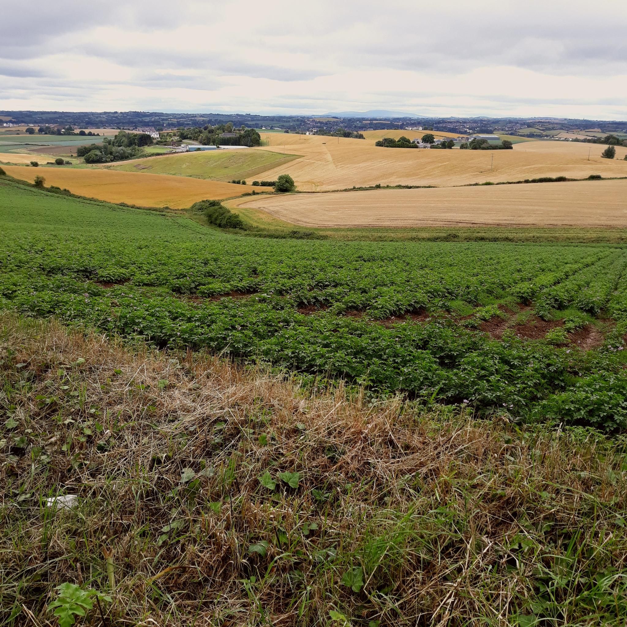
Always worth the ascent. If only for the view towards Sliev Croob and the Mournes. Beautiful patch work of swollen hills, cut by colourful fields, that meander all the way to the shore of Strangford Lough below. There are several interesting woodland gravel trails in the woods, connecting to Scrabo, and Ards. Twilight is magic up here. Smooth tarmac Decent down to Ards via Scrabo Road is a joy, with the tower on your left, and the sprawling Lough, and Newtownards to your right.
0
0
This is the best example in Northern Ireland of a pre Norman ecclesiastical enclosure with its buildings. Nendrum is associated with St Mochaoi who died at the end of the 5th century, and is linked with St Patrick in a much later source. Notices of Nendrum clergy, including three bishops, begin in the 7th century and the excavation of a sophisticated tide mill on the shore near the site has shown that the mill was active in the early 7th century, which underlines the early importance of Nendrum. References continue until a fire in 976, perhaps a Viking raid, when the head of the church (erenagh) was burned in his house. In the late 12th century a small Benedictine monastic cell was founded on the site, but by 1302–1306 this was the parish church, abandoned for Tullynakill on the mainland in the 15th century. H.C. Lawlor excavated the site from 1922 to 1924, when enclosure walls, church and round tower were restored. The glacial hill is crowned with three concentric walled enclosures, irregularly oval in plan. Little is known of the outer cashel, only partly in state care. In the middle cashel on the south-west side are circular platforms for huts, which excavation suggested were craft workshops, and a rectangular building known as the ‘schoolhouse’, also a workshop. In the inner cashel were the most important buildings, including the church with its graveyard and the base of a round tower north-west of the church. The west wall of the church was rebuilt in the 1920s, incorporating a reconstructed sundial at the south-west corner. Finds from the 1920s excavation, including the well-known bell of Nendrum, are in the Ulster Museum and Down Museum at Downpatrick. Underwater archaeological work in the 1990s showed that there is a stone jetty south-east of the enclosure, now inundated in the lough, and medieval pottery was found close by. ( source: department of communities )
0
0
There is a decent sized network of Woodland Gravel trails in Killynether that connect to the old Quarry Path, and Scrabo Tower.
0
0
Love spending time here. There is a park bench to the far east corner, and to the left of that hosts one of the best views of the Lough. When tides out you can see traces of the old Salmon fisheries. Its so quiet, and there is a picnic area just to the side of the visitors centre. The site also boasts fragments of an early Sun Dial that have been placed by the entrance to the Church.
0
0
Reagh Island ( An tOileán Riabhach meaning “The Brindled Island” ) is one of the many islands in Strangford Lough. Along with some other islands, it provides shelter for Ringneill Bay and Reagh Bay. There is a car park and you can walk to the shore along a lovely woodland pass. get in for a dip or just take a well earned rest.
1
0
Great atmosphere. Especially towards evening when the quiet really begins. listen to the Birds call across the Lough, or sit and rest for a while. The Castle is also great for dodging a rain shower as the main hall still maintains its roof.
1
0
발리니콜 주변에서 가장 인기 있는 경로
발리니콜 주변에서 가장 인기 있는 명소


더 살펴보기
다른 지역의 최고의 러닝 트레일 & 경로를 살펴보세요.
