경로

플래너

기능

업데이트

App

로그인 또는 가입

앱 다운로드

로그인 또는 가입

경로
러닝 트레일
독일
바이에른

상부 팔츠

상부 팔츠 최고의 러닝 경로

4.4

(5810)

102,915

달리기 하는 사람

7,255

러닝

상부 팔츠에서 하이킹하며 바이에른 구석 부분까지 살펴볼까요? 상부 팔츠에 있는 모든 하이킹 및 워킹 경로 컬렉션 중 가장 멋진 하이킹 경로를 엄선하여 소개해드릴게요. 다른 하이커가 공유한 실제 팁과 사진을 살펴보고 후기를 읽으며 마음에 드는 상부 팔츠 워킹 경로를 찾아보세요.

마지막 업데이트: 8월 7, 2026

4.5

(8)

727

달리기 하는 사람

#1.

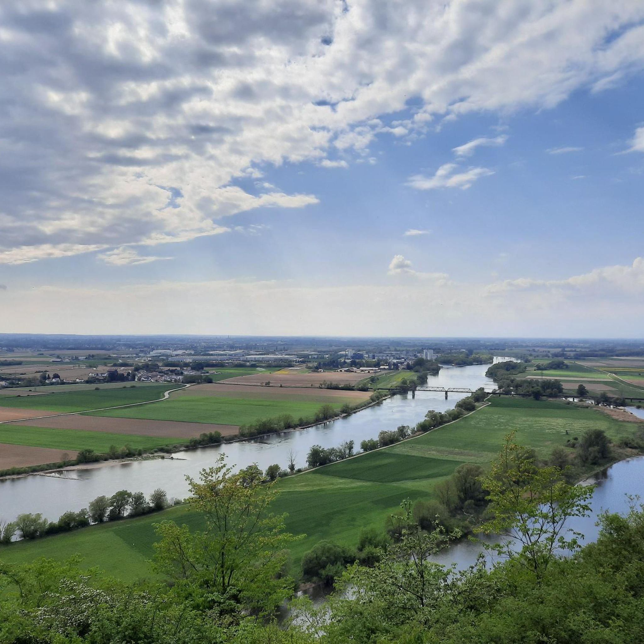
Regensburg Hauptbahnhof에서 출발하는 마리아오르트의 나압 다리 – 도나우 절벽 전망 순환 코스

20.5km

02:09

70m

70m

어려운 조깅. 우수한 체력 필요. 대부분 포장된 지면. 실력과 관계없이 누구나 갈 수 있음.

기기에서 길안내

휴대폰으로 전송

저장

어려움

보통 조깅. 좋은 체력 필요. 대부분 포장된 지면. 실력과 관계없이 누구나 갈 수 있음.

보통
guide_signup
저희가 komoot 모바일 앱로 길을 안내해 드리겠습니다.
무료 komoot 계정로 끝없는 야외 모험을 손쉽게 찾고, 맞춤 설정하며 길안내할 수 있어요.

무료 회원 가입

보통 조깅. 좋은 체력 필요. 대부분 포장된 지면. 실력과 관계없이 누구나 갈 수 있음.

보통

보통 조깅. 좋은 체력 필요. 대부분 포장된 지면. 실력과 관계없이 누구나 갈 수 있음.

보통

보통 조깅. 좋은 체력 필요. 대부분 포장된 지면. 실력과 관계없이 누구나 갈 수 있음.

보통

보통 조깅. 좋은 체력 필요. 대부분 포장된 지면. 실력과 관계없이 누구나 갈 수 있음.

보통

보통 조깅. 좋은 체력 필요. 대부분 포장된 지면. 실력과 관계없이 누구나 갈 수 있음.

보통

보통 조깅. 좋은 체력 필요. 대부분 포장된 지면. 실력과 관계없이 누구나 갈 수 있음.

보통

3.9

(15)

404

달리기 하는 사람

보통 조깅. 좋은 체력 필요. 대부분 포장된 지면. 실력과 관계없이 누구나 갈 수 있음.

보통

4.0

(13)

389

달리기 하는 사람

보통 조깅. 좋은 체력 필요. 대부분 포장된 지면. 실력과 관계없이 누구나 갈 수 있음.

보통
무료 회원 가입 후 상부 팔츠 러닝 경로를 7,246개 더 확인하세요

더 다양한 경로와 다른 탐험가들의 추천을 살펴보세요.

무료 회원 가입

이미 komoot 계정이 있나요?

투어 추천은 다른 사람들이 komoot에서 완료한 수천 개의 활동을 바탕으로 구성되어 있습니다.
오늘 무료 계정으로 시작하세요

다음 모험이 기다리고 있어요.

로그인 또는 가입하기

상부 팔츠 주변 인기 장소

레겐스부르크 러닝 트레일

바이에른 숲 러닝 트레일

오버팔츠의 바이덴 러닝 트레일

슈반도르프 러닝 트레일

암베르그 러닝 트레일

Amberg-Sulzbach 러닝 트레일

참 러닝 트레일

노이슈타트 안 데어 발트나브 러닝 트레일

오버팔츠의 노이마르크트 러닝 트레일

Naturpark Oberer Bayerischer Wald 러닝 트레일

상부 팔츠의 다른 모험

뛰어라 野외 - 독일 전체의 트레일 러닝 루트

러닝 컬렉션 에 의해

The Female Explorer

커뮤니티 팁

Freelancer 🥾 🚵 🏍️🏃‍♂️ 🧗🏼‍♂️
7월 3, 2026, View from Safferlingsteg Bridge

보행자 및 자전거 다리가 철로를 가로질러 보행자와 자전거 이용자의 안전한 통행을 가능하게 합니다. 또한 이 산책로에서는 번화한 레겐스부르크 중앙역의 좋은 전망을 감상할 수 있습니다. 기차를 촬영하기에 이상적인 장소입니다.

번역: Google

2

0

멋진 지역의 경이로운 구간

번역: Google

1

0

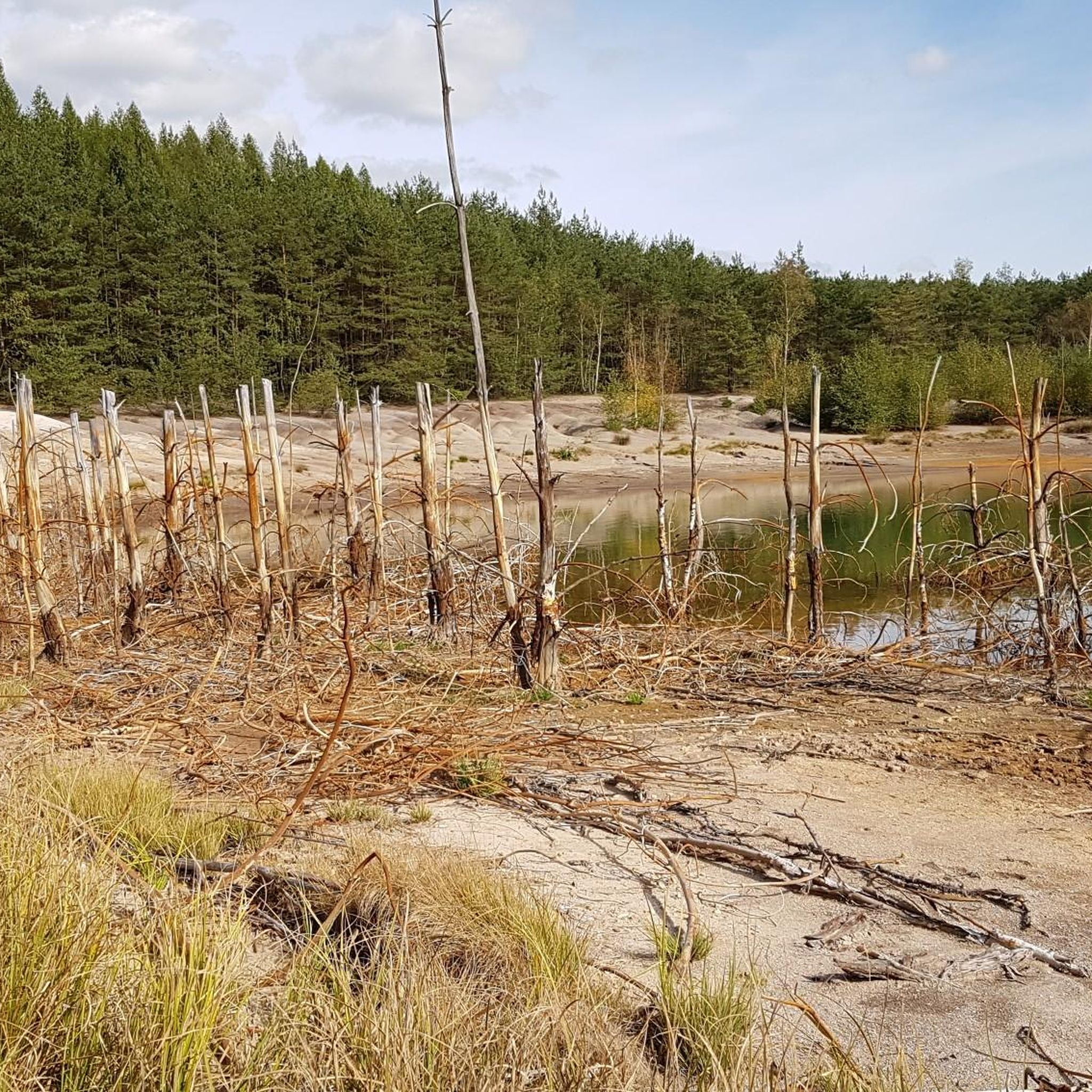
Knappensee The lake's origins can be traced back to the cessation of lignite mining by the Bavarian lignite industry in the 1980s. Flooding of the pit began in 1981, creating the lake with an area of 55 hectares and an average depth of 5 meters (deepest point: 6.5 meters). It is approximately 1 kilometer long and 460 meters wide. The lake's name likely derives from the miners' association or the miners of the open-cast mine, whose work led to its creation after mining operations ceased. The "Knappensee Circular Trail" was created around the lake. Since 2012, this trail, offering 3,900 meters of hiking and cycling routes, has been intended to support tourism in the region. Two-thirds of the circular trail lies within the municipality of Wackersdorf. A parking lot for cars is available on the south side. The water quality of the lake is monitored by the Weiden Water Management Office in the Upper Palatinate region using a measuring station located in the northern third of the lake. The measurement data is available from the Bavarian State Office for the Environment. After the open-cast mine was flooded, the lake water was highly acidic (pH value in 1998: 3.6); however, this has since changed unexpectedly, as the pH value is now reported to be 6.8. Fishing in the lake is permitted only with a fishing license and a local day permit, with a maximum catch of 5 fish per day. Source: Excerpts from www.wikipedia.de

번역: Google

3

0

In 2007, the Czech association "Terra Tachovia" conceived the idea of erecting milestones of time along the Golden Road, the important medieval trade route between Nuremberg and Prague. This resulted in a cross-border work of art. 43 stone works of art have now been erected along the route. In Weiden, the milestone is dedicated to the composer Max Reger.

번역: Google

10

0

"Strength lies only in joint action" is inscribed on this memorial stone at the entrance to Max Reger Park. Citizens of Weiden donated the engraved granite block in 1955 under Mayor Hans Schelter. Schelter, born in Röthenbach near Arzberg in 1905, had already been a SPD city councilor in his hometown until 1933. After the Second World War, he came to Weiden, was elected to the city council in 1946, and won direct election as mayor in 1952. He shaped the city primarily through major construction projects and promoted sponsorships and partnerships (home districts of Tachau, Issy-les-Moulineaux, and Macerata). He remained in office until April 30, 1970.

번역: Google

9

0

The Lower Gate is the only one of eight city gates in the medieval city wall that has survived to this day. It was originally built with the wall around 1350, based on a decree by Emperor Charles IV in 1347. During the Thirty Years' War, the gate was severely damaged by enemy fire in 1635. The necessary reconstruction was then largely carried out in its current form. In 1945, the gate was damaged again when an American tank crashed into it. This, however, created the opportunity to create a pedestrian passageway. This idea was realized in 1955.

번역: Google

9

0

Two mighty pedunculate oaks dominate Schlörplatz. In 1824, a jubilee oak was planted here to mark the 25th anniversary of the reign of Maximilian I Joseph, the Bavarian ruler of the House of Wittelsbach (initially as Elector from 1799, and as King from 1806). Beneath it stands the monument to Gustav von Schlör. This jubilee oak at the monument and the Peace Oak in the center of the square (donated in 1871 by Josef Fiedler of Almesbach) are pedunculate oaks, which quickly form a wide-spreading crown on a short trunk.

번역: Google

9

0

The small Nepomuk Chapel at the entrance to Max Reger Park, officially called the "Bridge Chapel of St. John Nepomuk," was built starting in 1738. It was prompted by a vow by Imperial Austrian Field Marshal Christoph Rudolf Fellner von Feldegg, who, faced with the shaky bridge over the Waldnaab River, vowed that if his troops crossed the river unscathed, he would donate a chapel. Shortly thereafter, von Feldegg fell in 1739 in the Battle of Grocka during the Russo-Austrian Wars against the Turks near Belgrade. The sandstone statue of St. John Nepomuk was created by the Nabburg sculptor Johann Franz Dult.

번역: Google

12

0

상부 팔츠에서 가장 인기 있는 경로

상부 팔츠 가족 하이킹

상부 팔츠에서 가장 인기 있는 명소

Natural Monuments

Store rating

komoot 모바일 앱으로 영감을 받아보세요

무료 komoot 계정로 끝없는 야외 모험을 손쉽게 찾고, 맞춤 설정하며 길안내할 수 있어요.

또는

지금 komoot에 가입하세요

Store rating

찾고 계신 것을 찾지 못하셨나요?

상부 팔츠에서 더 많은 러닝 트레일 & 경로를 확인하고 목적지에서 완벽한 경로를 찾아보세요.

슈반도르프오버팔츠의 노이마르크트티르셴로이트오버팔츠의 바이덴암베르그레겐스부르크노이슈타트 안 데어 발트나브Amberg-Sulzbach바이에른 숲Naturpark Oberer Bayerischer Wald

더 살펴보기

다른 지역의 최고의 러닝 트레일 & 경로를 살펴보세요.

다른 탐험 장소

상부 팔츠의 자연보호구역

근처 어드벤처 가이드

스턴 즐길거리

background

새로운 정복을 위한 준비를 하세요

무료로 가입하기

탐험하기
경로경로 플래너기능바우처 사용하이킹MTB 트레일로드 사이클링 경로바이크패킹사이트맵
앱 다운로드
소셜 미디어에서 팔로우하기

© komoot GmbH

개인 정보 보호 정책