경로

플래너

기능

업데이트

App

로그인 또는 가입

앱 다운로드

로그인 또는 가입

로그인 또는 가입

경로
하이킹
독일
라인란트-팔츠
마옌-코블렌츠

뭉크

뭉크 최고의 워킹 & 하이킹 경로

4.6

(8539)

32,603

등산객

680

하이킹

정확한 경로를 찾는 것이 때로는 어렵지만 뭉크에서 하이킹을 하면 다양한 경치를 마음껏 감상할 수 있답니다. 뭉크에서 가장 멋진 하이킹과 워킹 중에서 마음에 드는 활동을 시작해보세요.

마지막 업데이트: 5월 20, 2026

4.8

(73)

172

등산객

#1.

Boos에서 출발하는 Booser Doppelmaar 습지 – Booser Maar 전망 순환 코스

5.72km

01:39

140m

140m

초급용 하이킹. 모든 체력 수준에 적합. 실력과 관계없이 누구나 쉽게 갈 수 있는 길.

기기에서 길안내

휴대폰으로 전송

저장

초급

보통 하이킹. 좋은 체력 필요. 실력과 관계없이 누구나 쉽게 갈 수 있는 길.

보통
guide_signup
저희가 komoot 모바일 앱로 길을 안내해 드리겠습니다.
무료 komoot 계정로 끝없는 야외 모험을 손쉽게 찾고, 맞춤 설정하며 길안내할 수 있어요.

무료 회원 가입

초급용 하이킹. 모든 체력 수준에 적합. 실력과 관계없이 누구나 쉽게 갈 수 있는 길.

초급

초급용 하이킹. 모든 체력 수준에 적합. 실력과 관계없이 누구나 쉽게 갈 수 있는 길.

초급

보통 하이킹. 좋은 체력 필요. 실력과 관계없이 누구나 쉽게 갈 수 있는 길.

보통
무료 회원 가입 후 뭉크 주변 하이킹 경로를 676개 더 확인하세요

더 다양한 경로와 다른 탐험가들의 추천을 살펴보세요.

무료 회원 가입

이미 komoot 계정이 있나요?

투어 추천은 다른 사람들이 komoot에서 완료한 수천 개의 활동을 바탕으로 구성되어 있습니다.

오늘 무료 계정으로 시작하세요

다음 모험이 기다리고 있어요.
로그인 또는 가입하기

뭉크 주변 인기 장소

뭉크 사이클링

뭉크 MTB 트레일

뭉크 로드 사이클링 경로

뭉크 주변 그래블 라이딩

뭉크 러닝 트레일

커뮤니티 팁

Frank
3월 20, 2026, Shaun the Sheep Sculpture

네, 뭐라고 해야 할까요, 그냥 숀 더 쉽이죠🤣😂🐑🐑🐑📸📸🥳 꼭 봐야 합니다☝🏽

번역: Google

1

0

October is probably not a good time to buy honey, the box was empty

번역: Google

0

0

Especially pleasant when it's very hot🥵

번역: Google

0

0

The Boos Double Maar consists of two silted-up maars, which today appear as shallow depressions in the terrain. They are located within the municipality of Boos. The two maars formed between 10,150 and 14,160 years ago and belong to the Quaternary volcanic field of the Volcanic Eifel. The two maars form large, circular basins surrounded by tuff embankments. They lie on a west-southwest-east-northeast trend, thus following the Variscan strike of the subsurface. The west-southwest maar has a diameter of approximately 700 m and a depth of between 30 and 60 m; the east-northeast maar is between 650 and 700 m and a depth of between 50 and 87 m. Both depressions are very humid, so there are still areas that have a permanent water surface. The waters were formerly used as fish ponds, but later silted up and served as meadows and fields. Today, there is once again a fish pond in the west-southwestern part of the maar, the Booser Weiher. In the vicinity of the maars, there are tuff pits where the volcanic tuff formed during the eruption of the maars was mined. Very beautiful nature.

번역: Google

0

0

Tower closed. Danger of collapse

번역: Google

0

0

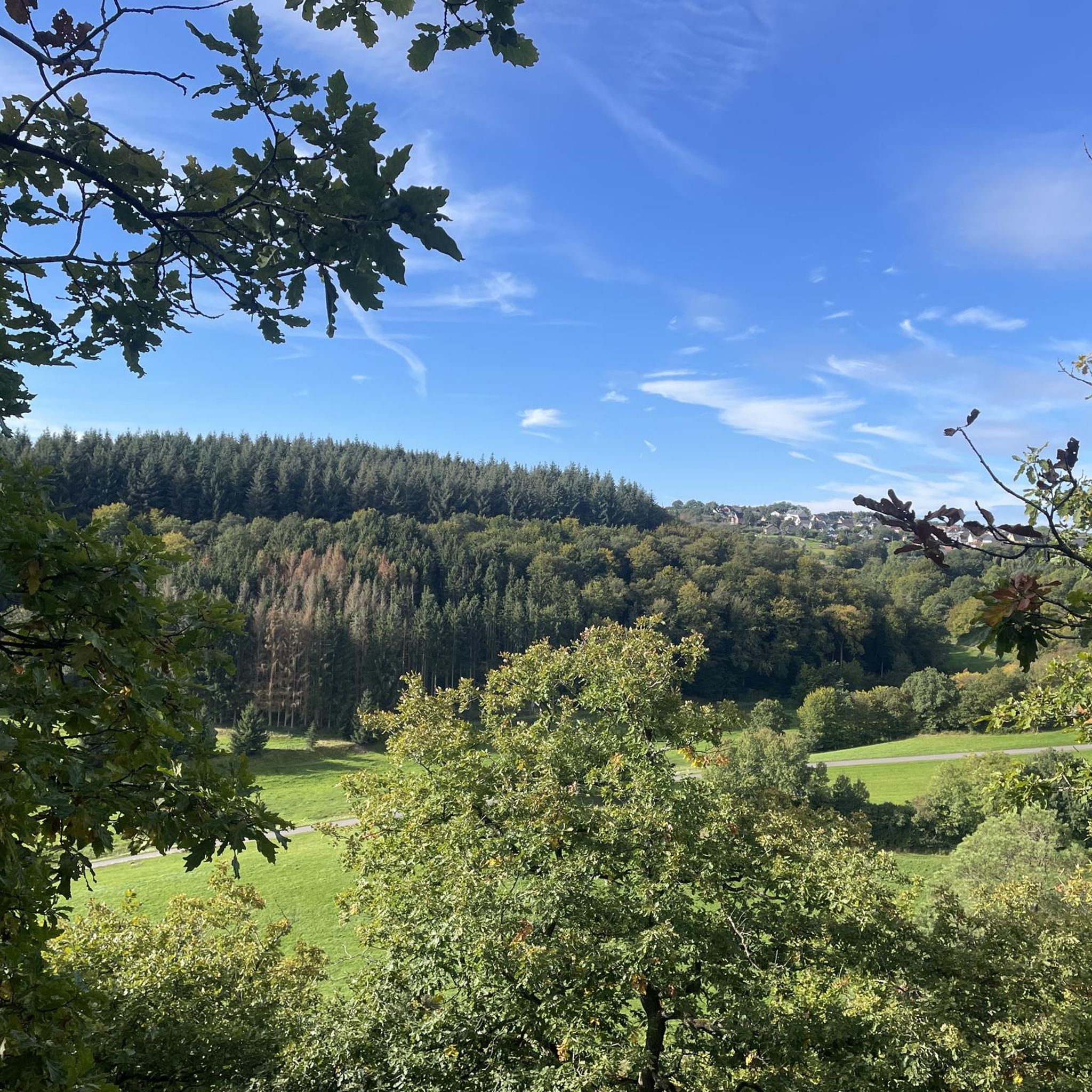
This view of the Booser Maar with the Booser Weiher is simply picturesque.

번역: Google

0

0

The history of the Volcanic Eifel can be explored at the Booser Doppelmaar. The Booser Doppelmaar consists of two silted-up maars, which today appear as flat hollows in the terrain. The two maars were formed between 10,150 and 14,160 years ago. Viewed from above, the two maars are circular basins. The west-southwest maar has a diameter of around 700 m and is between 30 and 60 m deep, the east-northeast maar is between 650 and 700 m large and has a depth of 50 to 87 m. The two hollows are very wet, so there are still places that have a permanent water surface. The water areas were previously used as fish ponds, but later silted up and served as meadows and fields. Today there is again a fish pond in the west-southwestern maar, the Booser Weiher, see also https://de.wikipedia.org/wiki/Booser_Doppelmaar

번역: Google

1

1

You can try the honey straight away. There is a glass in the bottom drawer and wooden sticks are ready. There is no price list, you have to pay what you think. When you see the price of the large glass and the amount of handwork that goes into it, it should be worth something to you. We really enjoyed the honey. Hopefully the money won't be stolen.

번역: Google

0

0

뭉크 주변에서 가장 인기 있는 경로

뭉크 사이클링

뭉크 주변에서 가장 인기 있는 명소

Places to see

Store rating

komoot 모바일 앱으로 영감을 받아보세요

무료 komoot 계정로 끝없는 야외 모험을 손쉽게 찾고, 맞춤 설정하며 길안내할 수 있어요.

또는

지금 komoot에 가입하세요

Store rating

더 살펴보기

다른 지역의 최고의 하이킹를 살펴보세요.

안데르나흐벤도르프매켄Wierschem멘디그니케니히위닝겐뢰프발렌다르마옌로이델스터츠몬레알나운하임코베른-곤도르프알켄브로덴바흐트림니더펠옥텐둥니더베르트뮐하임-칼리히하젠포트Naturschutzgebiet Nettetal폴치비르네부르크하우스틴케르벤코텐하임아이니그오버펠아크트필리그아르프트볼크스펠트뮌스터마이펠트지벤바흐브레이플레이트크루프트투르스파이칼텐거랑샤이드발데쉬콜리그레멘게링안샤우크레츠디체이드바센하임바이터스부르크케릭월켄디블리치베르멜칼트우르미츠룩셈바이젠투름히르텐뇌르터스하우젠헤레스바흐나흐츠하임로니그케티그가페낙웰링기르슈나흐사피그키르히발트루베르멀록장크트 세바스티안웰셴바흐

근처 어드벤처 가이드

아르바흐 즐길거리

background

새로운 정복을 위한 준비를 하세요

무료로 가입하기

탐험하기
경로경로 플래너기능하이킹MTB 트레일로드 사이클링 경로바이크패킹사이트맵
앱 다운로드
소셜 미디어에서 팔로우하기

© komoot GmbH

개인 정보 보호 정책