연지 주변 최고의 교통량 없는 자전거 라이딩 코스
4.3
(8)
582
자전거 타는 사람
63
라이딩
Rougé 주변의 교통 없는 로드 사이클링 코스는 구불구불한 언덕, 고요한 연못, 삼림 지대로 특징지어지는 푸른 시골을 가로지릅니다. 루아르-아틀란티크(Loire-Atlantique) 데파르트망에 자리한 이 지역은 이전 철도 노선을 개조하여 만든 녹색 도로를 포함한 전용 자전거 도로망을 갖추고 있습니다. 토양의 높은 철분 함량 때문에 길과 개울에서는 종종 독특한 붉은 빛깔을 띠는 풍경을 볼 수 있습니다. 이 지역은 자연의 아름다움과 로드 사이클링에 적합한 다양한 지형을 제공합니다.
Rougé 주변 최고의 교통 없는 로드 사이클링 코스
- 가장 인기 있는 교통 없는 로드 사이클링 코스는 샤토브리앙(Châteaubriant) 출발 로드바이크…
마지막 업데이트: 8월 27, 2026
15
자전거 타는 사람
21.4km
00:51
120m
120m
초급용 로드 라이딩. 모든 체력 수준에 적합. 지면 대부분이 잘 포장되어 있고 라이딩하기 쉬움.
5
자전거 타는 사람
36.1km
01:37
310m
310m
보통 도로 자전거 타기. 좋은 체력 필요. 투어 중 라이딩하기 어려운 비포장 구간이 있을 수 있음.

무료 회원 가입
5
자전거 타는 사람
76.6km
03:12
520m
520m
보통 도로 자전거 타기. 좋은 체력 필요. 지면 대부분이 잘 포장되어 있고 라이딩하기 쉬움.
5
자전거 타는 사람
63.6km
02:47
360m
360m
보통 도로 자전거 타기. 좋은 체력 필요. 투어 중 라이딩하기 어려운 비포장 구간이 있을 수 있음.
2
자전거 타는 사람
47.2km
01:59
340m
340m
보통 도로 자전거 타기. 좋은 체력 필요. 투어 중 라이딩하기 어려운 비포장 구간이 있을 수 있음.
더 다양한 경로와 다른 탐험가들의 추천을 살펴보세요.
무료 회원 가입
이미 komoot 계정이 있나요?
투어 추천은 다른 사람들이 komoot에서 완료한 수천 개의 활동을 바탕으로 구성되어 있습니다.
오늘 무료 계정으로 시작하세요
다음 모험이 기다리고 있어요.
로그인 또는 가입하기


커뮤니티 팁

안녕하세요, 관심 장소 • Rougé에서 Châteaubriant까지 이어지는 10km 자전거 도로는 지도상에 올바르게 위치하지 않았습니다 (48°16'19.6"N 1°39'50.1"W). 올바른 좌표는 다음과 같습니다: 47°46'48.7"N 1°27'11.3"W. 진심으로
0
0

The west bridge of Lake Voireau offers a beautiful, unobstructed view of the reservoir. The largest body of water in Loire-Atlantique, this lake stretches through the heart of the forest. Its wooded banks and landscaped beaches make it a pleasant stopover for a nature break or a swim.
0
0

The church, which consists of a large nave and two six-bay aisles, a transept, and a three-bay choir without an ambulatory, is 65 meters long. The transept is 26.50 m long, and the naves are 17.5 m wide. The bell tower is 65 meters high without the cross. It has a set of five bells made in 1895 by the Bollée foundry in Le Mans: Saint-Nicolas (the bourdon), weighing 4027 kg, playing the A of octave 2 Anne, weighing 1552 kg, playing the D of octave 3 Marie, weighing 1067 kg, playing the M of octave 3 Joséphine-Jeanne, weighing 726 kg, playing the F sharp of octave 3 Henriette-Victorienne, weighing 450 kg, playing the A of octave 3
0
0
The original chapel, initially dedicated to Notre-Dame, was built by Geoffroy IV, Baron of Châteaubriant, on the site where the cattle market was held from May to October until 1763. A text attests to its existence in 1263. [Threatening to fall into ruin, it was demolished in 1518, leaving only the choir of the old chapel standing. The place of worship was immediately rebuilt in a more spacious form using Châteaubriant schist (Nozay stone), based on the plans of Jean Delorme, brother of Philibert Delorme, thanks to the demolition of a neighboring house and the financial support of Jean de Laval. However, the latter's poor financial situation meant that by 1530, only the nave of the building had been built. At the death of Françoise de Foix in 1537 and Jean de Laval in 1543, the Notre-Dame chapel still lacked a framework. It was not until 1551 that the final work was undertaken by Baron Anne de Montmorency. The dedication of the new place of worship took place ten years later, on November 5, 1561, in the presence of the coadjutor of the Bishop of Nantes, and the name of Notre-Dame was changed to Saint-Nicolas, for an unknown reason. On the same day, the body of Jean de Laval, then encased in a lead reliquary, was transported from the castle chapel to the new building. Jean de Laval had wished to see the chapel erected as a collegiate church, but this wish was not granted. However, the building, as vast as a church, shared the honors of worship with the Church of Saint-Jean de Béré, which was then the parish church of the town, until the Revolution. Indeed, the Saint-Nicolas chapel, although of undeniable architectural value, was not suitable for worship in a parish as large as that of Châteaubriant. Nevertheless, in the 15th and 16th centuries, masses, vespers, and many ceremonies were held in the chapel for reasons of convenience, as it was closer to the town of Châteaubriant, while baptisms were all celebrated at Saint-Jean de Béré. At the end of the 19th century, the church, which became the parish seat in 1801, was completely rebuilt. The architect Eugène Boismen drew up the plans, inspired by those of the Saint-Nicolas basilica in Nantes, one of the first neo-Gothic projects in France, which was beginning to inspire architects throughout the west of the country. The foundation stone was blessed on April 25, 1875, by Bishop Fournier of Nantes. The choir, sacristies, transept, and five bays were only completed at the time of the consecration, which was performed by his successor, Bishop Le Coq, on February 1, 1881. The foundations of the bell tower and the remaining bay began in June 1892, based on plans by architect François Bougoüin. The tower and spire were completed in August 1894.
0
0
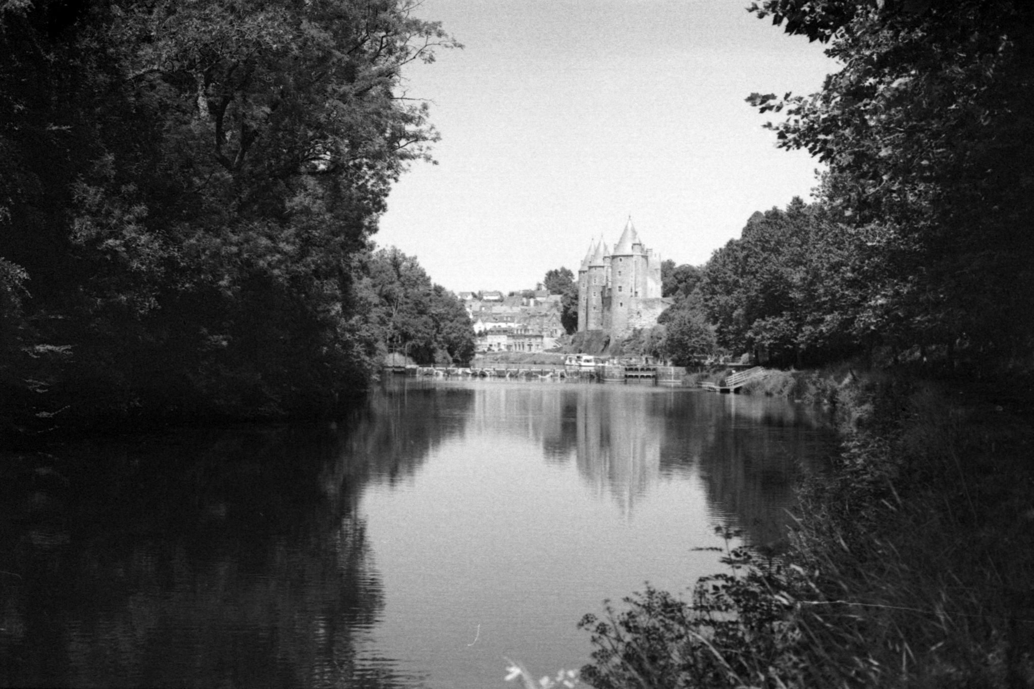
nighttime. A medieval fortress and Renaissance building, Châteaubriant Castle recounts ten centuries of history. In the Middle Ages, Châteaubriant Castle was at the heart of the Marches of Brittany. It served as a stronghold defending the duchy against the Kingdom of France. The keep, ramparts, seigneurial chapel, and the medieval courtyard lodgings still bear witness to the power of this fortress. In the 16th century, the bailey became a residence opening onto the gardens. The castle gardens are open to the public from February to December. Visit maps are available at the reception-shop for a better understanding of the site. A 3D space allows you to discover, with free access, the architectural evolution of the castle, from the 11th century to the present day. From February to December, heritage mediators will accompany you on an in-depth tour of the castle, its keep, and its gardens. During school holidays, family workshops allow parents and children to develop their creativity or spark their curiosity! Opening days: Gardens are open to the public, Wednesday to Sunday: 9am-6pm (February-March and October-December) or 9am-7:30pm (April-September). Prices: - Free entry for those over €0.00 (Free access to the château gardens) - Individual adult rate from €3.00 to €6.00 (Guided tours, free for those on minimum income and special cards) - Individual child rate from €0.00 (Guided tours free for those under 26) - Individual child rate from €0.00 (Guided tours free for those under 26) Child from €4.00 to €8.00 (Family activity) - Adult group rate from €5.00 (From 15 people) Payment methods: Credit cards - Bank and postal checks - Cash Tours Self-guided tours (individual): Yes Guided tours (individual): Yes Average visit duration (individual): 1 hour Self-guided tours (groups): Yes Guided tours on request (groups): Yes Guided tours (groups): Yes Average visit duration (groups): 1 hour Languages: Tour: French, English - Signs: French, English Services: Interactive kiosk - Shop - WiFi Additional information: Groups of 15 people or more are welcome - Pets allowed (Dogs on leashes are allowed in the park.) - Points of interest visible without a tour Access Location: SNCF train station: 0.5 km
0
0

This recently built church (end of the 19th century) is visible from afar with its 65 meters in height.
0
0
The castle is a self-guided tour. A little tip: there are bike racks inside the castle, just beyond the entrance.
1
0

very pleasant little break at the edge of the pond on the promenade which also borders the castle ramparts.
0
0
자주 묻는 질문
Rougé 주변에는 교통량이 적은 로드 사이클링 코스가 얼마나 있나요?
Rougé 주변에는 교통량을 최소화하는 데 중점을 둔 50개 이상의 전용 로드 사이클링 코스가 있어 사이클리스트에게 다양한 경험을 제공합니다. 이 코스는 지역의 아름다운 풍경을 통과하는 부드럽고 즐거운 라이딩을 위해 설계되었습니다.
초보자나 가족에게 적합한 쉽고 교통량이 없는 로드 사이클링 코스가 있나요?
네, Rougé에는 쉽고 교통량이 없는 여러 로드 사이클링 코스가 있습니다. 대표적인 예로 샤토브리앙(Châteaubriant)에서 Rougé까지 이어지는 그린웨이가 있습니다. 이 13km 코스는 옛 철도 노선을 따라 조성되어 차량 없이 여유로운 라이딩을 즐기기에 완벽합니다. 또한, 20km가 조금 넘는 샤토브리앙 출발 로드바이크 루프 코스와 같은 다른 쉬운 코스도 찾을 수 있습니다.
Rougé의 교통량이 없는 로드 사이클링 코스에서는 어떤 지형을 예상할 수 있나요?
Rougé 주변의 지형은 끊임없이 이어지는 완만한 언덕이 특징이며, 사이클리스트에게 즐거움을 주면서도 적절한 도전 과제를 제공합니다. 푸르른 시골 풍경과 Choisel 호수와 같은 고요한 연못, 그리고 Bois de la Houssaye와 같은 숲을 지나게 됩니다. 이 지역의 높은 철 함량 때문에 일부 길은 독특한 붉은색을 띨 수도 있습니다.
Rougé에서 교통량이 없는 로드 사이클링을 즐기기에 가장 좋은 시기는 언제인가요?
봄과 가을은 온화한 기온과 아름다운 풍경 덕분에 Rougé에서 로드 사이클링을 즐기기에 가장 쾌적한 시기입니다. 여름철에도 특히 아침이나 늦은 오후에는 즐거울 수 있지만, 더워질 수 있습니다. 겨울철에도 사이클링은 가능하지만, 서늘한 기온과 잠재적으로 습한 날씨에 대비해야 합니다.
교통량이 없는 로드 사이클링 코스를 따라 주목할 만한 랜드마크나 명소가 있나요?
물론입니다! 많은 코스가 흥미로운 장소를 지나갑니다. 역사적인 샤토브리앙 성(Châteaubriant Castle)은 종종 샤토브리앙 성 – 샤토 드 샤토브리앙 루프 코스와 같은 더 긴 코스에 포함되는 중요한 랜드마크입니다. 또한 브루츠 광산 박물관(Musée des Mines de la Brutz)과 같은 장소에서 이 지역의 광산 역사를 탐험할 수도 있습니다.
Rougé에서의 사이클링에 대해 다른 로드 사이클리스트들이 가장 즐기는 점은 무엇인가요?
이 지역은 komoot 커뮤니티에서 평균 4.33점의 높은 평가를 받고 있습니다. 리뷰어들은 종종 코스의 평온함, 아름다운 그린웨이, 그리고 교통량이 적은 평화롭고 매력적인 사이클링 경험을 선사하는 매력적인 시골 풍경을 칭찬합니다.
Rougé에서 순환형 교통량이 없는 로드 사이클링 코스를 찾을 수 있나요?
네, Rougé 주변의 교통량이 없는 로드 사이클링 코스 중 상당수는 루프 형태로 설계되어 시작점과 종료점이 동일합니다. 예를 들어, Torche 호수 – 샤토브리앙 성 루프 코스는 적당한 난이도의 경치 좋은 순환 라이딩을 제공합니다.
이러한 교통량이 없는 코스에 접근하기 위해 차를 주차할 수 있는 곳이 있나요?
주차는 일반적으로 Rougé 자체나 샤토브리앙과 같이 이러한 코스의 출발점이 되는 마을이나 도시에서 가능합니다. 특히 그린웨이나 인기 있는 사이클링 경로의 시작점 근처에 있는 지정된 공공 주차 공간을 찾아보세요.
Rougé의 독특한 '붉은 장소' 측면을 탐험하는 코스가 있나요?
명시적으로 '붉은 장소' 코스로 명명된 것은 아니지만, 이 지역의 이름인 'Rougé'는 높은 철 함량에서 유래했으며, 이는 일부 지역 도로와 물에 독특한 붉은색을 띠게 합니다. 이 지역의 광산 역사를 탐험하는 'Circuit du Fer'(철의 순환 코스)와 같은 코스는 이 독특한 지질학적 특징을 엿볼 수 있게 해줄 것입니다.
이용 가능한 가장 긴 중간 난이도의 교통량이 없는 로드 사이클링 코스는 무엇인가요?
가장 긴 중간 난이도 코스 중 하나는 샤토 드 샤토브리앙 – 비오로 호수 루프 코스로, 75km 이상을 달리며 약 500미터의 고도 상승이 있습니다. 이 코스는 다양한 풍경을 가로지르는 상당한 거리를 제공합니다.
교통량이 많지 않은 더 길고 도전적인 라이딩 옵션이 있나요?
네, 교통량이 없는 코스에 중점을 두면서도 많은 코스가 상당한 거리와 고도 상승을 포함하는 중간 난이도를 제공합니다. 예를 들어, 샤토브리앙 트램-트레인 출발 샤토브리앙 성 – 샤토 드 샤토브리앙 루프 코스는 350미터 이상의 오르막과 거의 64km에 달하는 거리를 포함하며, 조용한 도로에서 좋은 운동을 제공합니다.
연지 주변에서 가장 인기 있는 명소


더 살펴보기
다른 지역의 최고의 로드 사이클링 경로를 살펴보세요.
