브레스가르트 베이 피처에서 가장 멋진 4개의 천연기념물
Bresegard bei Picher 주변의 자연 기념물은 독일 메클렌부르크포어포메른 주의 Griese Gegend 지역에 위치해 있습니다. 이 지역은 빙하기에 형성된 광활한 숲, 푸른 초원, 작은 습지로 특징지어집니다. 이 지역은 모래 토양을 특징으로 하며, 중요한 조류 천국을 포함한 생태학적 가치로 유명합니다. 탐험을 위한 다양한 자연 명소를 제공합니다.
Bresegard bei Picher 주변 최고의 자연 기념물
- 가장 인기 있는 자연 기념물은 이전 군사 훈련 지역에 위치한 자연 기념물인 유랑하는 모래 언덕 (Schwarze Berge)입니다. 이 지역은 현재 메클렌부르크에서 가장 큰 연속적인 모래 황무지로 인정받는 Lübtheener…
마지막 업데이트: 9월 1, 2026
야크트슈테른 루트비히슬루스트 (14개의 가로수길)
하이라이트 • 숲
번역자 Google •
팁에 의해

이동하는 모래언덕(슈바르체 베르게)
하이라이트 • 자연 기념물
번역자 Google •
팁에 의해

이런 장소를 발견하려면 지금 가입하세요
최고의 싱글 트랙, 봉우리 및 다양한 흥미로운 야외 장소에 대한 추천을 받아보세요.
무료 회원 가입
티하우스 언덕에서 바라본 모래언덕 전망
하이라이트 • 전망대
번역자 Google •
팁에 의해

Griesen 지역에서 가장 큰 고석
하이라이트 • 자연 기념물
번역자 Google •
팁에 의해

오늘 무료 계정으로 시작하세요
다음 모험이 기다리고 있어요.
로그인 또는 가입하기
커뮤니티 팁

반드시 북쪽에서 이쪽으로 오세요. 다른 모든 면에서는 중앙 지역이 넓게 울타리로 둘러싸여 있습니다. 계절에 따라 다를 수도 있지만 안전이 제일입니다.
0
0

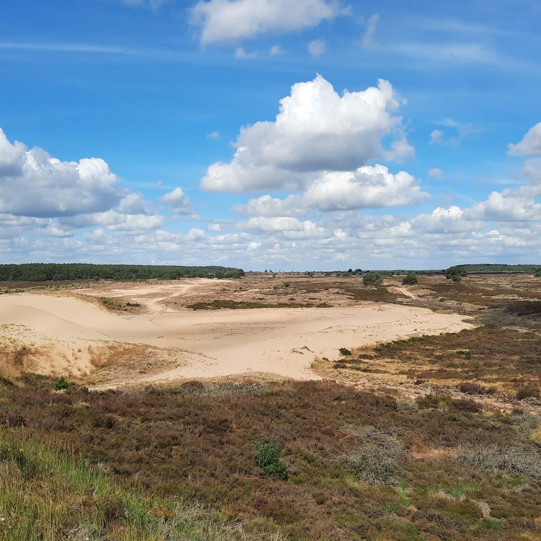
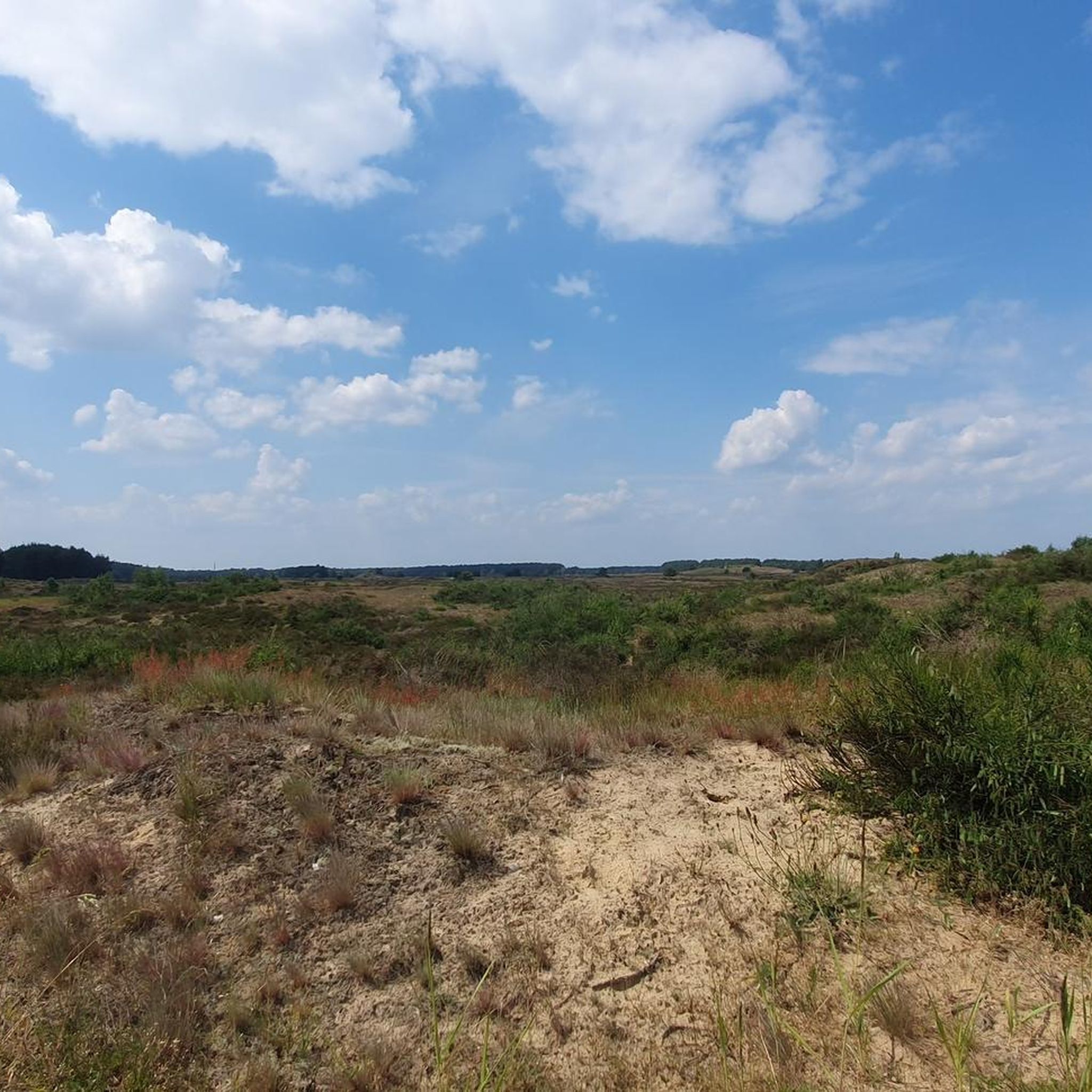
There is no longer a covered seating area on the hill. But if you are looking for shade, you can look for it on or in the house. From the hill, you can admire a wonderful panorama - including the inland dune.
0
0
At 19 tons, this red gneiss, which lies directly on the path between Neu Krenzlin and Göhlen, cannot be overlooked. The weakly metamorphic orthogneiss was probably transported here by glaciers during the end of the Saale Ice Age (Warthe stage). The age of the rock is estimated to be between 1.8 and 1.9 billion years. Right next to the Brocken there is a large-leaved lime tree that provides wonderful shade in the summer. So the rock not only offers an interesting regional historical point, but also a great place to linger. The only thing missing is a bench to sit on.
0
0

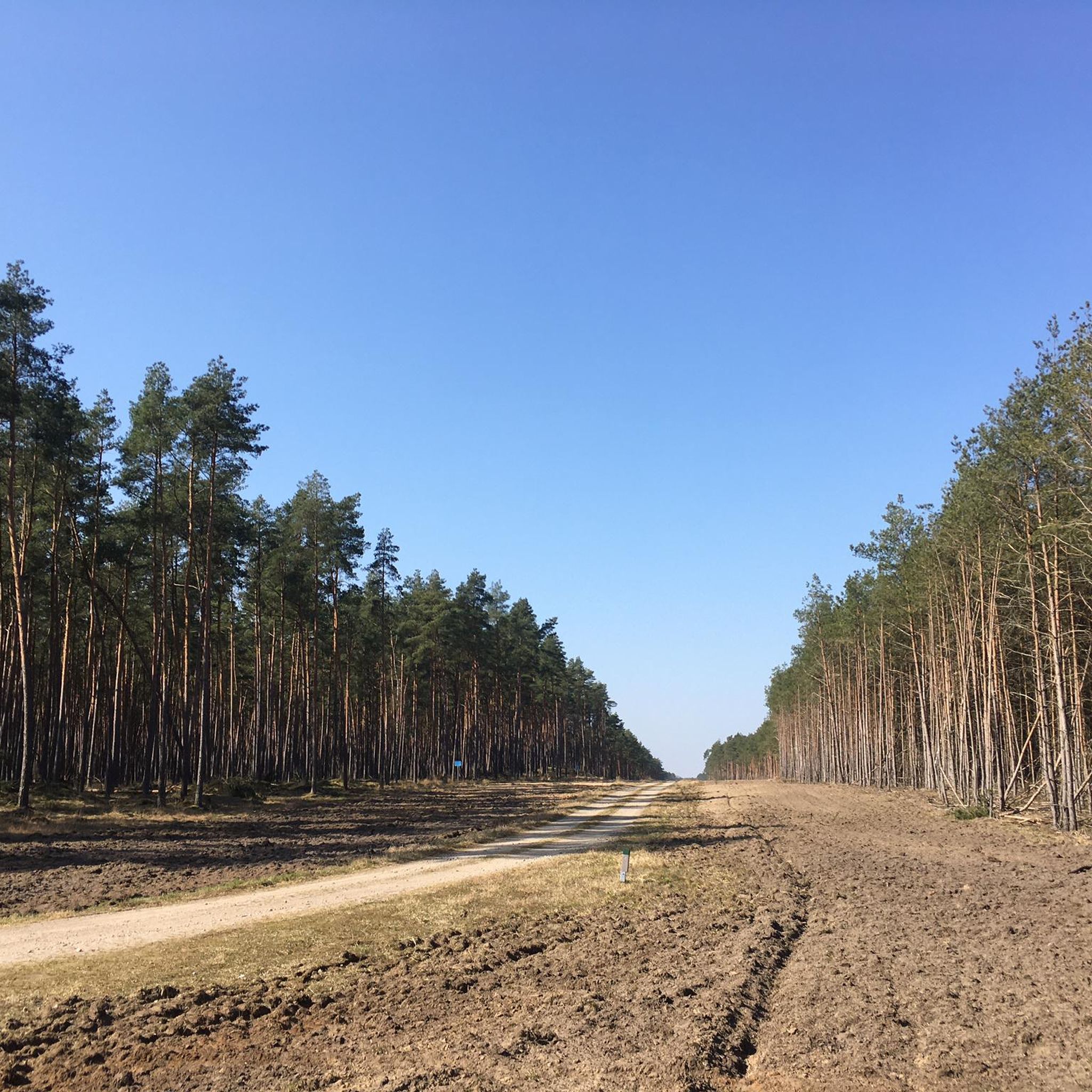
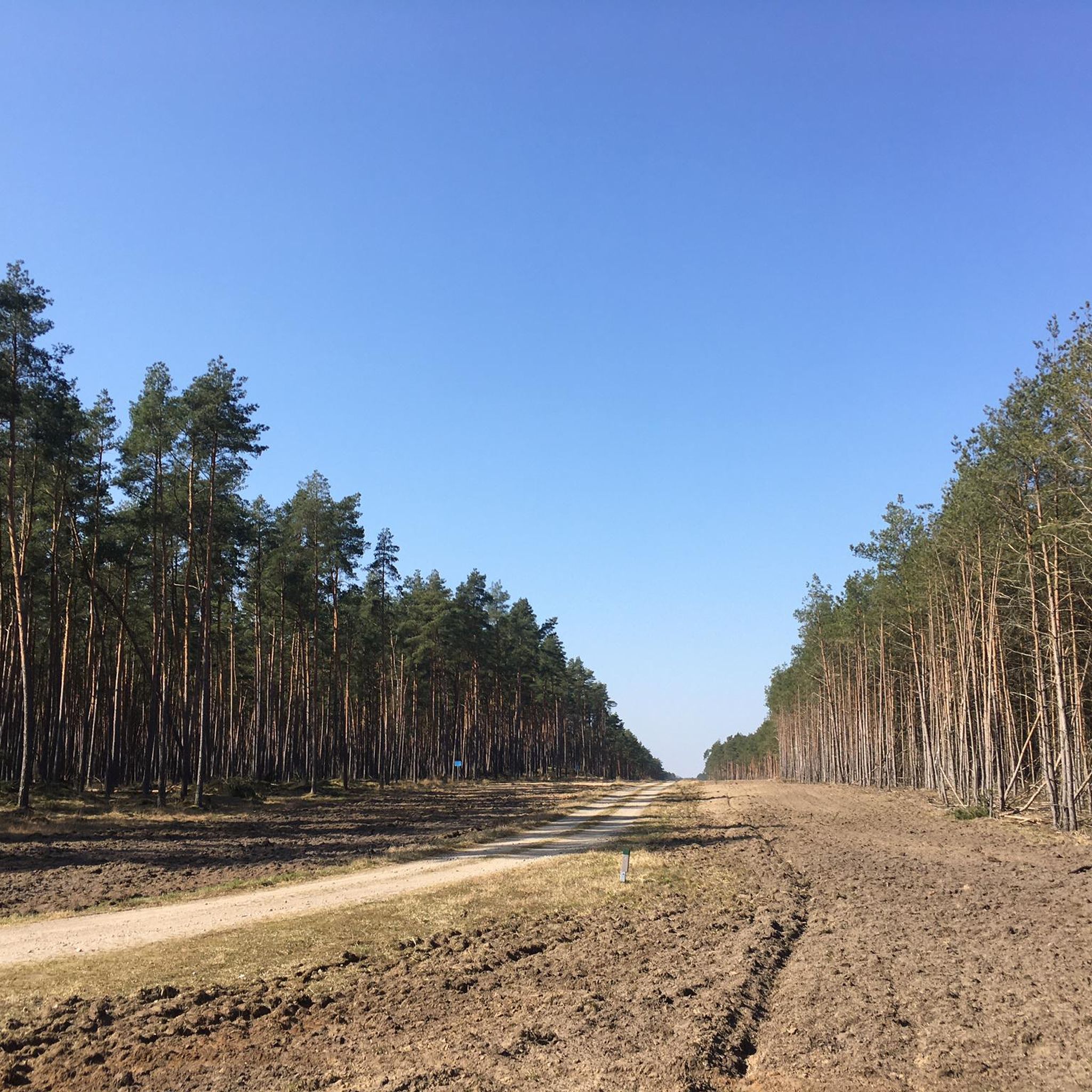
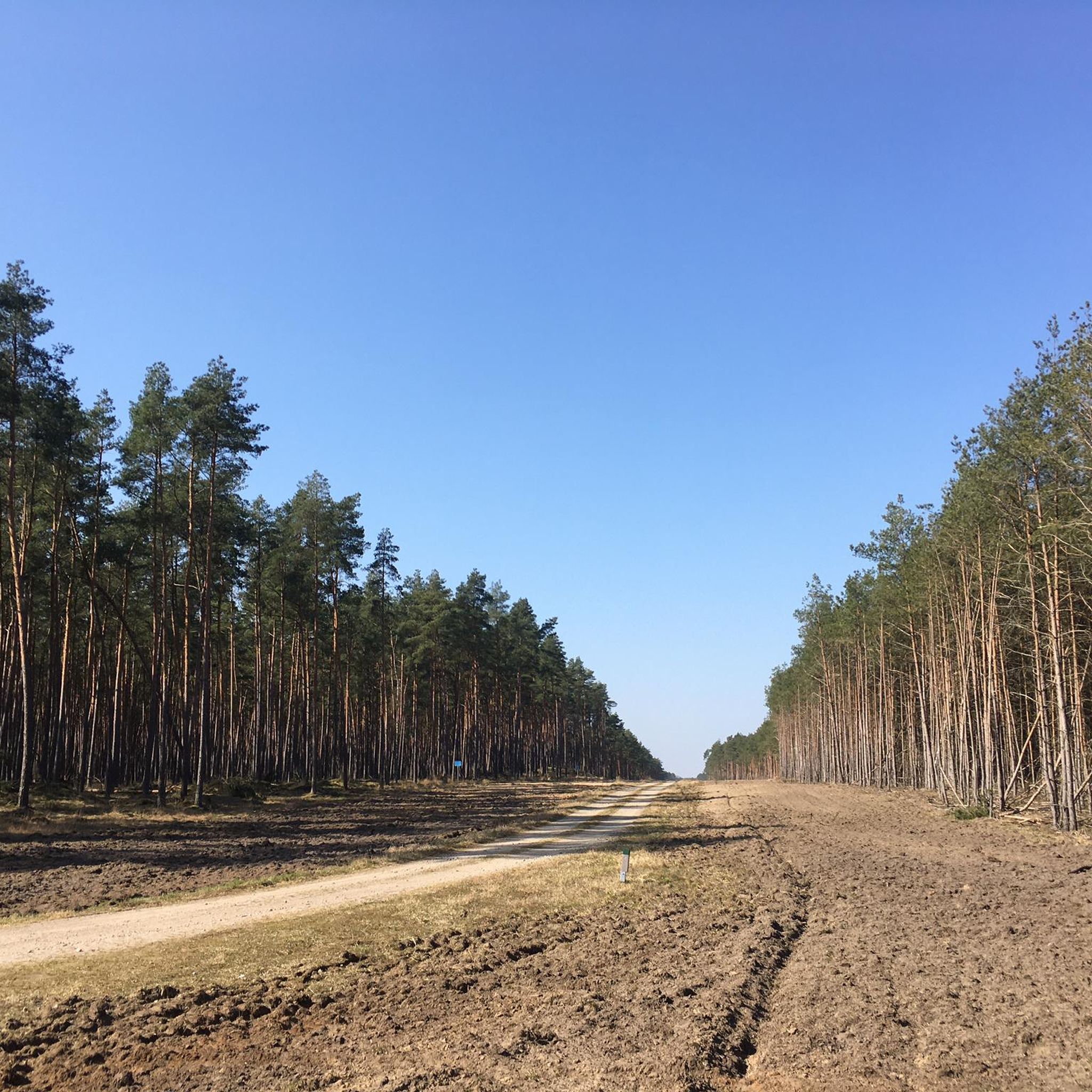
Very large expansion of this hunting star.
0
0

The Ludwigslust hunting star was laid out west of his hunting lodge by order of Christian Ludwig II in the 1730s. The avenues lead through damp areas, such as cracks and scours with alder growth, and drier clumps with mostly coniferous wood. The star with its avenues has a north-south extension of approx. 5 km and an east-west extension of approx. 6 km. Source: https://www.ludwigslust.de/Kultur-Tourismus/Sehenswertes/Ludwigslust/Schlosspark.php?object=tx,3634.345.1&NavID=3634.134&La=1
0
0

The Ludwigsluster Jagdstern was laid out west of his hunting lodge in the 1830s by order of Christian Ludwig II. The avenues lead through damp areas, such as quarries and pools with alder vegetation, and drier clumps with predominantly coniferous wood. With its avenues, the star has a north-south extension of approx. 5 km and an east-west extension of approx. 6 km. In the closer star area around the island, moist to wet forest areas predominate; in the wider star area, on the other hand, the meadow areas increase. These humid lowlands are rich in game. The avenues were designed as unrolled hunting dams with drainage ditches on both sides. In 1756 Duke Friedrich tied the Ludwigsluster Canal in the Jagdstern. Large parts of the alder forest are now valuable biotopes that enjoy legal protection. Today, near-natural forestry adapts to these conditions. The city of Ludwigslust has created an educational forest trail in this area. https://www.stadtludwigslust.de/natur-und-erendung/rund-um-natur/
4
0


Lookout point, rest area "Teehaus" with a wide view of the heathland and the dunes. ------------------------ Väle Johrn would have you, now a werre up bicycle and tau faut up'n padd dör de LübheenerHeide can struggle. Dat Rebeit is ok as stripes, stripes, shooting range, military training area and JabelerHeide künnig. All de Wäg (gravel, chippings, sand, asphalt fragments) laaten sik fien fohrn and de body ümtau sünd nu werre dör de Heid henndör verbunn. (Lübbendorf, Ramm, Belsch, Quast (Wüstung), Laupin, Loosen, Kavelmoor, HohenWoos, AltJabel, Vielank, Volzrade, Jessenitz, Trebs and ProbstJesar. Etc ...) In't Johr 2019 is up duss flag de grote WaldbrandLübheen 🚒 wäst, can be up Stunns still at all de swatten Bööm. Süst exists here, so as mostly in the GriesenGegend, ut väl Dannbööm🌲, Sand un Heide man - man klor, all the Gäl SandBargen (including Black Mountains) and inland dunes do not forget ... Dat giwt in de Heid bannig väl KrüzWäg un Twälen (fork) and dor süll'n de Wieser (signs) help the right Padd tau finn. Man de Wieser didn’t show the right padd, but you’re able to bitter. One war all for miehr as 150 Johrn us Fritz Reuter schräben: “… As ick achter de Möhl kamm, kamm ick in de Heid'ne desolate area! Sand an Dannenbusch an Heid'krut ... so again that Oog stretches! Weg´gungen bi Weg´, yeah, äwer wecker Weg what de right? " (F.Reuter to KalißerHeid, South WestMecklenb.)
0
1
자주 묻는 질문
Bresegard bei Picher 주변에서 어떤 자연 경관을 볼 수 있나요?
Bresegard bei Picher 주변 지역은 더 큰 Griese Gegend의 일부로, 빙하기에 의해 형성된 다양한 풍경이 특징입니다. 광활한 소나무 숲, 푸른 초원, 작은 습지를 볼 수 있습니다. 24 Wassersprünge와 같은 독특한 수계, 내륙 사구, 거대한 빙하 표석 등이 주목할 만한 특징입니다. 이 지역은 특히 조류를 포함한 풍부한 생물 다양성으로도 유명합니다.
이 지역에 역사적인 자연 기념물이 있나요?
네, 루트비히슬루스트 사냥 별 (14개의 길)은 중요한 역사적인 자연 기념물입니다. 18세기에 파르포스 사냥을 위해 조성되었으며, 귀중한 알더 생물 서식지를 포함한 다양한 숲 지역을 통과하는 독특한 길 시스템을 특징으로 합니다. 역사적인 경관 디자인과 자연 보존의 흥미로운 조화입니다.
자연 기념물 근처에서 어떤 야외 활동을 즐길 수 있나요?
이 지역은 하이킹과 사이클링을 즐기기에 훌륭한 기회를 제공합니다. 모래 토양, 숲, 초원을 포함한 Griese Gegend의 다양한 지형을 탐험할 수 있습니다. 특정 하이킹 코스는 Bresegard bei Picher 주변 하이킹 가이드에서 찾을 수 있습니다. 사이클리스트는 Bresegard bei Picher 주변 로드 사이클링 코스 가이드에 나열된 다양한 코스를 발견할 수 있습니다.
자연 기념물 주변에 쉬운 하이킹 코스가 있나요?
네, 편안한 나들이에 적합한 여러 쉬운 하이킹 코스가 있습니다. 예를 들어, 'Hagenow Railway Water Tower – Hagenow Land Railway Station loop' 또는 'Sude Bridge – Fish ladder at a lock loop'와 같은 코스를 찾을 수 있습니다. Bresegard bei Picher 주변 쉬운 하이킹 가이드에서 더 많은 옵션을 확인할 수 있습니다.
방문할 만한 가족 친화적인 자연 기념물이 있나요?
물론입니다. 루트비히슬루스트 사냥 별 (14개의 길)은 교육적인 숲길을 제공하여 가족 친화적인 곳으로 간주됩니다. 또한, Griese 지역에서 가장 큰 빙하 표석은 그늘을 제공하는 큰 라임 나무와 함께 가족들이 접근하기 쉽고 흥미로운 장소입니다.
자연 기념물을 방문하기 가장 좋은 시기는 언제인가요?
Bresegard bei Picher가 위치한 Griese Gegend는 풍경이 살아나는 봄에 특히 아름답습니다. 하지만 광활한 숲과 초원은 따뜻한 계절 내내 아름다운 경치와 고요함을 제공하므로, 봄부터 초가을까지 야외 활동에 이상적입니다.
독특한 지질학적 지형을 볼 수 있나요?
네, 이 지역에는 독특한 지질학적 특징이 있습니다. 메클렌부르크에서 가장 큰 연속적인 모래 황야의 일부인 방랑하는 모래 언덕(슈바르체 베르거)을 방문할 수 있습니다. 또 다른 인상적인 지형은 빙하기 동안 빙하에 의해 운반된 19톤의 붉은 화강암 바위인 그리즈 지역에서 가장 큰 빙하 표석입니다.
'24개의 물줄기' 천연 기념물이 특별한 이유는 무엇인가요?
24개의 물줄기(24 Wassersprünge)는 수력 발전으로 작동하는 샘물 분수 시스템을 갖춘 독특한 천연 기념물입니다. 폭포의 잔잔한 소리와 고요한 주변 환경을 갖춘 평화로운 환경을 제공하며, 자연수의 미묘한 힘을 보여줍니다.
이 지역은 조류 관찰에 좋은가요?
네, 이 광범위한 지역은 조류 관찰에 탁월합니다. 그리즈 게겐트(Griese Gegend)는 중요한 조류 천국으로 알려져 있습니다. 근처에 있는 유럽 조류 보호구역 루비츠(Lewitz)는 독일에서 가장 큰 연속적인 초지 풍경으로, 흰꼬리수리, 물수리, 물총새, 두루미를 포함한 다양한 조류 종의 안식처입니다.
자연 경관을 감상할 수 있는 전망대가 있나요?
네, 경치 좋은 전망대를 찾을 수 있습니다. 티하우스 언덕에서 바라본 모래 언덕 전망은 황야와 내륙 모래 언덕의 넓은 파노라마를 제공하며, 이 지역의 독특한 풍경에 대한 훌륭한 시각을 제공합니다.
방문객들이 이 지역에서 일반적으로 매력을 느끼는 점은 무엇인가요?
방문객들은 종종 그리즈 게겐트(Griese Gegend)의 평온함과 자연의 아름다움을 높이 평가합니다. 광활한 숲, 평화로운 초원, 그리고 24개의 물줄기와 같은 독특한 천연 기념물은 고요한 휴식을 제공합니다. 루트비히슬루스트 사냥 별(Ludwigslust Hunting Star)과 같은 유적지에서 특히 잘 드러나는 이 지역의 풍부한 역사 또한 자연과 유산을 모두 관심 있는 사람들에게 매력을 더합니다.
브레스가르트 베이 피처 주변에서 가장 인기 있는 명소


더 살펴보기
브레스가르트 베이 피처 주변의 최고의 동굴을 찾기 위해 이 가이드를 확인해보세요:
