경로

플래너

기능

업데이트

App

로그인 또는 가입

앱 다운로드

로그인 또는 가입

경로
Places to see
Natural Monuments
독일
라인란트-팔츠
불카네이펠

켈베르그

켈베르그‬에서 가장 멋진 ‪20‬개의 천연기념물


천연기념물을 방문하여 켈베르그의 아름다운 풍경을 만나보세요. 켈베르그에 있는 20
개의 천연기념물과 상세 정보를 살펴본 후에 방문하고 싶은 천연기념물을 다음 모험 계획에 추가해보세요!

마지막 업데이트: 7월 22, 2026

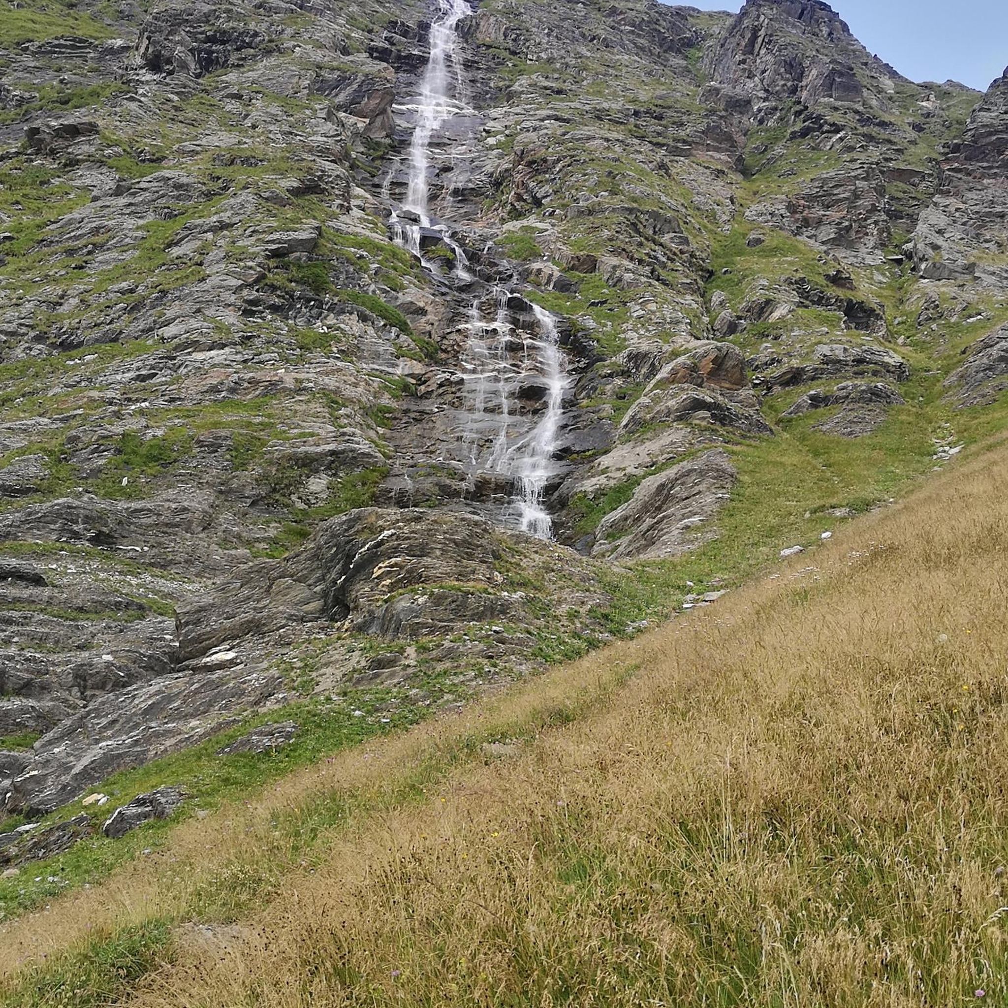
드라이뮐렌 폭포

하이라이트 • 폭포

The Dreimühlen waterfall, also referred to as the Nohner waterfall, is an artificial waterfall near Ahütte that was created through the construction of a railway line by merging streams. The …

번역자 Google •

에 의해

하이킹 보기

휴대폰으로 전송

저장

Nohner Mühle의 암벽

하이라이트 • 자연 기념물

The first highlight right at the parking lot. This is also where the path to the waterfall starts

번역자 Google •

에 의해

저장

이런 장소를 발견하려면 지금 가입하세요

최고의 싱글 트랙, 봉우리 및 다양한 흥미로운 야외 장소에 대한 추천을 받아보세요.

무료 회원 가입

보오스 아이펠투름 전망탑

하이라이트 • 전망대

I counted 125 steps. Benches at the observation tower invite you to linger. The view from the tower is simply fantastic, even if it wasn't quite so clear today. The …

번역자 Google •

에 의해

저장

보오스 용암 폭탄

하이라이트 • 자연 기념물

The explanatory panels give a good insight into what happened at this spot ages ago. It's very impressive to see the shifting of the soil layers.

번역자 Google •

에 의해

저장

울메너 마르

하이라이트 • 호수

This Eifel town is also on my very personal list of travel destinations for a literary tour, because - what probably very few people know: there, on the Ulmener Maar, …

번역자 Google •

에 의해

저장

무료로 가입하여 켈베르그 주변의 더 많은 자연 기념물을 발견하세요.

무료 회원 가입

이미 komoot 계정이 있나요?

오늘 무료 계정으로 시작하세요

다음 모험이 기다리고 있어요.
로그인 또는 가입하기

켈베르그 주변 인기 장소

Discover a volcanic history — hiking in Germany’s Eifel mountains

켈베르그 하이킹

켈베르그 사이클링

켈베르그 MTB 트레일

켈베르그 로드 사이클링 경로

켈베르그 주변 그래블 라이딩

켈베르그 러닝 트레일

켈베르그 주변의 다른 모험

Discover a volcanic history — hiking in Germany’s Eifel mountains

하이킹 컬렉션 에 의해

Ferienregion Kelberg Vulkaneifel

커뮤니티 팁

JakobusPilger
5월 16, 2026, Rock Face at Nohner Mühle

화산 아이펠 지역 너머로도 알려진 인기 있는 관광지인 드라이뮐렌 폭포로 가는 길에, 등산객은 물 위에 솟아 있는 석회암 바위 지형을 조금 미리 보게 됩니다. 오늘 길에서 누군가 말했듯이, 그것은 슈바벤 알프를 조금 닮았습니다.

번역: Google

1

0

The karstified limestone cliffs are the first highlight on the path from the parking lot to the waterfall. Here, the stream has carved its way through the limestone, creating the rock face. The limestone originated as a deposit of dead marine organisms on the seabed of a shallow ocean that covered this area millions of years ago. Later, the ground was uplifted by tectonic processes. Limestone reacts with acid and is therefore dissolved by rainwater and surface water, which is slightly carbonated due to the CO2 in the air. This process creates weathered formations and caves. The formation of the Dreimühlen Waterfall is also related to this process.

번역: Google

5

0

Beautiful rock face to see.

번역: Google

5

0

For information about the limestone cliffs, see e.g. https://kreis-ahrweiler.de/kvar/VT/hjb1960/hjb1960.54.htm

번역: Google

2

0

Imposing limestone wall behind the Nohner Mill

번역: Google

2

0

The Ulmen Maar lies 420 meters above sea level today, covers an area of 5.5 hectares, and is 36 meters deep. The bubbles at the maar's edge demonstrate that volcanism is still active. They bear witness to a turbulent past—but rest assured, there's no eruption in sight! A wall of various rocks and ash, up to 20 meters thick, surrounds the cone. For those interested, these testimonies to this explosive past are beautifully displayed in St. Matthias Church. This unique wall, with its different colored layers and rounded inclusions, is worth seeing for more than just geologists. The slopes of the maar basin are covered with a beautiful forest, which can be explored on a circular walk. A detour to the medieval castle ruins, from which the Crusaders once launched their campaigns, is recommended. The view from the crater rim over the maar and the Eifel beyond will take your breath away. Whether after a sweaty hike or a long drive, the blue of the Ulmer Eifel lake is all too tempting in summer. However, bathing in the maar is prohibited because it is designated as a nature and water protection area.

번역: Google

6

0

The so-called Dreimühlen waterfall is also known as the Nohn waterfall. The name Nohn waterfall comes from the waterfall's proximity to the town of Nohn. The houses on the outskirts of Nohn are only a few hundred meters above the waterfall. Most people talk about the Dreimühlen waterfall, however. The name Dreimühlen comes from a former castle called Dreimühlen. Today, however, only the remains of the walls are said to remain. We looked for the former castle on our trip, but couldn't find anything of it. The waterfall in the Eifel is located between the towns of Üxheim, Kerpen and Nohn. Although the other large towns in the Eifel are not located here, many visitors come here. Some of them travel especially to visit the waterfall. The Dreimühlen waterfall is one of the most visited Eifel attractions. Almost every holidaymaker in the area comes to the waterfall at least once during their Eifel vacation. In addition, many day tourists travel from outside, making it the most visited waterfall in the Eifel. They all want to see the unique natural wonder.

번역: Google

16

1

Nice entrance to hiking tours to the waterfall

번역: Google

2

0

켈베르그 주변에서 가장 인기 있는 경로

켈베르그 하이킹

켈베르그 주변에서 가장 인기 있는 명소

Places to see

Store rating

komoot 모바일 앱으로 영감을 받아보세요

무료 komoot 계정로 끝없는 야외 모험을 손쉽게 찾고, 맞춤 설정하며 길안내할 수 있어요.

또는

지금 komoot에 가입하세요

Store rating

더 살펴보기

켈베르그 주변의 최고의 동굴을 찾기 위해 이 가이드를 확인해보세요:

드라이스-브뤼크독와일러힌터와일러다운발렌본오버슈타트펠트슈타이닝겐니더슈타트펠트네로스살름힐레스하임이머라스키르히바일러베텔도르프롤스타인블렉하우젠위더스도르프록스킬돔-라머스도르프오버베팅겐스타인버그다르샤이드크라덴바흐회르샤이드슈츠스트로츠뷔슈비르겔네이헨호엔펠스-에싱겐불카네이펠의 베를린겐네들렌오베레헤-스트로하이히사메르스바흐우들러브록샤이드펠름케르펜(아이펠)샬켄메렌데메라스스트론엘샤이드듀데스펠트질렌펠트겔렌베르크베인하우젠카츠빈켈뮈켈른색슬러버레스본윙켈(아이펠)웃체라스슈테펠른리센도르프회르슈하우젠봉가드뮐렌바흐바스버그마이스부르크베렌바흐비스바움Dauner Maare페우스도르프보덴바흐볼러욱스하임칼렌본-슈에른뒤파치슐러슈타트킬아르바흐융케라스니츠위어스펠트군데라스레테라스사센오베렐츠덴스본드리스커스바흐케르셴바흐리스탈호페라스라이메라스우스회흐스트베르크쾨테리헨모스브루흐카페리히콜베라스베레본웰체라스브뤼크탈할슐라그샤이드오르몬트Lampertstal Und Alendorfer Kalktriften Und Mit Fuhrbach Und Mackental풀베르마르

근처 어드벤처 가이드

베인하우젠 즐길거리

background

새로운 정복을 위한 준비를 하세요

무료로 가입하기

탐험하기
경로경로 플래너기능하이킹MTB 트레일로드 사이클링 경로바이크패킹사이트맵
앱 다운로드
소셜 미디어에서 팔로우하기

© komoot GmbH

개인 정보 보호 정책