카자흐스탄에서 가장 멋진 18개의 천연기념물
천연기념물을 방문하여 카자흐스탄의 아름다운 풍경을 만나보세요. 카자흐스탄에 있는 18
개의 천연기념물과 상세 정보를 살펴본 후에 방문하고 싶은 천연기념물을 다음 모험 계획에 추가해보세요!
마지막 업데이트: 10월 11, 2026
차린 협곡의 강 계곡
하이라이트 • 협곡
번역자 Google •
팁에 의해


이런 장소를 발견하려면 지금 가입하세요
최고의 싱글 트랙, 봉우리 및 다양한 흥미로운 야외 장소에 대한 추천을 받아보세요.


두 번째 콜사이 호수
하이라이트 • 호수
팁에 의해
Kapamsay 캐니언
하이라이트 • 협곡
팁에 의해

Kyzyzl Kup (티라미수 산)
하이라이트 • 자연 기념물
These mountains formed on the floor of a primeval sea.
Weathering and erosion contributed to the creation of …
번역자 Google •
팁에 의해

오늘 무료 계정으로 시작하세요
다음 모험이 기다리고 있어요.
커뮤니티 팁

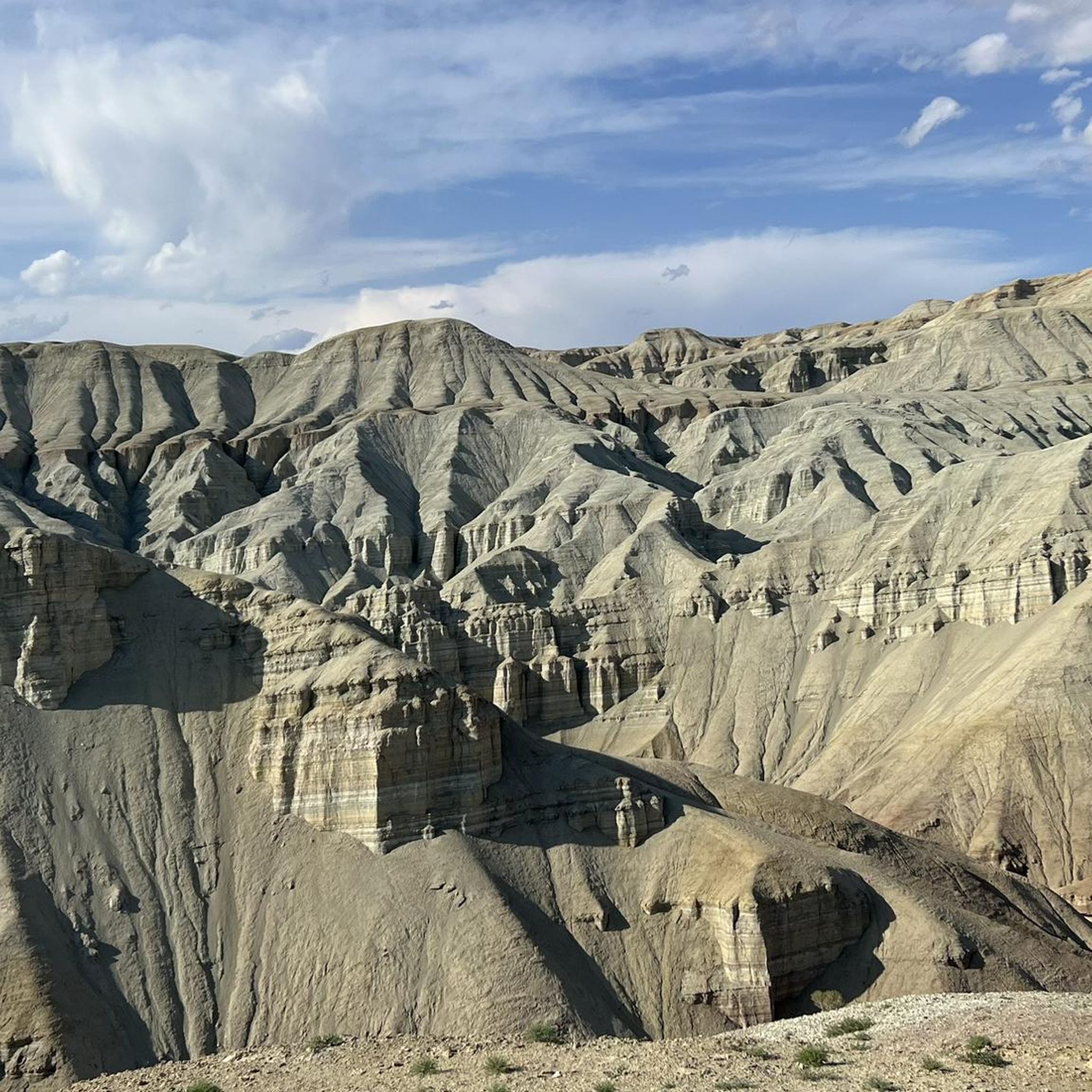
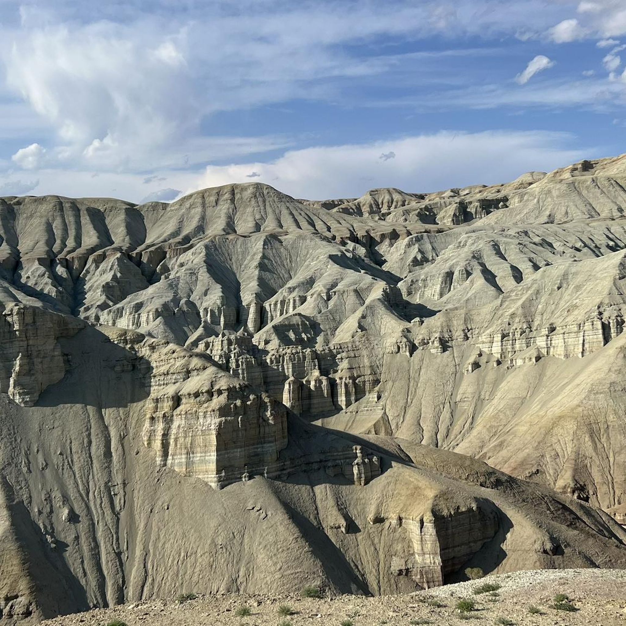
„티라미수 산”이라고 불리는 Kyzyzl Kup은 색상이 섬세하게 층을 이룹니다. 위쪽은 갈색 점토질 이암이고, 그 아래는 흰색, 회색, 흰색, 녹색, 빨간색, 녹색입니다. 전반적으로 녹색을 띱니다. 띠는 산 주위를 명확하게 구불구불 이어지며 매끄럽게 깎인 유기적인 형태를 아름답게 표시합니다. 가끔 드물게 사암 봉우리가 부드러운 형태를 뚫고 나옵니다. 씻겨 내려간 배수로가 붉은 암석 속에 있습니다. 포르피리트인가요? 토끼 한 마리가 제 앞에서 도망칩니다. 씻겨 내려간 빗물 배수로를 굴과 햇볕 가리개로 이용합니다.
0
0
Bokty 산은 평원 위에 강력한 외톨이처럼 우뚝 솟아 있으며 (그 위로 140m 이상), ESG의 탁상 산과 같습니다 (기원도 비슷합니다). 다만... 훨씬 더 아름답고, 주변과 확연히 구분되며, 더 다채롭고... 더 장관입니다. 흰색, 빨간색, 베이지색 갈색으로 층층이 쌓여 있습니다. 산 주위를 한 바퀴 돌 수 있으며, "수정 알 돌"과 "산호 식물" (회색 결정질 핵을 가진 구형 황토색 돌과 회색 돌로 된 식물, 아마도 먼지/진흙으로 덮인 것들...)을 찾을 수 있습니다. 테라스에서 잘 걸을 수 있으며, 붉은 층에 더 가까이 다가가 비현실적인 풍경을 멋지게 감상할 수 있습니다.
0
0
카팜사이 캐니언은 빛이 가득하고 더운 평원에 최소한의 그늘을 제공합니다. 그것은 밝은 백악질 흰색, 때로는 사암색으로 빛납니다. 목자들의 동굴은 사다리를 통해 접근할 수 있습니다. 습하고 푸른 구석에는 메추라기가 살고 있습니다. 벽은 조화롭고 때로는 놀랍게 형성되어 있습니다.
0
0

협곡 끝에 도착했을 때 강가에 아주 멋진 휴식 공간이 기다리고 있다는 것은 정말 멋진 놀라움입니다.
1
1
The lake lies at an altitude of approximately 1,800 meters above sea level, reaches a depth of up to 80 meters, and measures around 1,850 meters in length and 500 meters in width. It is fed by meltwater from the glaciers of the Zailiyskiy Alatau Mountains, which are part of the northern Tian Shan range.
0
0

The canyon's massive chalk cliffs reach heights of up to 70 meters in places and stretch for 2.7 kilometers, with an average width of 140 meters. The canyon is located on the Tupkaragan Plateau in Mangghistau's Silicon Valley. The slopes consist of Paleogene and Lower Neogene deposits. The Paleogene is composed of massive, chalky marls, white chalk, and limestone. The cream-colored, sometimes dazzling white, walls reach heights of several dozen meters. At the bottom of the canyon lie some very large, fallen boulders. Archaeologists suspect that a deep river once flowed at the foot of the chalk cliffs. Today, the river is gone, but rainwater has collected in its reservoir, forming a pool. Thanks to the shade and moisture, a small grove or green oasis has formed among the cliffs. The Paleogene is the oldest period of the Cenozoic Era (the modern geological era), beginning about 66 million years ago and ending with the Neogene around 23.3 million years ago. It is the period after the extinction of the dinosaurs, during which mammals established themselves as the dominant land animals and evolved rapidly. Proboscideans evolved into the largest land mammals. Initially, the continents were isolated. Around 27 million years ago, a land bridge formed between Africa and Eurasia, allowing animals to spread. This continental drift also led to the formation of the Molasse Sea in the Alpine foothills of Austria. The climate was relatively warm at the beginning of the Cretaceous period and drier towards the end. The Paleogene encompasses the Paleocene, Eocene, and Oligocene epochs. The term "Tertiary" is no longer used; instead, Paleogene and Neogene are used.
0
0
Bozzhyra is a magnificent landscape in Kazakhstan. The remote mountain range in the western part of the Ustyurts Plateau shines from white to yellow, red, and brown. It consists of limestone and chalk cliffs and is known for its unique rock formations. The name means "gray-blue land" in Kazakh. Mount Bokty is depicted on the old 1,000-tenge banknote of the National Bank of Kazakhstan. It rises amidst a white salt pan, where fossils may also be found, a remnant created by weathering and erosion. The area is remote, and infrastructure is poorly developed. It is advisable to be well prepared, with shops and gas stations nearby.
1
0
A magnificent world between the Caspian Sea coast and the Ustyurt Massif. These mountains formed on the floor of a primeval sea. Weathering and erosion contributed to the creation of this protected area, which impresses with its extraordinary beauty and colors. The mountains are composed of chalk rock and are distinguished by their striking color layers, hence the name Tiramisu Mountains. The lightest colors are found at the foot of the rocks, alternating with pink and beige.
2
0
카자흐스탄에서 가장 인기 있는 명소


찾고 계신 것을 찾지 못하셨나요?
지역별 최고의 하이라이트를 확인하여 카자흐스탄의 더 놀라운 자연 기념물을 찾아보세요:
더 살펴보기
카자흐스탄의 최고의 동굴을 찾기 위해 이 가이드를 확인해보세요:
