부탄에서 가장 멋진 10개의 천연기념물
천연기념물을 방문하여 부탄의 아름다운 풍경을 만나보세요. 부탄에 있는 10
개의 천연기념물과 상세 정보를 살펴본 후에 방문하고 싶은 천연기념물을 다음 모험 계획에 추가해보세요!
마지막 업데이트: 8월 17, 2026
타이거스 네스트 수도원 (파로 탁상)
하이라이트 • 종교적 장소
번역자 Google •
팁에 의해

모티탕 타킨 보호구역
하이라이트 • 자연 기념물
번역자 Google •
팁에 의해
이런 장소를 발견하려면 지금 가입하세요
최고의 싱글 트랙, 봉우리 및 다양한 흥미로운 야외 장소에 대한 추천을 받아보세요.
무료 회원 가입
히든 밸리(봉테 라 북동쪽, 지그메 도르지 국립공원)
하이라이트 • 전망대
번역자 Google •
팁에 의해
강카르 푸엔숨 전망
하이라이트 • 전망대
번역자 Google •
팁에 의해
조몰하리 전망이 있는 스투파
하이라이트 • 종교적 장소
번역자 Google •
팁에 의해
오늘 무료 계정으로 시작하세요
다음 모험이 기다리고 있어요.
로그인 또는 가입하기
부탄 주변 인기 장소
커뮤니티 팁

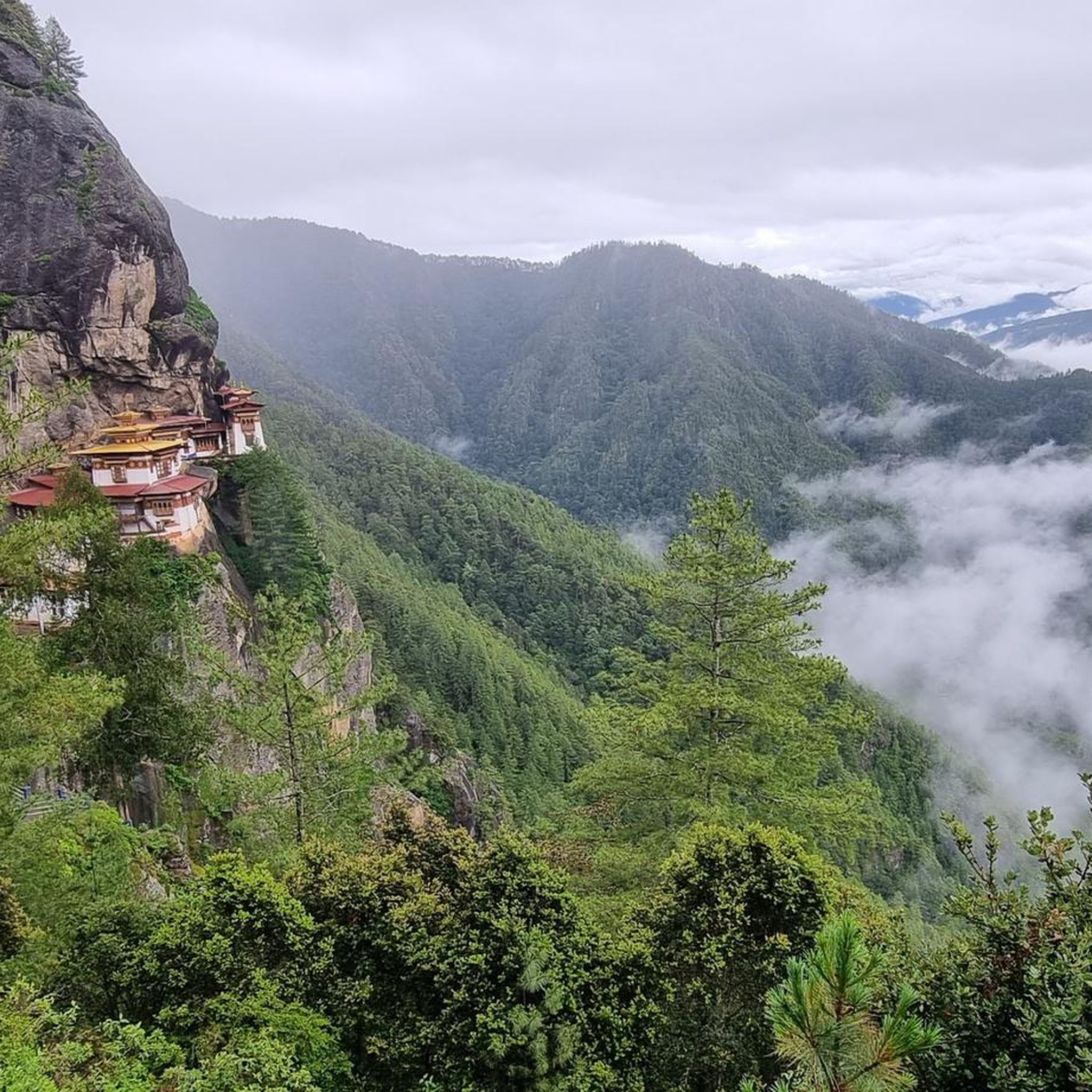
Taktshang, also spelled Taktsang or Tiger's Nest, is a Buddhist monastery in the Paro Valley in the Kingdom of Bhutan. The word Taktshang is Tibetan and literally translates to "Tiger's Den." It is located at an altitude of 3,120 meters in the Himalayas and is only accessible by a hike of several hours or by mule. The monastery complex is a frequently photographed cultural landmark of the Kingdom of Bhutan. The monastery was consecrated in 1692 and includes the Taktsang Senge Samdup Cave, where, according to legend, Guru Padmasambhava meditated for three years, three months, three weeks, three days, and three hours in the 8th century. Padmasambhava, also known as the Guru with the Eight Names and holding the honorific title Rinpoche, brought Buddhism to Bhutan. The monastery is dedicated to him. Source: https://de.wikipedia.org/wiki/Taktshang
2
0
Drukpa Kunley, a religious preacher and skilled tantric practitioner, was asked by the people of Bhutan to perform a miracle. After consuming an entire cow and a goat, he joined the goat's head to the cow's skeleton, thus creating the takin. This magical animal, called Dong Gyem Tsey (Takin), became a common sight in the hills of Bhutan and was declared the national animal due to its religious significance. Source: https://www.drukasia.com/bhutan/thimphu/takin-enclosure/
2
0
Besides Gangkhar Puensum, other Himalayan peaks are also visible depending on the weather. In my case, Masang Kang (7194m) was visible.
1
0

The absolute highlight that is visited on every trip to Bhutan. The climb is quite strenuous but very worthwhile.
1
0

The high valley northeast of the ‘Bonte La’ pass is also known as the ‘Hidden Valley’. The extensive area extends over heights between approx. 4,600 and 4,750 m and is surrounded by mountain ranges with heights of over 5,000 m. In the north lies the steep edge of the Tshophu lakes.
1
0
The two Tshophu lakes are located in a side valley at an altitude of 4,380 m. Access to the lakes is from Jangothang. Trekking groups on the Jomolhari Trek continue uphill from the lakes to the Bonte La pass (4,890 m). Groups on other treks in the region, such as the ‘Snowman Trek’, make a day trek to the Tshophu lakes to acclimatise to the altitude.
1
0
A day's stage on the Jomolhari Trek leads over the high mountain pass Bonte La with an altitude of 4,890 m. The ascent usually takes place from Jangothang (4,100 m) and goes past the Tshophu lakes (4,380 m); after crossing the pass, the hike leads south down into the valley of the 'Dhumzo Chhu' and the homestead at 'Soi Yakse' (3,820 m).
1
0
The Jichu Drake and Jomolhari glaciers at an altitude of about 4,300 m are the main sources of the Paro Chhu River in the Jigme Dorji National Park. The Paro Chhu flows southeast of the city of Paro at an altitude of about 2,300 m into the Thimphu Chhu and is called the Wong Chhu, which is also known as the Raidāk River in its lower reaches. This river is a tributary of the mighty mountain stream Brahmaputra.
1
0
부탄에서 가장 인기 있는 경로
부탄에서 가장 인기 있는 명소


더 살펴보기
부탄의 최고의 동굴을 찾기 위해 이 가이드를 확인해보세요:
