켄더처치에서 가장 멋진 5개의 천연기념물
천연기념물을 방문하여 켄더처치의 아름다운 풍경을 만나보세요. 켄더처치에 있는 5
개의 천연기념물과 상세 정보를 살펴본 후에 방문하고 싶은 천연기념물을 다음 모험 계획에 추가해보세요!
마지막 업데이트: 10월 4, 2026


이런 장소를 발견하려면 지금 가입하세요
최고의 싱글 트랙, 봉우리 및 다양한 흥미로운 야외 장소에 대한 추천을 받아보세요.
Graig Syfyrddin(Edmund's Tump) 정상
하이라이트 • 전망대
팁에 의해

Mynydd Ferddin 정상과 삼각점
하이라이트 • 정상
팁에 의해
Clehonger 폭포
하이라이트 • 자연 기념물
팁에 의해

오늘 무료 계정으로 시작하세요
다음 모험이 기다리고 있어요.

커뮤니티 팁


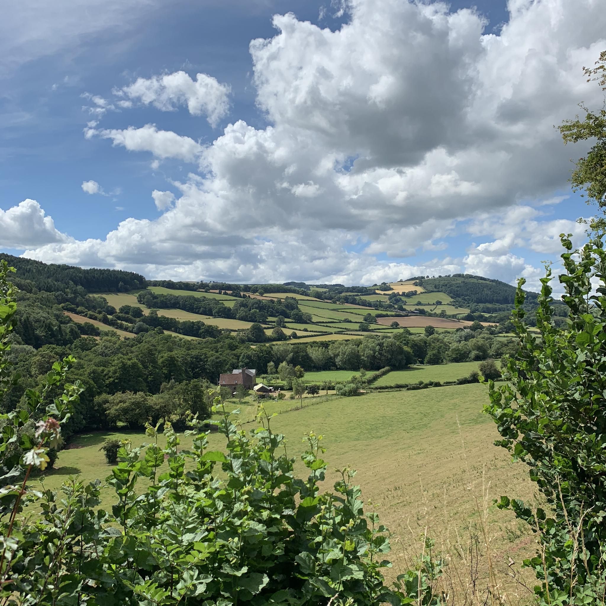
Mynydd Ferddin, at 323 metres with 120 metres of prominence, is a UK P100 (Hump) peak. There is a nice walk up to Mynydd Ferddin from Longtown Village. There are lovely views out across the Herefordshire countryside and The Black Mountains from here. It has a trig pointed summit, but this is slightly off the public footpath.
0
0
There is a small waterfall here, At its best after decent rainfall
0
0

Although you can barely walk about 2.5m above the surrounding land on this 12-century-old dike, you still get a nice picture of the area. For those walking the Beacons Way, this is a nice run-up to the hills of Brecon Beacon National Park.
1
0

Hidden a quiet part of Little Birch village, the brickwork of Higgins' Well dates from the early 19th century. Some improvements were added later, including a large pool as an animal trough for use during Victoria's diamond jubilee. Higgins Well has long been an important and unfailing supply of water for the village. A local legend about the well, as told on http://www.visitoruk.com/Hereford/little-birch-C592-V11335.html runs as follows: "The original outlet for the waters of the well was in a meadow at the top of the steep bank which rises above the present well. The owner of this meadow became so annoyed at the trespasses of the villagers across his land to the well that he had it filled up. However, shortly afterwards, while smoking his pipe in the great chimney corner of his house, he was startled by a sudden eruption of water under his feet." "To his untutored mind, the waters forcing this new outlet were a sign that the guardian spirit protecting the local people's rights was asserting itself. To appease this spirit, but determined not to reopen the well, he moved down to the present site and started to dig. In due course water began to bubble up through the underlying rock and, miraculously, the inrush in the chimney corner disappeared. The water spirit was obviously satisfied that water was once again made available to the people. This "act of contrition" resulted in local immortality for Mr Higgins."
0
0

Really cool trail, nice to look to one side and see England, and to the other and see Wales. Interesting that England is mostly farmland, whilst Wales is nice and wild.
2
0
Graig Syfyrddin or just The Graig, is a 423m high hill near Grosmont in north-eastern Monmouthshire, Wales. The summit knoll is known as Edmund's Tump. The hill consists of an isolated mass of the micaceous sandstones of the Brownstones Formation, a unit of the Old Red Sandstone well known from the nearby Black Mountains, of which it can be considered an outlier in both the geographical and geological sense
1
0

Offa's Dyke (Welsh: Clawdd Offa) is a large linear earthwork that roughly follows the current border between England and Wales. The structure is named after Offa, the Anglo-Saxon king of Mercia from AD 757 until 796, who is traditionally believed to have ordered its construction. Although its precise original purpose is debated, it delineated the border between Anglian Mercia and the Welsh kingdom of Powys. The earthwork, which was up to 65 feet (20 m) wide (including its flanking ditch) and 8 feet (2.4 m) high, traversed low ground, hills and rivers. Today it is protected as a scheduled monument. Some of its route is followed by the Offa's Dyke Path; a 176-mile (283 km) long-distance footpath that runs between Liverpool Bay in the north and the Severn Estuary in the south. Although the Dyke has conventionally been dated to the Early Middle Ages of Anglo-Saxon England, research in recent decades – using techniques such as radioactive carbon dating – has challenged the conventional historiography and theories about the earthwork, and show that it was started in the early fifth century, during the sub-Roman period.
2
0
켄더처치 주변에서 가장 인기 있는 경로
켄더처치 주변에서 가장 인기 있는 명소


더 살펴보기
켄더처치 주변의 최고의 동굴을 찾기 위해 이 가이드를 확인해보세요:
