경로플래너기능업데이트
App
로그인 또는 가입
앱 다운로드
로그인 또는 가입
경로
Places to see
Mountain passes
이탈리아
사우스 티롤

테렌텐 - 테렌토

테렌텐 - 테렌토‬에서 가장 멋진 ‪14‬개의 산길

테렌텐 - 테렌토에서 가장 멋진 산길을 아래에서 살펴보세요. 풍경을 감상하기에도 좋고, 오르막길/내리막길을 따라 걷기에도 좋은 곳이랍니다. 커뮤니티가 특별 도움을 통해 공유한 콘텐츠인 만큼 믿을 수 있는 정보이니 마음에 드는 산길이 있다면 바로 다음 모험 계획에 추가해서 바로 방문해보세요.

마지막 업데이트: 10월 15, 2026

뷔르츠요흐 고개 오르기

하이라이트 (구간) • 등반

멋지고 힘든 오르막길로, 훌륭한 계곡을 통과하고 거의 교통량이 없는 산간 계곡을 따라 이어집니다. 18%까지의 작은 경사 구간이 계속 나타나지만, 짧은 휴식 구간도 있습니다 (이 점에 대해서는 앞선 분의 의견에 반박해야 합니다).

번역문 보기

팁에 의해

라이딩 보기휴대폰으로 전송
저장

다넬샤르테 (2,437m)

하이라이트 • 산악 고개

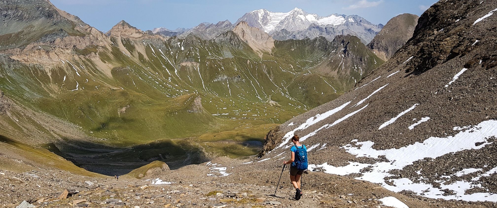
Scharte am Pfunderer Höhenweg. Not as demanding as the neighboring, rocky Gaisscharte. However, in the rise from both sides again and again very steep, rocky grass backs that require head …

번역자 Google •

팁에 의해

저장

이런 장소를 발견하려면 지금 가입하세요

최고의 싱글 트랙, 봉우리 및 다양한 흥미로운 야외 장소에 대한 추천을 받아보세요.

무료 회원 가입

뮐발더 요클 (2,342m)

하이라이트 • 산악 고개

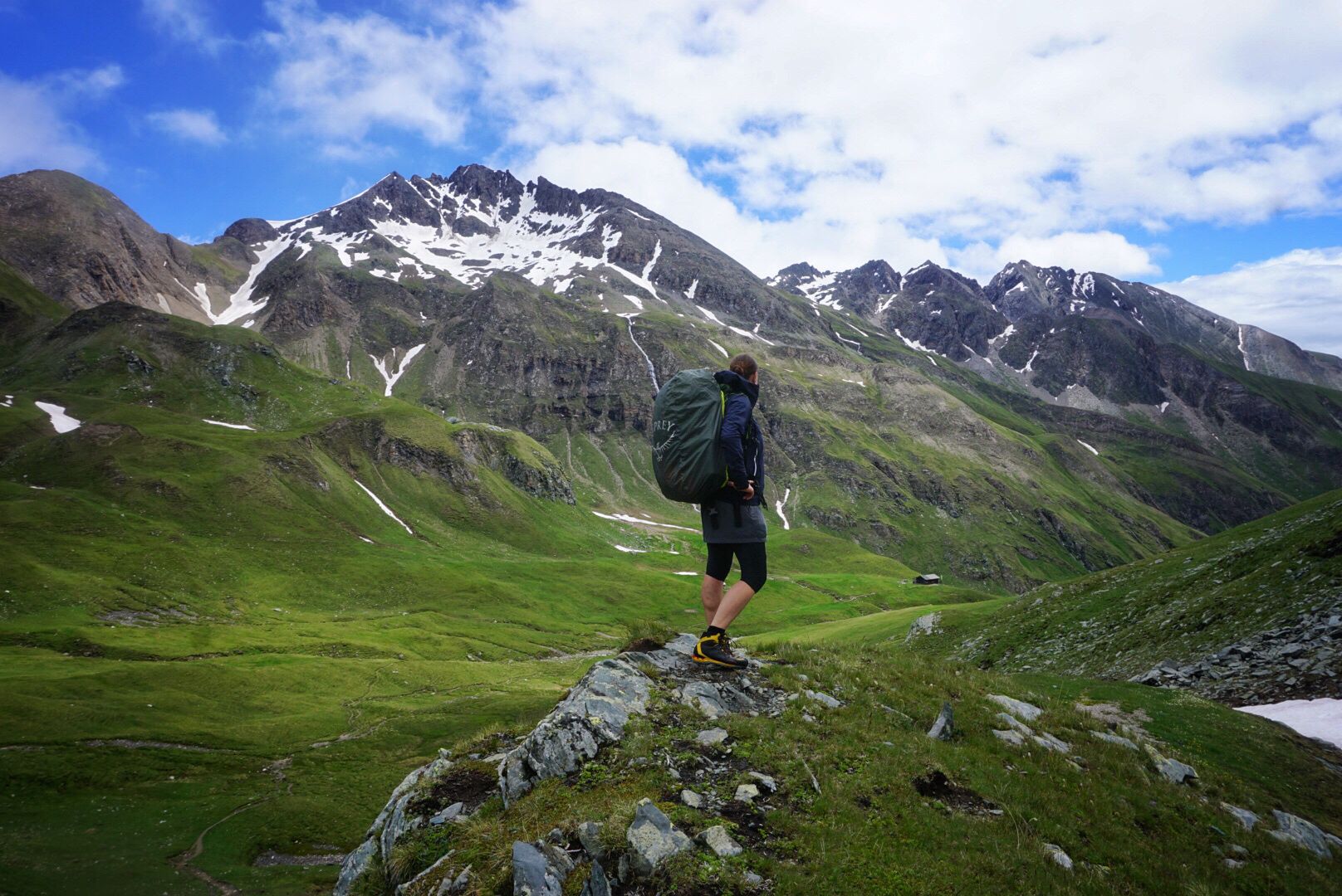
An indescribable view awaits you here. This trail leads just below the summit of the Speikboden. Here you can enjoy a mountain panorama as it is in the book.

번역자 Google •

팁에 의해

저장

호흐제 샤르테 등반 구간

하이라이트 • 등반

You come from the Gampis Alm, definitely recommended, elderberry juice, past two picturesque lakes. Before going into a block field, be sure to pay attention to the path markings. You're …

번역자 Google •

팁에 의해

저장

호에 자게 고개

하이라이트 • 산악 고개

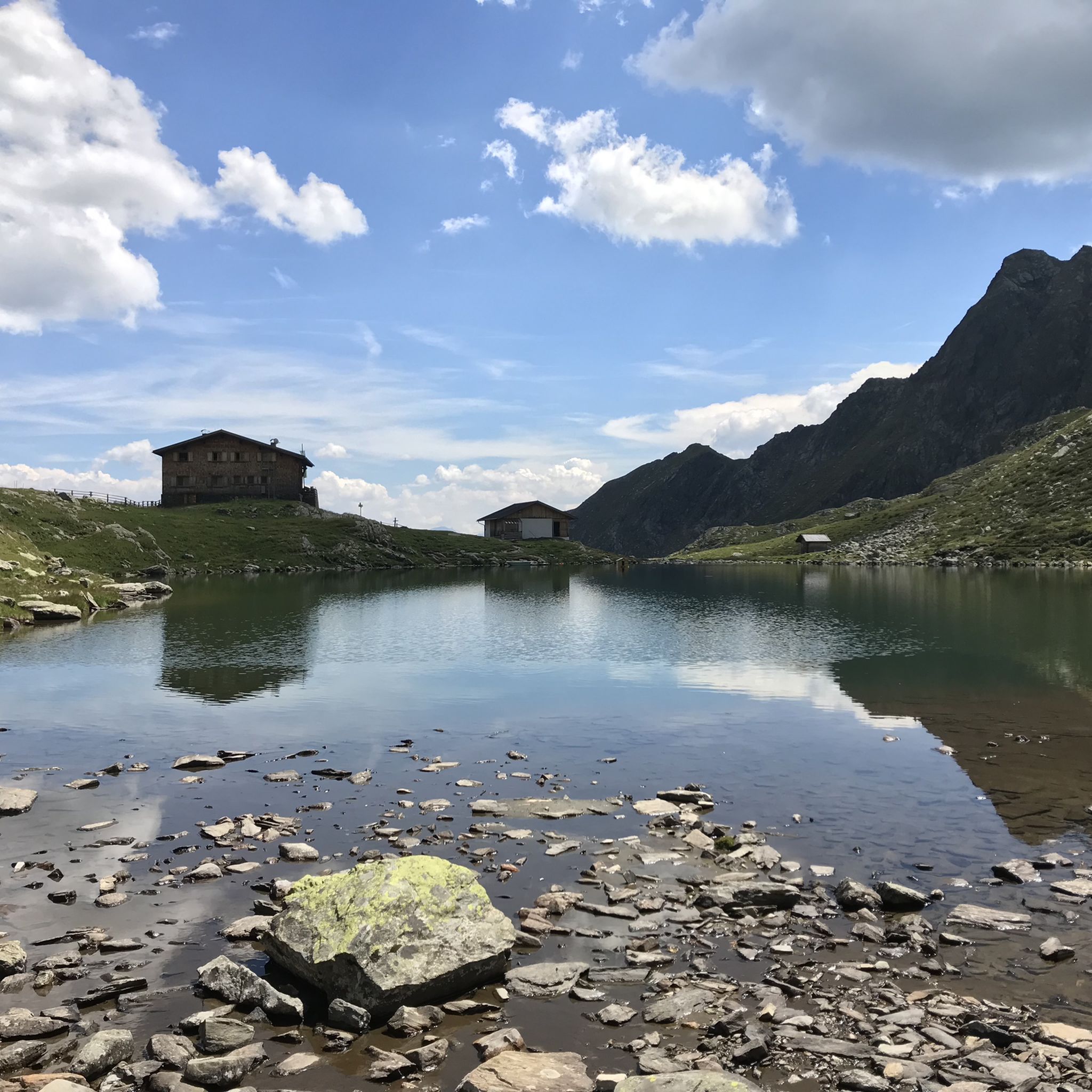
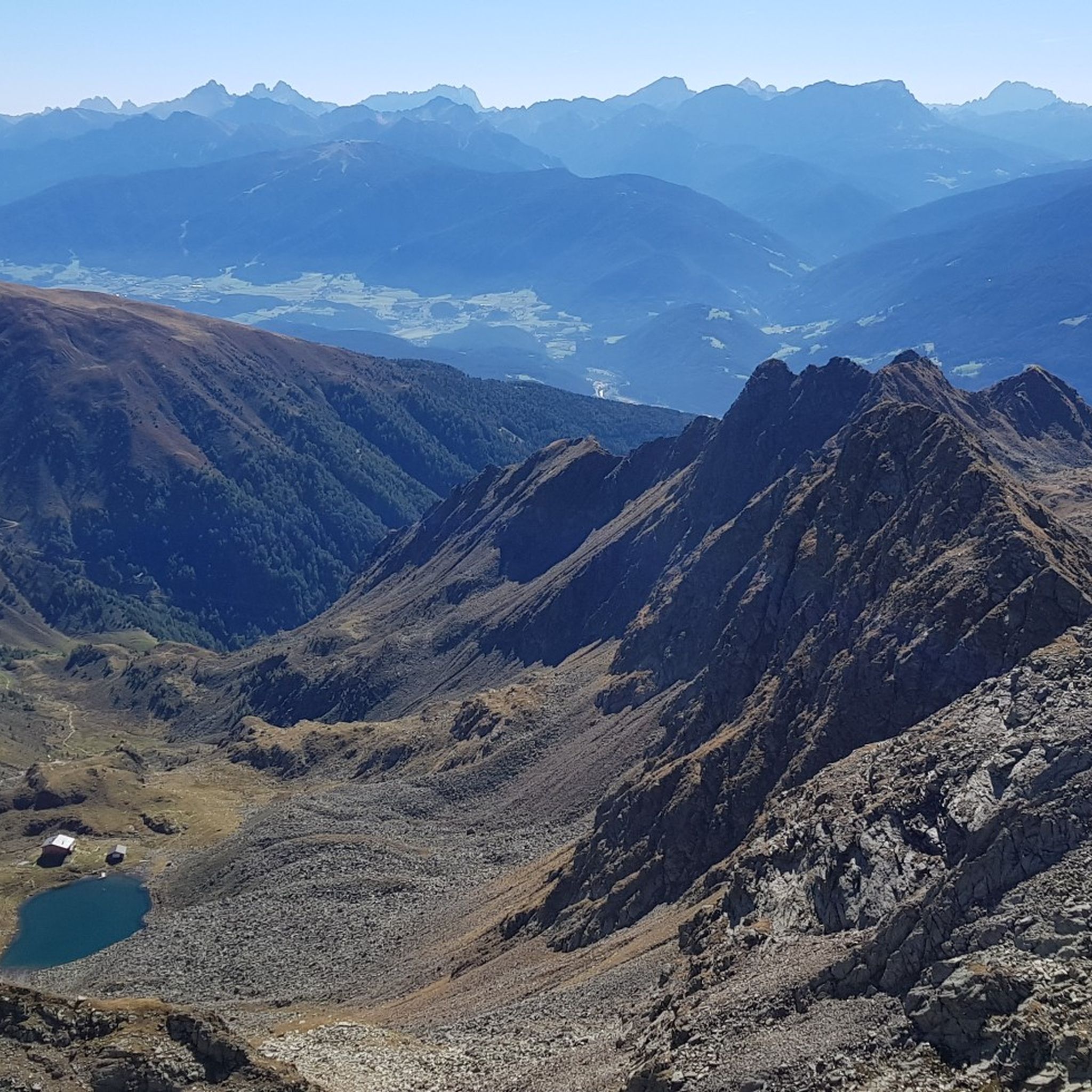
Here you have to gather your strength one last time and climb up the ridge to enjoy the magnificent view of the Tiefrastenhütte and the lake at 2,642 meters above …

번역자 Google •

팁에 의해

저장

무료로 가입하여 테렌텐 - 테렌토 주변의 더 많은 산악 고개를 발견하세요.

무료 회원 가입

이미 komoot 계정이 있나요?

오늘 무료 계정으로 시작하세요

다음 모험이 기다리고 있어요.

로그인 또는 가입하기

테렌텐 - 테렌토 주변 인기 장소

ALPINE. SOLITARY. BREATHTAKING. The Pfunderer High Route

남타이롤의 Pfunderer Mountain Trail - 고고산 하이킹

테렌텐 - 테렌토 하이킹

테렌텐 - 테렌토 사이클링

테렌텐 - 테렌토 로드 사이클링 경로

테렌텐 - 테렌토 MTB 트레일

테렌텐 - 테렌토 주변 그래블 라이딩

테렌텐 - 테렌토 등산

테렌텐 - 테렌토 러닝 트레일

테렌텐 - 테렌토 주변의 다른 모험

ALPINE. SOLITARY. BREATHTAKING. The Pfunderer High Route

하이킹 컬렉션 에 의해

komoot

커뮤니티 팁

Markus
8월 12, 2025, Climb to Würzjoch Pass via Lüsen

If you're only planning a one-day hike to the Würzjoch, I recommend the western approach from Brixen, St. Andrä. The approach from Lüsen is definitely worth the extra climb as an alternative. The gradient is undoubtedly very steep for much of the way, but I didn't see the 18-19% mentioned here, at least not on my Wahoo today. The biggest challenge lies in the first half, which is always an advantage in my opinion. The road surface varies greatly from "good" to "disastrous." Traffic was light, so you're mostly alone. (August, peak season) And I don't want to offend anyone, but due to a lack of transportation while on vacation, I (46 years old, averagely "talented" at best) rode up on a rental road bike (11-32 cassette) from the local bike shop (10 kg) without having to dismount. Go for it!!

번역: Google•

0

1

멋지고 힘든 오르막길로, 훌륭한 계곡을 통과하고 거의 교통량이 없는 산간 계곡을 따라 이어집니다. 18%까지의 작은 경사 구간이 계속 나타나지만, 짧은 휴식 구간도 있습니다 (이 점에 대해서는 앞선 분의 의견에 반박해야 합니다). 도로 표면에 관해서는, 이 구간을 오르막길로만 추천할 수 있습니다. 표면 상태는 보통이며, 건조한 날씨에도 작은 물줄기 때문에 많은 곳이 젖어 있습니다. 이는 산간 계곡을 가로지르는 나무 다리와 함께 빠른 내리막길의 즐거움을 감소시킵니다. 하지만 오르막길로는 이 구간을 항상 선호할 것입니다. @Wolfi 인용: “보상 – 거의 교통량이 없고 매우 아름다운 전망.”

번역: Google•

3

0

Fantastically beautiful place to rest with a great view 😎🤩

번역: Google•

4

0

In Jöchle you also have a great view and at the cross there is also a bench to rest on 👍, be careful ⚠️ there is a risk of not wanting to go any further 😜🤣😂 !!!

번역: Google•

5

0

As a racing bike rider (from Lüsen to the merger with Würzjochstraße) I would avoid going in both directions from this section. Even very well trained people have to relegate. No fun going down either.

번역: Google•

0

7

I never had to step off my bike on a climb before. Now I did multiple times. This is the hardest thing I ever did. This climb gives you no opportunity to recover. It's steep from the start in Lüssen. After that you get a short flat segment and a slight descent, but when the real climb begins it doesn't stop. Don't expect it getting any easier after the parts where you need to stand up on your pedals to stay upright. The last bit of the climb is beautiful. I cried. But mainly because it was over. I recommend this climb for the super fit, people with a 34 cassette or more. Or people who want to hurt themselves. If I ever cycle it again, it will be down.

1

7

You come from the Gampis Alm, definitely recommended, elderberry juice, past two picturesque lakes. Before going into a block field, be sure to pay attention to the path markings. You're standing in front of the massif and don't know where to go up to the Hohe Saw, so pay attention to the markings! It was very easy, with the help of the hands, the high saw gap was reached. Descent via stairs to the Tiefrasten hut.

번역: Google•

2

0

On the Pfunderer Höhenweg the Dannelscharte marks the last high point in front of the Brenninger bivouac and offers great views to the top of the Wurmaul.

번역: Google•

2

0

테렌텐 - 테렌토 주변에서 가장 인기 있는 경로

테렌텐 - 테렌토 하이킹

테렌텐 - 테렌토 주변에서 가장 인기 있는 명소

Places to see

Store rating

komoot 모바일 앱으로 영감을 받아보세요

무료 komoot 계정로 끝없는 야외 모험을 손쉽게 찾고, 맞춤 설정하며 길안내할 수 있어요.

또는

지금 komoot에 가입하세요
Store rating

더 살펴보기

이 가이드를 통해 더 많은 장대한 산악 통과를 확인해보세요 테렌텐 - 테렌토 주변:

바디아 - 압테이산타 크리스티나 게르데이나 - 그뢰덴의 성 크리스티나 - 산타 크리스티나 발가르데나셀바 - 볼켄슈타인 - 셀바 디 발 가르데나Badia의 Corvara - Corvara시아스텔 - 카스텔루스 - 카스텔로토Urtijëi - Gröden의 St. Ulrich - OrtiseiSan Martin De Tor - Badia의 San Martino - Thurn의 St. Martin빌뇌스 - 푸네스마레오 - 에네베르그 - 마레베계층 - 타이어푸에즈-가이슬러 자연 공원Karneid - Cornedo All'Isarco웰슈노펜 - 노바 레반테피취 - 발 디 비제나투르파크 푸에즈-가이슬러 - Parco Naturale Puez-Odle도이치노펜 - 노바 포넨테라 발 - 벵엔 - 라 발레라젠 - 라이온Vintl - Vandoies뮐발트 - 셀바 데이 몰리니Völs Am Schlern - 피에 알로 실리아르브릭센 - 브레사논브레너 - 브레네로루젠 - 루손섹스텐 - 세스토이니첸 - 산 칸디도리피안 - 리피아노무스 인 파시에 - 모스 인 파시리아알데인 - 알디노Passeier의 St. Martin - Passiria의 San MartinoRatschings - 라신Passeier의 St. Leonhard - Passiria의 San Leonardo스틸프스 - 스텔비오프라이엔펠트 - 캄포 디 트렌스스터징 - 비피테노토블라흐 - 도비아코티롤 - 티롤뮐바흐 - 리오 디 푸스테리아쿤스 - 케인스메란 - 메라노Eppan An Der Weinstraße - Appiano Sulla Strada Del Vino스케나 - 시나리오라나세인트 로렌젠 - 산 로렌조 디 세바토클라우젠 - 치우사알군드 - 라군도Taufers Im Münstertal - Tubre말스 - 말레스 베노스타슈날스 - 세날레스그란 - 큐론 베노스타네이턴스 - 네이턴스Unsere Liebe Frau Im Walde-St. 펠릭스 - 세날레-산 펠리체말링 - 말렝고프랙스 - 브레이스텍셀그루페 자연공원자연 공원 Texelgruppe - Parco naturale Gruppo di Tessa보젠아우어 - 오라테를란 - 테를라노안드리안 - 안드리아노프라드 암 스틸프서 요흐 - 프라토 알로 스텔비오칼테른 안 데어 바인슈트라세 - 칼다로 술라 스트라다 델 비노라이베스 - 라이퍼스아른탈 - 발레 아우리나묠텐 - 멜티나바데나 - 파텐사른탈 - 사렌티노프레타우 - 프레도이브론졸로 - 브란졸Truden Im Naturpark - Trodena Nel Parco Naturale샌드 인 타우퍼스 - 캄포 투레스프란젠스페스테 - 포르테차Rasen-Antholz - Rasun-Anterselva울텐 - 울티모펠트투른스 - 벨투르노하플링 - 아벨렌고Welsberg-Taisten - Monguelfo-TesidoGsies - 발레 디 케이시스Tramin An Der Weinstraße - 테르메노 술라 스트라다 델 비노쿠르타치 안 데어 바인슈트라세 - 코르타치아 술라 스트라다 델 비노Partschins - 파신니더도르프 - 빌라바사예네시엔 - 산 제네시오 아테시노몬탄 - 몬타냐마르텔 - 마르텔로날스 - 날레스체름스 - 체르메스라스 - 라사반 - 바르나Burgstall - 우편Tisens - 테시모뵈란 - 베라노가가존 - 가가존로데넥 - 로덴고Parco naturale dello 실리아 - 카티나치오올랑 - 발다오라쓰리 픽스 자연 공원빌란더스 - 빌란드로Fanes-Sennes-Prags 자연 공원Naturpark Fanes-Sennes-Prags - Parco Naturale Fanes-Sennes-Braies브루넥 - 브루니코리튼 - 레논페르카 - 페르카Naturpark Rieserferner-Ahrn - Parco Naturale Vedrette Di Ries-Aurina안테리보 - 알트레이슐란더스 - 실란드로텍셀그룹세인트 판크라즈 - 산 판크라치오세인트 판크라즈키엔스 - 키엔스글룬스 - 글로렌자노이마르크트 - 에그나슐루데른스 - 슬루데르노로랭 - 로레뇨웨이드브루크 - 폰테 가르데나가이스증명하다 - 증명하다팔젠 - 팔즈바비안 - 바비아노플라우스나츠 샤브 - 나즈 샤브Parco naturale Vedrette di Ries - Aurina살로르노 - 살룬래치 - 끈마그레 술라 스트라다 델 비노Kurtinig An Der Weinstraße - 코르티나 술라 스트라다 델 비노카스텔벨-차르스 - 카스텔벨로-시아르데스몽티글러 발트 - 보스코 디 몬티콜로

근처 어드벤처 가이드

키엔스 - 키엔스 즐길거리

background

새로운 정복을 위한 준비를 하세요

무료로 가입하기
탐험하기
경로경로 플래너기능바우처 사용하이킹MTB 트레일로드 사이클링 경로바이크패킹사이트맵
앱 다운로드
소셜 미디어에서 팔로우하기

© komoot GmbH

개인 정보 보호 정책