경로

플래너

기능

업데이트

App

로그인 또는 가입

앱 다운로드

로그인 또는 가입

로그인 또는 가입

경로
Places to see
Natural Monuments
이탈리아
롬바르디아
베르가모

란자니코

란자니코‬에서 가장 멋진 ‪20‬개의 천연기념물


천연기념물을 방문하여 란자니코의 아름다운 풍경을 만나보세요. 란자니코에 있는 20
개의 천연기념물과 상세 정보를 살펴본 후에 방문하고 싶은 천연기념물을 다음 모험 계획에 추가해보세요!

마지막 업데이트: 5월 16, 2026

피초 포르미코 정상

하이라이트 • 정상

Pizzo Formico dominates the Farno basin, above Gandino on the south side and the Clusone plateau on the north side. Very popular in winter by cross-country skiers, it offers, from …

번역자 Google •

에 의해

하이킹 보기

휴대폰으로 전송

저장

미스마산 정상

하이라이트 • 정상

A myth for every Bergamo man and famous as a boy because despite its name and height, it was considered the highest hill in the Bergamo area.

번역자 Google •

에 의해

저장

이런 장소를 발견하려면 지금 가입하세요

최고의 싱글 트랙, 봉우리 및 다양한 흥미로운 야외 장소에 대한 추천을 받아보세요.

무료 회원 가입

보그 만

하이라이트 • 해변

Great view of the steep cliffs.

번역자 Google •

에 의해

저장

목동의 십자가

하이라이트 • 기념물

Panoramic point at an altitude of 1250m, a few tens of meters from the “Dante Baroncelli” bivouac. Beautiful view over the towns of Val Gandino

번역자 Google •

에 의해

저장

포차 데이 세테 테르미니

하이라이트 • 호수

At the pool there is a monument in memory of General Raffaele Cadorna. The plaque commemorates the parachute landing carried out in August 1944 by the general, known to his men by the battle name of "Valenti".

ecodibergamo.it/stories/eppen/outdoor/lungo-lantica-via-della-lana-fino-alla-cima-del-monte-sparavera_1422748_11

번역자 Google •

에 의해

저장

무료로 가입하여 란자니코 주변의 더 많은 자연 기념물을 발견하세요.

무료 회원 가입

이미 komoot 계정이 있나요?

오늘 무료 계정으로 시작하세요

다음 모험이 기다리고 있어요.
로그인 또는 가입하기

란자니코 주변 인기 장소

란자니코 로드 사이클링 경로

란자니코 사이클링

란자니코 하이킹

란자니코 MTB 트레일

란자니코 러닝 트레일

란자니코 주변 그래블 라이딩

커뮤니티 팁

Davide
9월 7, 2025, Pozza dei Sette Termini

from here you enter the pasture on the obvious ramp to climb to the top of the sparavera

번역: Google

0

0

The pyramid located near the Cross serves as a shelter for food and necessities (privately owned)

번역: Google

1

0

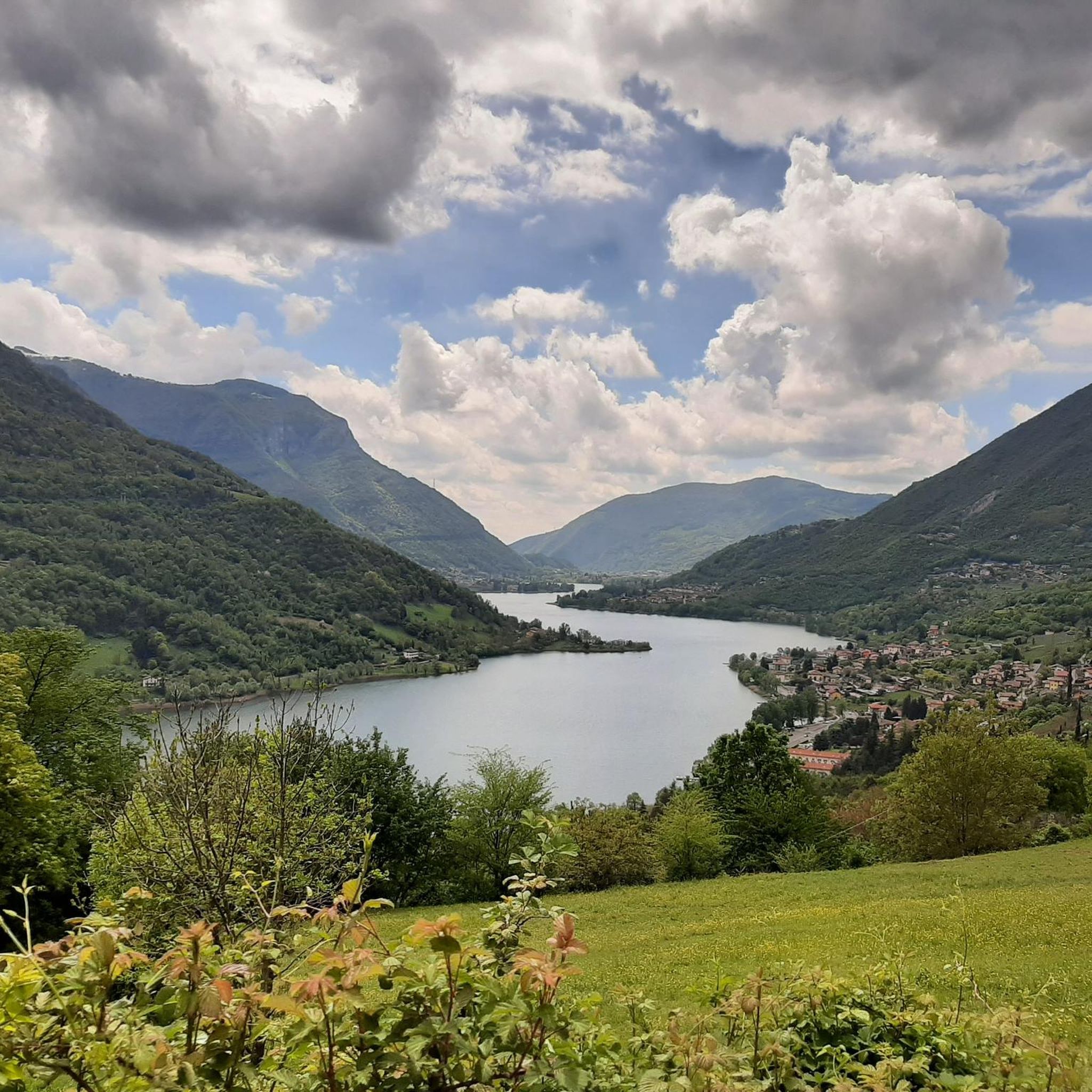
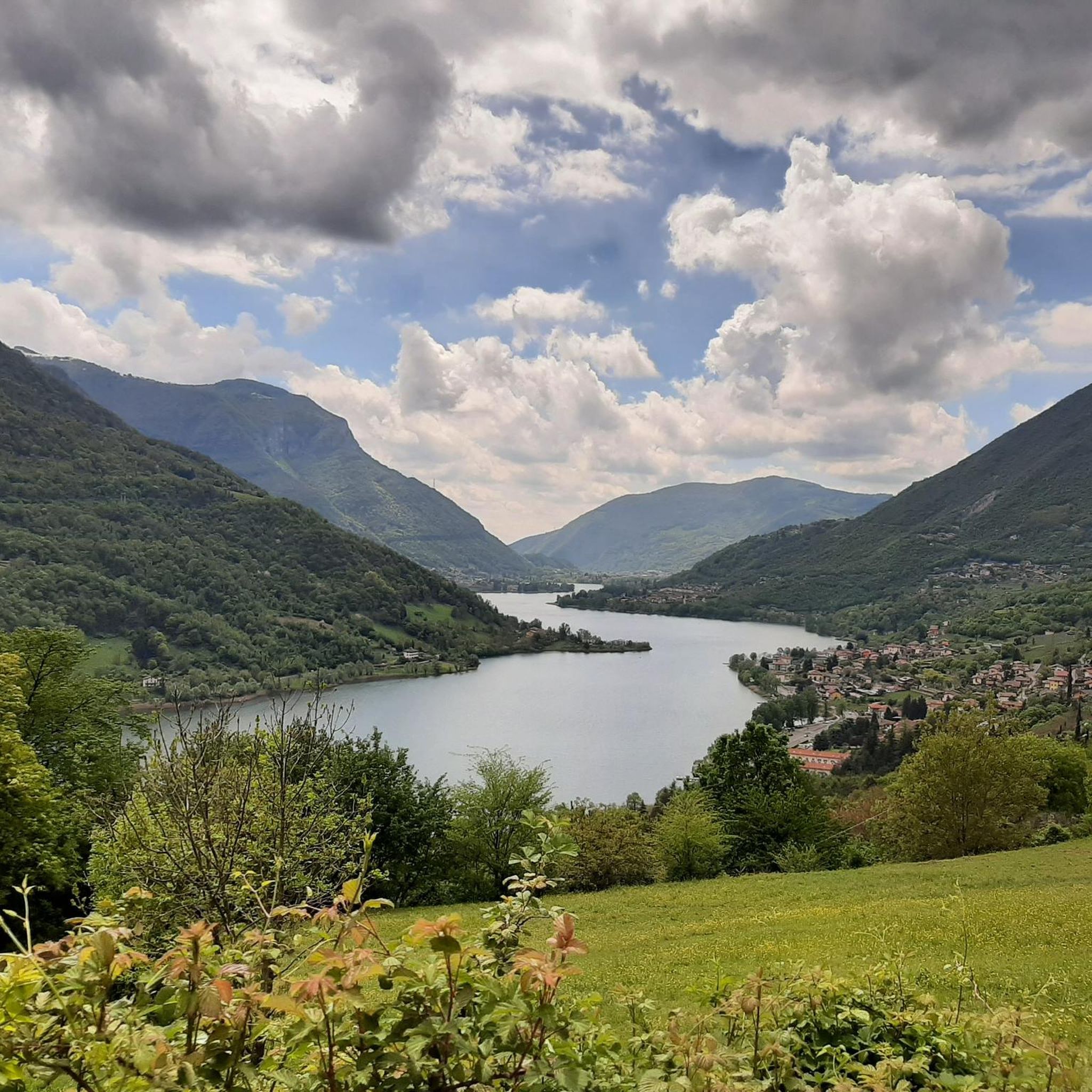
panoramic view of the Gandino valley.

번역: Google

0

0

Luca
5월 25, 2025, Croce dei Pastori

Very panoramic position, with a view over the entire Val Gandino.

번역: Google

0

0

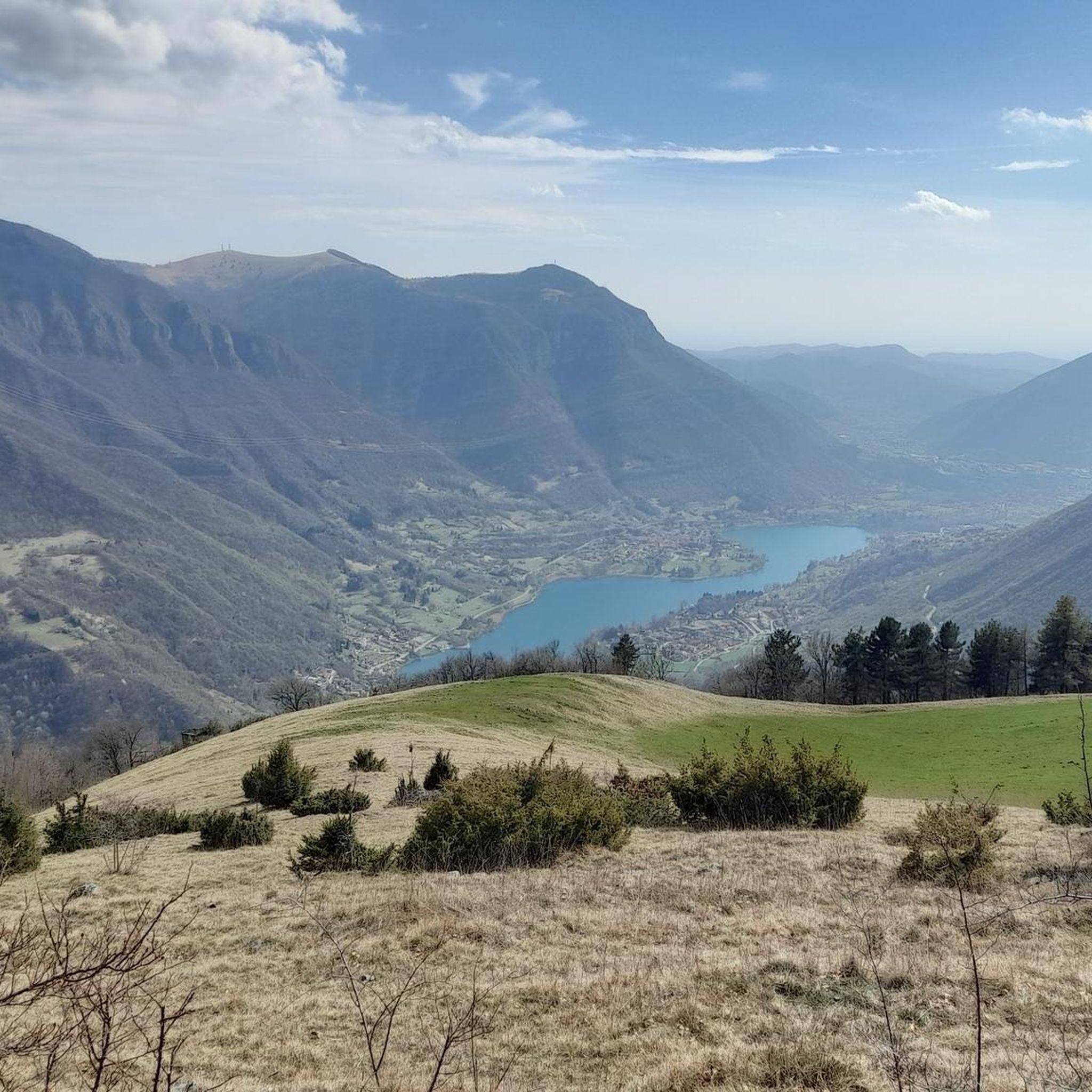
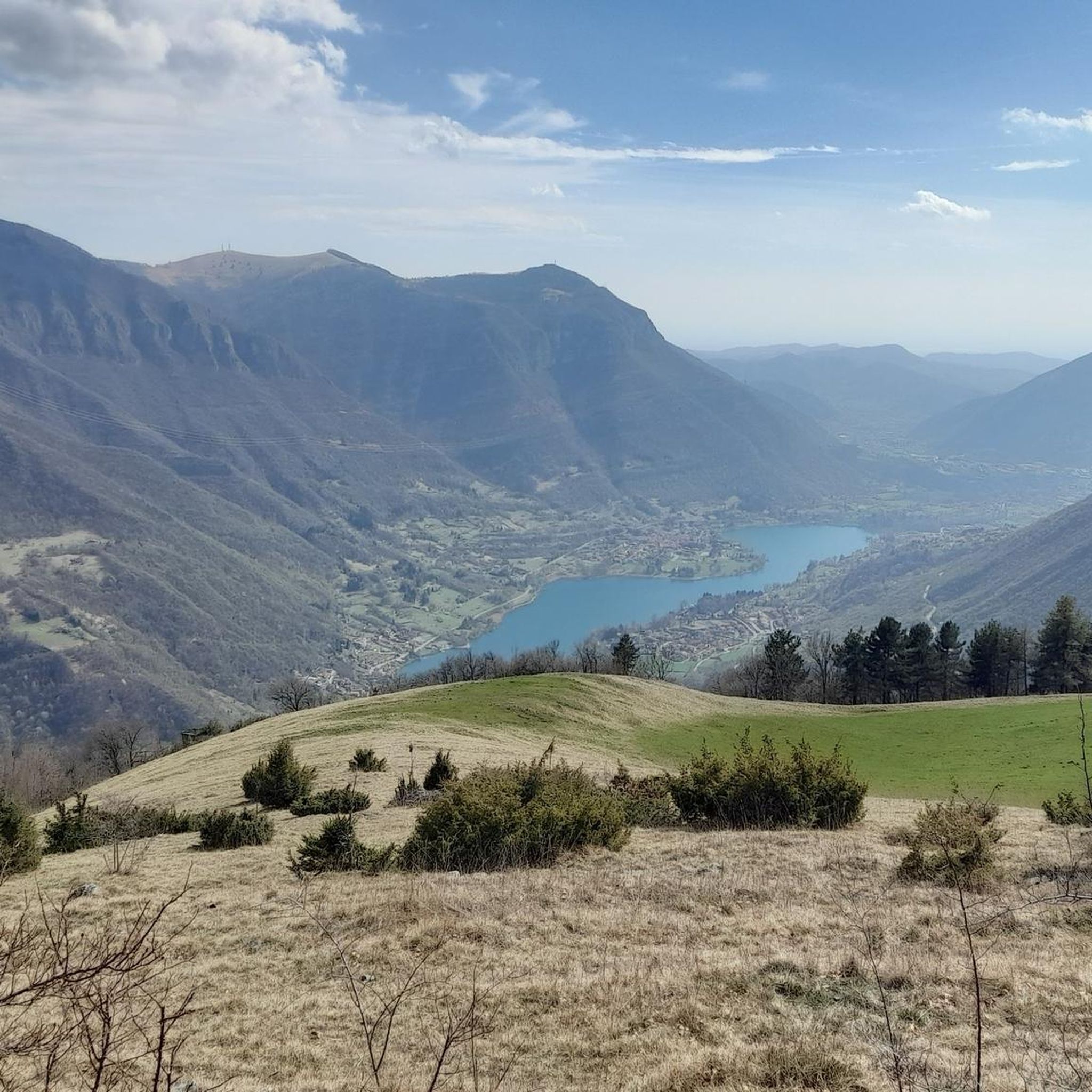
From Pizzo Formico (1636 m) you can enjoy a spectacular view of the Bergamo Prealps, the Seriana Valley, the Gandino Valley and, on clear days, even Monviso. What you can see from the summit: Val Seriana and the Clusone plateau. Val Gandino, with its historic villages. Presolana, the "Queen of the Orobie". Lake Iseo, visible on clear days. Adamello Group, the Bergamo and Lecco Orobie. Po Valley, with glimpses of the Apennines. The summit cross, 12 meters high, is a point of reference for hikers and is illuminated on special occasions

번역: Google

1

0

The Croce dei Pastori is a panoramic point located at 1250 meters above sea level in the Gandino Valley, near the Dante Baroncelli Bivouac. It is a large wooden cross, positioned on the edge of a slope, with a spectacular view of the valley2. Main features: Altitude: 1250 m. Location: Along the path that leads to the Conca del Farno. History: The original cross was placed in 1716 and subsequently replaced in 2002. Panorama: Direct view of the Gandino Valley and the surrounding mountains. Access: Reachable with an excursion from Barzizza di Gandino, passing through the Tribulina della Guazza. The Croce dei Pastori is a perfect place for a break during an excursion, with benches and tables for refreshments. If you wait for sunset, you can enjoy a unique spectacle with the lights of the villages in the valley that slowly light up

번역: Google

0

0

The Dante Baroncelli Bivouac is located at 1257 meters above sea level in the Groaro Valley, near the Tribulina della Guazza and the Croce dei Pastori, from which you can enjoy a spectacular view of the Gandino Valley. Main features: Altitude: 1257 m Location: Groaro Valley, near the Tribulina della Guazza Access: Reachable via the CAI 545 path Structure: Small but welcoming, with well-kept interiors Recommended route: Departure from the Conca del Farno, following the CAI 545 path The bivouac is an excellent stopping point for hikers heading to Pizzo Formico or the Rifugio Parafulmine

번역: Google

0

0

The Pozza dei Sette Termini is a hiking point of interest located at 1309 meters above sea level in Val Gandino, in the province of Bergamo. It can be reached via the CAI 544B trail, which starts from the Church of Santa Maria degli Angeli in Valpiana. Characteristics of the Pozza dei Sette Termini: Altitude: 1309 m Route: CAI 544B trail Difficulty: Hiking (E) Travel time: About 50 minutes there and 35 minutes back History: Near the pool there is a monument in memory of General Raffaele Cadorna, who made a parachute landing in this area in 1944 Panorama: View of Mount Barzena and the possibility of continuing towards Mount Sparavera The pool is surrounded by a fence and is located along a path that connects Malga Lunga and Monticelli. It is an ideal place for a break during an excursion in the area.

번역: Google

1

0

란자니코 주변에서 가장 인기 있는 경로

란자니코 로드 사이클링 경로

란자니코 주변에서 가장 인기 있는 명소

Places to see

Store rating

komoot 모바일 앱으로 영감을 받아보세요

무료 komoot 계정로 끝없는 야외 모험을 손쉽게 찾고, 맞춤 설정하며 길안내할 수 있어요.

또는

지금 komoot에 가입하세요

Store rating

더 살펴보기

란자니코 주변의 최고의 동굴을 찾기 위해 이 가이드를 확인해보세요:

아르데시오간델리노그로모발고글리오론코벨로브랜지올트레센다 알타이솔라 디 폰드라프레몰로발본디온오네타파레레나카로나올트레 일 콜레고르노세리나밸브포폴로솔토 콜리나모이오 데 칼비광장가자니가빌라 도냐발 브렘빌라콜자트발토르타도세나베르토바브루마노간디노산 조반니 비앙코로베타쉴파리오카스니고코스타 세리나코르날바리바 디 솔토아존조그노알구아산 펠레그리노 테르메피아졸로탈레지오베데세타아비아티코알비노빌미노어 디 스캘브가혹한브렘바나 광장클루손발네그라넴브로피아노폰테노유비알레 클라네조셀비노브라카콜레레로타 디마냐블렐로폰테 노사피오라노 알 세리오씨네산토모보노 테르메메졸도오르니카산타 브리지다쿠시오카실리오푸이피아노 발레 이마냐엔딘 가이아노올모 알 브렘보카스티오네 델라 프레솔라나폰테라니카알자노 롬바르도보시코세레테송가바초피노 델 몬테타베르놀라 베르가마스카세드리나아베라라파르자니카코르나 이마그나로케텔로베르베노연인프라달룽가스칸조로시아네이트카프리노 베르가마스코코스타 볼피노소리솔카스트로카메라타 코넬로코스타 발레 이마냐피아리오토레 볼돈오노레카자노 산안드레아빌라 디 세리오베둘리타론콜라라니카로고세네이트 소프라치사노 베르가마스코레프빌라 달메카피존고를알메카사짜알메노 산 살바토레비앙자노가베리나 테르메스트로차프리도어페이아비골로팔라자고아드라라 산 로코카르비코세나테 소토알메노 산 바르톨로메오빌라 다다모나스테롤로 델 카스텔로소토 일 몬테 조반니 Xxiii폰티다스피논 알 라고토레 드 로베리팔라디나아드라라 산 마르티노페드렝고직렬포레스토 스파르소바르자나트레스코어 발네아리오칼루스코 다다빌롱고보르고 디 테르조루자나알바노 산알레산드로사르니코비아다니카발브렘보크레다로그론암비베르브렘바테 디 소프라모조마펠로비가노 산 마르티노산 파올로 다르곤폰테 산 피에트로베르조 산 페르모솔자브루사포르토보나테 소프라메돌라고테르노 디솔라오리오 알 세리오잔도비오수이시오프레세조쿠르노치뇰로 디솔라엔트라티코트레비올로스테차노보타누코보나테 소토자니카필라고코문 누오보달민고르라고포냐노우르그나노트레빌리오베르델리노베르델로오시오 소프라스피라노카라바조카프리아테 산 게르바시오브렘바테브리냐노 게라 다다마돈아자노 산 파올로부상간도소오시오 소토시세라노카노니카 다다그라소비오파라 게라 다다폰티롤로 누오보아르센루라노카스텔 로조네볼티에르포르노보 산 조반니칼벤자노랄리오카로비오 델리 안젤리파가자노콜로뇨 알 세리오바그나티카미사노 디 게라 다다카스텔리 칼레피오몬텔로모짜니카바리아노모렝고아르자고 다다카시라테 다다코스타 디 메자트이소바르바타기살바파라 올리바나 콘 솔라마르티넨고로마노 디 롬바르디아그루멜로 델 몬테치우두노Pià콜리 디 베르가모델라다 노르드 자연공원반대하다폰타넬라카베르나고

근처 어드벤처 가이드

엔딘 호수 즐길거리

background

새로운 정복을 위한 준비를 하세요

무료로 가입하기

탐험하기
경로경로 플래너기능하이킹MTB 트레일로드 사이클링 경로바이크패킹사이트맵
앱 다운로드
소셜 미디어에서 팔로우하기

© komoot GmbH

개인 정보 보호 정책