경로

플래너

기능

업데이트

App

로그인 또는 가입

앱 다운로드

로그인 또는 가입

경로
Places to see
독일
헤세
메인-킨지그-크라이스

린젠게리히트

20의 린젠게리히트가지 명소 & 주요 장소


린젠게리히트에는 둘러볼 만한 장소가 많답니다. 하이킹 또는 사이클링을 좋아한다면 린젠게리히트에 숨겨진 20
가지 보석을 만날 수 있을 거예요. 이 지역의 주요 명소를 살펴보면서 다음 모험을 계획해보세요.

마지막 업데이트: 7월 6, 2026

루트비히탑 (하넨캄)

하이라이트 • 전망대

So far, the tower was always open. Should he ever be closed - the key is in the mountain inn.

번역자 Google •

에 의해

하이킹 보기

휴대폰으로 전송

저장

미헬바흐 근처 카흘탈 자전거길

하이라이트 • 자전거 도로

You shouldn't miss the Kahltal cycle path. Very nicely laid out and numerous places to stop and rest.

번역자 Google •

에 의해

저장

이런 장소를 발견하려면 지금 가입하세요

최고의 싱글 트랙, 봉우리 및 다양한 흥미로운 야외 장소에 대한 추천을 받아보세요.

무료 회원 가입

바트 오브의 그라디어베르크

하이라이트 • 기념물

A graduation mill is a plant for salt production. This brine is passed through brushwood. The water evaporates and the salt content rises.

Above all, these old graduation towers are …

번역자 Google •

에 의해

저장

킨치그 범람원

하이라이트 • 강

If it weren't for the A66 ...

번역자 Google •

에 의해

저장

킨치그제와 룰제

하이라이트 • 호수

There is a path between the two lakes, so you can walk around each lake individually if you want. While you can observe many water birds in the bird sanctuary …

번역자 Google •

에 의해

저장

무료로 가입하여 린젠게리히트 주변의 더 많은 명소를 발견하세요.

무료 회원 가입

이미 komoot 계정이 있나요?

오늘 무료 계정으로 시작하세요

다음 모험이 기다리고 있어요.
로그인 또는 가입하기

린젠게리히트 주변 인기 장소

Endless forests, flowing trails – MTB in Germany’s Spessart region

Mountain biking in the Spessart – Awesome trails in Germany

Mountain biking in the Spessart – Awesome trails in Germany

린젠게리히트 하이킹

린젠게리히트 로드 사이클링 경로

린젠게리히트 러닝 트레일

린젠게리히트 사이클링

린젠게리히트 MTB 트레일

린젠게리히트 주변 그래블 라이딩

린젠게리히트 주변의 다른 모험

Endless forests, flowing trails – MTB in Germany’s Spessart region

산악자전거 라이딩 컬렉션 에 의해

visitspessart

커뮤니티 팁

Mathias Lechi
5월 25, 2026, Kinzig Floodplains

더운 날에는 수영까지 할 수 있습니다 ;)

번역: Google

1

0

The Kinzig is a river approximately 86 kilometers long. It rises in Sterbfritz, flows southwest through the Main-Kinzig district of Hesse, and flows into the Main from the right in Hanau. The Kinzig is a second-order river in low mountain ranges. It overcomes an elevation of 301 meters and has a bed gradient of 3.5 per thousand. The Kinzig's catchment area covers 1,058 square kilometers, and the calculated mean discharge (MQ) at the mouth of the Kinzig is 10.97 cubic meters per second. The Kinzig was first documented in 796 as "iuxta fluvium Kincihen." In 815, the name was written as "Chinzicha," around 900 as "Kincicha"/"Kinzicham," in 1364 as "Kinzige," in 1584 as "Kintzig," in 1607 as "Bintz," in 1681 as "Kintz," in 1716 as "Kins," in 1769 as "Kinzing," and in 1802 as "Kinzig." In the river's headwaters, there was the now-defunct village of Kinzig, mentioned in 815 as "Chirizichheimero." The village and river were often confused by monastery scribes at that time with "Chizzicha" (now Bad Kissingen), both of which were described as being located in the Saalegau. The name presumably derives from the ancient Celtic *ku̯anti̯o- meaning "flat hill, valley." The name was therefore derived from the mountainous region from which the Kinzig flows. Source: Wikipedia

번역: Google

2

0

A very nice bike path

번역: Google

3

0

It is a great place to cycle all year round.

번역: Google

3

0

Of course, it is a lot of fun to cycle along the great cycle path along the Kahl when the sun is shining.

번역: Google

6

1

A beautiful cycle path that leads along the Kahl

번역: Google

3

1

The Kinzig is also used by the brave (not just children) to cool down. Very romantic.

번역: Google

4

0

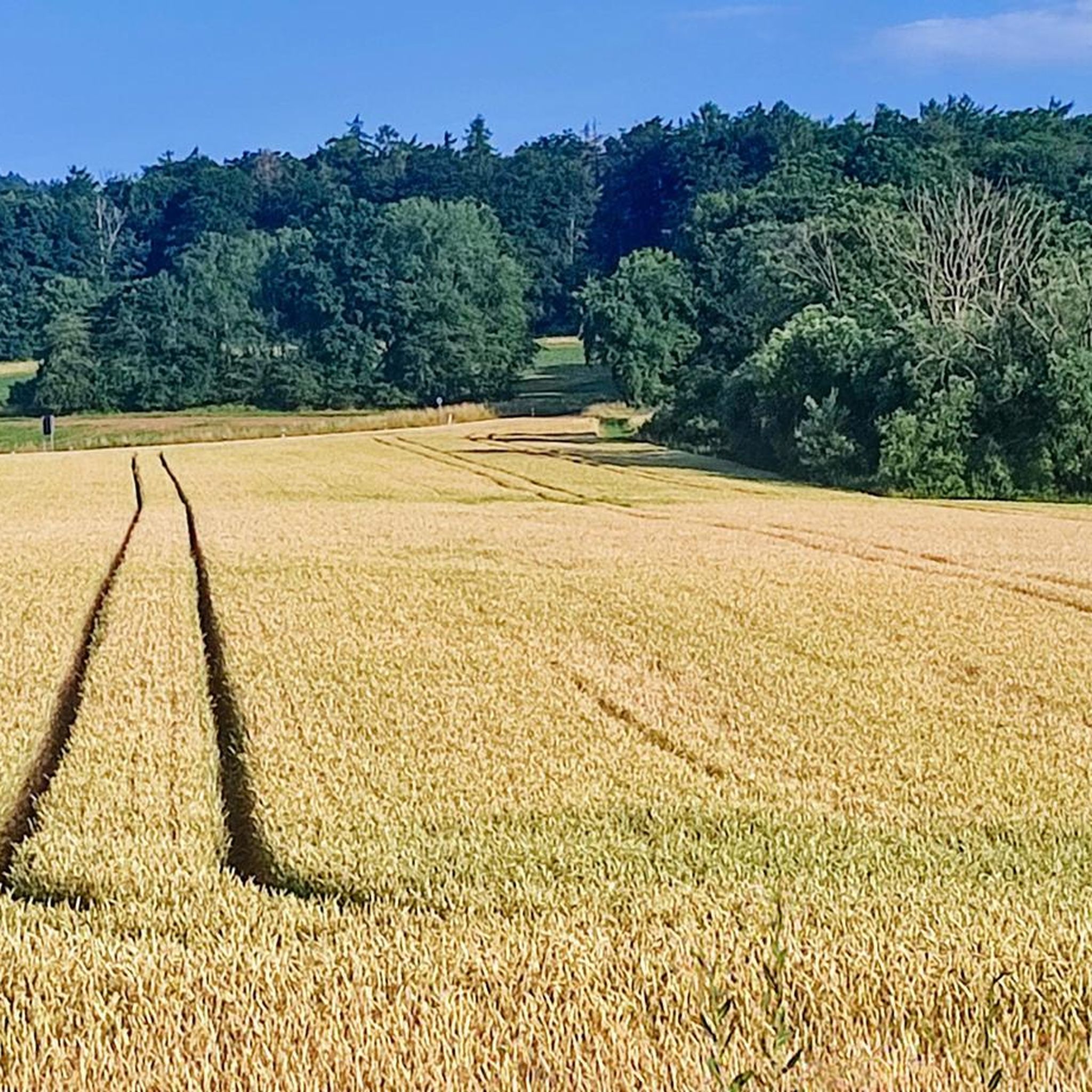
Attention: The path between the two lakes was almost impassable today (6/2/23). There were deep tractor tracks in many places, probably due to the fact that it had been very damp here for weeks beforehand. It is possible that these tractor gullies were created when the farmer mowed the field, because everything was covered with hay, so potholes and gullies were often only noticed when it was already too late to avoid them.

번역: Google

4

0

린젠게리히트 주변에서 가장 인기 있는 경로

린젠게리히트 하이킹

린젠게리히트 주변에서 가장 인기 있는 명소

Natural Monuments

Store rating

komoot 모바일 앱으로 영감을 받아보세요

무료 komoot 계정로 끝없는 야외 모험을 손쉽게 찾고, 맞춤 설정하며 길안내할 수 있어요.

또는

지금 komoot에 가입하세요

Store rating

더 살펴보기

찾고 있는 하이라이트를 아직 못 찾으셨나요? 다른 지역의 주요 명소 가이드를 확인해보세요:

브라흐탈구츠베지르크 스페사르트요스그룬트플로르스바흐탈바트 소덴-잘뮌스터Wächtersbach슈타이나우 안 데어 슈트라세신탈함머스바흐랑겐셀볼트배드 오브슐뤼히테른겔른하우젠메인탈비베르게문트로네부르크그룬다우니더도르펠덴브루흐쾨벨그로스크로첸부르크프라이게리히트니데라우에를렌제노이베르그쇠넥하나우버스타인핫셀로스Naturpark Hessischer SpessartKinzigtalsperre불라우Forst AuroraErlensee Bei ErlenseeWeideswiesen-Oberwald Bei Erlensee

근처 어드벤처 가이드

겔른하우젠 즐길거리

background

새로운 정복을 위한 준비를 하세요

무료로 가입하기

탐험하기
경로경로 플래너기능하이킹MTB 트레일로드 사이클링 경로바이크패킹사이트맵
앱 다운로드
소셜 미디어에서 팔로우하기

© komoot GmbH

개인 정보 보호 정책