경로

플래너

기능

업데이트

App

로그인 또는 가입

앱 다운로드

로그인 또는 가입

로그인 또는 가입

경로
러닝 트레일
프랑스
오베르뉴 론 알프스
알베르빌

자연 보호 구역 드 라 그랑 사시에르

경로
러닝 트레일
프랑스
오베르뉴 론 알프스
알베르빌

자연 보호 구역 드 라 그랑 사시에르

자연 보호 구역 드 라 그랑 사시에르 최고의 러닝 경로

4.3

(28)

7,115

달리기 하는 사람

135

러닝

자연 보호 구역 드 라 그랑 사시에르에서 하이킹하며 알베르빌 구석 부분까지 살펴볼까요? 자연 보호 구역 드 라 그랑 사시에르에 있는 모든 하이킹 및 워킹 경로 컬렉션 중 가장 멋진 하이킹 경로를 엄선하여 소개해드릴게요. 다른 하이커가 공유한 실제 팁과 사진을 살펴보고 후기를 읽으며 마음에 드는 자연 보호 구역 드 라 그랑 사시에르 워킹 경로를 찾아보세요.

마지막 업데이트: 5월 20, 2026

13

달리기 하는 사람

#1.

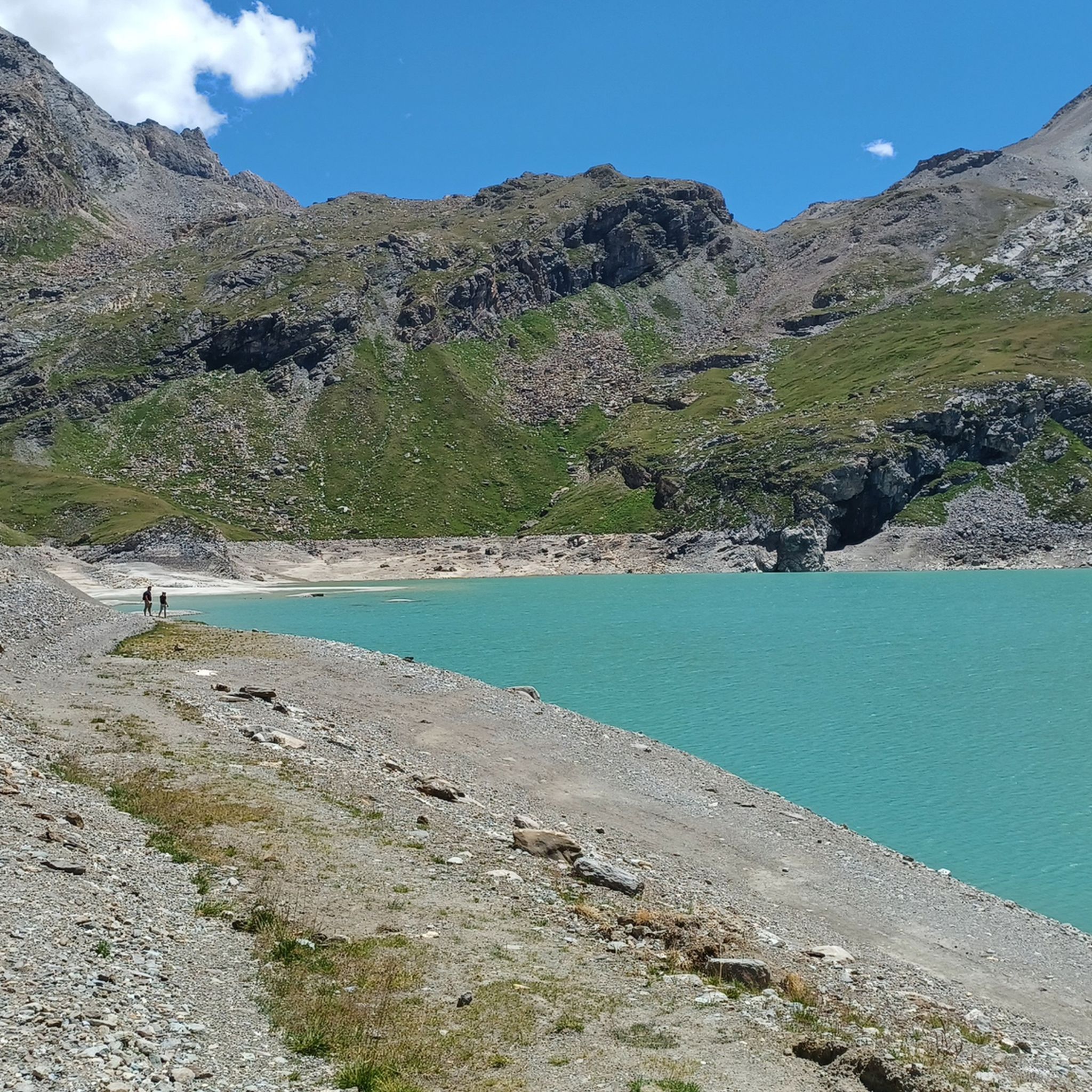
Barrage du Saut에서 출발하는 라크 뒤 소 – 사시에르 스트림 순환 코스

13.0km

02:14

550m

550m

어려운 조깅. 우수한 체력 필요. 튼튼한 신발을 신고 미끄러지지 않게 조심해야 하며, 높은 산을 오른 경험이 있어야 함.

기기에서 길안내

휴대폰으로 전송

저장

어려움

어려운 조깅. 우수한 체력 필요. 대부분 포장된 지면. 실력과 관계없이 누구나 갈 수 있음.

어려움
guide_signup
저희가 komoot 모바일 앱로 길을 안내해 드리겠습니다.
무료 komoot 계정로 끝없는 야외 모험을 손쉽게 찾고, 맞춤 설정하며 길안내할 수 있어요.

무료 회원 가입

어려운 조깅. 우수한 체력 필요. 튼튼한 신발을 신고 미끄러지지 않게 조심해야 하며, 높은 산을 오른 경험이 있어야 함.

어려움

보통 조깅. 좋은 체력 필요. 대부분 포장된 지면. 실력과 관계없이 누구나 갈 수 있음.

보통

어려운 조깅. 우수한 체력 필요. 튼튼한 신발을 신고 미끄러지지 않게 조심해야 하며, 높은 산을 오른 경험이 있어야 함.

어려움
무료 회원 가입 후 자연 보호 구역 드 라 그랑 사시에르 주변 러닝 경로를 131개 더 확인하세요

더 다양한 경로와 다른 탐험가들의 추천을 살펴보세요.

무료 회원 가입

이미 komoot 계정이 있나요?

투어 추천은 다른 사람들이 komoot에서 완료한 수천 개의 활동을 바탕으로 구성되어 있습니다.

오늘 무료 계정으로 시작하세요

다음 모험이 기다리고 있어요.

로그인 또는 가입하기

자연 보호 구역 드 라 그랑 사시에르 주변 인기 장소

포리에 제도이터 — 3000m 시 에바드 15자

자연 보호 구역 드 라 그랑 사시에르 하이킹

자연 보호 구역 드 라 그랑 사시에르 사이클링

자연 보호 구역 드 라 그랑 사시에르 로드 사이클링 경로

자연 보호 구역 드 라 그랑 사시에르 MTB 트레일

자연 보호 구역 드 라 그랑 사시에르 등산

자연 보호 구역 드 라 그랑 사시에르 주변의 다른 모험

포리에 제도이터 — 3000m 시 에바드 15자

하이킹 컬렉션 에 의해

komoot

커뮤니티 팁

Antoine Fabre
5월 17, 2026, Val d'Isère

모든 취향을 위한 진정한 여름 생활과 활동.

번역: Google

0

0

정말로 훌륭한 장소이며 돌아오는 길에 아주 길고 멋진 블랙 트레일이 있습니다 👌😍

번역: Google

0

0

Home sweet home... an exceptional playground!

번역: Google

0

0

This old hamlet ("hameau") gives an idea of how austere life used to be for Alpine dwellers. In winter, people often shared a room with their animals, using their body heat for heating. When there was no work due to poor harvests, some residents emigrated to Alsace or Ticino to seek employment.

번역: Google

0

0

The hike to the Aiguille de la Grande Sassière (a 3,751 m high mountain in the Graian Alps) is easy. The west and east of this part of the Alps form the watershed between the Rhône (Isère) and Po (Dora Baltea) rivers, which also forms the border between France and Italy. Climbing to the summit also offers a unique opportunity to see a glacier and two glacial lakes. If you're in the area, don't miss this breathtakingly scenic hike in the Vanoise National Park!

번역: Google

0

0

The Aiguille de la Grande Sassière, or often simply the Grande Sassière, is a 3751 m high mountain in the Graian Alps, located south of the Mont Blanc group, or more precisely just southeast of the Petit Saint Bernard Pass, on the ridge that separates the west and east of this part of the Alps and forms the watershed between the Rhone (Isère) and the Po (Dora Baltea), and across which runs the national border between France and Italy. This ridge also forms the seam between the Aosta Valley and the historic Savoy in the Savoie department and, a few kilometers further southeast of the mountain, between the two adjacent national parks of Gran Paradiso and Vanoise, at the height where, within these protected areas, passes connect the north and south sides of the parks: to the west, the Col de l’Iseran Tarentaise (Isère) and Maurienne (Arc Valley), to the east of the Colle del Nivolet the Aosta Valley and the Orco Valley (Piedmont).

번역: Google

0

0

The Prariond refuge is beautifully located in the Vanoise National Park. It offers an ideal location to admire the fauna and flora. The refuge is accessible all year round. During the guarding period, you can even enjoy a catering service. Reservations must be made directly on the refuge website: https://refuge-prariond.vanoise.com/

번역: Google

0

0

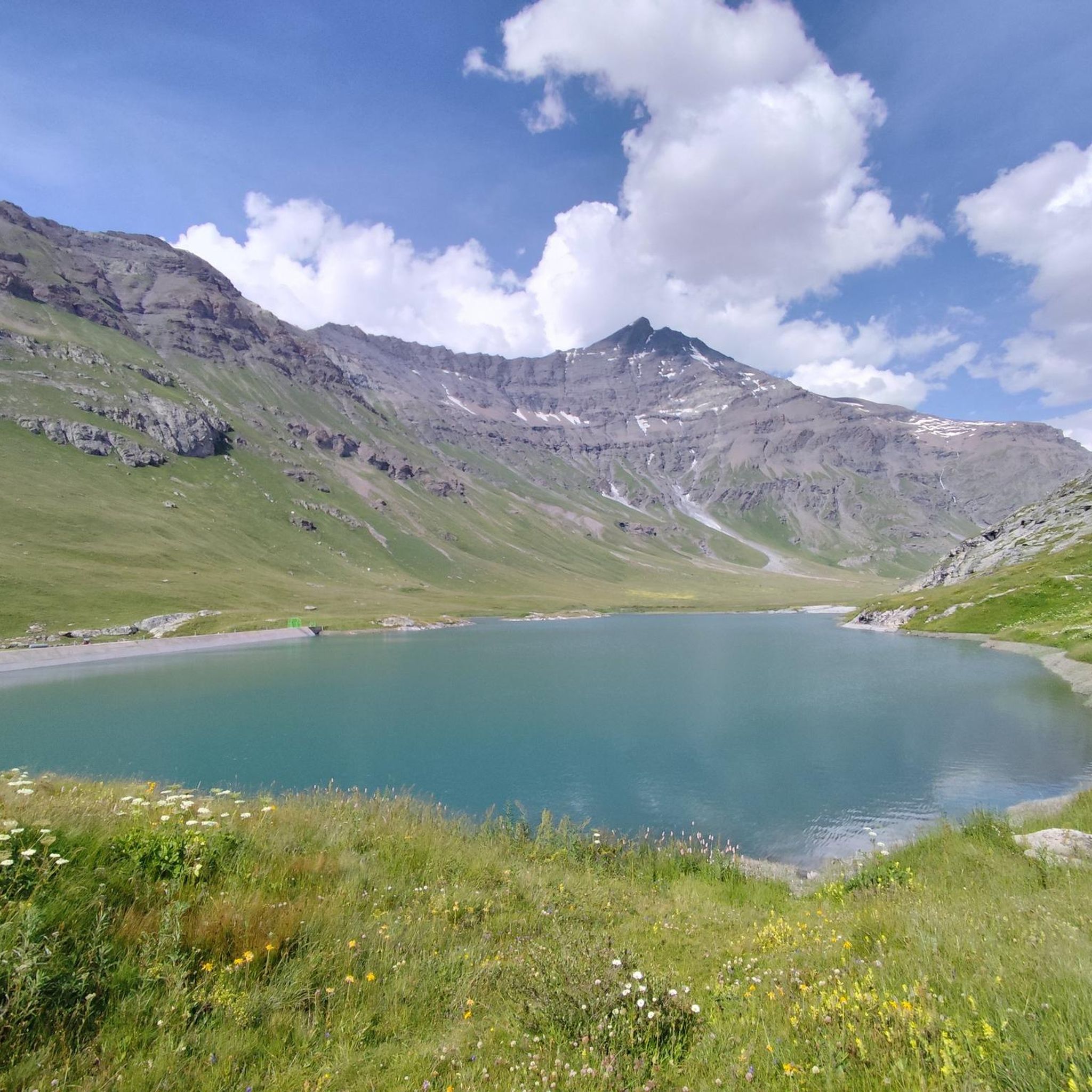
As its name suggests, this charming little stream is located in the Grande Sassière nature reserve, at the foot of the eponymous needle. It connects the Sassière lake and the Saut lake in the magnificent alpine environment of the Tarentaise.

번역: Google

1

0

자연 보호 구역 드 라 그랑 사시에르 주변에서 가장 인기 있는 경로

자연 보호 구역 드 라 그랑 사시에르 하이킹

자연 보호 구역 드 라 그랑 사시에르 주변에서 가장 인기 있는 명소

Places to see

Store rating

komoot 모바일 앱으로 영감을 받아보세요

무료 komoot 계정로 끝없는 야외 모험을 손쉽게 찾고, 맞춤 설정하며 길안내할 수 있어요.

또는

지금 komoot에 가입하세요

Store rating

더 살펴보기

다른 지역의 최고의 러닝 트레일 & 경로를 살펴보세요.

보퍼트Aire d'adhésion du Parc National de la Vanoise오뜨루체티그네스부르 생 모리스락 뒤 쉐브릴락 드 티뉴발디제르라 플라뉴 타랑테즈바누아즈Parc National De La Vanoise (Aire D'Adhésion)세빈스레 벨빌프랄로냥 라바누아즈레 알뤼생봉타랑떼즈Les Avanchers-Valmorel자연 보호 구역 플랜 드 투에다자연 보호 구역샴페인 앙 바누아즈라크 드 생 게랭세즈빌라로거에임라플랑클레리몽테일뢰르페이시 낭크루아수은플루멧몬발레잔라 바티생니콜라스라샤펠락 드 로젤랑랜드리라크 드 라 기타즈빌라르 쉬르 도롱포레 데파르망탈 드 타미에플랜체린그리뇽로그나이스레 샤펠알론다즈르부아Salins-Fontaine플라네이에서-블레이팔루드Forêt Domaniale Du Mont JovetRéserve Biologique Intégrale De Merdassiers Nant PareuxRéserve Biologique Dirigée De La Dent Du Villard생마르셀무티에자연 보호 구역 네츄럴 데 오 드 빌라로제벤톤퀴지코헤노즈Forêt De Rhonne노트르담 뒤 프레오트쿠르보젤라 지에타즈테네솔투르 앙 사부아세자르슈크레스트 볼란드본빌라르Sainte-Hélène-Sur-IsèreSaint-Paul-Sur-Isère노트르담 드 벨콩우기네Feissons-Sur-Isère노트르담 데 밀리에르먼전본네발마소드에그블랑쉬라크 드 라 지로트라 레셰르길리쉬르이제르라 페리에르생장드벨빌Sainte-Foy-TarentaiseFeissons-Sur-Salins생바이탈브리즈 레 뱅몽타니Forêt Du Darbelay프론테넥스투르논Verrens-Arvey그레시 쉬르 이제르

근처 어드벤처 가이드

자연 보호 구역 즐길거리

background

새로운 정복을 위한 준비를 하세요

무료로 가입하기

탐험하기
경로경로 플래너기능하이킹MTB 트레일로드 사이클링 경로바이크패킹사이트맵
앱 다운로드
소셜 미디어에서 팔로우하기

© komoot GmbH

개인 정보 보호 정책