모르낙 쉬르 쉬드르 최고의 워킹 & 하이킹 경로
4.5
(414)
4,059
등산객
170
하이킹
정확한 경로를 찾는 것이 때로는 어렵지만 모르낙 쉬르 쉬드르에서 하이킹을 하면 다양한 경치를 마음껏 감상할 수 있답니다. 모르낙 쉬르 쉬드르에서 가장 멋진 하이킹과 워킹 중에서 마음에 드는 활동을 시작해보세요.
마지막 업데이트: 8월 30, 2026
4.3
(11)
42
등산객
8.20km
02:05
20m
20m
This moderate 5.1-mile (8.2 km) loop hike explores the historic village of Mornac-sur-Seudre, its medieval gate, and surrounding marshlands.
3.9
(13)
110
등산객
보통 하이킹. 좋은 체력 필요. 실력과 관계없이 누구나 쉽게 갈 수 있는 길.

무료 회원 가입
5.0
(3)
31
등산객
4.12km
01:03
10m
10m
초급용 하이킹. 모든 체력 수준에 적합. 실력과 관계없이 누구나 쉽게 갈 수 있는 길.
4.8
(5)
22
등산객
11.6km
02:55
10m
10m
보통 하이킹. 좋은 체력 필요. 실력과 관계없이 누구나 쉽게 갈 수 있는 길.
4.5
(2)
11
등산객
초급용 하이킹. 모든 체력 수준에 적합. 실력과 관계없이 누구나 쉽게 갈 수 있는 길.
더 다양한 경로와 다른 탐험가들의 추천을 살펴보세요.
무료 회원 가입
이미 komoot 계정이 있나요?
투어 추천은 다른 사람들이 komoot에서 완료한 수천 개의 활동을 바탕으로 구성되어 있습니다.
오늘 무료 계정으로 시작하세요
다음 모험이 기다리고 있어요.
로그인 또는 가입하기

커뮤니티 팁

모르낙의 시장 건물은 중세 시대에 처음 등장했습니다. 1664년에야 비로소 그 존재를 증명하는 최초의 서면 증거가 나타났습니다. 이 건물들은 아마도 더 오래되었을 것이며 1550년대에 지어졌을 수 있습니다. 시장은 일반적으로 돌기둥으로 지지되고 타일로 덮인 목조 구조물입니다. 코즈와 피자니의 시장과 마찬가지로 종교 전쟁의 우여곡절을 겪고 손상되거나 파괴되었다가 평화가 회복된 후 재건되었을 것으로 추정할 수 있습니다. 모르낙 시장 건물의 위치는 유명한 박람회 장소였으며 주민들이 영주에게 지불하는 권리를 대가로 상품을 판매할 수 있도록 했습니다. 이는 영주에게 중요한 수입원이자 시장 건물을 완벽한 상태로 유지해야 하는 의무를 부과했습니다. 영주와 판매자를 구속하는 행위는 해당 시장 건물의 상품 판매 및 유지 보수 권리를 명시하는 계약을 봉인했습니다.
0
0

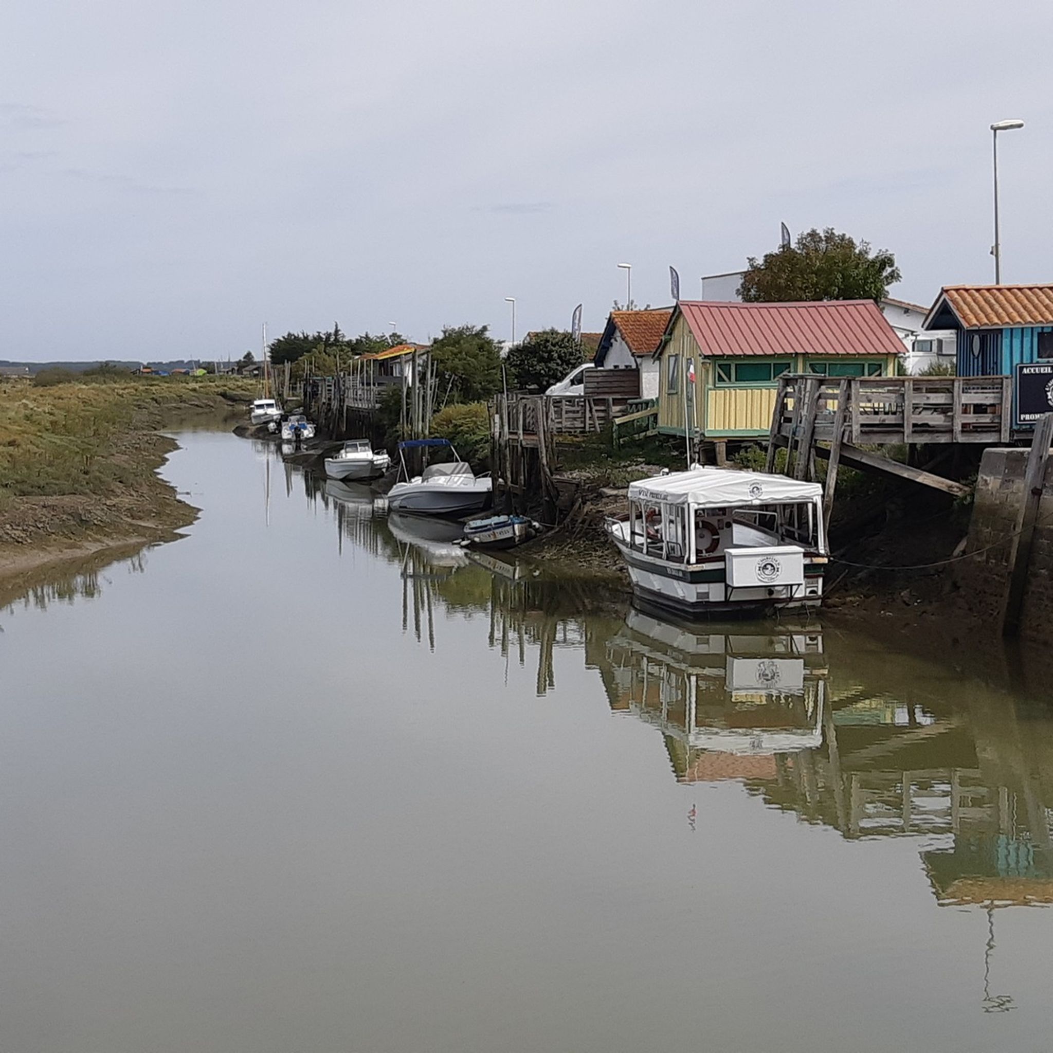
The port of Ribérou is a major heritage site in Saujon, bearing witness to a prosperous maritime past linked to the salt and wine trade. Transformed in the 19th century by ambitious works, it has now been reinvented as a place for living, relaxation, and preserving local history. 🛶 Origins and the Middle Ages The port of Ribérou takes its name from the Latin word ripa ("riverbank") or the Occitan word ribèira ("river"). It is located at the head of the Seudre estuary. It existed as early as the 11th century and became an important river and sea port thanks to its strategic position at the head of the estuary, used particularly for the salt trade—then called "white gold"—a highly sought-after product for preserving food. 🚢 Medieval Period and International Trade With the opening of British markets during the reigns of Eleanor of Aquitaine and Henry II Plantagenet, ships laden with wool, salt, wine, and other goods flocked to Ribérou. In the 16th century, the port exported local wines (such as cognac and pineau) throughout Europe. In 1577, during the Wars of Religion, the port was a strategic site: troops were stationed there, and battles took place. 🏗️ Decline, Reconstruction, and the 19th Century The estuary gradually silted up, making navigation difficult. By 1691, only smaller vessels could dock there. During the French Revolution, the sale of the tidal mill, which helped remove sediment, worsened the silting, leading to the port's decline. A modernization project began in 1822, but it wasn't until 1839 that an ambitious program was launched under the impetus of Jules Dufaure—a native of Saujon and Minister of Public Works—with the construction of sturdy quays, slipways, a lock bridge (marking the boundary between fresh and salt water), and reception facilities. In 1842, the work was completed, and the main quay was named Quai Dufaure in honor of this political support. 📉 Gradual Decline and Modernization The arrival of the railway in 1876 and the persistent problems of silting led to a decline in the port's traditional commercial activity, already facing competition from other transport networks. In the 20th century, the port gradually lost its economic importance but remained active for traditional fishing and became a place for pleasure boating, leisure, and local culture. Urban and tourism development projects (particularly in 2011–2012) modernized the port while preserving its historical charm. 🌊 Today The port of Ribérou is now a small fishing and pleasure port, much appreciated for its walks along the Seudre River, water sports (canoeing, kayaking, paddleboarding, etc.), and seasonal events.
0
0

The port of Ribérou is a fishing and pleasure port located at the end of the Seudre estuary, in Saujon. It is one of the two ports in the city, along with that of Breuil, a little downstream. Active since the 11th century, it took on its current appearance from 1842, under the impetus of the Minister of Public Works at the time, Jules Dufaure, a "local boy", who thus attempted to revive maritime trade and fishing activities, which were then in decline. Ideally located, on the edge of the city center, the La Lande leisure center and the preserved areas of the Seudre marshes (towpaths transformed into walking trails), it has become one of the major tourist attractions in Saujon, where theme evenings and the July 14 fireworks are organized. In 2011, the municipality began a renovation program for the port site, entrusted to the architect-urban planner Sophie Blanchet. It consists of transforming the old car parks into a pedestrian esplanade, a real meeting place with modern street furniture and, in the long term, green spaces. From the quays, lined with bourgeois buildings, small picturesque streets lined with hollyhocks allow you to crisscross the district and reach the city centre. The Ribérou lock bridge, known as the "bridge of opposing waters", was renovated in 2010. It marks the separation between the waters of the estuary (port side: brackish water) and the waters of the river (retention basin side: fresh water). Ribérou is a starting point for certain water sports (canoeing and kayaking). It is approximately 250 metres long and 40 metres wide. From Ribérou, it is possible to reach successively the ports of Breuil (Saujon), L'Éguille, Mornac, Chaillevette, Chatressac (Chaillevette), Grandes Roches and Orivol (Étaules), La Grève in Duret and Coux (Arvert), La Grève (La Tremblade) and La Cayenne (Marennes).
0
0
The SAINT-PIERRE church dominates the village from its fortified bell tower. Original in many ways, the Romanesque building houses a holy water font made of a real shell. From the side, you reach the small garden of the chevet, well hidden. Stone sarcophagi (Merovingian or Carolingian depending on the source) bear witness to the archaeological excavations that the church has undergone. There are many stories in Mornac but that of the fire of August 2, 1943 marked the identity of the village. Indeed, the bell tower has not always had this appearance. It had the more traditional shape of a spire until lightning struck it. Many young students come to Mornac-sur-Seudre to participate in the clearing and the excavations that follow. Seduced by the local atmosphere, many of them stayed and opened the first craft workshops in the village, some of which are still present, such as pottery and leather.
0
0
The line was opened to traffic in 1876 by the Compagnie du chemin de fer de la Seudre, and then extended to the channel of La Grève at La Tremblade. In 1880, the line was bought by the State Railways Administration, which absorbed the bankrupt Compagnie des chemins de fer de l'Ouest in 1908. The State Network, after its merger with the other national railway companies in 1938, became the Société nationale des chemins de fer français (SNCF). In 1939, the line was closed to passenger traffic, but continued its activity for the transport of goods until 1980. Tourist service In 1984, the association of the Seudre Tourist Railway (CFTS) started running a tourist train again but stopped tourist operation in 2002. The infrastructure (track, stations and Chaillevette depot) was then bought by the department of Charente-Maritime. Between 2004 and 2006, the operation of the line was entrusted to CFTA, a subsidiary of Véolia Transport, but ceased in 2007. In 2008, the association Trains & Traction was entrusted with the operation of the line, and has continued the activity since then. Tourist operation takes place from the beginning of May to the end of September with daily traffic in July and August. Some special trains are organized in season or out of season like the "Train des Loupiottes1" or the "Train Éclade de moules". Most recently, the Train des Mouettes has opened up to gastronomy with refined meals with its restaurant train the "Seudre Océan Express", reviving the myth of rail travel for the time of a refined meal (reservation required by telephone). The office is at the Saujon Chemin Vert station, and the workshop is in Chaillevette, in the middle of the line. The following equipment is currently operated by volunteers Steam locomotives • Schneider (no. 2503), 1891 - Arrived at Chaillevette in 1984. In service since 2004. • Henschel, 1912 - Arrived at Chaillevette in 1984. Inaugurated (being heated) on 20 June 2015. • Fives-Lille (no. 3716), 1910 - Out of service (undergoing complete restoration). • Borsig (type T 3 Prussian (de)), 1906 - Out of service (undergoing complete restoration). Diesel locomotives • Decauville, 1960 - Operational • Blanc-Misseron, 1958 - Out of service (undergoing complete restoration). • SACM (no. 10019), 1956 - Operational • Moyse, 1968 – Operational • Brissonneau and Lotz, 1971 - Operational • CFD, 1965 - Operational • CFD, 1965 - Out of service (undergoing complete restoration). • SACM/Alstom/CAFL, 1956 Decauville, 1967 – Out of service (undergoing complete restoration).Baudet, Donon and Roussel – Shunter rebuilt to SACM plans in 1961 with a Baudouin engine. - Operational • Decauville, 1967 – Shunter Operational Accumulator locomotive • Orenstein & Koppel no. 320 13-ton accumulator locomotive, from a foundry in Niederbronn-les-Bains. Railcars • X 5822 - Out of service (undergoing complete restoration). • Billard railcar no. 902, type A 75 D built in 1947, ex-CFD of Indre-et-Loire, entrusted by the FACS; • X 2208 ex-Limoges depot, entrusted under agreement with the SNCF, on loan to the Central Brittany railways; • X 2251 ex-Limoges depot, entrusted under agreement with the SNCF, on loan to the Central Brittany railways.
0
0

Succeeding a Merovingian church whose remains were discovered in 1951 (as well as a cemetery dating from the 6th century), the foundation of the current church could date back to the 10th or 11th century. with a modernization in the 12th century, where it takes more or less its current appearance. The bell tower was destroyed during the Hundred Years' War and then rebuilt with the facade in the 15th century. A fire due to a violent storm affected the bell tower in 1943. The upper part was reinterpreted by the addition of square bays giving it a defensive character. The slate spire has not gone up. The Saint-Pierre church is a Romanesque building with certain archaic features. The facade, of great severity, dates from the 15th century. Almost devoid of ornamentation, it consists of a broken arched portal with prismatic moldings, confined by a Gothic niche (on the right) and surmounted by a narrow bay. The nave, formerly divided into 5 bays, now has only 4, separated by columns backed by pilasters. The whole was originally covered with ribbed vaults, destroyed in 1837, replaced by an arched vault and subsequently dismantled in turn. The nave is covered with an exposed framework. Large transept arches delimit the square of the transept, covered with a barlong dome on squinches. The crosspieces are covered with a pointed barrel vault, and are extended by apsidioles. Semi-circular arcades, supported by fine columns with capitals decorated with plant or geometric motifs, punctuate the walls of the apse, covered with an oven bottom where traces of frescoes dating from the 12th century are visible, although degraded. century. The walls of the nave, the transept and part of the choir retain traces (from the 17th century) of the funeral liter of a lord of Mornac. The exterior offers, on the north wall, the remains of a Romanesque portal (11th century). The bedside, typical of the Saintongeais Romanesque, is made up of 3 horizontal registers, delimited by cords. The last level is made up of an arcade formed of arched arcades carried by columns with capitals decorated with plant, animal or geometric motifs. The whole is surmounted by a cornice with modillions where animals and human or demonic faces are represented. Buttress columns topped with capitals decorated with interlacing and stylized plants punctuate the walls
0
0
모르낙 쉬르 쉬드르 주변에서 가장 인기 있는 명소


더 살펴보기
다른 지역의 최고의 하이킹를 살펴보세요.
