경로

플래너

기능

업데이트

App

로그인 또는 가입

앱 다운로드

로그인 또는 가입

경로
러닝 트레일
미국

그루지야

그루지야 최고의 러닝 경로

4.5

(138)

12,545

달리기 하는 사람

1,160

러닝

그루지야에서 하이킹하며 미국 구석 부분까지 살펴볼까요? 그루지야에 있는 모든 하이킹 및 워킹 경로 컬렉션 중 가장 멋진 하이킹 경로를 엄선하여 소개해드릴게요. 다른 하이커가 공유한 실제 팁과 사진을 살펴보고 후기를 읽으며 마음에 드는 그루지야 워킹 경로를 찾아보세요.

마지막 업데이트: 7월 7, 2026

5.0

(2)

275

달리기 하는 사람

#1.

Beltline Eastside Trail via Piedmont Park — Atlanta

10.6km

01:06

60m

60m

The Atlanta Beltline Eastside Trail offers a dynamic urban jogging experience, blending city views with green pockets. As you move along the paved path, you'll encounter vibrant public art and historic railway remnants, including the unique Krog Street Tunnel known for its ever-changing graffiti. This moderate route spans 6.6 miles (10.6 km) and involves a gentle elevation gain of 195 feet (60 metres), making it suitable for a steady workout. You can expect to complete the entire journey in about 1 hour and 6 minutes, enjoying the lively atmosphere throughout. It's a great way to see a different side of Atlanta.

Planning your visit to the Eastside Trail is straightforward, as access points are convenient and numerous along the route. You'll find many shops, cafes, and restaurants directly accessible, perfect for a pre- or post-jog refreshment. Be aware that the trail's immense popularity means it can become very crowded, especially on pleasant weather weekends. You will share the paved surface with walkers, cyclists, and scooter riders, so staying aware of your surroundings is important to ensure a smooth experience. Consider an early morning or weekday visit if you prefer fewer people.

This trail is a central artery of Atlanta's urban revitalization, transforming old railway corridors into a lively public space. It stands out as a prime example of how infrastructure can connect communities and foster outdoor activity within a bustling city environment. The route also provides direct access to Piedmont Park, offering a refreshing natural escape if you wish to extend your outing. It's a testament to Atlanta's commitment to green spaces and accessible recreation.

기기에서 길안내

휴대폰으로 전송

저장

보통

5.0

(1)

44

달리기 하는 사람

This 4.8-mile (7.7 km) Savannah Riverfront to Forsyth Park jogging route offers a moderate workout with just 62 feet (19 metres) of elevation gain, typically taking around 47 minutes. You'll experience a captivating blend of urban charm and natural beauty, starting along the historic Riverfront before meandering through picturesque squares and culminating in the serene expanse of Forsyth Park, with its iconic fountain and Spanish moss-draped live oaks.

For the best experience, plan your run for the early morning or late afternoon to avoid the heat and crowds, especially if you're looking for less crowded jogging trails in Savannah, Georgia. The entire route is on paved surfaces, making it a smooth and accessible option for most, including those wondering if the Savannah Riverfront to Forsyth Park loop is good for beginners.

This loop is a fantastic way to see many of Savannah's landmarks, from the "Waving Girl" statue to the various monuments within Forsyth Park, a 30-acre cultural heart of the city. It provides a unique opportunity to combine exercise with a comprehensive tour of the historic district's natural features and architectural highlights.

보통
guide_signup
저희가 komoot 모바일 앱로 길을 안내해 드리겠습니다.
무료 komoot 계정로 끝없는 야외 모험을 손쉽게 찾고, 맞춤 설정하며 길안내할 수 있어요.

무료 회원 가입

30

달리기 하는 사람

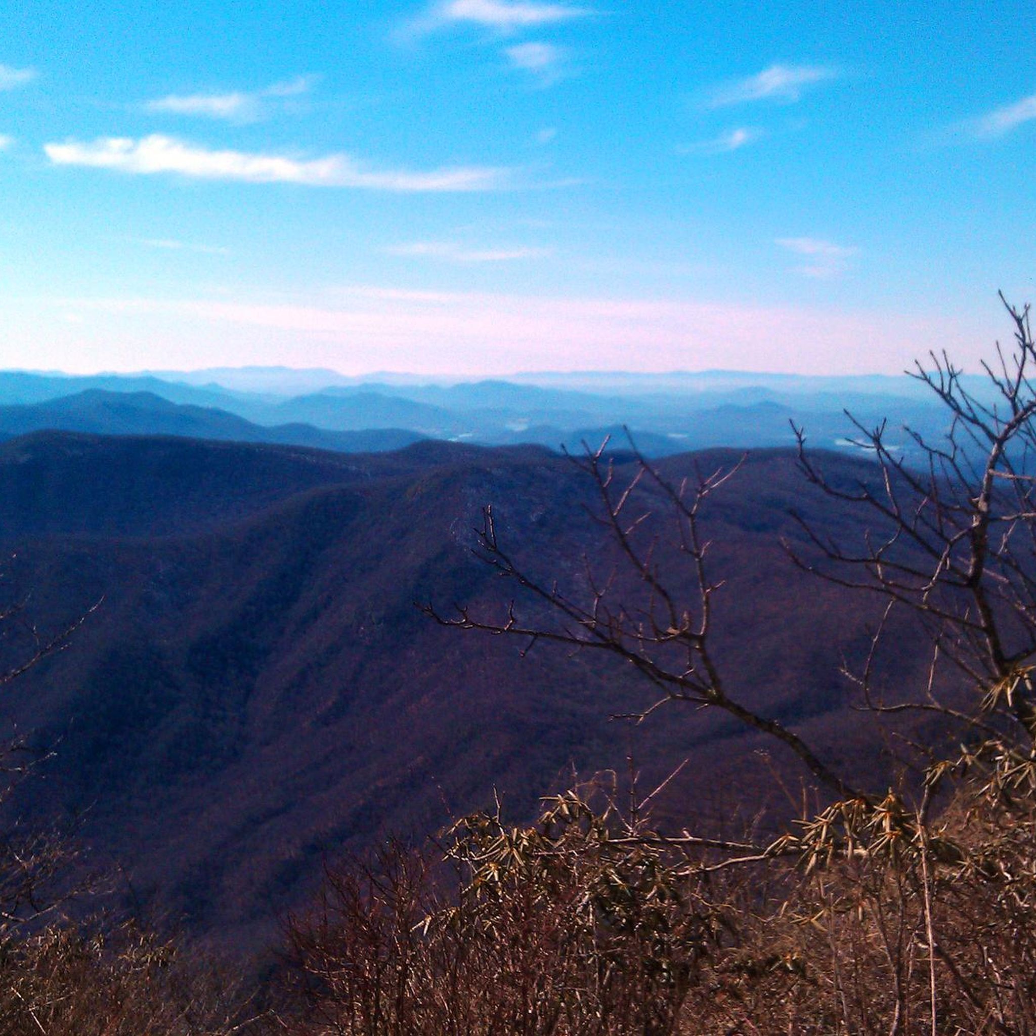
Currahee Mountain Road offers a moderate jogging experience, covering 5.4 miles (8.7 km) with a significant elevation gain of 802 feet (245 metres). You can expect to complete this route in about 59 minutes, making it a good option for a consistent uphill challenge. The trail primarily follows a gravel Forestry Road, FSR 62, as it climbs Currahee Mountain. As you jog, you will encounter varied surface conditions, from well-maintained stretches to areas with ruts and exposed rock. The true reward is the Currahee Mountain Summit View, where you can enjoy outstanding panoramic vistas stretching approximately 50 miles in every direction, including the distant Blue Ridge Mountains.

Before you head out, be aware that the trail's conditions can change, especially after heavy rain. Such weather can create slippery and rutted sections due to water accumulation and loose gravel, so plan your visit accordingly. The final mile to the summit is particularly steep, so good fitness is recommended if you plan on running the entire route. Parking is generally available at the trailhead, making access straightforward for your jogging adventure.

The mountain's name, Currahee, holds a special meaning, translating to "stands alone" in Cherokee. This aptly describes its striking, isolated peak within the Chattahoochee-Oconee National Forest. The route provides a unique opportunity to experience both a challenging workout and a historical landmark. Its distinct character sets it apart from other trails in the region, offering a memorable journey to a summit with expansive views.

보통

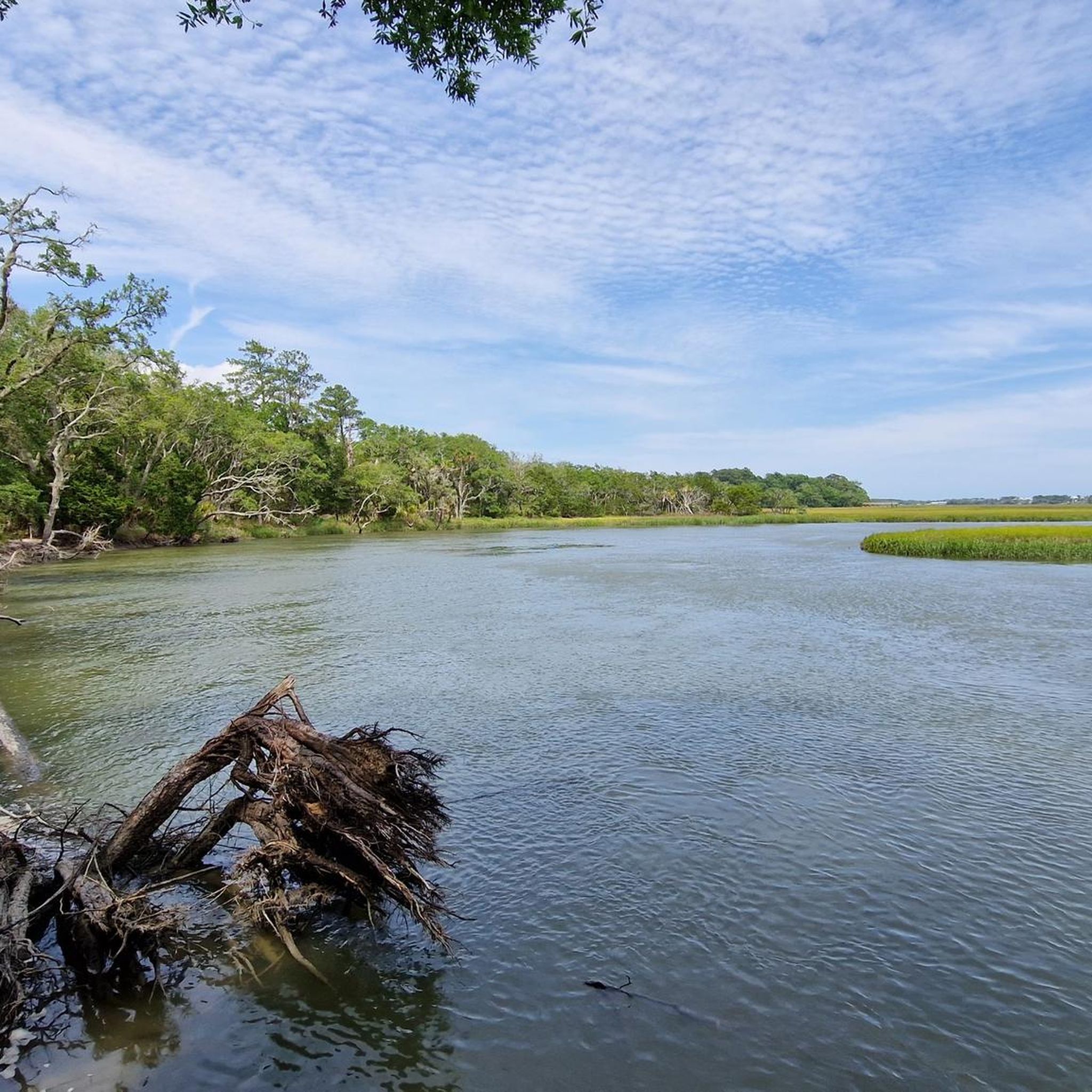
The Sandpiper, Avian & Big Ferry Trail loop is a fantastic option for a moderate 4.7-mile (7.6 km) jogging route near Savannah, offering a diverse coastal experience. You'll traverse sandy paths and sturdy boardwalks through maritime forests, enjoying views of moss-draped live oaks and expansive marshlands, particularly from the Big Ferry Loop Marsh View. With only 29 feet (9 metres) of elevation gain, it's a relatively flat run that can be completed in about 49 minutes, perfect for a steady pace and soaking in the scenery.

Located within Skidaway Island State Park, the trail is easily accessible, though it's always wise to check park hours and conditions before heading out. Parking is available at the park, and the route is generally well-marked. Consider visiting during cooler parts of the day or year, as coastal Georgia can get quite warm, and bring water to stay hydrated.

This route is a gem for wildlife enthusiasts, being part of Georgia's Colonial Coast Birding Trail, with opportunities to spot over 300 bird species, deer, and even dolphins along the Skidaway Riverside. The Avian Loop Trail also leads to the Intracoastal Waterway at Skidaway Narrows, offering more chances for wildlife viewing, including osprey. It's a great way to combine exercise with nature observation and a touch of local history.

보통

5.0

(1)

13

달리기 하는 사람

Embark on a moderate jogging route through Savannah's Daffin and Forsyth Parks. This 6.4-mile (10.2 km) loop offers a refreshing urban escape, taking you past the iconic Forsyth Park Fountain and through avenues lined with 156 live oak trees in Daffin Park. You'll experience a gentle elevation gain of just 44 feet (13 metres) over an estimated 1 hour and 3 minutes, making it a comfortable run. The path connects these two vibrant green spaces, providing a varied and pleasant atmosphere for your workout.

Planning your jogging session is straightforward, as both Daffin and Forsyth Parks are easily accessible. You will find parking generally available near both parks, making it convenient to start your journey. The route features paved and lighted sidewalks, with Daffin Park also offering a dedicated rubberized running trail for an even softer surface. This makes the trail suitable for joggers of all levels, including beginners.

This route stands out for its unique blend of urban parkland and historic charm, showcasing Savannah's commitment to green spaces. It connects two distinct areas, allowing you to experience both the structured beauty of Daffin Park and the lively, Spanish moss-draped pathways of Forsyth Park. The trail offers a glimpse into the city's natural and architectural heritage, making it more than just a simple jog.

보통

13

달리기 하는 사람

The Truman Linear Park Trail to Lake Mayer offers a refreshing escape for joggers, blending urban greenway with serene lakeside views. You'll follow a smooth, wide concrete path, often shaded by trees, before reaching the picturesque Lake Mayer. The lake loop itself provides beautiful scenic views of the pond, where you can often spot ducks and geese, and you have the option of a paved or softer dirt/grass surface. It's a pleasant journey through varied terrain, perfect for a consistent, enjoyable run.

Planning your visit is straightforward, as the trail is well-maintained and easily accessible. Lake Mayer Park, the destination of this route, features ample parking, restrooms, and even fitness stations, making it a convenient starting or ending point. The entire route is equipped with lighting, security cameras, and emergency call boxes, ensuring a safe experience whether you go in the morning or evening.

This route is a key part of Savannah's "Tide to Town" urban trail network, connecting various recreational areas and offering a direct, off-road connection from DeRenne Avenue south to Lake Mayer Park. The Truman Linear Park Trail is ADA accessible and provides a valuable community resource for outdoor activity. Future plans aim to extend this network even further, enhancing Savannah's reputation for accessible outdoor recreation.

보통

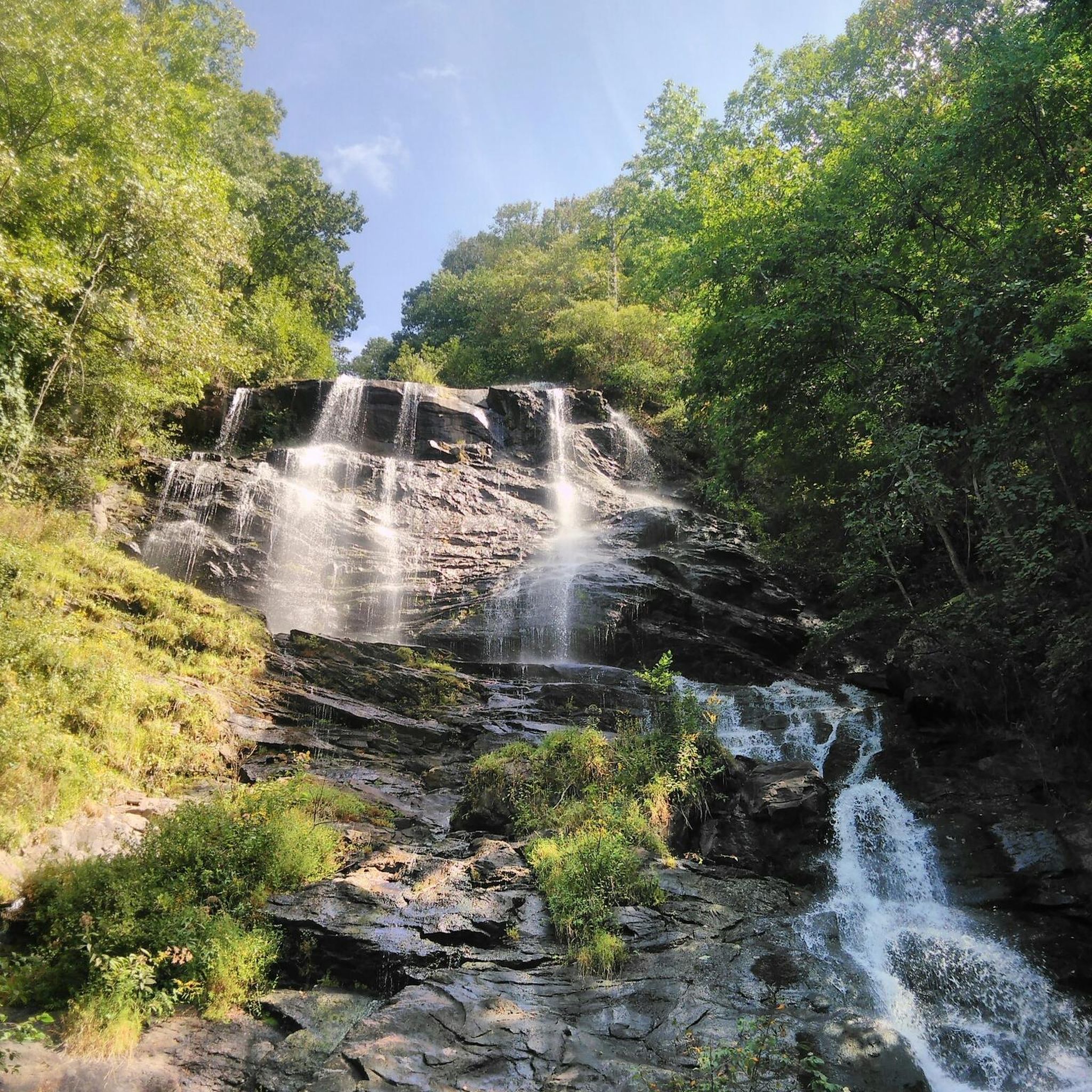
If you are looking for a challenging jogging route, the Len Foote and Appalachian Approach Loop Trail delivers a demanding 12.2 miles (19.6 km) with a significant 2405 feet (733 metres) of elevation gain. You can expect lung-busting climbs and descents through dense forests, passing the impressive Amicalola Falls and offering glimpses of the southern Appalachian mountains. This difficult route, estimated to take around 2 hours and 33 minutes, features sandy, moss-covered forest floors, creek crossings, and an impressive old-growth tulip tree.

To plan your visit, know that the trail starts in Amicalola Falls State Park before entering the Chattahoochee National Forest. Be prepared for varied and strenuous conditions throughout the route. The Len Foote Hike Inn, a rustic lodge accessible only by foot, is located roughly halfway and provides a good spot to refill water and use facilities.

This loop combines sections of the Len Foote Hike Inn Trail and the iconic Appalachian Approach Trail, making it a notable journey. The Hike Inn itself offers welcome Blue Ridge vistas, adding to the unique experience of this trail. It is a demanding route that truly tests your endurance in a beautiful natural setting.

어려움

If you're seeking a challenging jogging route, the Upper Truck and Bluff Trail Loop delivers a vigorous workout through varied and potentially rugged terrain. This difficult 9.0 miles (14.4 km) route will have you gaining 1173 feet (358 metres) in elevation, typically taking around 1 hour and 55 minutes to complete. As you navigate the winding path through a lovely forest, make sure to pause at the Sunset Rock Overlook for rewarding panoramic views.

Planning your visit is straightforward, with parking generally available near the trailheads. This dog-friendly trail is suitable for trail running, but be prepared for the moderate to challenging conditions underfoot. Consider starting your jog early to enjoy cooler temperatures and fewer people, especially on weekends, ensuring a more peaceful experience on the route.

This loop is nestled within the Chickamauga and Chattanooga National Military Park, offering a unique blend of natural beauty and historical significance. The trail provides excellent opportunities for wildlife observation and birding as you move through its diverse forest environment. It stands out in the region for its combination of a demanding physical challenge and scenic overlooks, making it a notable choice for experienced joggers.

어려움

Embark on the Tallulah Falls Rail Trail for a moderate jogging experience spanning 3.3 miles (5.3 km), with an elevation gain of 227 feet (69 metres). This route, which you can complete in about 34 minutes, guides you along the serene shores of the Tallulah River, winding through heavily wooded areas that offer ample shade. You will encounter towering rock outcrops and cross a magnificent 230-foot-long suspension bridge, providing unique views over the river as you jog.

This multi-use trail is accessible for various activities, including walking, cycling, and even wheelchairs, making it a welcoming option for many visitors. Dogs are also permitted on the trail, provided they are kept on a leash and you clean up after them. Convenient parking is generally available within Tallulah Gorge State Park, ensuring easy access to the trailhead for your visit.

Located within the scenic Tallulah Gorge State Park, this trail offers more than just a pleasant jog; it immerses you in a rich natural environment. As you move along the path, you can listen for the distinct sounds of the flowing Tallulah River, which adds to the tranquil atmosphere. The iconic suspension bridge is a highlight, offering a memorable vantage point and a unique feature that sets this route apart in the region.

보통

6

달리기 하는 사람

Start your jogging journey on the Piedmont Park loop, an easy 2.6 miles (4.1 km) route that offers a refreshing escape right in the city. You'll experience a gentle elevation gain of just 92 feet (28 metres), making it perfect for a quick workout that takes about 26 minutes to complete. As you move, you'll pass by the tranquil waters of Lake Clara Meer, reflecting the surrounding greenery. The path winds through open grassy areas and under the shade of mature trees, providing a pleasant mix of sun and cool spots. Keep an eye out for glimpses of the Atlanta Botanical Garden as you enjoy the urban oasis.

Piedmont Park is easily accessible, making it simple to start your jogging adventure whenever you're ready. You can reach the park conveniently by public transport or find parking nearby, though it can get busy during peak hours. If you're bringing a furry friend, leashed dogs are welcome on the trails, and there are even designated off-leash areas within the park for them to enjoy. Consider an early morning or late afternoon visit to avoid the midday crowds and enjoy cooler temperatures, especially during warmer months. This central location means you can fit a quick run into your day without much hassle.

This loop is a popular choice for those seeking a blend of urban convenience and natural beauty, offering diverse scenery throughout your run. You'll be treated to impressive skyline views of Atlanta, providing a unique backdrop to your exercise. The park serves as a vital green space in the heart of the city, offering a peaceful retreat from the bustling streets. From here, you also have the option to connect directly to the Atlanta BeltLine Eastside Trail if you wish to extend your jogging session further. It's a great way to experience Atlanta's outdoor culture.

초급
무료 회원 가입 후 그루지야 러닝 경로를 1,151개 더 확인하세요

더 다양한 경로와 다른 탐험가들의 추천을 살펴보세요.

무료 회원 가입

이미 komoot 계정이 있나요?

투어 추천은 다른 사람들이 komoot에서 완료한 수천 개의 활동을 바탕으로 구성되어 있습니다.

오늘 무료 계정으로 시작하세요

다음 모험이 기다리고 있어요.
로그인 또는 가입하기

그루지야 주변 인기 장소

Chattahoochee-Oconee National Forests 러닝 트레일

하버샴 카운티 러닝 트레일

길머 카운티 러닝 트레일

라분 카운티 러닝 트레일

패닌 카운티 러닝 트레일

도슨 카운티 러닝 트레일

유니언 카운티 러닝 트레일

채텀 카운티 러닝 트레일

룸프킨 카운티 러닝 트레일

풀턴 카운티 러닝 트레일

그루지야의 다른 모험

East Coast Greenway — Atlantic Seaboard를 따라 잊을 수 없는 Ride

사이클링 컬렉션 에 의해

Sue

커뮤니티 팁

Sue
8월 26, 2025, Forsyth Park

Forsyth Park is a 30-acre landmark in Savannah’s historic district, known for its iconic fountain, shaded paths, and community events, including farmers’ markets and concerts. Cyclists are welcome to ride through the park on paved paths, just be mindful of pedestrians, especially during busy hours. Open daily from 7 a.m. to 11 p.m., it’s a perfect spot to explore on foot or two wheels while soaking in the city’s charm.

0

0

Beautiful overnight accommodation in the heart of nature. There are 20 bedrooms with bunk beds and a mattress for children. Dinner and breakfast are eaten together. On a guided tour of the house, you'll learn about the building's history, the Japanese-inspired architecture, the environmental awards (e.g., about the composting system with worms), the connection to Len Foote, and the observation deck with astronomical art. After dinner, you can enjoy the game room or attend a lecture. The warm showers are very pleasant after the strenuous climb. It's a shame there are no facilities for day visitors. Lunch packs are available for overnight guests. https://hike-inn.com/ The moderate, five-mile trail starting from the top of Amicalola Falls is among the most popular mountain trails in the North Georgia Blue Ridge. And one of its most beautiful and diverse. The two-to-four hour hike crosses small streams, traverses scenic ridges and ambles through stands of mountain laurel and rhododendron. Backpacker magazine included our trail as one of 36 “Best American Hikes” and our Inn is included on National Geographic Traveler’s “Stay List.”

번역: Google

2

0

It's worth taking a blanket and a picnic with you and enjoying the atmosphere for a while.

번역: Google

0

0

mtm05005
6월 9, 2025, Ponce Market

Ponce City Market is a food hall in the historic Sears, Roebuck & Co building. There are a variety of food stalls so there is something for everyone.

0

0

Ponce City Market

0

0

The Atlanta Beltline Eastside Trail is a multi-use path alongside a green space that runs through the city. With its smooth pavement and flat terrain, it's perfect for running. It's a popular route for cyclists, walkers, and runners, so you'll likely see plenty of others enjoying this pathway.

0

0

Sue
1월 23, 2025, Ponce Market

Ponce City Market is a hub for shopping and dining, featuring restaurants and a park on its rooftop. Inside, there is a fantastic food hall reminiscent of New York City's Chelsea Market. Situated in the historic former Sears warehouse, it is one of the most iconic brick buildings in the Southeast. Just off the Beltline Trail, it's a great spot to refuel during or after your run.

1

0

This picturesque park spans 200 acres, with walking and jogging trails, picnic areas, a public swimming pool, two ponds, and a dog park. Piedmont Park has a rich history—once a forest, a farm, and a fairground, it is now a popular urban park hosting annual music festivals. It's a vibrant hub for community outdoor activities and a fantastic place for a scenic run.

0

0

그루지야에서 가장 인기 있는 경로

그루지야 하이킹

그루지야에서 가장 인기 있는 명소

Places to see

Store rating

komoot 모바일 앱으로 영감을 받아보세요

무료 komoot 계정로 끝없는 야외 모험을 손쉽게 찾고, 맞춤 설정하며 길안내할 수 있어요.

또는

지금 komoot에 가입하세요

Store rating

찾고 계신 것을 찾지 못하셨나요?

그루지야에서 더 많은 러닝 트레일 & 경로를 확인하고 목적지에서 완벽한 경로를 찾아보세요.

유니언 카운티하버샴 카운티메리웨더 카운티채터후치 카운티페이에트 카운티바토우 카운티홀 카운티머스코지 카운티코웨타 카운티캠든 카운티플로이드 카운티클레이튼 카운티컬럼비아 카운티데칼브 카운티헨리 카운티채텀 카운티라분 카운티오코니 카운티매디슨 카운티귀넷 카운티리치먼드 카운티리버티 카운티록데일 카운티빕 카운티잭슨 카운티룸프킨 카운티휴스턴 카운티글린 카운티풀턴 카운티론데스 카운티머레이 카운티오글소프 카운티길머 카운티Athens-Clarke County Unified Government (Balance)Augusta-Richmond County Consolidated Government (Balance)Macon-Bibb County체로키 카운티월튼 카운티탤벗 카운티피치 카운티스티븐 카운티워커 카운티휘트필드 카운티포사이스 카운티캐롤 카운티폴딩 카운티클락 카운티도슨 카운티콥 카운티데이드 카운티에서패닌 카운티카투사 카운티트룹 카운티브라이언 카운티해리스 카운티배로우 카운티더글라스 카운티Chattahoochee-Oconee National Forests

더 살펴보기

다른 지역의 최고의 러닝 트레일 & 경로를 살펴보세요.

캘리포니아일리노이콜로라도뉴욕매사추세츠 주하와이텍사스플로리다호놀룰루 카운티유타오리건마우이 카운티메인여자 이름워싱턴애리조나펜실베니아메릴랜드코네티컷미네소타미주리뉴저지노스 캐롤라이나사우스 캐롤라이나알래스카네바다테네시애팔래치아 산맥오하이오뉴햄프셔미시간카우아이 카운티네브래스카하와이 카운티로드 아일랜드캔자스켄터키오클라호마위스콘신인디애나뉴 멕시코Oregon Islands Wilderness사우스다코타아이다호와이오밍아이오와노스 다코타San Francisco샌프란시스코 카운티Washington D.C컬럼비아 특별구버몬트델라웨어아칸소푸에르토 리코San Juan산후안 무니시피오Cataño과이나보 무니시피오Guaynabo웨스트 버지니아루이지애나카타 오 무니시피오바야몬 무니치피오먼로 카운티앨라배마토아 바하 무니치피오Bayamón몬태나캐롤라이나 무니시피오Carolina트루히요 알토 무니치피오Trujillo Alto미시시피LoízaToa BajaAguada아과다 무니치피오로이사 무니치피오Toa Alta토아 알타 무니시피오Rincón린콘 무니치피오도라도 무니치피오DoradoAñasco아스코 무니치피오모카 무니치피오MocaAguadilla아과딜라 무니치피오Vega Baja베가 바하 무니치피오라하스 무니치피오리오 그란데 무니치피오Vega Alta베가 알타 무니치피오Luquillo미국령 버진 아일랜드루키요 무니치피오Salinas살리나스 무니치피오Aibonito아이보니토 무니치피오LajasCayey케이이 무니시피오Cidra시드라 무니치피오Caguas카구아스 무니치피오Villalba빌라바 무니치피오San LorenzoGurabo구라보 시립오산 로렌조 무니시피오Mayagüez코아모 무니치피오CoamoSan Germán산 게르만 무니시피오Canóvanas카노바나스 무니치피오Cabo Rojo카보 로조 무니치피오Río GrandeLas PiedrasFajardo라스 피에드라스 무니치피오파하르도 무니치피오코메르오 무니시피오ComeríoJuana Díaz후아나 디아즈이사벨라 무니치피오IsabelaHumacao후마카오 무니치피오

다른 탐험 장소

그루지야의 국립 경관

근처 어드벤처 가이드

트윅스 카운티 즐길거리

Ocmulgee National Monument 즐길거리

background

새로운 정복을 위한 준비를 하세요

무료로 가입하기

탐험하기
경로경로 플래너기능하이킹MTB 트레일로드 사이클링 경로바이크패킹사이트맵
앱 다운로드
소셜 미디어에서 팔로우하기

© komoot GmbH

개인 정보 보호 정책