ルート

プランナー

機能

アップデート

App

ログインまたはサインアップ

アプリを入手

ログインまたはサインアップ

ルート
Places to see
イタリア
ベネト
ヴィチェンツァ

アルシエロ

アルシエロ周辺のアトラクション&必見スポット - トップ20


アルシエロには必見のスポットがたくさんあります。ハイキング愛好家やサイクリング愛好家の方は、ぜひアルシエロを探索してこのエリアにある20
の隠れたスポットを訪れてみてください。このエリアの必見スポットを確認し、次の冒険に出かける計画を立てましょう。

最終更新日: 7月 6, 2026

ストラーダ・デッレ・52・ガレリエ

ハイライト (セグメント) • トレイル

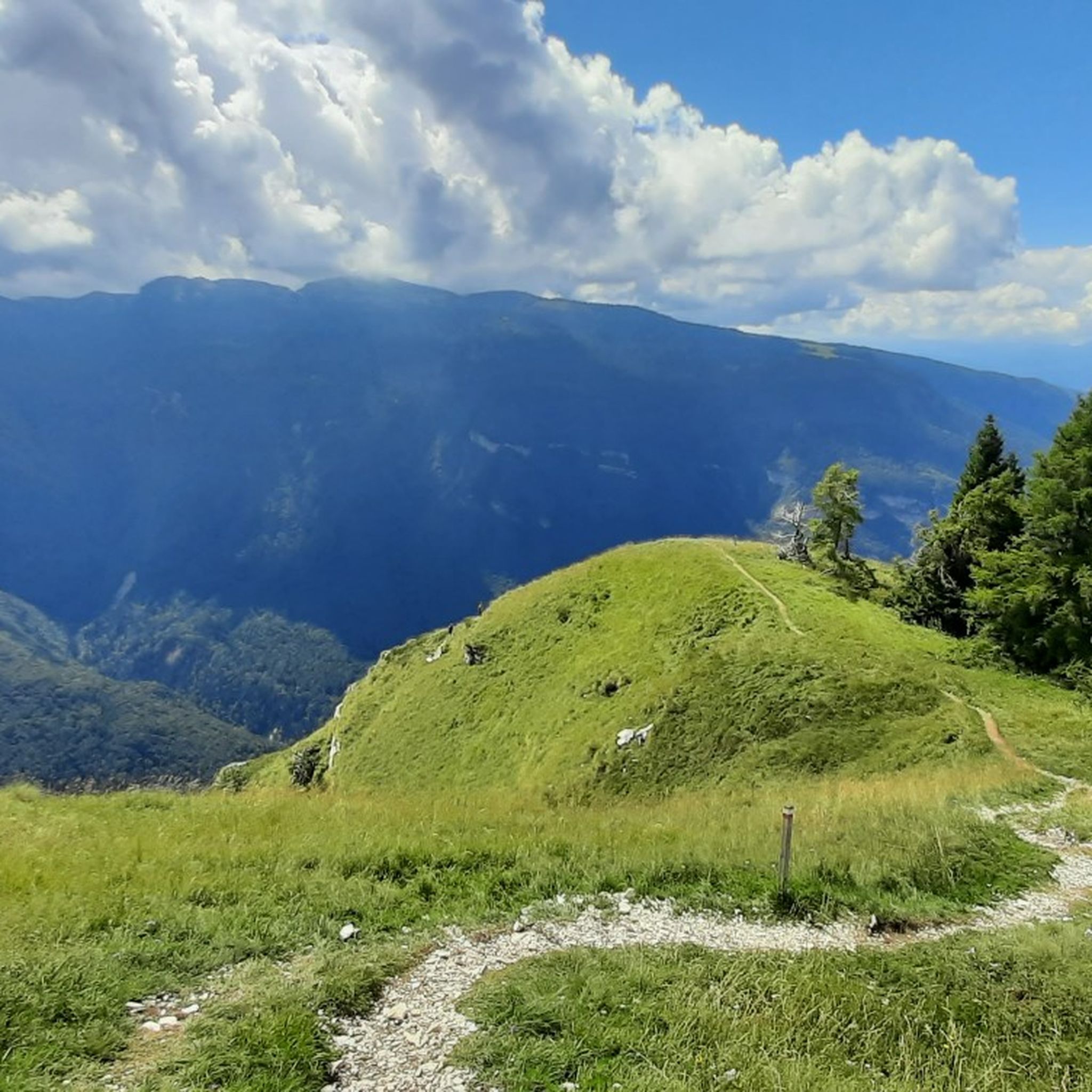
Historical route of the First World War, tunnels created in 10 months of hard work by many men to be able to bring weapons, ammunition, water, food to the front of the conflict against the Austrians. The 52 tunnels are quite easy to walk through, I recommend trekking clothing and a torch to use inside the tunnels to be able to see where you are walking, I recommend it to everyone with a minimum of training

翻訳者 Google •

役立つ情報

によるものです

ここでのハイキングを見る

スマートフォンに送信

保存

The Rifugio Generale Achille Papa is a refuge on the upper edge of the Val Canale at 1928 meters. It was built after the First World War and uses buildings from a former Italian barrack camp. Since then it has been rebuilt several times, today the building is quite imposing and renovated according to sustainable criteria.

The view up here is pretty breathtaking! Both from the hut, as well as the hut itself. Even the journey through the tunnel that ends here is an experience. In the hut you can strengthen yourself and even stay overnight. There is also a bivouac. Info unfortunately only in Italian: caischio.it/rifugio-papa

翻訳者 Google •

役立つ情報

によるものです

保存

今すぐサインアップして、こんな場所を発見しよう

最高のシングルトラック、ピーク、その他のエキサイティングなアウトドアスポットのおすすめを受け取ろう。

無料新規登録

52のトンネルの道 — モンテ・パスビオ

ハイライト (セグメント) • トレイル

I recommend at least once in your life to take this path, only in this way you can understand what our ancestors were capable of.

翻訳者 Google •

役立つ情報

によるものです

保存

The Winged Dragon of Vaia is a work by the artist Marco Martalar built with scrap wood in memory of the Vaia storm of 2018.

翻訳者 Google •

役立つ情報

によるものです

保存

ラ・ストラーダ・デッリ・スカルッビ

ハイライト (セグメント) • トレイル

Strada degli Scarubbi:
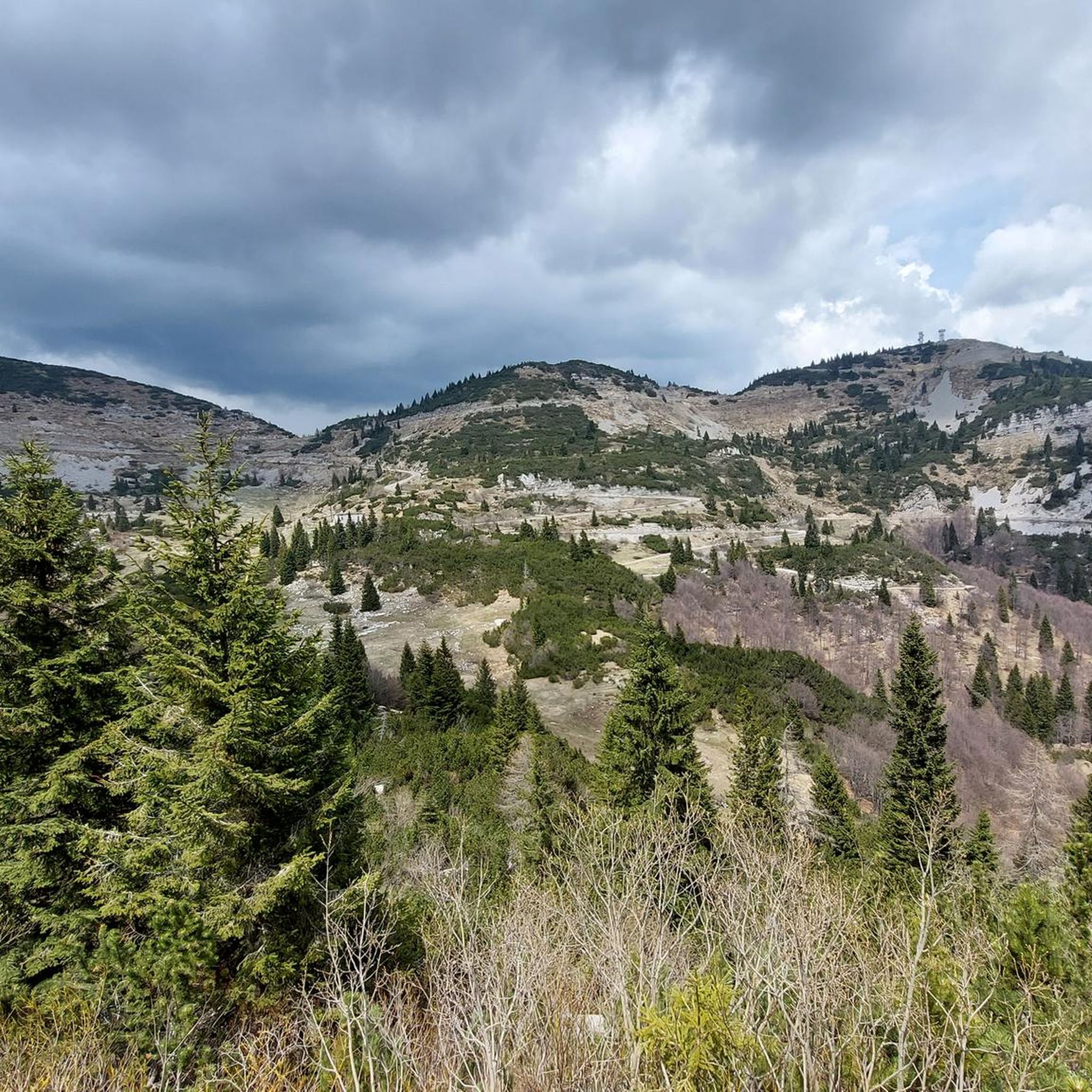
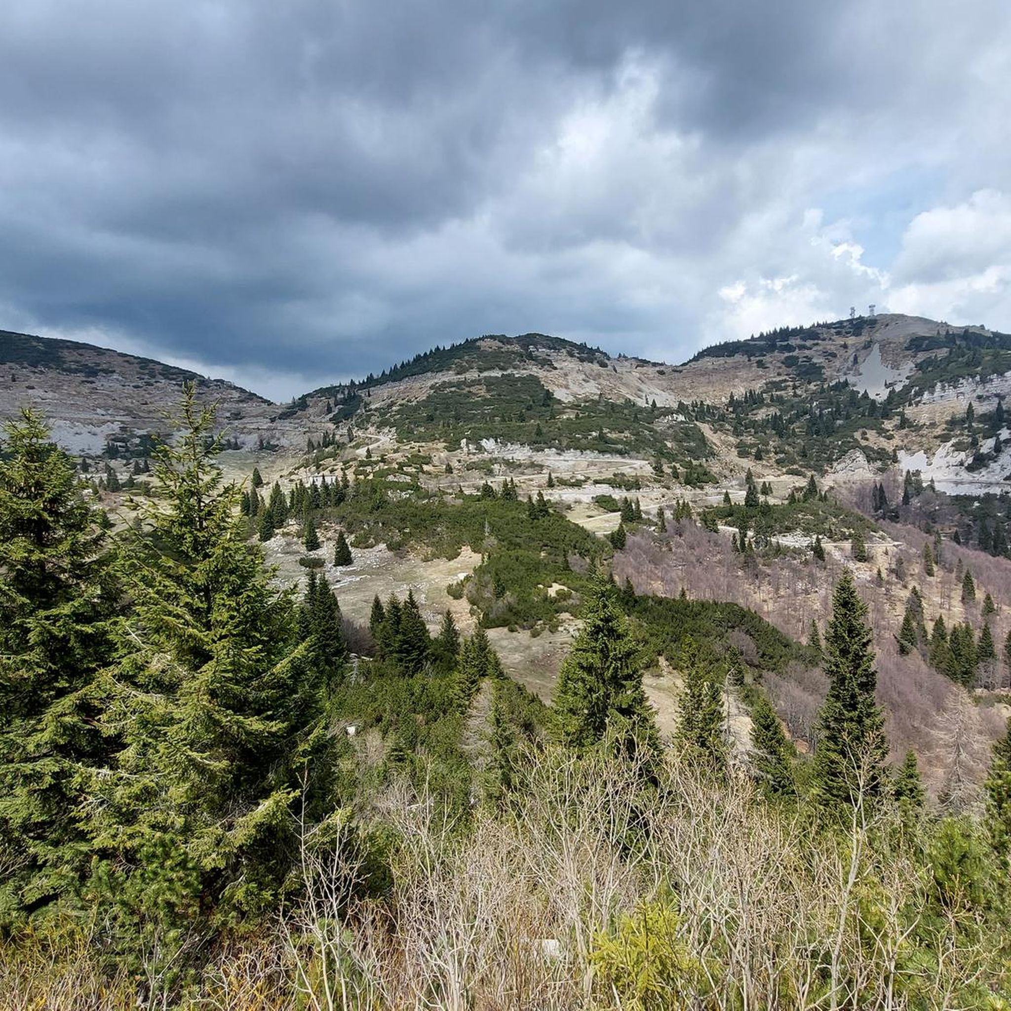
La strada degli Scarubbi è una strada carrabile del massiccio del Pasubio, nelle Prealpi vicentine, costruita durante la Prima guerra mondiale. Lunga 10,5 chilometri, parte dal Passo Xomo (1058 m) e arriva alle Porte del Pasubio (1928 m).
Storia:
La strada degli Scarubbi fu costruita nell'estate del 1917, durante la Prima guerra mondiale, dall'Esercito Italiano per avere un accesso alla zona sommitale del Pasubio e quindi alla prima linea. Percorsa da autocarri, era tuttavia esposta all'artiglieria austriaca del vicino Monte Maio, essendo ricavata sul versante settentrionale del Monte Forni Alti. Veniva perciò percorsa in condizioni di particolare pericolo, in particolare durante la notte e a fari spenti. Furono sviluppate tecniche particolari per sfuggire all'artiglieria austriaca, come ad esempio sostare nei tornanti non in vista, per rendere più difficoltoso il puntamento dell'artiglieria nemica.
A causa della sua esposizione a nord, non era utilizzabile durante l'inverno e per buona parte della primavera: questi fattori resero necessaria la costruzione della strada delle 52 gallerie, molto più sicura ma non accessibile ai mezzi motorizzati.
Dopo il secondo dopoguerra la strada degli Scarubbi ha rappresentato, con quella degli Eroi, la principale via d'accesso alle prime automobili di gitanti. Chiusa al traffico motorizzato dagli anni ottanta con sbarra poco dopo Bocchetta Campiglia, è oggi accessibile solamente ai gestori del rifugio Achille Papa.
Oggi:
La strada degli Scarubbi è oggi di fatto l'unica via usata per l'accesso alla sommità del Pasubio con mezzi motorizzati. Nella sua parte intermedia, quella pianeggiante, è tuttavia soggetta a frane dopo le piogge primaverili e richiede annualmente lavori di manutenzione consistenti, per la rimozione dei detriti e la messa in sicurezza.
Viene inoltre scelta come via di discesa dalla maggior parte degli escursionisti, essendo molto più breve della Strada degli Eroi, sfruttando le scorciatoie sui tornanti delle Caneve di Campiglia.
Insieme all'altra rotabile rappresenta uno dei percorsi di maggior interesse storico e paesaggistico per la mountain bike.
(fonte Wikipedia)

役立つ情報

によるものです

保存

無料でサインアップして、さらに多くの観光スポットを発見しましょう アルシエロでの。

無料新規登録

すでにアカウントをお持ちですか?

無料アカウントで今日から始めよう

次の冒険が待っています。

ログインまたは登録

アルシエロ周辺で人気

Via delle Prealpi – ベネツィア前アルプスでMTBで旅する

アルシエロでのハイキング

アルシエロのロードバイクルート

アルシエロのMTBトレイル

アルシエロでのサイクリング

アルシエロでののグラベルライド

アルシエロのランニングコース

アルシエロでの登山&山歩き

アルシエロでのの他の冒険

Via delle Prealpi – ベネツィア前アルプスでMTBで旅する

マウンテンバイクのコレクション によって

Francesco | Cyclo Ergo Sum

コミュニティからのヒント

Roger Eggenberger 🐾👣
7月 13, 2025, La Strada degli Scarubbi

Road to the Rifugio Achille Papa. This is where you walk down if you're doing a circular hike with the 52 tunnels.

Google翻訳による翻訳

6

1

The first plans for the construction of a refuge on Pasubio date back to 1907. However, they were not realized until after the First World War, when the Schio section of the CAI began to build a refuge in memory of the soldiers who had fallen on Pasubio. Source: https://de.m.wikipedia.org/wiki/Rifugio_Achille_Papa

Google翻訳による翻訳

7

0

A magnificent hike. 52 tunnels lead up the mountain. Warning: Don't forget your flashlight!

Google翻訳による翻訳

11

0

One of the most beautiful and impressive hikes I've ever done. Simply breathtaking. The Strada delle 52 Gallerie, also known as the Strada della 1ª Armata or Strada della Prima Armata, is one of the most famous and most visited Italian military roads of the First World War. It was built to supply the Italian positions on the Pasubio.

Google翻訳による翻訳

6

1

Named after General Achille Papa, Gold Medal for military valor who died during the First World War in 1917, the refuge is located at the saddle of the Porte del Pasubio, at 1,928 meters above sea level, on the massif of the same name. Today the Papa refuge is owned by the CAI of Schio and boasts around sixty beds.

Google翻訳による翻訳

2

1

The new Dragon was made with the burnt wood left over from the fire of Martalar's previous works. Located in a panoramic position, it is certainly worth a visit.

Google翻訳による翻訳

1

0

The new Vaia Dragon (officially 'Drago Vaia Regeneration') is spectacular, imposing, and completely different from its predecessor: larger, more menacing, and above all more enraged by the human stupidity that destroys nature and art, a fact exemplified by the anonymous arson attack on the previous work. It has literally been reborn from the work that burned on the night of August 23, 2023: in addition to sharing the same position, 10-15% of the wood was recovered from the previous dragon. A symbol of rebirth and resilience. It has returned after less than a year as the largest wooden dragon in the world: 16 meters long x 7 meters high (double the size of the first), 6 tons of wood, more than 3,000 pieces on a steel frame. Unlike its predecessor, the dragon was not created on site, but inside a warehouse in Pedescala, then transported here in two enormous pieces and assembled. I quote the artist, Marco Martalar: "It took ten months of work to create, and the work carries with it the memory of what happened to its predecessor. Inside it are not only the roots of Storm Vaia, but also a part of the old dragon that was destroyed, while the other parts were deliberately charred and then reassembled with the rest of the wood." https://www.lavaronegreenland.it/drago-vaia/ https://www.martalar.it

Google翻訳による翻訳

4

0

Unfortunately, this highlight burned down in August 2023. It's a real shame. The Dragon Trail there is still a worthwhile little walk, though. Edit: A new dragon has since been built.

Google翻訳による翻訳

2

1

アルシエロでのの人気ルート

アルシエロでのハイキング

アルシエロでのの人気観光スポット

Natural Monuments

Store rating

komootモバイルアプリでインスピレーションを得よう

無料のkomootアカウントがあれば、無限のアウトドアコースを簡単に見つけてカスタマイズし、ナビで案内できます。

または

今すぐkomootに参加しよう

Store rating

さらに探索

まだ探しているハイライトが見つかりませんか?他の地域のトップアトラクションのガイドを見てみましょう:

ポージナラギスキオヴァッリ・デル・パスビオトネッツァデルシモーネレコアーロ・テルメロトツォヴァルダスティコロアナペデモンテアジアーゴラステバッセトッレベルヴィチーノヴェーロ・ダスティココゴッロデルセンジオFozaエーネゴヴァルスターニャカルヴェーネルジアーナガリオグリジニャーノディゾッコルーゴ・ディ・ヴィチェンツァキュッパーノカルトラーノクレスパドーロチズモーンデルグラッパカレテッツェ・スル・ブレンタバッサノデルグラッパアルベットーネポーヴェ・デル・グラッパカミザーノ・ヴィチェンティーノRosàマロスティカポッツォレオーネピオヴェーネロシェットファラ・ヴィチェンティーノカルティリアーノソラーニャサンナザリオ南斗モッサーノノベノヴェンタビセンティーナロマーノ・デッツェリーノムッソレンテモンテガルダモンテガルデッラピアネッツェマゾーン・ヴィチェンティーノバルバラーノ・ヴィチェンティーノグルーモロデッレアバデッセアグリアーロスキアヴォーンモルヴェーナロンガーレコンコカンポロンゴスルブレンタサルセドカステニェーロロッサーノ・ヴェネトカッソーラブレッサンヴィードヴィッラーガサントルソズリアーノブレガンツェクイント・ヴィチェンティーノアルクニャーノゾヴェンチェードザネアルタヴィッラヴィセンティーナブレンドラバルダーニョサンドリーゴトッリ・ディ・カルテソロモンテヴィアーレモンテベッロヴィチェンティーノボルツァーノビセンティーノクレアッツォサルチェードモンテッキオマッジョーレSic Altopiano Dei Sette Comuniグランコーナサレーゴソヴィッツォサンゲルマノデイベリチソッサーノカンピーリアデイベリチドゥエヴィッレモントルソ・ヴィチェンティーノロニゴアルツィニャーノモンテッキオ・プレカルチーノアルティッシモカルドーニョトリッシノガンベッラーラコスタビッサーラサンピエトロムッソリーノマラーノ・ヴィチェンティーノイーゾラ・ヴィセンティーナガンブリアーノカステルゴンベルトモンティチェッロコンテオットーティエネマロヴィッラヴェルラコルネード・ヴィチェンティーノポイアーナマッジョーレゼルメゲードアジリアーノヴェネトジメッラアロンテオルジャーノノガローレビセンティーノキャンポサンヴィートディレグッツァーノモンテディマーロブロリアーノフィモン湖

近くのアドベンチャーガイド

トネッツァデルシモーネでやるべきこと

background

新しいピークを征服する準備をしよう

無料でサインアップ

探検する
ルートルートプランナー機能ハイキングMTBトレイルロードバイクルートバイクパッキングサイトマップ
アプリをダウンロード
SNSでフォローする

© komoot GmbH

プライバシーポリシー