ルート

プランナー

機能

アップデート

App

ログインまたはサインアップ

アプリを入手

ログインまたはサインアップ

ログインまたはサインアップ

ルート
Places to see
イタリア
ベネト
ヴィチェンツァ

ヴァッリ・デル・パスビオ

ヴァッリ・デル・パスビオ周辺のアトラクション&必見スポット - トップ20


ヴァッリ・デル・パスビオには必見のスポットがたくさんあります。ハイキング愛好家やサイクリング愛好家の方は、ぜひヴァッリ・デル・パスビオを探索してこのエリアにある20
の隠れたスポットを訪れてみてください。このエリアの必見スポットを確認し、次の冒険に出かける計画を立てましょう。

最終更新日: 5月 25, 2026

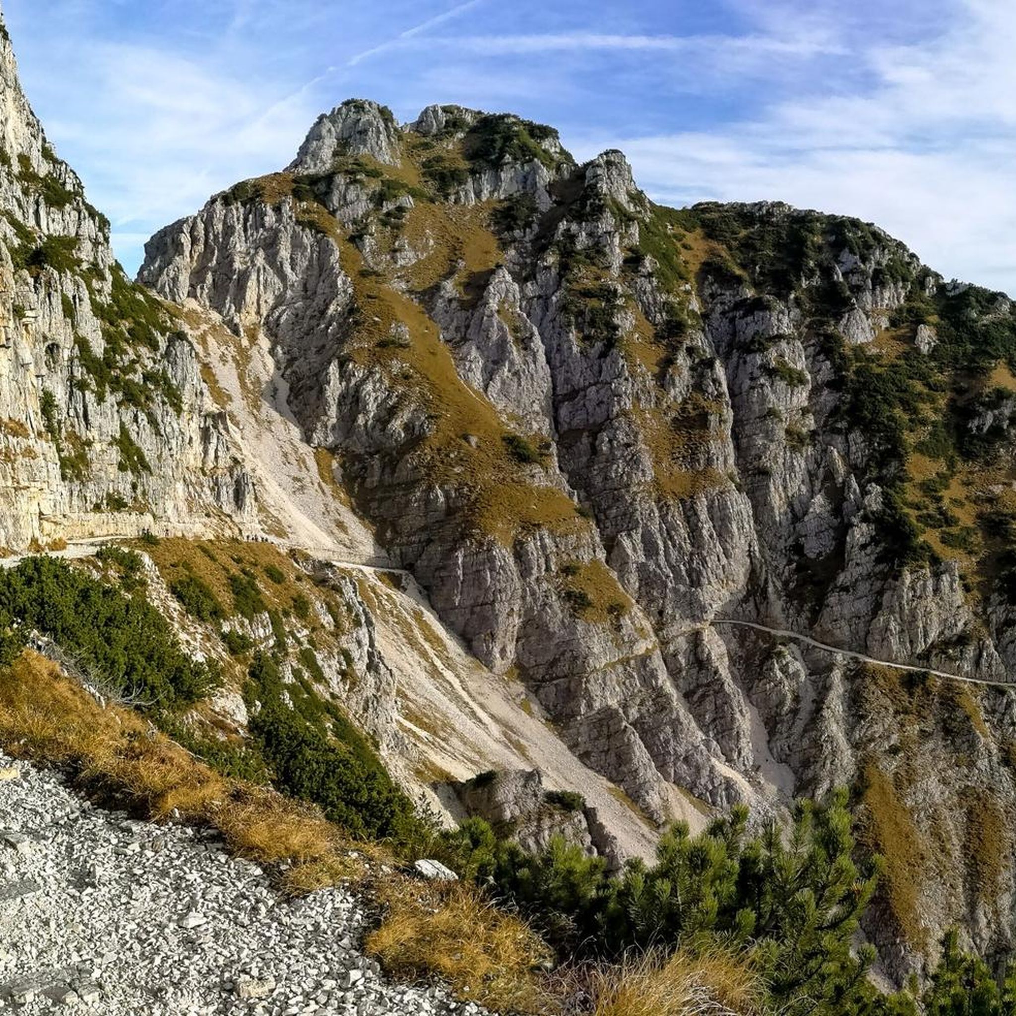
ストラーダ・デッレ・52・ガレリエ

ハイライト (セグメント) • トレイル

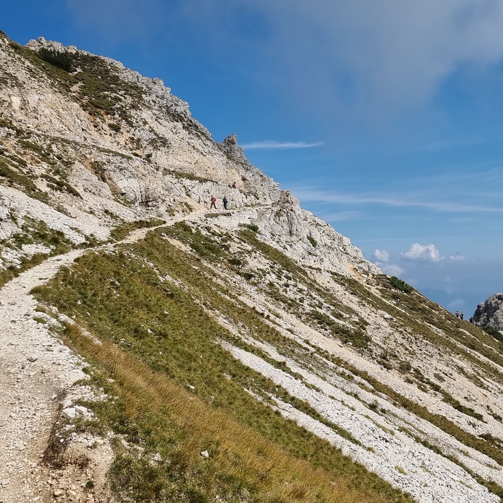
Historical route of the First World War, tunnels created in 10 months of hard work by many men to be able to bring weapons, ammunition, water, food to the front …

翻訳者 Google •

役立つ情報

によるものです

ここでのハイキングを見る

スマートフォンに送信

保存

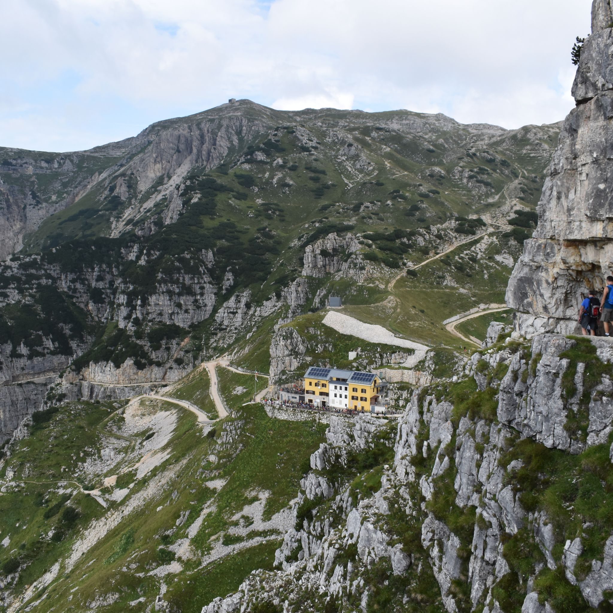
The Rifugio Generale Achille Papa is a refuge on the upper edge of the Val Canale at 1928 meters. It was built after the First World War and uses buildings …

翻訳者 Google •

役立つ情報

によるものです

保存

今すぐサインアップして、こんな場所を発見しよう

最高のシングルトラック、ピーク、その他のエキサイティングなアウトドアスポットのおすすめを受け取ろう。

無料新規登録

52のトンネルの道 — モンテ・パスビオ

ハイライト (セグメント) • トレイル

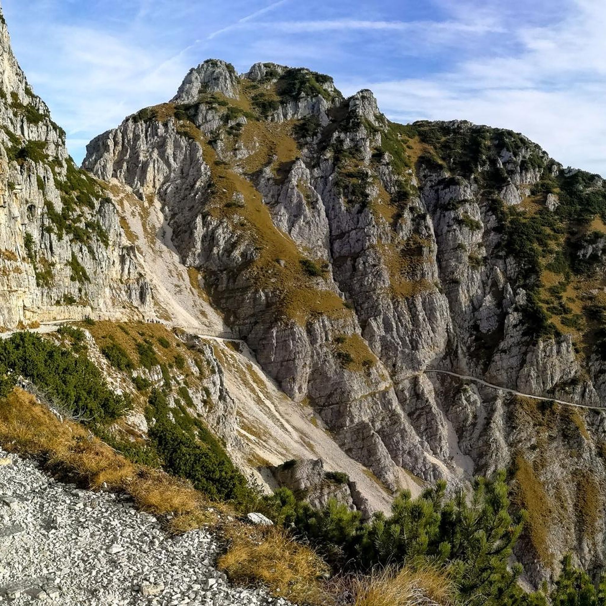
I recommend at least once in your life to take this path, only in this way you can understand what our ancestors were capable of.

翻訳者 Google •

役立つ情報

によるものです

保存

ラ・ストラーダ・デッリ・スカルッビ

ハイライト (セグメント) • トレイル

Strada degli Scarubbi:
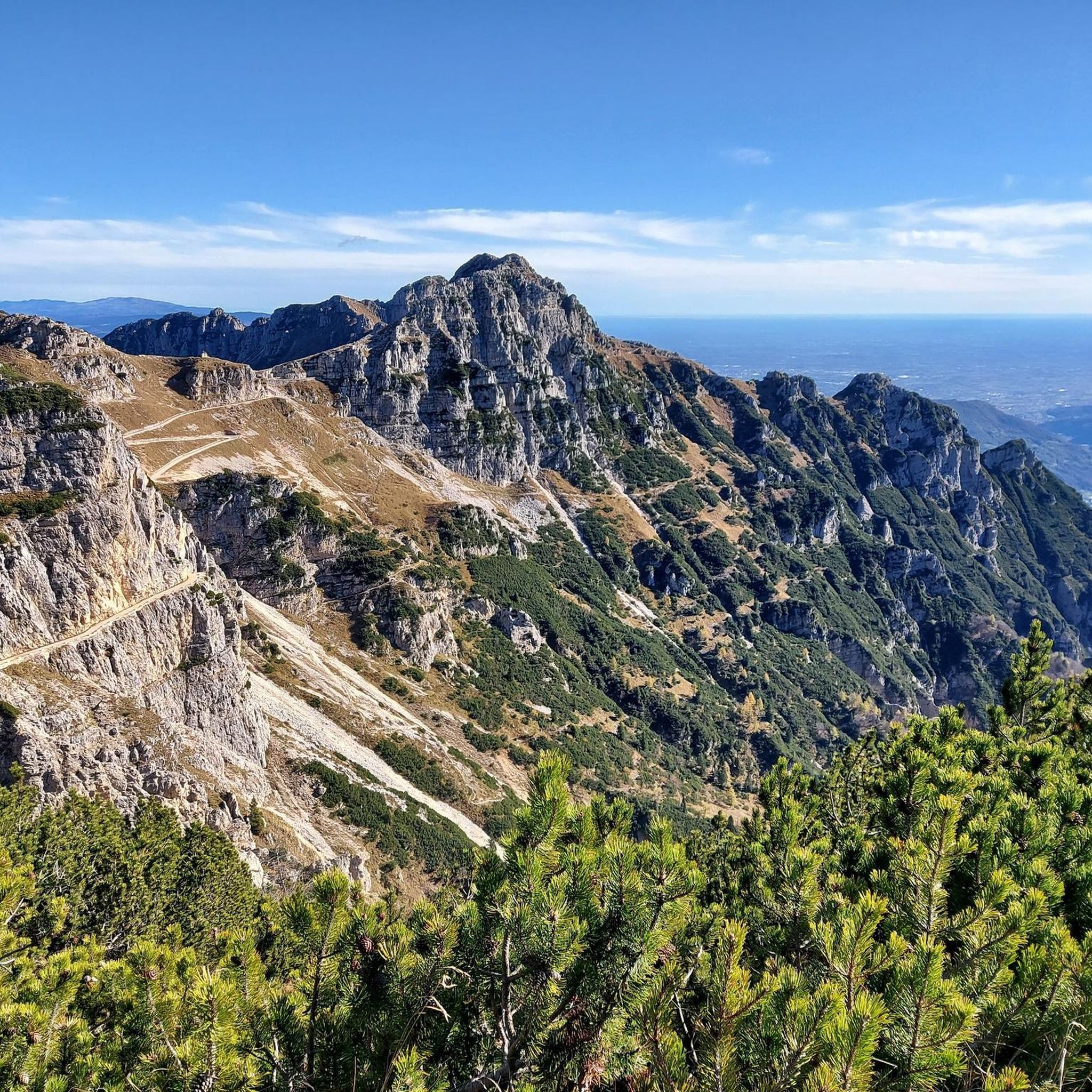
La strada degli Scarubbi è una strada carrabile del massiccio del Pasubio, nelle Prealpi vicentine, costruita durante la Prima guerra mondiale. Lunga 10,5 chilometri, parte dal Passo …

役立つ情報

によるものです

保存

The Cesare Battisti refuge is located at the foot of Passo Tre Croci (or della Lora) and the Catena delle Tre Croci.

It is the starting point and destination of …

翻訳者 Google •

役立つ情報

によるものです

保存

無料でサインアップして、さらに多くの観光スポットを発見しましょう ヴァッリ・デル・パスビオでの。

無料新規登録

すでにアカウントをお持ちですか?

無料アカウントで今日から始めよう

次の冒険が待っています。

ログインまたは登録

ヴァッリ・デル・パスビオ周辺で人気

Il Sentiero della Pace – viaggio nella memoria storica del Trentino

ヴァッリ・デル・パスビオでのハイキング

ヴァッリ・デル・パスビオのMTBトレイル

ヴァッリ・デル・パスビオのランニングコース

ヴァッリ・デル・パスビオでののグラベルライド

ヴァッリ・デル・パスビオでのサイクリング

ヴァッリ・デル・パスビオのロードバイクルート

ヴァッリ・デル・パスビオでの登山&山歩き

ヴァッリ・デル・パスビオでのの他の冒険

Il Sentiero della Pace – viaggio nella memoria storica del Trentino

ハイキングのコレクション によって

Visit Trentino

コミュニティからのヒント

Roger Eggenberger 🐾👣
7月 13, 2025, La Strada degli Scarubbi

Road to the Rifugio Achille Papa. This is where you walk down if you're doing a circular hike with the 52 tunnels.

Google翻訳による翻訳

6

1

The first plans for the construction of a refuge on Pasubio date back to 1907. However, they were not realized until after the First World War, when the Schio section of the CAI began to build a refuge in memory of the soldiers who had fallen on Pasubio. Source: https://de.m.wikipedia.org/wiki/Rifugio_Achille_Papa

Google翻訳による翻訳

7

0

A magnificent hike. 52 tunnels lead up the mountain. Warning: Don't forget your flashlight!

Google翻訳による翻訳

11

0

One of the most beautiful and impressive hikes I've ever done. Simply breathtaking. The Strada delle 52 Gallerie, also known as the Strada della 1ª Armata or Strada della Prima Armata, is one of the most famous and most visited Italian military roads of the First World War. It was built to supply the Italian positions on the Pasubio.

Google翻訳による翻訳

6

1

Named after General Achille Papa, Gold Medal for military valor who died during the First World War in 1917, the refuge is located at the saddle of the Porte del Pasubio, at 1,928 meters above sea level, on the massif of the same name. Today the Papa refuge is owned by the CAI of Schio and boasts around sixty beds.

Google翻訳による翻訳

2

1

Together with the 52 Tunnels hike you can make a circular walk here

Google翻訳による翻訳

1

0

The Road of the 52 Tunnels (properly known as the "First Army Road") is an extraordinary and daring masterpiece of military engineering from the First World War, especially considering the period in which it was built. It climbs the steep and inaccessible southern slope of the Pasubio massif, amidst spires, gorges, and precipices. Breathtaking views. It was built in 1917 in just 10 months to solve a serious problem the Italian Army encountered during the Great War against the Austro-Hungarian Army: supplying the front line on the summit of Pasubio. After the Imperial advance with the Strafexpedition of 1916, the Scarubbi Road (until then used as a roadway on the north slope) found itself under enemy artillery fire; extremely dangerous and unusable. It was therefore decided to open this intrepid route on the south slope, hidden from enemy view and fire. The road is approximately 6,300 meters long, 2,300 meters of which are divided into 52 tunnels; the remaining 4 km are carved halfway through the rock, with an average gradient of 12%. It has a minimum width of 2.2 meters, allowing two mules to pass in both directions without obstruction. Tunnels 19 and 20 extend inside a rocky tower, following a helical path to overcome the difference in altitude! Today, the road is accessible on foot (no longer by bicycle, due to fatal accidents), with paid parking at Bocchetta Campiglia; in winter, it is impassable and dangerous, as piles of snow often block the tunnel entrances. It is a unique work of art that attracts thousands of tourists and hikers from all over Italy and Europe: from spring to autumn, it is best to avoid crowded weekends. Fatal accidents are not uncommon. https://www.stradadelle52gallerie.it https://it.wikipedia.org/wiki/Strada_delle_52_gallerie

Google翻訳による翻訳

3

0

beautiful, you get there from one of the most beautiful paths there is... a thousand colors in autumn!!! excellent to deal with children and/or dogs

Google翻訳による翻訳

3

1

ヴァッリ・デル・パスビオでのの人気ルート

ヴァッリ・デル・パスビオでのハイキング

ヴァッリ・デル・パスビオでのの人気観光スポット

Mountain Peaks

Store rating

komootモバイルアプリでインスピレーションを得よう

無料のkomootアカウントがあれば、無限のアウトドアコースを簡単に見つけてカスタマイズし、ナビで案内できます。

または

今すぐkomootに参加しよう

Store rating

さらに探索

まだ探しているハイライトが見つかりませんか?他の地域のトップアトラクションのガイドを見てみましょう:

ポージナスキオトネッツァデルシモーネラギアルシエロペデモンテヴァルダスティコラステバッセロアナレコアーロ・テルメヴェーロ・ダスティコエーネゴアジアーゴロトツォクイント・ヴィチェンティーノヴァルスターニャチズモーンデルグラッパFozaコゴッロデルセンジオグリジニャーノディゾッコトッレベルヴィチーノバッサノデルグラッパポーヴェ・デル・グラッパテッツェ・スル・ブレンタピアネッツェRosàポッツォレオーネカルティリアーノノベガリオソラーニャカルトラーノルジアーナルーゴ・ディ・ヴィチェンツァカルヴェーネロマーノ・デッツェリーノサンナザリオカミザーノ・ヴィチェンティーノキュッパーノカンポロンゴスルブレンタマゾーン・ヴィチェンティーノマロスティカピオヴェーネロシェットカレカステニェーロスキアヴォーンアルベットーネファラ・ヴィチェンティーノモルヴェーナムッソレンテ南斗クレスパドーロロッサーノ・ヴェネトモッサーノバルバラーノ・ヴィチェンティーノグルーモロデッレアバデッセブレッサンヴィードロンガーレモンテガルデッラブレガンツェアグリアーロノヴェンタビセンティーナモンテガルダコンコサンドリーゴサントルソヴィッラーガサルセドザネカッソーラボルツァーノビセンティーノゾヴェンチェードズリアーノアルクニャーノアルタヴィッラヴィセンティーナブレンドラモンテッキオマッジョーレドゥエヴィッレトッリ・ディ・カルテソロソヴィッツォモンテヴィアーレモンテベッロヴィチェンティーノバルダーニョクレアッツォサレーゴカンピーリアデイベリチグランコーナサンゲルマノデイベリチモンテッキオ・プレカルチーノサルチェードソッサーノSic Altopiano Dei Sette Comuniロニゴモントルソ・ヴィチェンティーノアルツィニャーノカルドーニョアルティッシモマラーノ・ヴィチェンティーノトリッシノサンピエトロムッソリーノイーゾラ・ヴィセンティーナコスタビッサーラティエネガンブリアーノマロガンベッラーラカステルゴンベルトモンティチェッロコンテオットーコルネード・ヴィチェンティーノノガローレビセンティーノヴィッラヴェルラポイアーナマッジョーレキャンポアジリアーノヴェネトゼルメゲードアロンテオルジャーノサンヴィートディレグッツァーノジメッラモンテディマーロブロリアーノフィモン湖

近くのアドベンチャーガイド

ポージナでやるべきこと

background

新しいピークを征服する準備をしよう

無料でサインアップ

探検する
ルートルートプランナー機能ハイキングMTBトレイルロードバイクルートバイクパッキングサイトマップ
アプリをダウンロード
SNSでフォローする

© komoot GmbH

プライバシーポリシー