ラテラザのおすすめウォーキング&ハイキングルート
4.5
(357)
1,378
ハイカー
17
ハイキング
ラテラザ周辺でのハイキングは、景色を満喫するのに最適な手段のひとつですが、適切なハイキングルートを見つけることは簡単ではありません。 ラテラザ周辺の人気ハイキング&ウォーキングコースを参考にすれば、行きたいルートをすぐに見つけられます。
最終更新日: 8月 30, 2026
4.5
(29)
89
ハイカー
18.2km
04:56
240m
240m
中程度のハイキング. ある程度のフィットネスレベルが必要です。 進みやすいルートです。あらゆるスキルレベルに適しています。
4.6
(31)
157
ハイカー
7.71km
02:13
190m
190m
中程度のハイキング. ある程度のフィットネスレベルが必要です。 進みやすいルートです。あらゆるスキルレベルに適しています。

無料新規登録
4.6
(36)
130
ハイカー
4.41km
01:14
80m
90m
初級者向けハイキング. あらゆるフィットネスレベルに適しています。 進みやすいルートです。あらゆるスキルレベルに適しています。
4.6
(28)
97
ハイカー
7.82km
02:11
150m
150m
中程度のハイキング. ある程度のフィットネスレベルが必要です。 進みやすいルートです。あらゆるスキルレベルに適しています。
3.7
(3)
16
ハイカー
20.7km
05:37
290m
290m
難しいハイキング. 標準以上のフィットネスレベルが必要です。 進みやすいルートです。あらゆるスキルレベルに適しています。
さらに多くのルートや他のユーザーのおすすめ情報を確認できます。
無料新規登録
すでにアカウントをお持ちですか?
おすすめのツアーは他のkomootユーザーが実際に経験した何千ものアクティビティに基づいています。
無料アカウントで今日から始めよう
次の冒険が待っています。
ログインまたは登録

コミュニティからのヒント


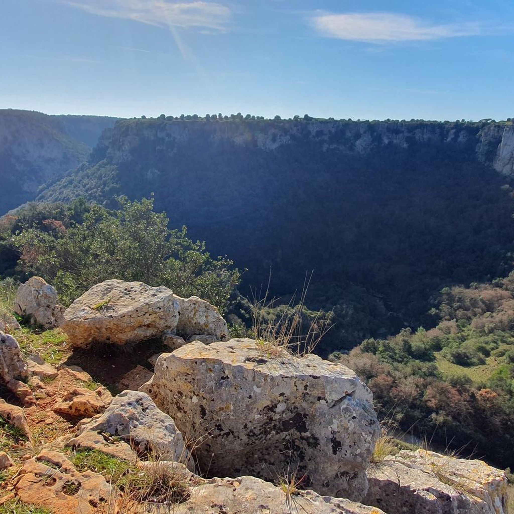
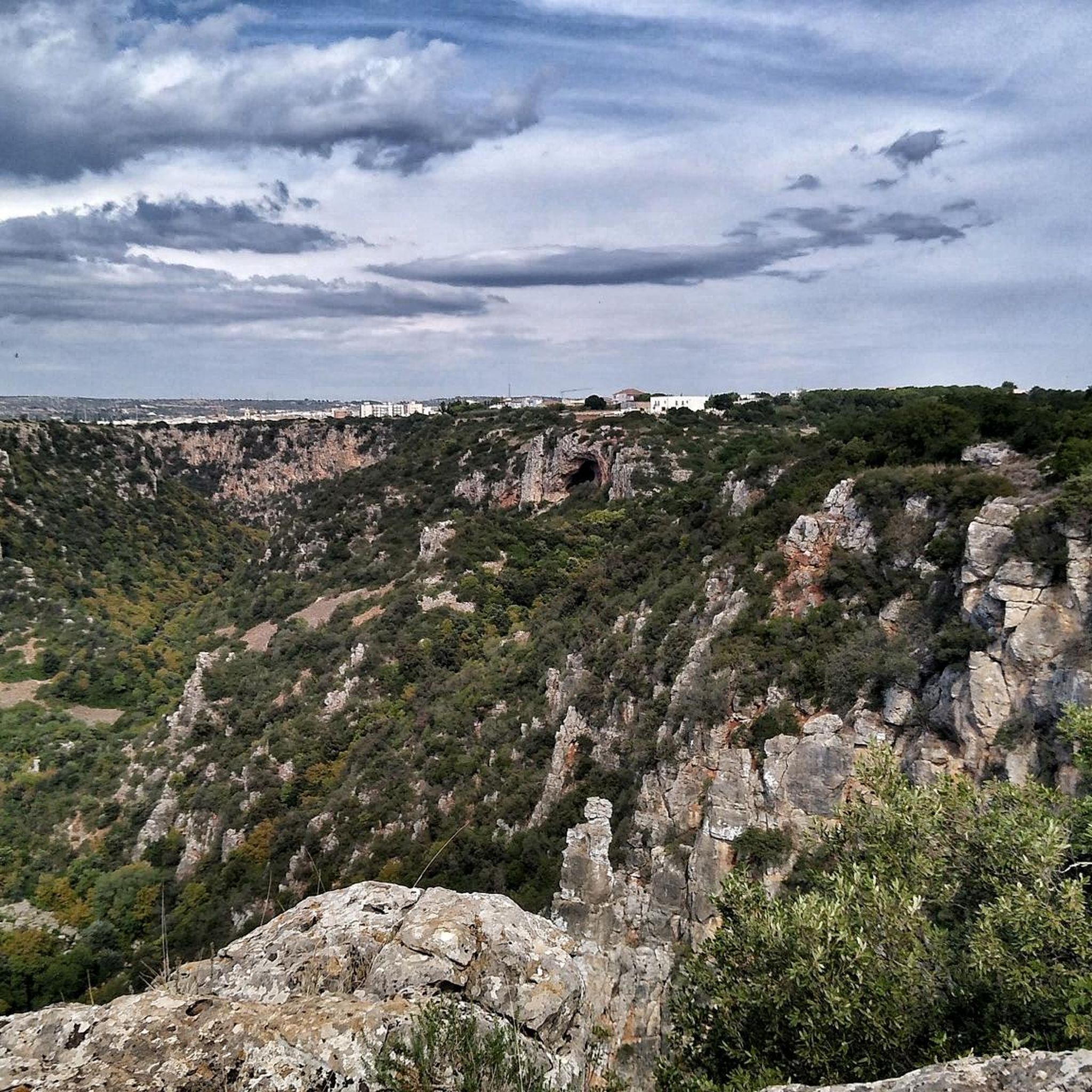
The Grotta Croce (The Cross Grotto) is a natural cavity set in the walls of the canyon. This cave ist home to several birds, including kestrels and swifts and if you are lucky, you can spot the eagle that inhabits the area.
0
0
There are a handful of those water collecting channels alongside the road. Most likely to catch the water running off the road during a downpour
0
0
Along the sides of the ravine as it snakes its way around the town are the ruins of rock-cut settlements so distinctive of Ginosa. These are the settlements of people who cut their houses and churches into the rock. The best place to visit these dwellings is on the eastern side of the town, in the Rione di Rivolta. At the end of the 5th century AD when the Roman Empire came under attack from the Goths and other Germanic tribes attacking Rome, the open plains were no longer safe. And it was then that people sought refuge in the relatively safer ravines. The soft, limestone bedrock made it easy to cut into the sides of the ravines to create places to live that were easier to protect against the Goths to begin with, but also the Saracens later. Over the turbulent centuries of the Middle Ages that followed the fall of the Western Roman Empire fully developed communities emerged in these ravines. These early Medieval troglodytes ‘built’ surprisingly complex villages simply by cutting into the rock at different levels. Besides creating domestic spaces – Casa Grotto (cave house), they also cut churches into the sides of the ravines. They also cut channels and cisterns into the rock to supply water. The rock cut villages in the ravines around Ginosa were still inhabited up until the 20th century. Today the Casa Grottos and rock cut churches with their Byzantine frescoes are a popular tourist attraction, particularly Villagio Rivolta. Here visitors can see the typical structure of the casa grotto, where rooms at the front were communal and where cooking would have taken place, while animals were kept in the room at the rear – for safety. In front of the houses you can see the network of human-made cisterns, basins and channels that caught and stored rain water. What today seems like a random collection of ruined artificial caves is in fact a very elaborate village made up of 66 individual houses, constructed over five levels one on top of the other connected by stairs.
0
0
Below the castle and in amongst the buildings right on the edge of Rione di Casale you can not miss an eye-catching gabled façade and bell tower. These are the noticeable features of 16th century church, Chiesa Matrice. A church that for centuries has had a special place in the religious traditions and history of Ginosa. Do not let the seemingly out of the way location of Chiesa Matrice lead you to think this is an insignificant church. Everything about this sacred space is intimately linked to the changing historical fortunes and allegiances of Ginosa. Construction of the church began towards the end of the 15th century to appease French soldiers. At the time, Ginosa was caught up in the Italian Wars – a series of conflicts that involved most of the major states of western Europe fight for territory and power. Giambattista Doria not only enlisted French architects to build the church, he also had it dedicated to a prominent French Saint, Martin of Tours. Take a closer look at the fading painting on the front façade beneath the rose window. It is thought to represent the legend of Martin’s Cloak. Martin is depicted on horseback cutting his cloak in two, one half of which he gave to the poor, nude beggar he is said to have encountered at the gates of Amiens. Saint Martin’s and the French soldiers’ hold over the church here was not to last long. In one of the five chapels, in an ornate wooden display case, is an 18th century statue of Mary holding Jesus and a rosary. In 1756 the town chose to re-dedicate the church to Mary, Madonna del Rosario. Since its construction in the early 16th century, the church has witnessed a number of changes. In the 17th century, like many churches in Italy it was restored in a Baroque style. All that remains of this period are the painted walls and ceiling at the back of the right-hand aisle. The rest of aisle, the left-hand aisle, the nave and apse is simply white. It does make for a very bright interior. Chiesa Matrice was in fact built on top of an earlier church. The edge of the apse of that earlier church, built in about 1000 AD, can be seen through a glass panel in the floor of the apse.
0
0
Along the sides of the ravine as it snakes its way around the town are the ruins of rock-cut settlements so distinctive of Ginosa. These are the settlements of people who cut their houses and churches into the rock. There are two parts of the rock village: Rione Casale and Rione di Rivolta. Travel Guides by Experienced Archaeologists & Historians Destinations • Europe • Italy Travel Guide • Puglia • Ginosa Historic Landmarks Facebook-f Twitter Pinterest 5 Historical Landmarks that Tell the Stories of Ginosa Discover the stories of a town in southern Italy where the inhabitants were living in rock-cut caves for centuries; from the time of the Romans to the not so distant past. Ginosa – a town off the beaten track, even for Puglia. Thomas Dowson Last Checked and/or Updated 15 December 2021 No Comments Italy Travel Tips & Ideas Like many towns in Puglia, Ginosa owes its fascination to its geographical location as much as its history. Both the physical and historical aspects of the town are immediately visible. In fact the two are intertwined, and have been for centuries. Many, many thousands of years ago a u-shaped bend in a river, as it meanders its way towards the Gulf of Taranto (about 20km away), created a spur of land that has obviously been very attractive to successive inhabitants of Ginosa. Over the centuries people have built on this spur and in the horseshoe-shaped ravine giving Ginosa its distinctive character today. These five historical landmarks are a great way to discover that character. Peucetian Funerary Structure Perhaps not as prominent as some of the other landmarks, but significant nonetheless. On the edge of the square in front of the town hall are the oldest remains of human habitation on view in Ginosa. Just below street level and underneath a row of holm oak trees is a series of Peucetian tombs, left exposed and visible through glass covers. Little is known about the Peucetians. They are one of three Iapygian populations that occupied what is Puglia today; the other two being the Daunians and Messapians. Some archaeologists have suggested that the Iapygians are descendants of the Illyrians, who crossed the Adriatic Sea and settled in southern Italy during the 9th century BC. Whatever their origins, artefacts excavated by archaeologists show they were in close contact with the nearby Greek colonies, such as Metaponto and Taranto. It was the Roman defeat of these Greek colonies in southern Italy in the Phyrric War (280 to 275 BC) that lead to the incorporation of the region into the Roman Republic. During the construction of the square in front of the Ginosa’s town hall, builders came across a Peucetian funerary complex. The necropolis was excavated by archaeologists and left open, but covered with protect glass structures to enable people to see the different types of tombs. One limestone sarcophagus stands above ground on the square; a few others can be seen in their original place within the tombs. Troglodyte Village Along the sides of the ravine as it snakes its way around the town are the ruins of rock-cut settlements so distinctive of Ginosa. These are the settlements of people who cut their houses and churches into the rock. The best place to visit these dwellings is on the eastern side of the town, in the Rione di Rivolta. Towards the end of the 5th century AD when the Roman Empire came under attack from the Goths and other Germanic tribes attacking Rome, the open plains were no longer safe. And it was then that people sought refuge in the relatively safer ravines. The soft, limestone bedrock made it easy to cut into the sides of the ravines to create places to live that were easier to protect against the Goths to begin with, but also the Saracens later. Over the turbulent centuries of the Middle Ages that followed the fall of the Western Roman Empire fully developed communities emerged in these ravines. These early Medieval troglodytes ‘built’ surprisingly complex villages simply by cutting into the rock at different levels. Besides creating domestic spaces – Casa Grotto (cave house), they also cut churches into the sides of the ravines. They also cut channels and cisterns into the rock to supply water.
0
0
Along the sides of the ravine as it snakes its way around the town are the ruins of rock-cut settlements so distinctive of Ginosa. These are the settlements of people who cut their houses and churches into the rock. The best place to visit these dwellings is on the eastern side of the town, in the Rione di Rivolta. In this part of southern Italy, the relatively flat landscape is cut through with a number of deep canyons created by rivers flowing into the Gulf of Taranto; hence the name Terre delle Gravine. Archaeological evidence shows that during the ‘Roman period’ people lived on the fertile plains. The Roman villas that have been excavated suggest a prosperous local economy based on agriculture. Towards the end of the 5th century AD when the Roman Empire came under attack from the Goths and other Germanic tribes attacking Rome, the open plains were no longer safe. And it was then that people sought refuge in the relatively safer ravines. The soft, limestone bedrock made it easy to cut into the sides of the ravines to create places to live that were easier to protect against the Goths to begin with, but also the Saracens later. Over the turbulent centuries of the Middle Ages that followed the fall of the Western Roman Empire fully developed communities emerged in these ravines. These early Medieval troglodytes ‘built’ surprisingly complex villages simply by cutting into the rock at different levels. Besides creating domestic spaces – Casa Grotto (cave house), they also cut churches into the sides of the ravines. They also cut channels and cisterns into the rock to supply water. The rock cut villages in the ravines around Ginosa were still inhabited up until the 20th century. Today the Casa Grottos and rock cut churches with their Byzantine frescoes are a popular tourist attraction, particularly Villagio Rivolta. Here visitors can see the typical structure of the casa grotto, where rooms at the front were communal and where cooking would have taken place, while animals were kept in the room at the rear – for safety. In front of the houses you can see the network of human-made cisterns, basins and channels that caught and stored rain water. What today seems like a random collection of ruined artificial caves is in fact a very elaborate village made up of 66 individual houses, constructed over five levels one on top of the other connected by stairs.
0
0
ラテラザでのの人気観光スポット

komootモバイルアプリでインスピレーションを得よう


さらに探索
他の地域の最高のハイキングを見てみましょう。
