パルコリージョナルデルデルタデルポー周辺のおすすめ犬連れハイキング&ウォーキング
4.3
(625)
6,647
ハイカー
6
ハイキング
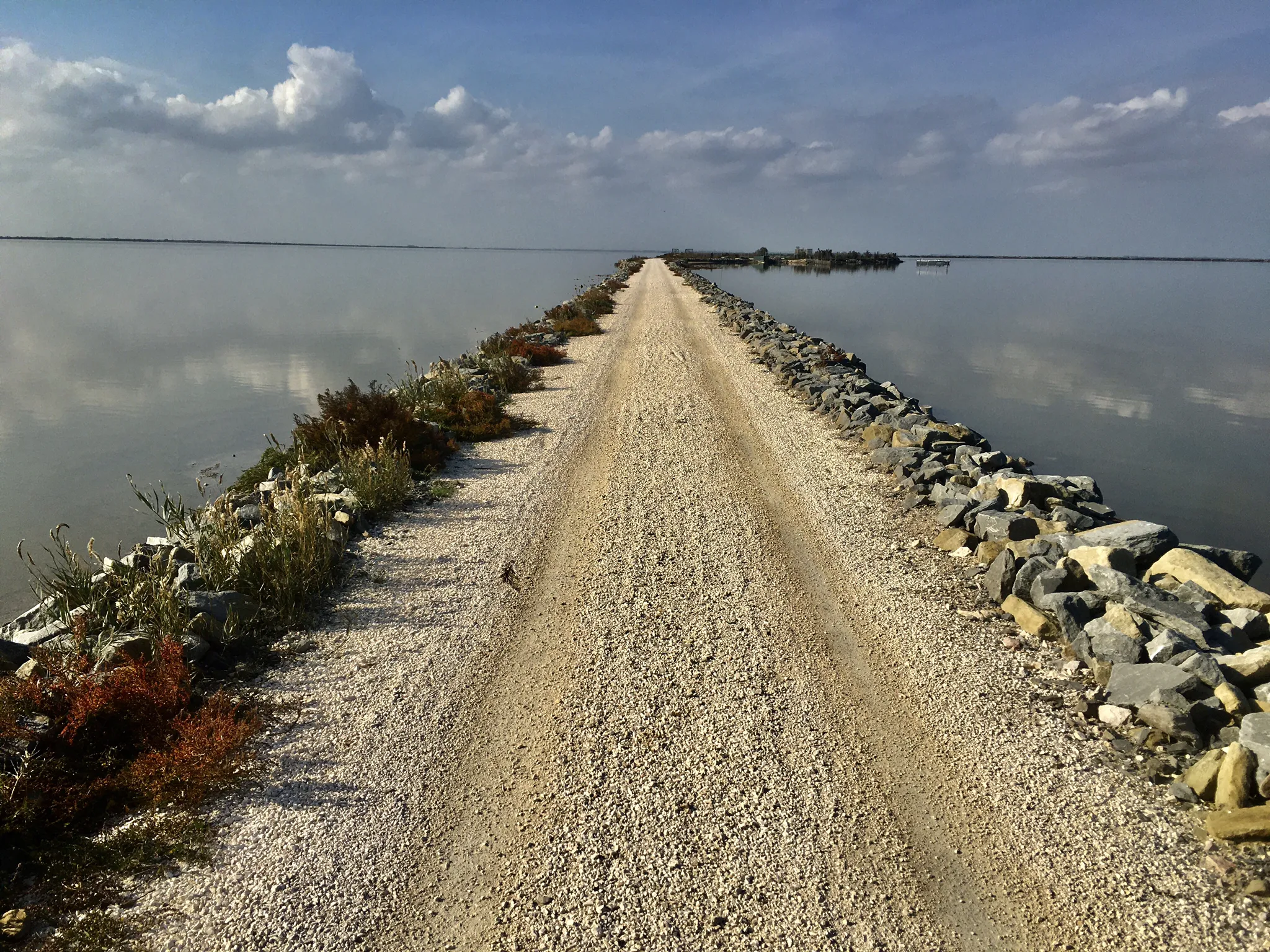
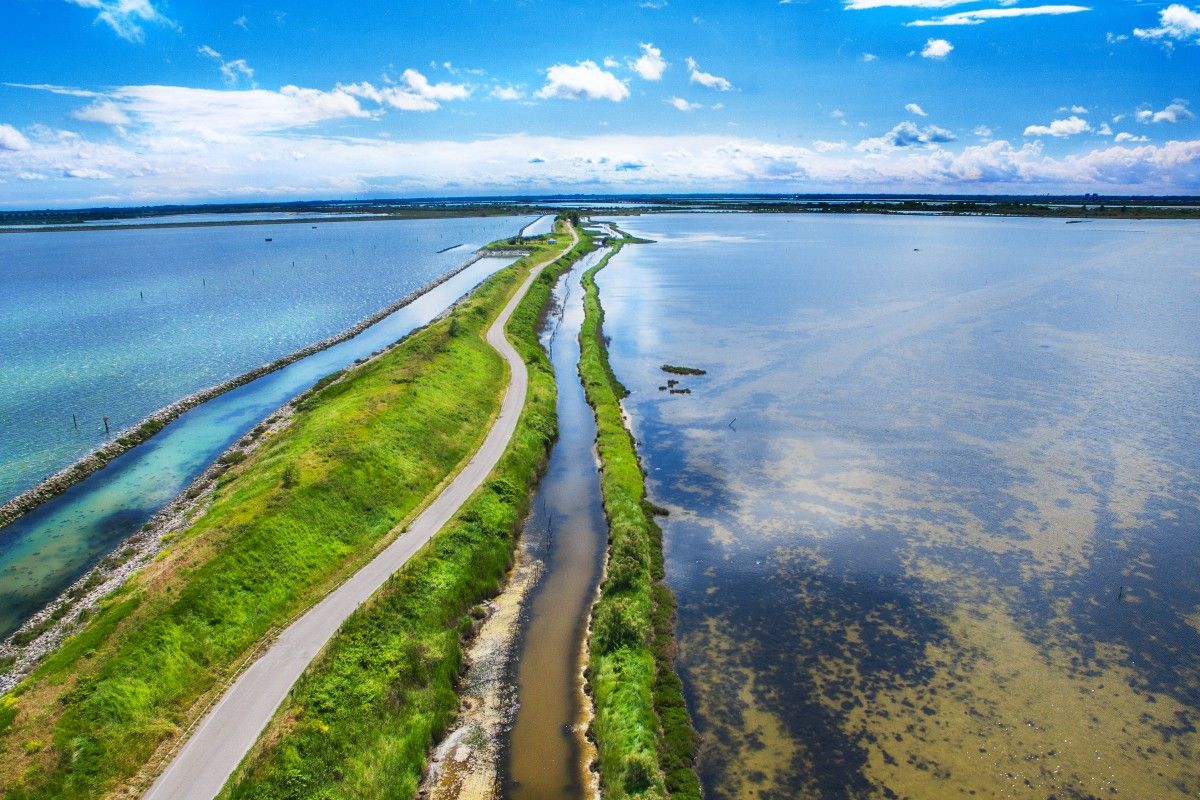
Parco regionale del Delta del Po周辺のハイキングは、陸と水が融合するユニークな「水陸両用」環境での犬同伴可能なトレイルを提供します。この地域は主に平坦な地形が特徴で、さまざまな体力レベルの人がアクセスしやすいルートとなっています。主な特徴には、広大な湿地帯、静かなラグーン、古代の松林、そしてポー川とその支流によって形成された海岸砂丘があります。トレイルはしばしば堤防に沿っており、水路や多様な生態系の景色を楽しめます。
Parco regionale del Delta del Po周辺の犬同伴可能な最高のハイキングトレイル
- 最も人気のある犬同伴可能なハイキングルートは、ソットマリーナ発、ソットマリーナのレッド灯台~イゾラ・デッロゥニオーネ橋ループで、距離17.3km(10.7マイル)、所要時間4時間20分です。この適度な難易度のルートからは海岸の景色が楽しめ、レッド灯台を通過します。
- 地元のハイカーに人気のもう一つのルートは、キオッジャ発、イゾラ・デッロゥニオーネ橋~ピッツェリア・ダ・E.N.D.、ソットマリーナループで、距離11.8km(7.4マイル)の適度な難易度のルートです。このルートからはラグーンの景色が楽しめ、歴史的な町キオッジャに繋がっています。
- 地元のハイカーに愛されているのは、キオッジャ発、キオッジャ魚市場~イゾラ・デッロゥニオーネ橋ループで、距離2.4km(1.5マイル)のトレイルは都市部やウォーターフロントエリアを通り抜け、所要時間は約37分です。
- Parco regionale del Delta del Po周辺のハイキングは、広大な湿地帯、ラグーン、河川敷が特徴で、一部には松林や砂丘もあります。このネットワークは、簡単な散歩から適度な難易度のハイキングまで、さまざまなレベルのオプションを提供しています。
- Parco regionale del Delta del Poのルートは、komootコミュニティから高く評価されており、500件以上のレビューで平均4.3つ星を獲得しています。5000人以上のハイカーがkomootを利用して、Parco regionale del Delta del Poの多様な地形を探索しています。
最終更新日: 9月 7, 2026
11
ハイカー
4.68km
01:11
10m
10m
初級者向けハイキング. あらゆるフィットネスレベルに適しています。 進みやすいルートです。あらゆるスキルレベルに適しています。
4.5
(8)
113
ハイカー
21.1km
05:17
10m
10m
難しいハイキング. 標準以上のフィットネスレベルが必要です。 進みやすいルートです。あらゆるスキルレベルに適しています。

18
ハイカー
11.1km
02:48
10m
10m
中程度のハイキング. ある程度のフィットネスレベルが必要です。 進みやすいルートです。あらゆるスキルレベルに適しています。
4.6
(13)
286
ハイカー
中程度のハイキング. ある程度のフィットネスレベルが必要です。 進みやすいルートです。あらゆるスキルレベルに適しています。
8
ハイカー
2.14km
00:32
0m
0m
初級者向けハイキング. あらゆるフィットネスレベルに適しています。 進みやすいルートです。あらゆるスキルレベルに適しています。
おすすめのツアーは他のkomootユーザーが実際に経験した何千ものアクティビティに基づいています。
無料アカウントで今日から始めよう
次の冒険が待っています。


コミュニティからのヒント


A town that preserves intact the traits of its maritime tradition, with its canals crossed by numerous bridges and the characteristic courtyards that open onto the waterways, offering evocative views. The brightly colored houses along the Vena Canal are one of Chioggia's most distinctive features, making it resemble a miniature of the lagoon capital, but with a livelier and more intimate feel.
0
0

Vigo Column, Piazzetta Vigo, Chioggia Vigo Column The Vigo Column, located in the square of the same name, is one of the most representative architectural elements of the city of Chioggia. Its location dates back to 1786, at the behest of Podestà Giulio Antonio Mussato. It was created from the collection of artifacts found during excavations in 1763 at the site of the former Praetorian Palace. Text / Source: City of Chioggia, Corso del Popolo, Chioggia (VE) https://www.comune.chioggia.ve.it/vivere-il-comune/luoghi/colonna-di-vigo/
14
0
One of the major projects completed during the Fascist era is the Sottomarina Dam, which, together with the Ca' Roman Dam built a few years earlier, completes the mouth of the Port of Chioggia. Construction began in the years following the First World War. Like the Murazzi (sea walls), the dam was constructed of brick and boulders of local Istrian stone and, in addition to finally completing the entrance to the Port of Chioggia, also allowed for a further expansion of the beach. The inauguration, as mentioned, took place in the midst of the Fascist regime on April 28, 1935, in the presence of the Duke of Aosta. The dam was immediately embraced by the local population, especially the residents of Sottomarina, a popular destination for their walks, so much so that many refer to it as "Sailors' Square." Text / Source: Lidi di Chioggia https://www.lididichioggia.it/la-diga-murazzi/
15
0
The Dam and the Walls, Sottomarina The Dam and the Walls The Walls are Istrian stone walls built by the Republic of Venice starting in the late 18th century to protect the inhabited centers of the lagoon from marine erosion. They are divided into three sections: one on the island of Lido, a second on the island of Pellestrina as far as Cà Roman, and a third along the coast of Sottomarina, running from Forte San Felice to the center of Sottomarina at a height of approximately 1200 meters. The famous War of Chioggia led to the complete destruction of Sottomarina, which became an uninhabited area, exposed to the sea without any protection and subject to frequent flooding. Reconstruction, which included the construction of the Walls, did not begin until 1600. The Walls along Via San Felice were more than 5 kilometers long and over 300 meters wide. They were built from square stones, primarily Istrian stone, erected on stilts extending to the Pellestrina coast and, of course, the Sottomarina coast. Initially, given the scale of the project and the lack of adequate equipment, construction seemed impossible, so it took thirty-eight years to complete in 1770. Legend has it that the inscription "Ausu romano, aere veneto" (With Roman boldness, with Venetian money) was already in place. The inscription is still visible when passing by on the Chioggia-Pellestrina vaporetto. The Murazzi ceased to function between the late 19th and early 20th centuries when the receding sea revealed an unexpected beach, thus forming a symbolic dividing line between "old" and "new" Sottomarina. Today, the Murazzi di Sottomarina are located about one kilometer from the sea: this has allowed for a large-scale revival of coastal tourism. The Murazzo now connects the entire Venetian coast, especially the outer islands, like a cordon, leaving only the three bays open, thus preserving the lagoon's waters. Text / Source: Lidi di Chioggia https://www.lididichioggia.it/la-diga-murazzi/
15
0
The Dam and the Walls, Sottomarina The Dam and the Walls The Walls are Istrian stone walls built by the Republic of Venice starting in the late 18th century to protect the inhabited centers of the lagoon from marine erosion. They are divided into three sections: one on the island of Lido, a second on the island of Pellestrina as far as Cà Roman, and a third along the coast of Sottomarina, running from Forte San Felice to the center of Sottomarina at a height of approximately 1200 meters. The famous War of Chioggia led to the complete destruction of Sottomarina, which became an uninhabited area, exposed to the sea without any protection and subject to frequent flooding. Reconstruction, which included the construction of the Walls, did not begin until 1600. The Walls along Via San Felice were more than 5 kilometers long and over 300 meters wide. They were built from square stones, primarily Istrian stone, erected on stilts extending to the Pellestrina coast and, of course, the Sottomarina coast. Initially, given the scale of the project and the lack of adequate equipment, construction seemed impossible, so it took thirty-eight years to complete in 1770. Legend has it that the inscription "Ausu romano, aere veneto" (With Roman boldness, with Venetian money) was already in place. The inscription is still visible when passing by on the Chioggia-Pellestrina vaporetto. The Murazzi ceased to function between the late 19th and early 20th centuries when the receding sea revealed an unexpected beach, thus forming a symbolic dividing line between "old" and "new" Sottomarina. Today, the Murazzi di Sottomarina are located about one kilometer from the sea: this has allowed for a large-scale revival of coastal tourism. The Murazzo now connects the entire Venetian coast, especially the outer islands, like a cordon, leaving only the three bays open, thus preserving the lagoon's waters. Text / Source: Lidi di Chioggia https://www.lididichioggia.it/la-diga-murazzi/
15
0

Beautiful place to watch the sun rise
1
0
よくある質問
ポデルタ州立公園には、犬と一緒に歩けるハイキングコースはいくつありますか?
ポデルタ州立公園地域には、犬と一緒に歩けるハイキングコースがいくつかあります。当ガイドでは、愛犬との散歩に最適な、簡単な散策から少し本格的なアドベンチャーまで、3つのルートを特別にキュレーションしています。
ポデルタ州立公園で犬と一緒にハイキングする際に、どのような景観が期待できますか?
ポデルタ州立公園は、陸と水が融合するユニークな「両生類」環境を提供しています。広大な湿地帯、静かなラグーン、メゾーラ・ウッズのような古代の松林、そして海岸の砂丘などを探索できます。多くのトレイルは川の流れや堤防沿いにあり、水路や多様な生態系のパノラマビューを楽しめます。
初心者や短い散歩に適した、簡単な犬同伴可能ルートはありますか?
はい、簡単な犬同伴可能オプションがあります。短くリラックスした散歩には、キオッジャの魚市場 – キオッジャからのイゾラ・デッルーニオーネ橋ループをご検討ください。このルートは2km強で、あなたと愛犬の両方に快適な体験を提供します。
ポデルタ州立公園で、犬と一緒に歩ける周回ルートを見つけることはできますか?
もちろんです!この地域の犬同伴可能トレイルの多くは周回ルートになっており、同じ場所からスタートしてゴールできます。例えば、ソットマリーナの赤い灯台 – ソットマリーナからのイゾラ・デッルーニオーネ橋ループは、中程度の17kmのループで、愛犬との長時間の外出に最適です。
犬と一緒にハイキングする際に、どのような注目すべきアトラクションや見どころがありますか?
愛犬と一緒にハイキングする際には、様々な興味深い光景に出会うことができます。ユニークな渡りを楽しめるポ・ディ・ニョッカの浮き橋やボッカセッテの浮き橋に注目してください。また、素晴らしい眺めを提供するアディジェ川河口のパノラマタワーを見つけたり、枯れ木のラグーンのようなエリアを探索したりすることもできます。
犬と一緒にポデルタ自然公園をハイキングするのに最適な季節はいつですか?
ポデルタ自然公園の平坦な地形は、一年中アクセス可能です。しかし、春と秋は快適な気温と鮮やかな自然の風景を提供し、長時間の散策に最適です。夏は暑くなることがあるため、早朝または午後の遅い時間がおすすめです。冬は、特にバードウォッチングにとってユニークで静かな体験を提供しますが、涼しく、潜在的に湿った条件に備えてください。
公共交通機関でアクセス可能な犬連れに優しいルートはありますか?
公共交通機関でのトレイルへのアクセスは様々です。特にキオッジャのような町から始まる多くのルートは、近くに公共交通機関のオプションがある場合があります。例えば、キオッジャ発、イスラ・デッロヌオーヴォネ橋 – ピッツェリア・ダ・E.N.D.、ソットマリーナのループは、一般的に接続が良いキオッジャの近くから始まります。特定の出発点については、常に現地の公共交通機関のスケジュールを確認するのが最善です。
ポデルタ自然公園の犬連れに優しいトレイルについて、他のハイカーが最も楽しんでいることは何ですか?
komootコミュニティは、ポデルタ自然公園でのハイキング体験を高く評価しており、平均スコアは4.3つ星です。レビューでは、静かで平坦なトレイル、ユニークな湿地の景観、そして豊富な野鳥の生息地がしばしば称賛されています。多くの人が、人間と犬の両方にとって楽しい、小道のアクセスの良さを評価しています。
デルタ・デル・ポーで犬と一緒にハイキングする際に、野生生物に関して考慮すべきことは何ですか?
デルタ・デル・ポーは、300種以上の鳥類、鹿、その他の小型哺乳類を含む、その卓越した生物多様性で知られるユネスコ世界遺産です。この繊細な生態系を保護し、愛犬の安全を確保するために、特に野生生物が多く生息する地域では、常に愛犬をリードにつないでおくことが重要です。これにより、動物への干渉を防ぎ、愛犬が潜在的な危険に遭遇するのを防ぎます。
経験豊富なハイカー向けに、より長く中程度の難易度の犬連れに優しいハイキングはありますか?
はい、愛犬とのより長く、より挑戦的な散策を求める方には、ソットマリーナ発、レッド灯台(Sottomarina)~イスラ・デッロヌオーヴォネ橋のループが素晴らしい選択肢です。この中程度の難易度の17kmのルートは、海岸線とラグーンの景観を楽しみながら、かなりの距離をカバーできます。
パルコリージョナルデルデルタデルポーでのの人気ルート
パルコリージョナルデルデルタデルポーでのの人気観光スポット

komootモバイルアプリでインスピレーションを得よう


さらに探索
他の地域の最高のハイキングを見てみましょう。
