アペニン・ルカーノ-ヴァル・ダグリ-ラゴネグレス国立公園周辺のおすすめ交通量の少ないサイクリングルート
4.7
(192)
3,633
ライダー
57
ライド
No traffic road cycling routes around Parco Nazionale dell'Appennino Lucano-Val d'Agri-Lagonegrese traverse a landscape characterized by rugged mountain ridges, rolling hills, and deep river valleys. The park encompasses peaks over 2,000 meters, such as Monte Sirino, offering significant elevation changes for cyclists. Dense forests of beech, oak, and fir cover higher elevations, while lower areas feature Mediterranean vegetation and river plains along the Agri River. This varied terrain provides a diverse road network suitable for different cycling preferences.
Best no…
最終更新日: 8月 23, 2026
4.5
(2)
37
ライダー
39.6km
01:53
410m
410m
中程度のロードライド. ある程度のフィットネスレベルが必要です。 ツアーの一部に、未舗装のため走行が難しい箇所があるかもしれません。
5.0
(1)
30
ライダー
62.0km
02:51
640m
630m
中程度のロードライド. ある程度のフィットネスレベルが必要です。 全般的に舗装状態が良好で走行しやすい道です。

無料新規登録
23
ライダー
57.7km
02:45
660m
660m
中程度のロードライド. ある程度のフィットネスレベルが必要です。 全般的に舗装状態が良好で走行しやすい道です。
21
ライダー
63.9km
03:04
790m
790m
中程度のロードライド. ある程度のフィットネスレベルが必要です。 全般的に舗装状態が良好で走行しやすい道です。
15
ライダー
64.2km
02:58
600m
600m
中程度のロードライド. ある程度のフィットネスレベルが必要です。 ツアーの一部に、未舗装のため走行が難しい箇所があるかもしれません。
さらに多くのルートや他のユーザーのおすすめ情報を確認できます。
無料新規登録
すでにアカウントをお持ちですか?
おすすめのツアーは他のkomootユーザーが実際に経験した何千ものアクティビティに基づいています。
無料アカウントで今日から始めよう
次の冒険が待っています。
ログインまたは登録




コミュニティからのヒント

The Grumentum Archaeological Park preserves, within an exceptionally suggestive landscape, the remains of one of the major Roman cities of Regio III: Lucania et Bruttii. Initially a small Lucanian center allied with Rome, settled since the beginning of the 3rd century BC, it was crossed by Hannibal during the Second Punic War, when he took the side of the Carthaginians, and was the scene of a battle narrated by Livy. Following a slow process of Romanization, which provided for land assignments to the Romans through the centuriation system, the center was monumentalized starting from the middle of the 1st century BC, when it was refounded as a Roman colony. From this period onwards, it was equipped with all the typical monuments of Roman cities, in imitation of the Urbe. Today the site, a unique example in Basilicata of a Roman urban plan that is clearly legible as a whole, allows a visit through the public and private spaces of the Roman city, still delineated by the regularity of the ancient road axes. From the theater you can reach the Italic temple, the domus with mosaics and, along the paving of the main plateia, the area of the Forum with public, civil and religious buildings (Capitolium, Augusteo, Porticus, Curia, Basilica, Forensic Baths). The route then continues to the Terme Maggiori, an extraordinarily preserved thermal complex, rich in luxurious decorative apparatus (mosaics, imported marbles...), to the Basilica of Santa Maria Assunta, which represents the first cathedral when the center became the seat of a bishop. The route ends near the monumental amphitheater, one of the oldest masonry amphitheaters known to us. Strategically positioned on the eastern edge of the hill, it is located overlooking the Pietra del Pertusillo Lake, in the heart of the Appennino Lucano National Park. A visit to Grumentum allows you to fully appreciate the close relationship between archaeology and nature, between landscape and culture. Source Ministry of Culture Discover all our routes on www.viaggiatorelento.com
0
0

Archaeological area of the ancient Roman Grumentum.
0
0
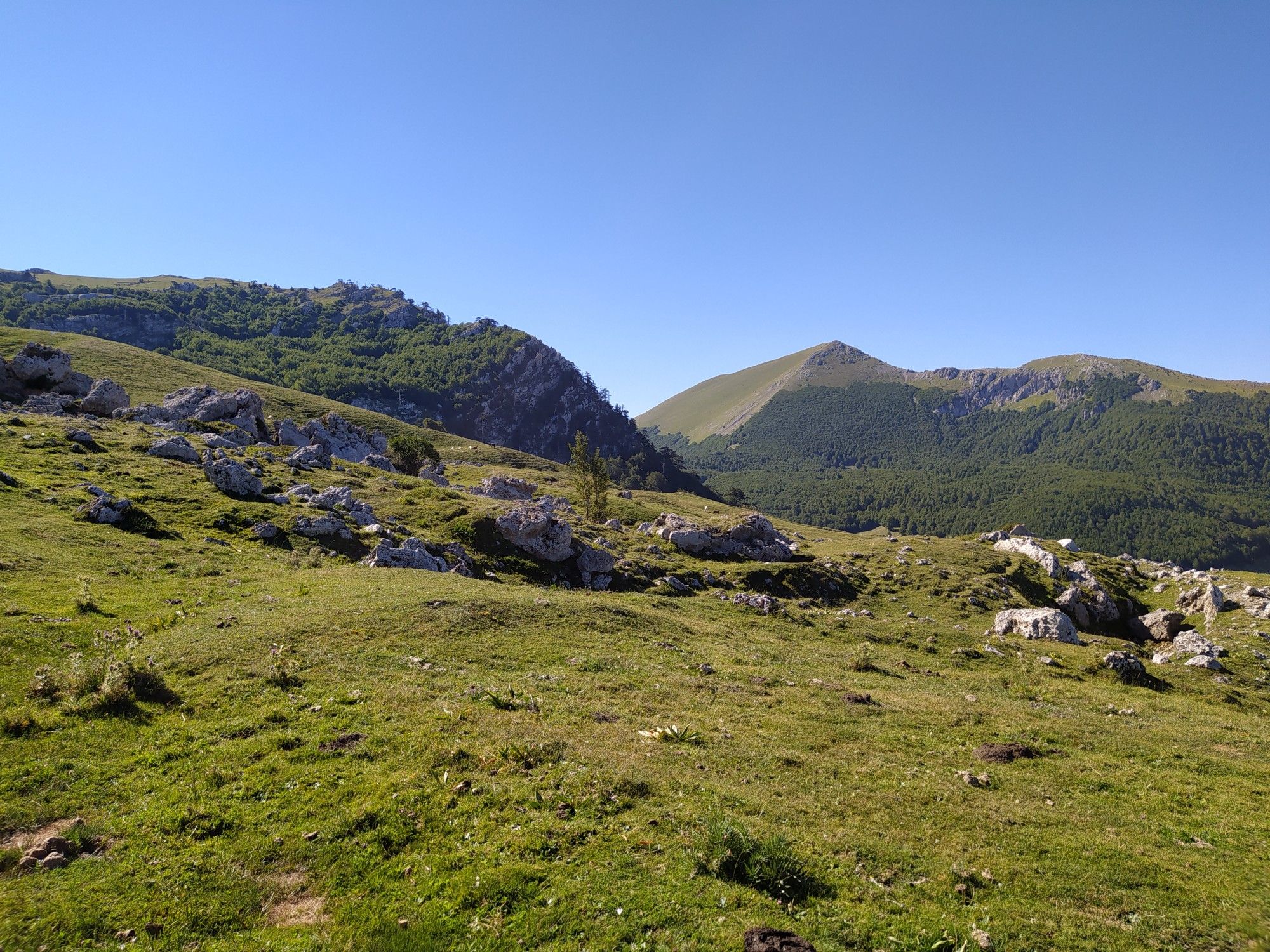
The right place to enjoy a ride through the woods, being enraptured by the beauty of nature.
0
0
A river surrounded by greenery, the perfect place for a peaceful run in the middle of nature.
0
0
At this point you can find a small bench where you can take a break next to the river, always remembering respect for nature.
0
0
The Agri river is an excellent place to relax in contact with nature, without necessarily having to take demanding walks.
1
0
At this point you can find a small bench where you can take a break next to the river, always remembering respect for nature.
1
0
In Agumentum it is possible to find an archaeological park of ancient Roman origin, this is the theatre.
1
0
よくある質問
アッペンニーノ・ルカーノ=ヴァル・ダグリ=ラゴーネグレセ国立公園には、交通量の少ないロードサイクリングルートがいくつありますか?
アッペンニーノ・ルカーノ=ヴァル・ダグリ=ラゴーネグレセ国立公園には、50以上の交通量の少ないロードサイクリングルートがあり、距離や難易度も様々です。探索できるルートは、簡単なものが4つ、中級が27、難しいものが19あります。
これらの交通量の少ないロードサイクリングルートでは、どのような地形が期待できますか?
この公園では、挑戦的な山岳登坂から、谷を抜けるより穏やかなライドまで、多様な地形を提供しています。険しい山稜、起伏のある丘、深い谷があります。多くのルートには長くて管理しやすい登坂があり、しばしばブナ、オーク、モミの密林を抜けたり、シルノ湖やペルトゥジッロ湖のような絵のように美しい水辺を通過したりします。
交通量の少ない周回型のロードサイクリングルートはありますか?
はい、多くのルートはループとして設計されており、同じ場所からスタートしてフィニッシュすることができます。例えば、マルシコ・ヌオーヴォから出発する約40kmの中程度の獲得標高のマルシコ・ヌオーヴォからの眺めのループや、54kmを超えるより長いマルシコ・ヌオーヴォからのヴィッジャーノのループを試すことができます。
ルート沿いで見られる景色の良いハイライトやランドマークは何ですか?
ルートはしばしば重要な自然および歴史的サイトを通過します。シルノ湖や人工的なペルトゥジッロ湖の近くをサイクリングするかもしれません。文化的なランドマークには、重要な巡礼地であるヴィッジャーノの黒い聖母の聖域や、ローマ時代の遺跡があるグルメンツム考古学公園が含まれます。公園には、息をのむような景色を提供するアリオソ山やヴォルトゥリーノ山のような印象的な山頂もあります。
アッペンニーノ・ルカーノ=ヴァル・ダグリ=ラゴーネグレセ国立公園での交通量の少ないロードサイクリングに最適な時期はいつですか?
ロードサイクリングに最適な時期は、一般的に春から秋にかけてです。夏は、特に日陰の森のエリアで快適な気候ですが、低地では暑さに備えてください。冬以外では、セッラタ・ピエルファオーネのようなエリアへのルートは、その素晴らしい景色から特におすすめです。出発前には必ず現地の気象条件を確認してください。
家族向けの交通量の少ないロードサイクリングルートはありますか?
多くのルートはかなりの標高差を伴いますが、これらの道路は交通量が少ないため、本質的に家族連れにとってより安全です。中級オプションとして、30km未満で管理しやすい登坂のある、マルシコ・ヌオーヴォからのロードバイクループを検討してください。常に、ルートの距離と標高が家族の体力レベルに合っているか評価してください。
これらのロードサイクリングルートの近くで駐車場を見つけることはできますか?
多くのルートは、マルシコ・ヌオーヴォ、パテルノ、モリテルノなど、公園内またはその端にある町や村から始まります。これらの場所には通常、公共の駐車場があります。ライドを計画する際は、利用可能な駐車オプションについて、特定の出発点を確認することをお勧めします。
公共交通機関でこれらのルートにアクセスできますか?
国立公園内の公共交通機関の選択肢は限られている場合があります。一部の大きな町にはバスの接続があるかもしれませんが、特定のルートの出発点に到達するには、個人所有の交通手段が必要になることがよくあります。公共交通機関を利用する場合は、事前にルートを計画し、バジリカータ州の現地のバス時刻表を確認することをお勧めします。
他のロードサイクリストはこの地域のサイクリング体験のどこを最も楽しんでいますか?
komootコミュニティは、アッペンニーノ・ルカーノ=ヴァル・ダグリ=ラゴーネグレセ国立公園でのロードサイクリング体験を高く評価しており、平均スコアは4.25つ星です。レビューでは、静かで交通量の少ない道路、多様で手つかずの風景、そして古代のブナ林を抜け、穏やかな湖を通過する挑戦的でありながらやりがいのある登坂がしばしば賞賛されています。
サイクリング中に野生動物を見る機会はありますか?
はい、この公園は生物多様性に富んでいます。サイクリング中、特に静かな森の区間では、イノシシ、アカシカ、アペニンノノウサギなどの様々な動物を見かけるかもしれません。バードウォッチャーは、イヌワシやハヤブサを目にする機会もあるかもしれません。健康な水域にはユーラシアカワウソが生息していますが、より見つけにくいです。
交通量の少ないルート沿いには、カフェや休憩できる場所はありますか?
ルートは交通量が少ないように設計されていますが、しばしば小さな村や町と接続したり、通過したりするため、地元のカフェ、トラットリア、または軽食を提供する小さなお店を見つけることができます。村と村の間の長い区間では、都市部ほど施設が多くない場合があるため、常に十分な水と軽食を持参することをお勧めします。例えば、マルシコ・ヌオーヴォやモリテルノから始まるルートでは、それらの町にオプションがあります。
アペニン・ルカーノ-ヴァル・ダグリ-ラゴネグレス国立公園でのの人気ルート
アペニン・ルカーノ-ヴァル・ダグリ-ラゴネグレス国立公園でのの人気観光スポット

komootモバイルアプリでインスピレーションを得よう


さらに探索
他の地域の最高のロードサイクリングルートを見てみましょう。
