ルートプランナー機能アップデート
App
ログインまたはサインアップ
アプリを入手
ログインまたはサインアップ
ルート
Places to see
Mountain passes
イタリア
南チロル

テレント-テレント

テレント-テレントの峠・トップ14

風景を楽しんだり、上りや下りを満喫したり、峠には楽しみ方がたくさんあります。テレント-テレントの素晴らしい峠の一覧を参照して、思い出に残るアドベンチャーに出かけましょう。コミュニティのメンバーがコミュニティのために投稿した峠のハイライトは、他のユーザーが実際におすすめする情報なので、どれも信頼できるものです。気に入った峠にさっそく向かってみましょう。

最終更新日: 10月 15, 2026

ヴュルツヨッホ峠への登り

ハイライト (セグメント) • 登山

美しいが、交通量がほとんどない素晴らしい谷を通り、山の小川沿いを登るやりがいのある上り坂です。最大18パーセントの急な坂が繰り返し現れますが、短い休憩場所もあります(この点については、前の話し手に反論したいと思います)。

路面状態については、このルートは登り坂にしかお勧めできません。路面は平均的にしか良くなく、乾燥した天気でも多くの場所で小さな沢の水で濡れています。これが、山の小川にかかる木製の橋が繰り返し現れることと相まって、速い下り坂の楽しみを損なっています。しかし、登り坂には常にこのルートを選びます。

@Wolfi氏の引用:「報酬 – 交通量が少なく、非常に美しい景色。」

翻訳を表示中

役立つ情報 は

によるものです

ここでのライドを見るスマートフォンに送信
保存

ダンネルシャルテ(2,437m)

ハイライト • 山道

Scharte am Pfunderer Höhenweg. Not as demanding as the neighboring, rocky Gaisscharte. However, in the rise from both sides again and again very steep, rocky grass backs that require head …

翻訳者 Google •

役立つ情報 は

によるものです

保存

今すぐサインアップして、こんな場所を発見しよう

最高のシングルトラック、ピーク、その他のエキサイティングなアウトドアスポットのおすすめを受け取ろう。

無料新規登録
An indescribable view awaits you here. This trail leads just below the summit of the Speikboden. Here you can enjoy a mountain panorama as it is in the book.

翻訳者 Google •

役立つ情報 は

によるものです

保存
You come from the Gampis Alm, definitely recommended, elderberry juice, past two picturesque lakes. Before going into a block field, be sure to pay attention to the path markings. You're …

翻訳者 Google •

役立つ情報 は

によるものです

保存

ホーエ・ゼーゲ

ハイライト • 山道

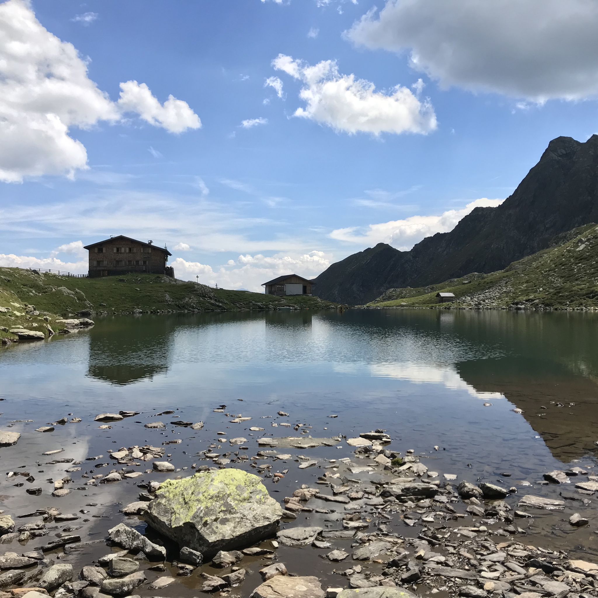
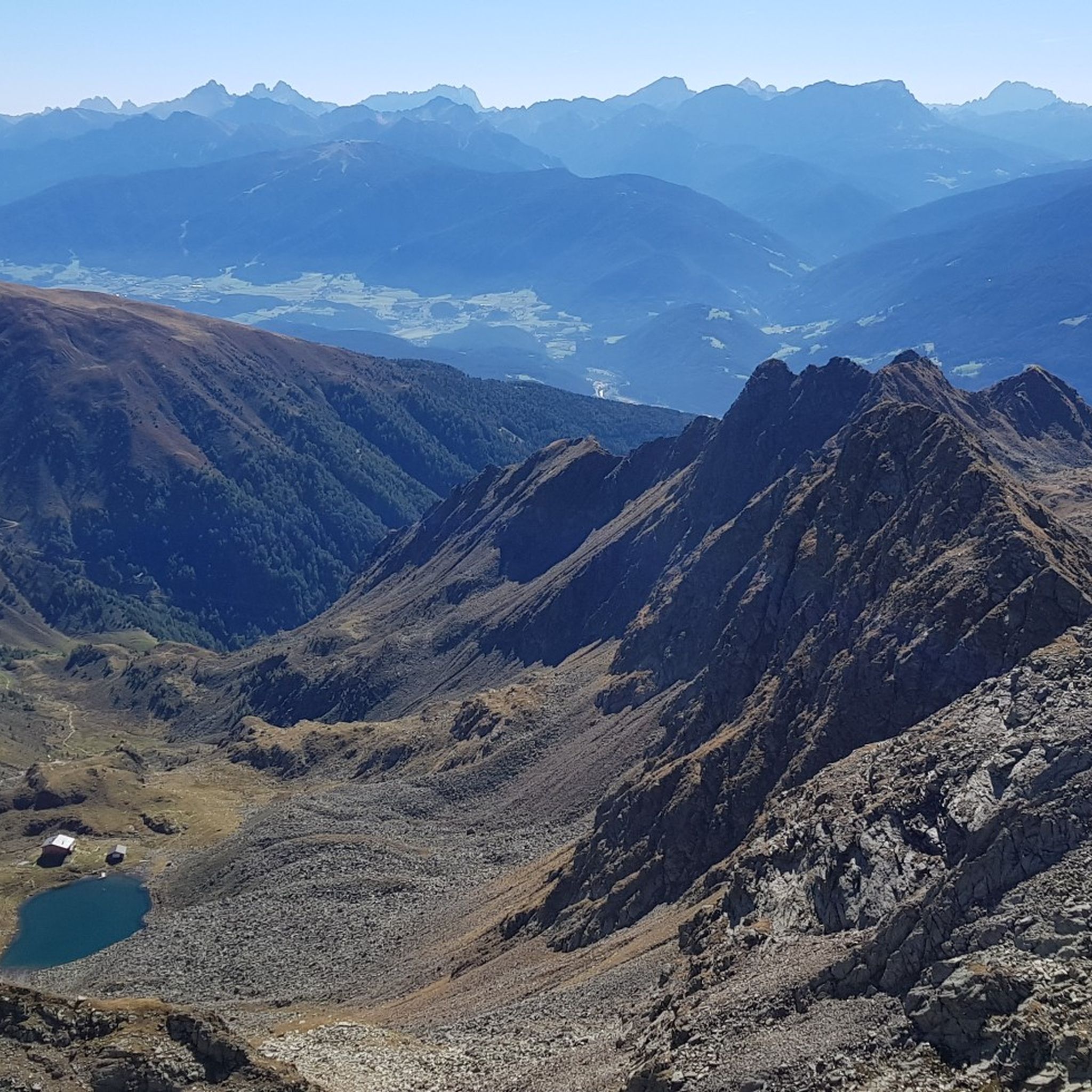
Here you have to gather your strength one last time and climb up the ridge to enjoy the magnificent view of the Tiefrastenhütte and the lake at 2,642 meters above …

翻訳者 Google •

役立つ情報 は

によるものです

保存

無料でサインアップして、さらに多くの山道を発見しましょう テレント-テレントでの。

無料新規登録

すでにアカウントをお持ちですか?

無料アカウントで今日から始めよう

次の冒険が待っています。

ログインまたは登録

テレント-テレント周辺で人気

ALPINE。SOLITARY。BREATHTAKING。The Pfunderer High Route

サウスタイロルのPfunderer Mountain Trail - 高山ハイキング

テレント-テレントでのハイキング

テレント-テレントでのサイクリング

テレント-テレントのロードバイクルート

テレント-テレントのMTBトレイル

テレント-テレントでののグラベルライド

テレント-テレントでの登山&山歩き

テレント-テレントのランニングコース

テレント-テレントでのの他の冒険

ALPINE。SOLITARY。BREATHTAKING。The Pfunderer High Route

ハイキングのコレクション によって

komoot

コミュニティからのヒント

Markus
8月 12, 2025, Climb to Würzjoch Pass via Lüsen

If you're only planning a one-day hike to the Würzjoch, I recommend the western approach from Brixen, St. Andrä. The approach from Lüsen is definitely worth the extra climb as an alternative. The gradient is undoubtedly very steep for much of the way, but I didn't see the 18-19% mentioned here, at least not on my Wahoo today. The biggest challenge lies in the first half, which is always an advantage in my opinion. The road surface varies greatly from "good" to "disastrous." Traffic was light, so you're mostly alone. (August, peak season) And I don't want to offend anyone, but due to a lack of transportation while on vacation, I (46 years old, averagely "talented" at best) rode up on a rental road bike (11-32 cassette) from the local bike shop (10 kg) without having to dismount. Go for it!!

Google翻訳による翻訳•

0

1

美しいが、交通量がほとんどない素晴らしい谷を通り、山の小川沿いを登るやりがいのある上り坂です。最大18パーセントの急な坂が繰り返し現れますが、短い休憩場所もあります(この点については、前の話し手に反論したいと思います)。 路面状態については、このルートは登り坂にしかお勧めできません。路面は平均的にしか良くなく、乾燥した天気でも多くの場所で小さな沢の水で濡れています。これが、山の小川にかかる木製の橋が繰り返し現れることと相まって、速い下り坂の楽しみを損なっています。しかし、登り坂には常にこのルートを選びます。 @Wolfi氏の引用:「報酬 – 交通量が少なく、非常に美しい景色。」

Google翻訳による翻訳•

3

0

Fantastically beautiful place to rest with a great view 😎🤩

Google翻訳による翻訳•

4

0

In Jöchle you also have a great view and at the cross there is also a bench to rest on 👍, be careful ⚠️ there is a risk of not wanting to go any further 😜🤣😂 !!!

Google翻訳による翻訳•

5

0

As a racing bike rider (from Lüsen to the merger with Würzjochstraße) I would avoid going in both directions from this section. Even very well trained people have to relegate. No fun going down either.

Google翻訳による翻訳•

0

7

I never had to step off my bike on a climb before. Now I did multiple times. This is the hardest thing I ever did. This climb gives you no opportunity to recover. It's steep from the start in Lüssen. After that you get a short flat segment and a slight descent, but when the real climb begins it doesn't stop. Don't expect it getting any easier after the parts where you need to stand up on your pedals to stay upright. The last bit of the climb is beautiful. I cried. But mainly because it was over. I recommend this climb for the super fit, people with a 34 cassette or more. Or people who want to hurt themselves. If I ever cycle it again, it will be down.

1

7

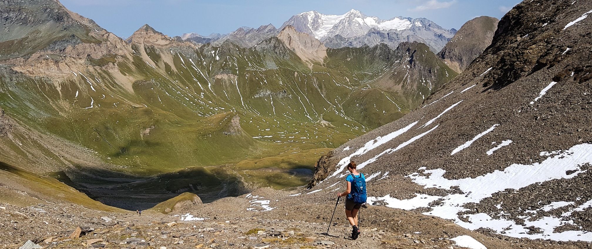
You come from the Gampis Alm, definitely recommended, elderberry juice, past two picturesque lakes. Before going into a block field, be sure to pay attention to the path markings. You're standing in front of the massif and don't know where to go up to the Hohe Saw, so pay attention to the markings! It was very easy, with the help of the hands, the high saw gap was reached. Descent via stairs to the Tiefrasten hut.

Google翻訳による翻訳•

2

0

On the Pfunderer Höhenweg the Dannelscharte marks the last high point in front of the Brenninger bivouac and offers great views to the top of the Wurmaul.

Google翻訳による翻訳•

2

0

テレント-テレントでのの人気ルート

テレント-テレントでのハイキング

テレント-テレントでのの人気観光スポット

Places to see

Store rating

komootモバイルアプリでインスピレーションを得よう

無料のkomootアカウントがあれば、無限のアウトドアコースを簡単に見つけてカスタマイズし、ナビで案内できます。

または

今すぐkomootに参加しよう
Store rating

さらに探索

これらのガイドでさらに壮大な山道を見てみましょうテレント-テレントでの:

バディア-アブテイSantaCristinaGherdëina-GrödenのSt.Christina-Santa Cristina Valgardenaセルヴァ-ウォルケンシュタイン-セルヴァディヴァルガーデナバディアのコルヴァーラ-コルヴァーラCiastel-カステルロット-CastelrottoUrtijëi-GrödenのSt.Ulrich-Ortiseiサンマルティーノデトル-バディアのサンマルティーノ-サーンのセントマーチンVillnöß-Funesマレッベ-エネベルク-マレッベティア-タイヤプエツガイスラー自然公園Karneid-Cornedo All'Isarcoウェルシュノフェン-ノヴァレヴァンテPfitsch-Val Di VizzeNaturparkPuez-Gaisler-パルコナチュラーレプエツ-Odleノーヴァポネン-ノヴァポネンテラヴァッレ-ウェンゲン-ラヴァッレLajen-Laionヴァンドー-ヴァンドーイエスミュールヴァルト-SelvaDei MoliniVölsAmSchlern-FiéAlloSciliarブリクセン-ブレッサノーネブレンネロ-ブレネロLüsen-Lusonセスト-セストInnichen-サンカンディドリフィアーノ-リフィアーノモーゾ・イン・パッセイアー-モーゾ・イン・パッシリアアルディーノ-アルディーノセントマーチンインパッセイアー-サンマルティーノインパッシリアラチーネス-ラチーネスセントレオンハルトインパッセイエ-サンレオナルドインパッシリアステルヴィオ-ステルヴィオフライエンフェルト-カンポディトレンスビピテノ-ビピテノドッビアーコ-ドッビアーコチロル-ティロロミュルバッハ-リオディプステリーカイネス-ケインズメラン-メラーノEppanAnDerWeinstraße-AppianoSullaStrada Del Vinoシェーナ-シーンラナサンロレンツォ-サンロレンツォディセバトキューザ-キウサラグンド-ラグンドTaufersImMünstertal-Tubreマルス-マレスベノスタSchnals-セナーレスクローン・ヴェノスタナトゥルンス-ナトゥルノUnsere Liebe Frau ImWalde-St。フェリックス-セナーレ-サンフェリーチェマーリング-マーレンゴブラーイエス-ブレイテクセルグルッペ自然公園Naturpark Texelgruppe-Parco naturale Gruppo di Tessaボーゼンオーラ-オラテルラーノ-テルラーノアンドリアーノ-アンドリアーノPrad Am Stilfser Joch-Prato Allo StelvioKalternAnDerWeinstraße-CaldaroSullaStrada Del Vinoライヴェス-ライファーAhrntal-Valle Aurinaメルティナ-メルティナヴァーデナ-Pfattenサレンティーノ-サレンティーノプレドーイ-プレドーイブロンツォーロ-ブランゾルトローデナイムナチュアパーク-トロデナネルパルコナチュラーレカンポ・トゥーレス-カンポ・トゥーレスフォルテッツァ-フォルテッツァRasen-Antholz-Rasun-Anterselvaウルティモ-ウルティモヴェルトゥルノ-Velturnoアヴェレンゴ-アヴェレンゴWelsberg-Taisten-Monguelfo-TesidoGsies-Valle Di CasiesTraminAnDerWeinstraße-TermenoSullaStrada Del VinoKurtatschAnDerWeinstraße-CortacciaSullaStrada Del Vinoパルチーネス-Parcinesニーダードルフ-ビジャバッサイェーネジーン-SanGenesio Atesinoモンターニャ-モンターニャマルテル-マルテッロナッレス-ナレスチェルメス-セルメスラーザ-ラーザヴァルナ-ヴァルナポスタル-郵便Tisens-テシモヴェラーノ-ベラノガルガッツォーネ-ガルガッツォーネロデンゴ-ロデンゴParco naturale dello Sciliar-Catinaccioヴァルダーオラ-ヴァルダーオラスリーピークス自然公園ヴィッランドロ-ヴィッランドロFanes-Sennes-Prags Nature ParkNaturpark Fanes-Sennes-Prags-Parco Naturale Fanes-Sennes-Braiesブルニコ-ブルニコリッテン-レノンペルカ-ペルカNaturpark Rieserferner-Ahrn - Parco Naturale Vedrette Di Ries-AurinaAnterivo-Altreiシランドロ-SilandroTexelgruppeサンパンクラーツィオ-サンパンクラーツィオサンパンクラーツィキエーネス-キエーネスグロレンツァ-グロレンツァノイマルクト-エグナズルデルノ-Sludernoラウレーニョ-ラウレーニョポンテガルデ-ポンテガルデナGaisProveis-証明ファルツェス-ファルツェスバルビアーノ-バルビアーノプラウスナツ・シャーヴェス-ナツ・シャーヴェスParco naturale Vedrette diRies-オーリナサロルノ-サロルノラーチェス-レースMagrèSullaStradaDelVinoKurtinigAnDerWeinstraße-CortinaSullaStrada Del VinoKastelbell-Tschars-Castelbello-CiardesMontiggler Wald-Bosco di Monticolo

近くのアドベンチャーガイド

キエーネス-キエーネスでやるべきこと

background

新しいピークを征服する準備をしよう

無料でサインアップ
探検する
ルートルートプランナー機能バウチャーを利用ハイキングMTBトレイルロードバイクルートバイクパッキングサイトマップ
アプリをダウンロード
SNSでフォローする

© komoot GmbH

プライバシーポリシー