テヴェレナー・ハイデのおすすめウォーキング&ハイキングルート
4.4
(1388)
4,761
ハイカー
42
ハイキング
テーフェレナー・ハイデ周辺のハイキングは、広大なヒースランド、重要なモア複合体、そして数多くの小さな湖や池を特徴とする多様な自然景観を提供します。この地域は、砂地や変化に富んだ森林地帯を含む、湿った環境と乾いた環境が混在しています。これらの多様な生息地は、開けた野原から森林の小道、水辺のトレイルまで、ハイカーにさまざまな地形を提供します。
テーフェレナー・ハイデ周辺のベストハイキングトレイル
- 最も人気のあるハイキングルートは、テーフェレナー・ハイデ自然保護区 – NATO E-3A航空基地ガイレンキルヒェンからのティーヴェンゼー・ループで、距離6.0マイル(9.7 km)、所要時間2時間29分で、多様な自然景観を巡ります。
- 地元のハイカーに人気のもう一つのルートは、ティーヴェンゼー – NATO E-3A航空基地ガイレンキルヒェンからのクリストフォルス湖ループで、距離4.4マイル(7.1 km)の簡単なトレイルで、この地域の湖や森林地帯を散策します。
- 地元のハイカーに愛されているのは、パイン湖 – NATO E-3A航空基地ガイレンキルヒェンからのテーフェレナー・ハイデ自然保護区ループで、距離4.6マイル(7.4 km)のトレイルはヒースランドを抜け、水辺の景観を通り、所要時間は約1時間55分です。
- テーフェレナー・ハイデ周辺のハイキングは、ヒースランド、モアランド、そして数多くの湖が特徴で、広大な眺めと多様な自然の印象を提供します。トレイルネットワークは、さまざまなレベルの体力に応じた簡単な散策や中程度のハイキングのオプションを提供します。
- テーフェレナー・ハイデのルートは、komootコミュニティから高く評価されており、1100件以上のレビューで平均4.5つ星を獲得しています。4000人以上のハイカーがkomootを利用して、テーフェレナー・ハイデの多様な地形を探索しています。
最終更新日: 8月 28, 2026
4.8
(413)
1,212
ハイカー
9.65km
02:29
50m
50m
中程度のハイキング. ある程度のフィットネスレベルが必要です。 進みやすいルートです。あらゆるスキルレベルに適しています。
4.7
(168)
494
ハイカー
7.10km
01:50
30m
30m
初級者向けハイキング. あらゆるフィットネスレベルに適しています。 進みやすいルートです。あらゆるスキルレベルに適しています。

無料新規登録
4.7
(75)
228
ハイカー
5.67km
01:27
20m
20m
初級者向けハイキング. あらゆるフィットネスレベルに適しています。 進みやすいルートです。あらゆるスキルレベルに適しています。
4.4
(46)
140
ハイカー
9.38km
02:24
40m
40m
中程度のハイキング. ある程度のフィットネスレベルが必要です。 進みやすいルートです。あらゆるスキルレベルに適しています。
4.3
(54)
164
ハイカー
3.17km
00:49
10m
10m
初級者向けハイキング. あらゆるフィットネスレベルに適しています。 進みやすいルートです。あらゆるスキルレベルに適しています。
さらに多くのルートや他のユーザーのおすすめ情報を確認できます。
無料新規登録
すでにアカウントをお持ちですか?
おすすめのツアーは他のkomootユーザーが実際に経験した何千ものアクティビティに基づいています。
無料アカウントで今日から始めよう
次の冒険が待っています。
ログインまたは登録

コミュニティからのヒント

Brasserie HeerLuX(Schinvelder Weihern、旧Roode Beekビジターセンター):月曜定休、それ以外は9時30分から営業
0
0

NATO Geilenkirchen Air Base is one of the most important North Atlantic Treaty (NATO) military airfields in Europe and is located just a few kilometers from the Dutch border near Geilenkirchen, Germany. This base, also known locally as Flugplatz Teveren, has existed since the 1950s and, since the 1980s, has been the primary location for one of NATO's most specialized airborne components: the Airborne Early Warning and Control Force (NAEW&CF). The base houses the NAEW&C headquarters and its E-3A AWACS component, a specialized unit operating Boeing E-3 AWACS aircraft. These aircraft are equipped with very large radar dishes and can detect, track, and control airspace, maritime zones, and borders. They function as airborne radars and command centers, making them crucial for the air defense and situational awareness of NATO countries. The 14 AWACS aircraft stationed here are manned by multinational teams from various NATO countries, including Belgium, Canada, Denmark, Germany, Greece, Italy, the Netherlands, Norway, Portugal, Turkey, and the United States. The base was established by the British Royal Air Force after World War II and used for various operational purposes from 1953 onwards. In the 1960s, the site was even temporarily used by the German Air Force before being modified and expanded in 1980 into the modern AWACS base we know today. NATO flight operations officially began there in 1982, and the unit achieved full operational capability in the late 1980s. Geilenkirchen's E-3 AWACS fleet plays a central role in a variety of missions, from air policing and surveillance of NATO airspace to supporting international exercises and crisis operations. AWACS flights are regularly deployed over Europe and in cooperation with other NATO units. Due to Geilenkirchen's strategic importance to European air defense, the facilities are subject to strict security measures. Occasionally, the base is placed on a heightened security level in response to intelligence reports of potential threats or incidents involving military infrastructure, but normal operations generally continue unabated. The base covers a large area of hundreds of hectares, has a long runway, and extensive facilities for maintenance, training, and logistics. Its strategic location close to the Dutch border makes it a vital platform for European and transatlantic defense cooperation.
0
0
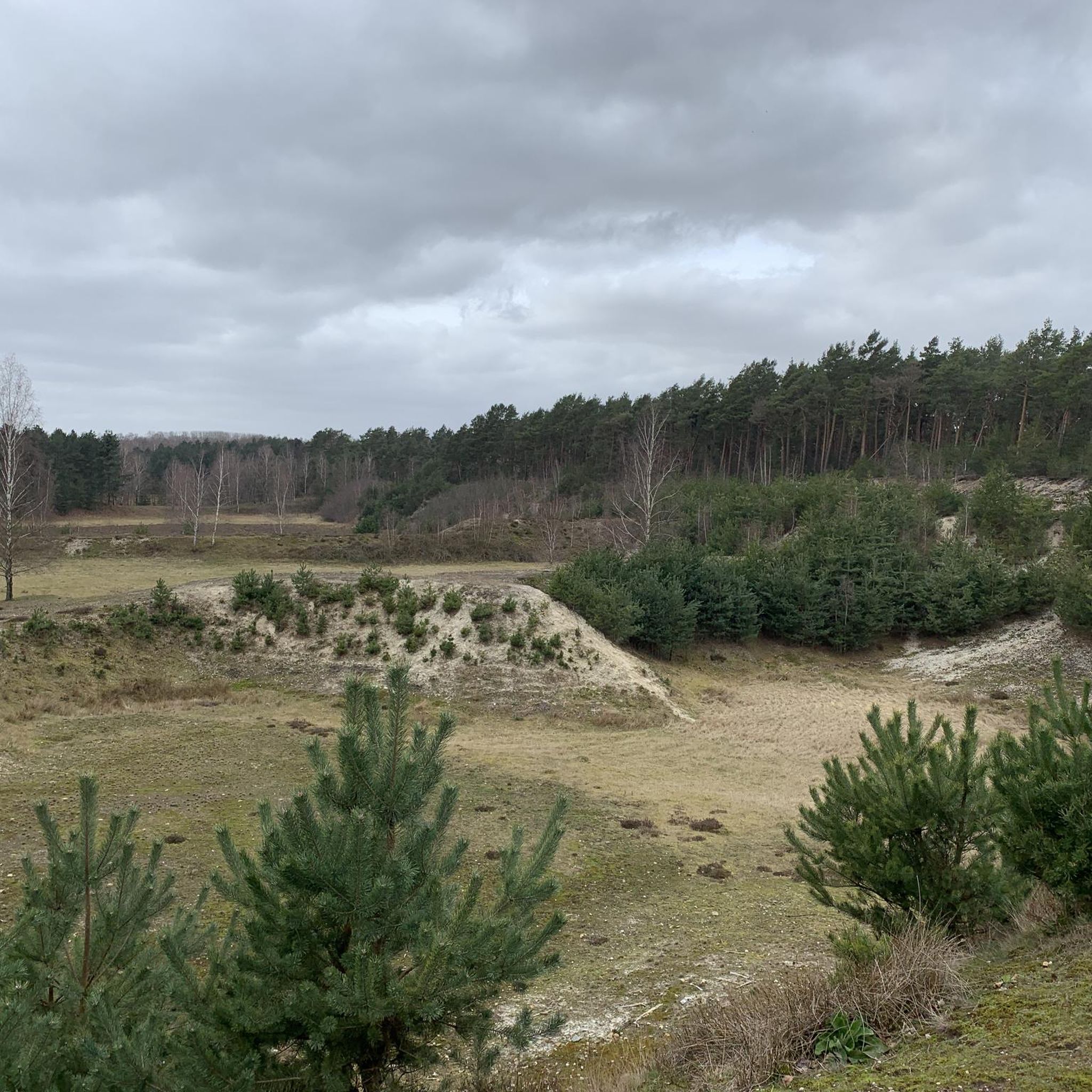
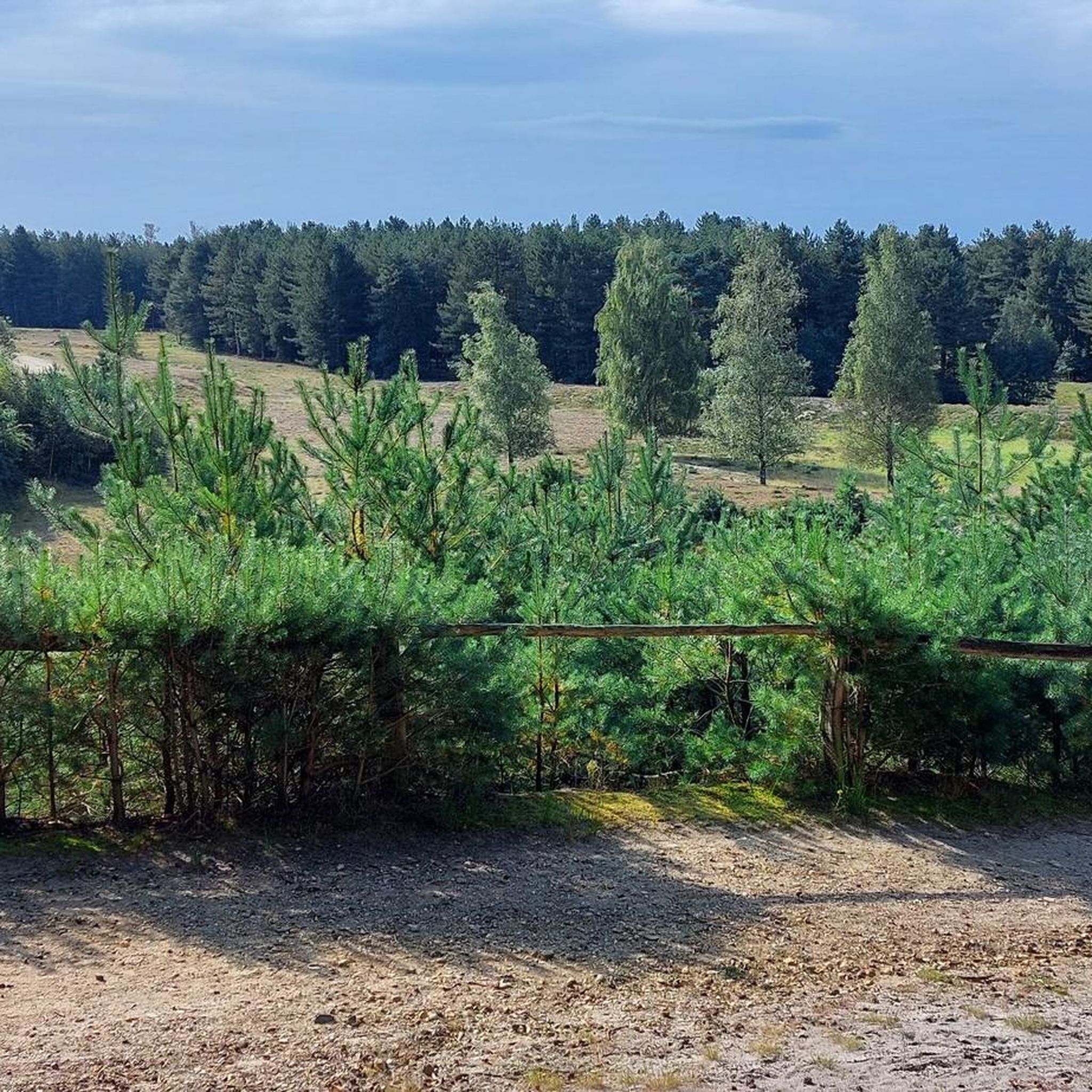
In the Teverener Heide Nature Reserve (NSG), you'll find various official lookouts and rest areas along the hiking trails where you can enjoy panoramic views of the natural surroundings. These spots have been deliberately created to provide visitors with a resting place overlooking heathland, fens, marshland, or sandy areas, so you can not only explore but also actively experience and observe nature. Along the signposted hiking trails, such as the Heideroute (marked purple), the Veenroute (black), the Meerroute (blue), and the Grote Rondwandeling (yellow), you'll regularly encounter waymarkers, rest areas, and viewpoints, often equipped with benches or open areas overlooking the heathlands and wetlands. Many maps and hiking trails, such as the Teewensee Circular Walk, explicitly highlight a viewpoint in the NSG Teverener Heide, indicating that there is a place where hikers/visitors can stop for a wide view of the nature reserve. These viewpoints aren't always towers or platforms like those you might be familiar with from dune areas, but rather benches and open spaces on slightly elevated heathlands or the edges of fens, offering unobstructed views of the landscape—ideal for photography, birdwatching, or simply enjoying the tranquility of the heathland.
0
0
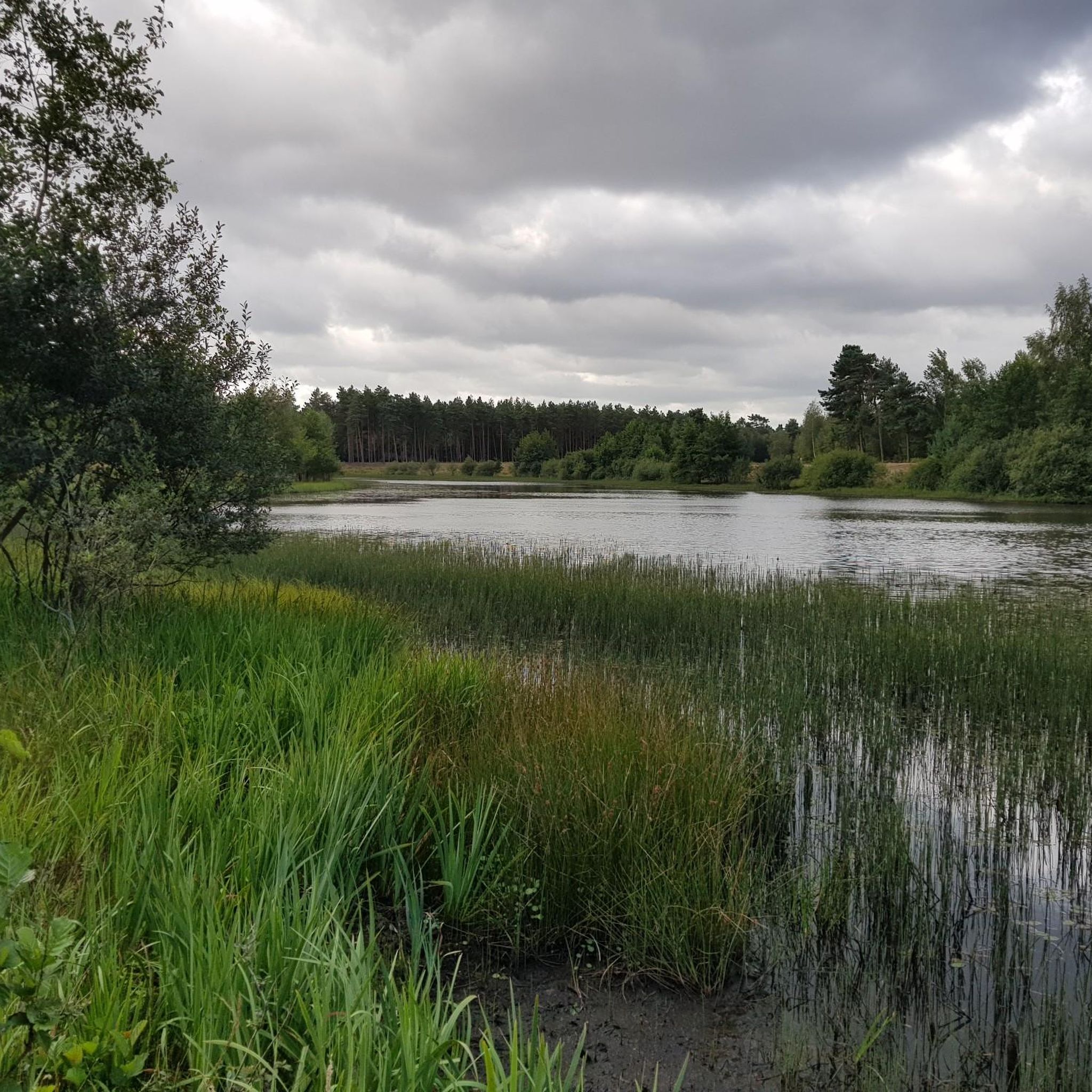
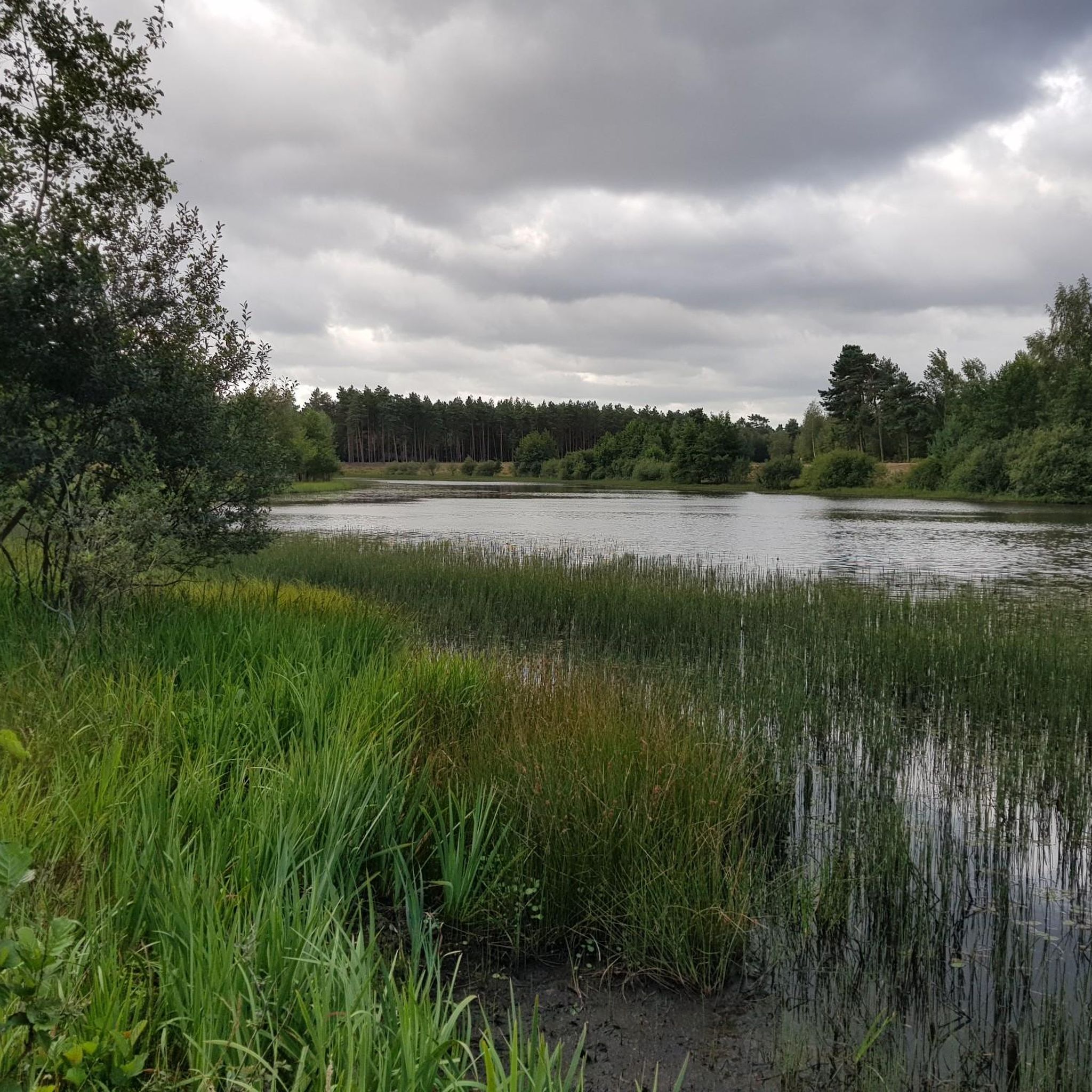
The Eikenvijver is one of the smaller, tranquil water features in the Teverener Heide and fits well within the characteristic mosaic of heathland, forest, and wetlands that makes this nature reserve so special. The pond is nestled between oaks and mixed forest, from which it takes its name. Due to its sheltered location, the Eikenvijver often appears tranquil and natural, with overhanging branches, shady banks, and a gradual transition from water to forest floor. Like many other lakes and ponds in the Teverener Heide, the Eikenvijver did not originate entirely naturally but developed from an old drainage area or depression in the ground where water could remain. Over the years, nature has taken over this location, and along the banks grow reed sedges and moisture-loving plants, while oak leaves create a nutrient-poor, slightly acidic water quality ideal for specific flora and fauna. Ecologically, the Eikenvijver is especially important as a habitat for amphibians. Frogs and toads use these quiet, fish-poor waters as breeding grounds because there's little disturbance and the banks offer ample hiding places. Dragonflies, aquatic insects, and small water beetles are also common here. Birds use the pond as a drinking and bathing spot, especially during dry periods. The Eikenvijver is located along or near the signposted hiking trails of the Teverener Heide and is often passed by unnoticed because it blends so naturally into the landscape. This makes it particularly valuable, as it's not a large open lake but an intimate body of water where you can clearly see how forest and water merge. It's a place that invites you to pause and observe, typical of the area's quiet, less conspicuous gems.
0
0

Teewensee is an idyllic lake surrounded by vast dunes and wooded areas, a place where water and sand blend harmoniously. Reeds and wild plants grow along the banks, while the open water provides a haven for birds, dragonflies, and other aquatic creatures. The area exudes peace and tranquility, ideal for walks or short breaks where you can fully immerse yourself in nature. The play of light on the water and the soft colors of the dunes change with each season, making Teewensee a photogenic and serene natural wonder.
0
0
From this vantage point, a magnificent panorama unfolds over Lake Rohrkolbensee, a clear lake surrounded by forest and dunes, and the Teewensee dunes with their undulating sand hills and lush vegetation. The view combines water, sand, and greenery into a harmonious, almost serene environment that invites peace and reflection. The dunes offer a gentle transition from forest to open water, and the reef-like landscape of the shore contrasts beautifully with the still surface of the lake. Birds, insects, and sometimes even deer make this area their home, allowing you to observe a vibrant piece of nature during a walk.
0
0
In the heart of the Teverener Heide lies a beautiful cottongrass bog, an open, wet area where white cottongrass dances in the wind like a rolling sea of silk. In spring and summer, it creates an enchanting spectacle: thousands of white tufts gently sway across the bog while dragonflies and butterflies glide among the stems. The cottongrass bog is a valuable nature reserve where damp heather moss and peat alternate. It is home to a rich biodiversity and reflects the delicate balance of these unique heathland landscapes.
0
0
よくある質問
テベレナー・ハイデでのハイキングでは、どのような地形に出会いますか?
テベレナー・ハイデは、驚くほど多様な景観を提供しています。広大な開けた荒野、ユニークな湿原や沼地、変化に富んだ森林が期待できます。この地域には、小さな湖や池も数多くあり、砂地や白い砂丘さえ見られます。ハイキングでは、湿った環境と乾いた環境の両方を楽しめます。
テベレナー・ハイデには、ハイキングコースの選択肢はたくさんありますか?
はい、テベレナー・ハイデには充実したトレイルネットワークがあります。40以上のハイキングルートが利用可能で、簡単な散策からやや難易度の高いものまで、さまざまな体力レベルに対応するオプションが用意されています。
トレイル沿いにある自然の見どころやアトラクションにはどのようなものがありますか?
この地域は自然の美しさに恵まれています。活気に満ちた荒野が広がるテベレナー・ハイデ自然保護区自体を探検できます。多くのルートは、絵のように美しいテベレナー・ハイデ湖群のそばを通り、特にパイン湖やクリストフォルス湖のような場所も含まれます。これらはかつての粘土や砂利の採掘場でしたが、現在は生物多様性に富んでいます。ユニークな生態学的特徴を持つ、際立ったウィゲレワック湿原もお見逃しなく。
初心者向けの簡単なハイキングオプションや、リラックスした散策はありますか?
もちろんです!テベレナー・ハイデには簡単なトレイルがたくさんあります。快適でアクセスしやすい体験には、NATO E-3A航空基地ガイレンキルヒェン発、ティーゼン湖~クリストフォルス湖ループを検討してみてください。この7.1kmのコースは簡単なレベルに分類され、美しい湖と森林の景色の中を歩きます。
テベレナー・ハイデで周回ハイキングルートを見つけることはできますか?
はい、テベレナー・ハイデの多くのトレイルは周回ルートとして設計されており、同じ地点からスタートして同じ地点に戻ることができます。NATO E-3A航空基地ガイレンキルヒェン発、テベレナー・ハイデ自然保護区~ティーゼン湖ループは、約10kmをカバーする人気のやや難易度の高い周回トレイルで、保護区の多様な景観を包括的に体験できます。
テベレナー・ハイデでのハイキングに最適な時期はいつですか?
テベレナー・ハイデは一年中美しいですが、特に8月下旬から9月にかけては最も鮮やかになります。この時期には、広大な荒野が豊かな色彩で咲き誇り、ハイキングに真に絵のような環境を提供します。
テベレナー・ハイデは家族でのハイキングに適していますか?
はい、テベレナー・ハイデは家族連れに最適な場所です。多くのトレイルは比較的平坦で整備されており、子供連れにも適しています。湖や森林を含む多様な景観は、若いハイカーが探検するのに魅力的な環境を提供します。
テベレナー・ハイデのハイキングトレイルでは犬を連れて行っても良いですか?
テベレナー・ハイデは一般的に犬に優しい場所であり、愛犬と一緒にハイキングを楽しむのに適しています。ただし、野生動物や他の訪問者を保護するため、特に敏感な自然地域では、犬をリードにつないでおくようにしてください。
テベレナー・ハイデを訪れる際、車はどこに駐車できますか?
テベレナー・ハイデ周辺には、さまざまなトレイルの出発点となるいくつかの指定駐車場があります。主な駐車場には、グローテンラート、シェルペンゼール、ホーエンブッシュがあり、そこでは道案内のための情報ボードも見つけることができます。
他のハイカーはテベレナー・ハイデのどのような点を最も楽しんでいますか?
この地域はkomootコミュニティから高く評価されており、1200件以上のレビューから平均4.3つ星を獲得しています。レビューアーは、特に荒野、湿原、数多くの湖といった多様な自然景観、そして広大な眺望と変化に富んだ自然の印象を提供する、整備され明確に標識されたトレイルをしばしば賞賛しています。
経験豊富なハイカー向けの、より長く挑戦的なルートはありますか?
テベレナー・ハイデには「難しい」トレイルはありませんが、より長く魅力的な体験を提供するいくつかの適度な難易度のルートがあります。NATO E-3A航空基地ガイレンキルヒェン発、パイン湖~ノンケ・ブースケ野外博物館ループは、適度な難易度の9.3kmのトレイルで、良い運動になり、変化に富んだ地形を探検できます。
テヴェレナー・ハイデでのの人気観光スポット

komootモバイルアプリでインスピレーションを得よう


さらに探索
他の地域の最高のハイキングを見てみましょう。
